
Sunday 27th June 2021
This was my final full day on the Shropshire/Wales border. I awoke in my tent, feeling ready for an eighteen-mile outing. Towards the end, I’d be following a few more miles of Offa’s Dyke Path. Initially, I’d be joining Glyndwr’s Way (another National Trail) from Knighton. In between the two, I’d have to connect the lines.

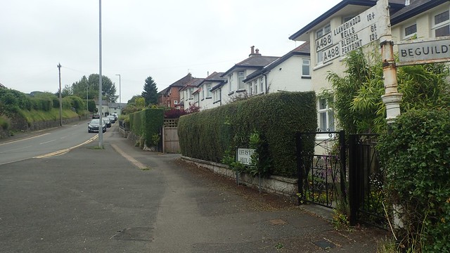
Another walk from the campsite and without needing to touch my car. I walked south from the campsite gates and immediately joined Offa’s Dyke Path; then following this trail across the local railway line. I was to join one of the many walkers who’d passed through hear, clacking and unlatching the metal gates.

This also led me over the River Teme and back in to Mid Wales.


There’s a point at which you can straddle the official border between the two UK nations. I’m not sure why they appear to have switched the left and right feet but, of course, I took a moment to do just this.


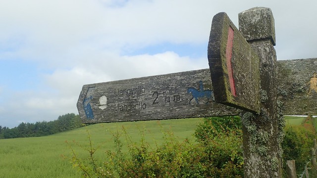
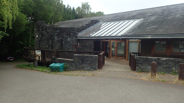
I followed the Dyke Path around to the front of the Offa’s Dyke Centre. Unfortunately, it was completed closed to the public during the weekend that I passed. I imagine this was related to the pandemic, although I have seen no official word on this. Sitting roughly halfway along the Offa’s Dyke Path, it also sits on the Welsh side of the border – and, as you may know, the Welsh government have always been more strict with their rules and regulations (and I’m not suggesting that’s a bad thing).
I left one National Trail and set off in search of Glyndwr’s Way; passing friendly Welsh locals on the edge of the town and heading for Garth Hill.

I didn’t know an awful lot about Glyndwr’s Way and nobody who I’ve met ever talks about in in the same vein as Offa’s Dyke. But what I did find surprising was the suggestion that, even in schools where Welsh has been taught as a first language, students only learn about English history. They are not taught about Owain Glyndwr and I find that quite sad. There’s already an ongoing threat to the Welsh language. I’m far more English than I could be Welsh but this seems so very wrong to me.


From the occasional views across to my hilltop walk of the previous mountain, I made my way around Garth Hill (only a transmitter sits on top; no trig point) and then a series of quiet country ways. Waymarking was good and the locals I passed seemed friendly, if also surprised to see someone out walking their Way.
There was a long and punishing climb up from Little Cwm-gilla. At times, it felt like it would never end, as I passed Ebrandy House before levelling out, some 200m of ascent later.

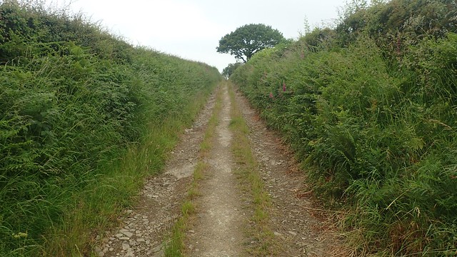
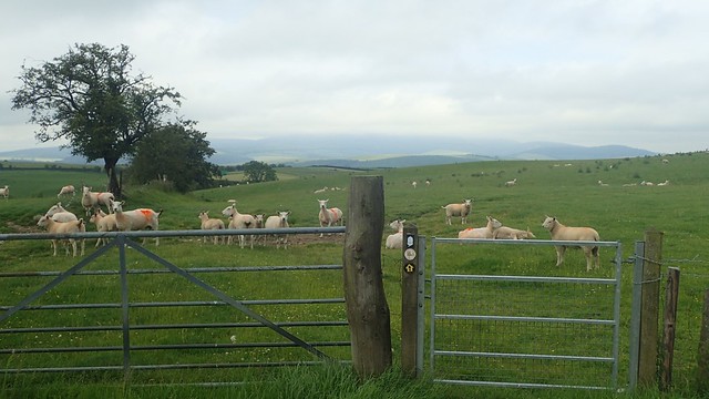
A quiet countryside route would follow. Broad and obvious tracks to follow. Large fields gates. Regular waymarking for the National Trail. Yet nobody about. Even a farmer or landowner.


A trig point sits beneath the true summit of Bailey Hill; some 415m above sea level. But this was as close as I would get. It resides upon private land and with no public right of way running near to it. I couldn’t hopped over gates with consideration (there was no-one about) but I was deterred by thoughts of the long grass. So far, I’d kept my feet dry on this morning, having received a good soaking on the previous day.
Blue sky began to burst free through the cloud, as I followed this bridleway for the final couple of miles to the village of Llangunllo.


Joining the B4356 road, I followed Glyndwr’s Way over the River Lugg and towards Llangunllo.


I hadn’t intended to head in to the village but I had struggled to find a bridleway peering away to my left. Feeling uncertain, I took time out on a bench in the centre and across the road from the local pub. After refuelling with peppermint tea and some snacks, I would return to the quest to find the invisible bridleway…

Of course, there was no bridleway – I was familiar with this concept by now! But the track ahead was fairly obvious and I followed it across two fields…
But this led to a dead-end. I was struggling to read the finer details of my OS map without a magnifying glass but it’s possible I should’ve passed through these gates to continue following on the other side of the hedge.

Again, no waymarking and these gates didn’t looking too convenient for anyone – certainly, not for a cyclist or horse rider. Powys County Council clearly don’t like to enforce the installation of waymarking. But depriving non-walkers from being able to explore these bridleways… I don’t understand that at all.

So. As I had done on the previous day, I retreated to and began following the B-road. I passed a seventy-year-old man carrying a chainsaw. He asked whether I was lost, which I wasn’t. I briefly explained that I was walking this way; knowing full well that I could be walking the full 2.5 miles of this one before it meets the A road!
(Looking again now, I could’ve taken a quiet road from Llangunllo, passing the church and heading up Pen-y-Clawdd Hill, to join the intended bridleway from another point.)

I paused at the driveways for Upper Weston and then Lower Weston farm. It’s possible that I could wandered down there in hope of joining a public right of way further on. Any other footpaths from the main road did no seem to exist. No sign of a lost stile, gate or fingerpost at any point within the hedge.

This wasn’t a busy road but I kept catching up with a family of bike riders, periodically stopping to let the little ones catch up and steady themselves. I passed a loud firing range on the left. Above and ahead of me, I could see a monument or obelisk on what I think was Black Hill. But my route wouldn’t run anywhere close enough to it.

I met those cyclists one last time as I turned right on to the A488 – the same road I had followed two days earlier, on my drives to and from Rhayader.

This road was much busier. I passed a pair of friendly, lycra-clad cyclists but had wide strips of grass on either side to keep me a safe distance from any speeding vehicles.

I crossed the River Lugg once more at Glan-Llugwy Bridge, before leaving the A-road at Tan-y-Coed farm.

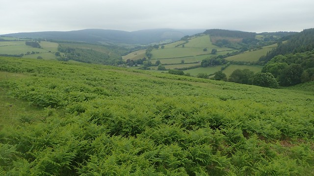
Following this track towards Forest Wood (as it’s named on the map), I soon realised that I was walking in to Radnor Forest.

These woods are a fair distance from what I’d consider to be the main bulk of Radnor Forest, further south. I hope to explore more of that in the future. But there is something special about walking through a forest, with a growing canopy overhead, the smells, the senses and even following a series of broad vehicle tracks.

Out the other side and I’d be stepping on to Open Access Land. Around the highest point of Llan-Fawr, I’d be expecting to find a trig point and somewhere for lunch.


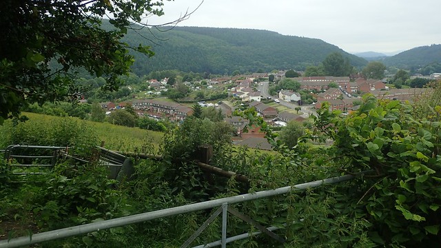
At 387m above sea level, this was no higher than any of the points I’d already crossed in the morning. But the views all around were outstanding. I could see much of my return route along Offa’s Dyke and a greater portion of Radnor Forest.
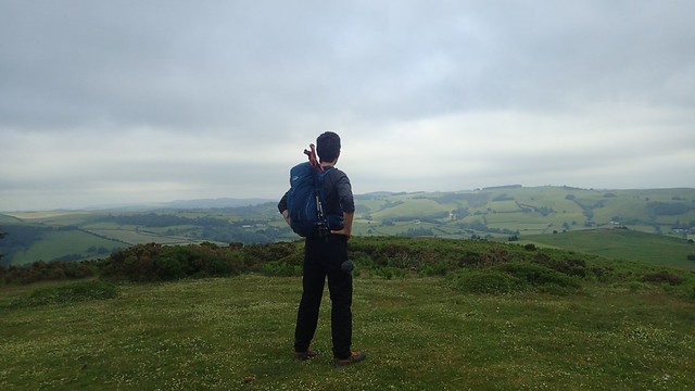
I could even pick out May Hill – not that it’s visible in any of my photos – where I’d been walking three days earlier. Somewhere beneath me must’ve been the Hergest Ridge in Herefordshire. I couldn’t see it but I had hopes of walking there the next morning, after packing up and on the way home.

After lunch, weathered fingerposts continued to guide me across this heathland.

Then, I arrived at a “fern forest”. Not quite up to my armpits on level ground but the right of way cut through here, without leaving a trace. I looked to walk around it but the bracken had spread as far wide as the field boundaries. I was going to have to march through it!

I started off moving from tree to tree; staying fairly close to the compass bearing I’d taken. Of course, I would pass a dead sheep within all of this growth – what did that suggest regarding my chances of surviving this growth?

Without needing GPS, I was able to handrail along the edge of the woods and find my way to an unmarked gate. It married up with the dashed lines on my map and I soon found my way down to the bridleway, where waymarking was present; just well hidden.
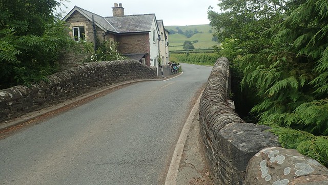
On to the B-roads of Whitton, where I’d cross the River Lugg for one final time.

Near to a crossroads, I found and followed a bridleway heading up to Pen-Lan. I even found an obscured waymarker in the undergrowth.

Another example of a public bridleway that was do-able for most walkers. But any horse riders and mountain bikers may struggle to negotiate some of the gates. I still feel it’s a shame that some sections of Powys and Wales are left like this. One alternative might be for riders to forge their own ways around, which would only cause upset to these landowners.

It was a steep climb to the top of Hawthorn Hill, where I’d join Offa’s Dyke Path. Probably my steepest climb of the day! I could look back to Llan-Fawr where I had lunch and know that, looking forward, my route maintain its current elevation until the final descent in to Knighton; town of my tent.


This memorial was dedicated to Richard Green Price for his tireless service to the county of Radnorshire and its railway line.

I also passed one of these old stone markers for the National Trail. I’d only previously seen these up on the Black Mountains and the Hatterall Ridge.

This year, the Offa’s Dyke Path celebrated its half-Century in age. Of course, the earthworks are many hundreds of years older. I can imagine a number of people have been making their own efforts to celebrate this occasion, with or without a pandemic.


There’s a short section of walking along the B4355 and then B4357, both of which can get quite busy and some cars will travel fast. It’s a shame public access can’t be sought through one of the adjoining fields. I felt as though I was back on the South Downs Way or even The Ridgeway, if only for a few minutes.

I made good progress alongside the earthworks and still, having seen hardly any other walkers all day. I’d soon be passing the golf course and heading in to Knighton (Tref-y-Clwdd) itself.


As I continued in to the town, I didn’t hesitate when it came to spotting the public toilets in one car park. This seems like a fine time to mention that I’d been holding one in all day, due to almost-queueing issues at the campsite with its one solitary toilet to be shared amongst ten pitches…

…Then I decided to put the map away and follow my nose back to the campsite… Which led me to a small church and of course, with other people about, I wasn’t going to whip my phone out, check my locations on GPS and reveal that I was suddenly uncertain of my whereabouts.

I managed to then find my way out through the town. It took three attempts to take this photo of the clock tower, as people emerged and walked right in to my shot. Each looking as startled to see my camera’s lens as I was feeling in response to their interruption.
Knighton more or less marks the halfway point along Offa’s Dyke Path. It’s still a shame that the visitor centre has been closed of late. Coronavirus rules in Wales have always been different to those in England so, I wouldn’t be surprised to see it remain closed.

Behind the visitor centre, you can walk up to and inspect a short section of the original earthworks and away from the National Trail path.


Crossing back over the River Teme and I’d return to my campsite for my final night at Panpwnton Farm. Sad to be leaving the area the next morning but also, somehow looking forward to the journey home. Another enjoyable walk and taster of two National Trails.
From memory, I believe it did rain overnight and this continued as I packed my kit away the next morning. Therefore, I abandoned my hopes of heading for the Hergest Ridge. I’ll do that walk another day. A few more miles of the Offa’s Dyke Path to savour. I would have a lot of unpacking and reorganising to do at home, before returning to work the next day. Sometimes, it pays to look after your life and not overdo it.


Thanks for reading.

Hi Olly.
Once again, a great read, with nice pics and info on local information too. 👍
LikeLike