Saturday 18th March 2017
This would be my second walk in the Burrowbridge area and an attempt to finalise a pre-walk, for a group event that I’m actually leading tomorrow.
My first walk here followed too many roads and hard paths for my liking. With some familiarity already behind me, I wanted to explore further.
I used the generous free car park at the foot of Burrow Mump and began my walk by heading in to the village, taking a left turn immediately after the pub.
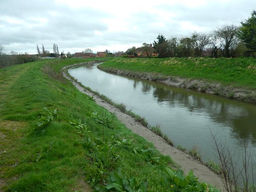
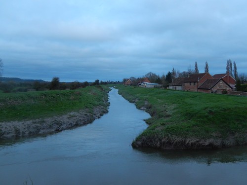
I think this is the River Parrett. There are several reasonably-sized rivers in this area and the River Parrett Trail joins several other paths, according to the OS map. You can follow this trail in to Langport, where I was only walking to Stathe, in about forty-five minutes.
 Whatever the river was, I know that I was following the East Deane Way.
I’d decided not to climb Burrow Mump immediately and would save it for the end of my walk, with less people around and darkness beginning to fall.

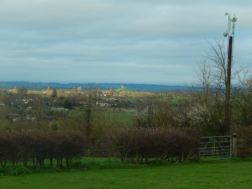
All around me, the landscape was as flat as you could imagine. I could see hills and woodland in the distance, wondering if it was Wedmore… Actually, it might’ve been Compton Dundon, away to the east.
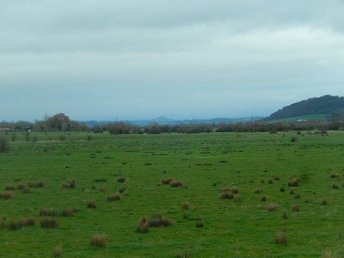
Looking past the rise and to the north-east, I could see Glastonbury Tor.
I left the riverside path at Stathe and turns to the road, where the Parrett runs parallel to the man-made Sowy River, which is a flood relief channel.

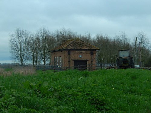
I walked as far as the pumping station before realising I had gone too far and missed the intended right-turn. There was a good view along the West Sedgemoor Main Drain, even if the river banks are restricted to private access.
Turning back, I couldn’t believe I had missed the wooden arrow and kissing gate. It was obvious… Which is more than I could say for the way ahead, which appeared to cross a private garden… Finger post pointing in one direction; waymark arrow suggesting another. I looked long and hard but couldn’t see another stile or gateway. Feeling too close to large houses either side, I returned to the road and sought a different path.
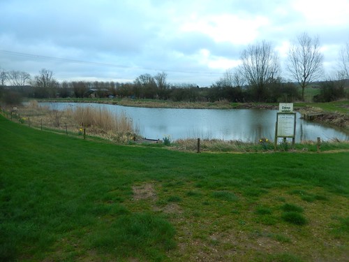
I would rejoin the East Deane Way and pass Stathe House to reach a path junction beside this fishing pond. Had I come from the other direction, I still would’ve arrived here. Oddly, there’s no blue blob to indicate its presence on the map (Grid reference: ST 373 285).
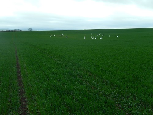
A succession of fields would follow, with no apparent diversion available, if I was to encounter ‘trouble’. But aside from these geese (I like to call them ‘gooses’), there wasn’t to be much else about.
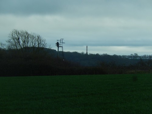
Away to my left, I could see what I previously mistook for the Wellington Monument… Later on this walk, I would learn that it is actually the Burton Pynsent Monument (no, I hadn’t heard of it, either).
It’s a Grade I Listed structure, designed by Capability Brown. You can find it in Curry Rivel and one of it’s other names is ‘Cider Monument’!

There was no clear path accurately following the right of way across this first, large field but a series of tracks had been worn and I took a gamble on following one to the far side. Then, it was safely over the railway line.
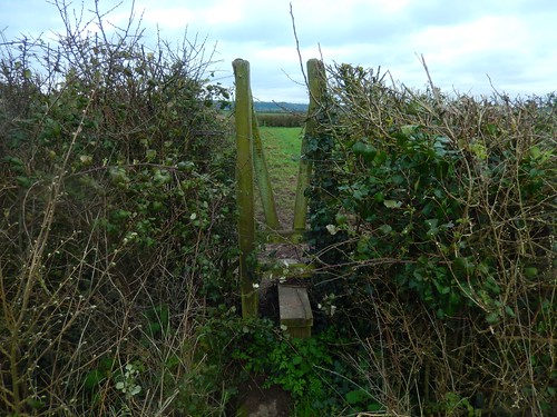
Beyond the train tracks, I would have to encounter a series of narrow, V-shaped squeezer stiles… Perhaps this is why few people walk the East Deane Way and, why it doesn’t even receive recognition from the Long Distance Walkers Association.

Over the next five fields, I’d find the way ahead was sometimes less obvious than in other places. I encountered this one herd of skinny-looking cattle near Hancox Farm. They were harmless and didn’t even car for the dog approaching from the opposite direction (who tried to stick its nose up my backside…).
Soon enough, I’d leave the East Deane Way and its V-shaped stiles to follow the roads in to Stoke St. Gregory. By now, I should also mention that I’d dropped off the southern edge of my OS map (No. 140) and was working solely from the screenshots on my smartphone.
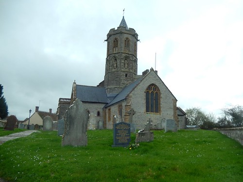
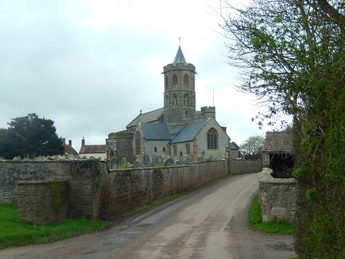
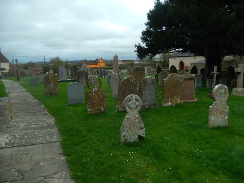
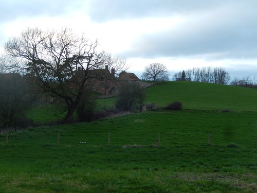
This was a nice intermission from the field that could get muddy at the worst of times and the Church of St. Gregory is one to admire.
Looking back from the churchyard, I could see one house that was so yellow, it was almost orange. On the previous walk near here, I think I saw a pink home.
From here, I was looking to join the River Parrett Trail although, it’s possible than it links up with the East Deane Way once again.

My route would take me up past the Willow and Wetlands Centre and this was about two-hours in to my walk (a good time to stop for lunch, had I not set out to do this in an afternoon). They even have their own café, The Lemon Tree. But all of this is closed on a Sunday.
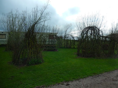
I found a couple of picnic benches amongst these willow sculptures (and trying to ignore the static caravan behind). An ideal place to rest.
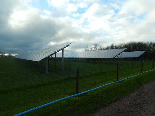
There was a small series of solar panels right next to this. It seemed a bit odd but probably provides much of the site’s power and, let’s be honest; it is much preferable to the stupidly-expensive and potentially-catastrophic eyesore that lies further west along the coast…
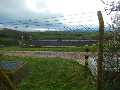
It was unfortunate, having to pass by another sewage treatment works so soon after an ideal lunch spot (you really could smell this one). Beyond this, I would reach Windmill Hill.
I seem to find a Windmill Hill in every district. Some, even, have more than one. It’s a shame that the original structures can rarely be found. But there is an information board at this point (and this is where I learned the truth about Burton Pynsent).

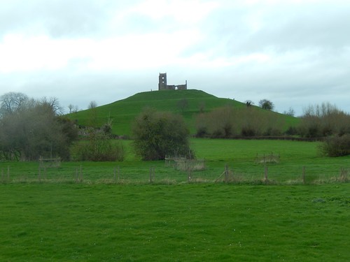
Standing a mere thirty-one metres above sea level, I can’t imagine Burrow Mump is so low down but, the views are superb. Above, you can see the River Tone and I would soon be heading for it.

Looking towards North Petherton.
Burrow Mump!

From the foot of the hill, I would leave the Parrett Trail and cross the River Tone via the structurally-sound Hook Bridge.
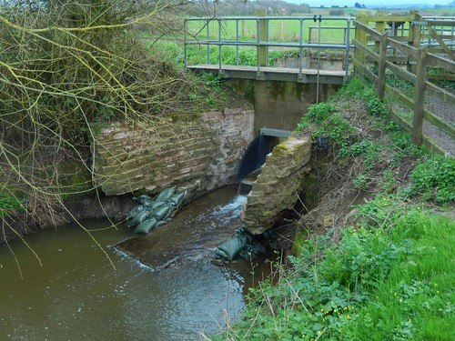
Away from the river, I walked alongside what’s marked as Crooked Drove Track but appears to be more of a stream or outflow. Interesting to note the sandbags – I guess the supporting walls are in danger of collapse after years of erosion… Not that I’m sure of what the bags are actually doing.
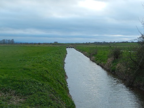
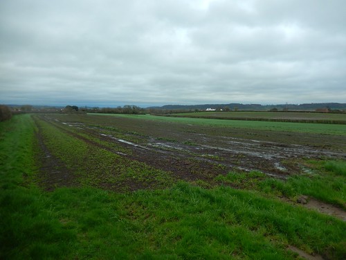
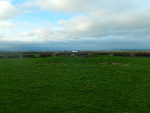
So much moorland apparently doing ‘nothing’. Occasional river and rhyne crossings but so very few public rights of way.
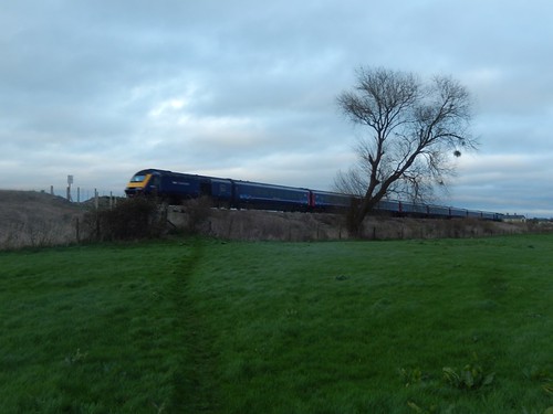
I had to cross the railway once more near East Lyng.

As soon as I had crossed over, I found another diesel engine was approaching from the other direction. I paused to take this photo. It may not be part of the Welsh Highland Railway but I rarely see a train or cross over a line on my walks.
Now, I would walk Cuts Road in to Athelney and rejoin the River Parrett Trail for one final time.
This is the same stretch that I used to close my previous walk here. One difference though, is that the path to King Alfred’s Monument now appears to be open. No “tempory” closure. But I’m saving that for my group walk. This monument marks the former location of Athelney Abbey.
Despite following the Parrett Trail, I was actually walking alongside the River Tone. Dusk was already settling in, by the time I returned to Burrowbridge.
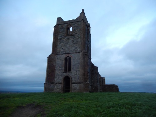
It was chilly at the top but I had the unfinished church all to myself.

Even with darkness falling, these views were superior to the mist-covered landscape I encountered weeks earlier.
I felt pleased to have finalised a reasonable nine-mile walk in this area with no great obstacles, other than the occasional squeezer stile. I’m not sure how many people will turn up as it is the Easter weekend but the weather is set to remain dry and it wasn’t nearly as muddy as I might’ve expected during my pre-walk.
