
Monday 14th August 2017
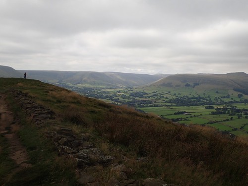
I’d reached Losehill Farm, around 300m above sea level and gasping for my breath.
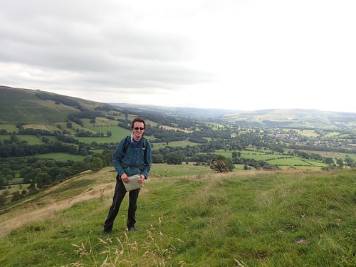
There was still another 200m or less before I would reach the summit of Lose Hill. Beyond that, I’d be following a ridge.
I took that first photo from what might be considered as a ‘false summit’, with a wooden post in the ground to act as a tripod. Anyone else I’d seen thus far was walking in the opposite direction.

Interestingly, I noticed last night that I’d followed this walk in the complete opposite direction to that intended by The Walking Englishman.

My intention was to save Mam Tor until the end and I hold no regrets over this decision.
Like Win Hill, which I’d visited in the morning; Lose Hill is also known by two other names:

Winhill Pike and Ward’s Piece.
Whatever you may think, I was happy to claim this as my second pike of the day!
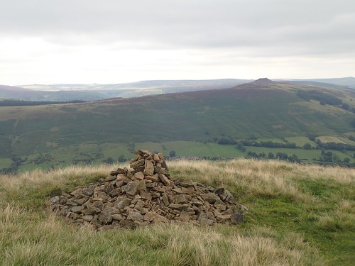
From this cairn, you can in fact see the aforementioned Win Hill/Winhill Pike.

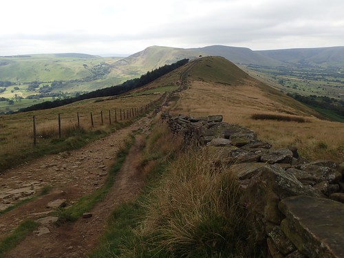
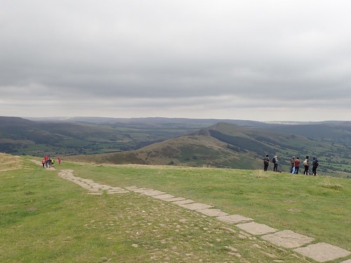
There was a toposcope on the actual summit. From here, I could follow a well-maintained path along the ridge, which would eventually lead me to Mam Tor.
It wasn’t raining but my jacket offered resistance to the cold wind. Is this typical of a summer’s day in the Peak District?
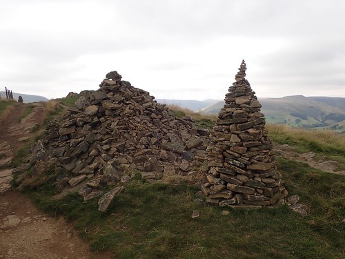
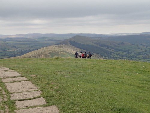
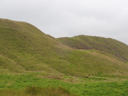
Other cairns could be found along the way, with an increasing number of people approaching from the opposite direction.
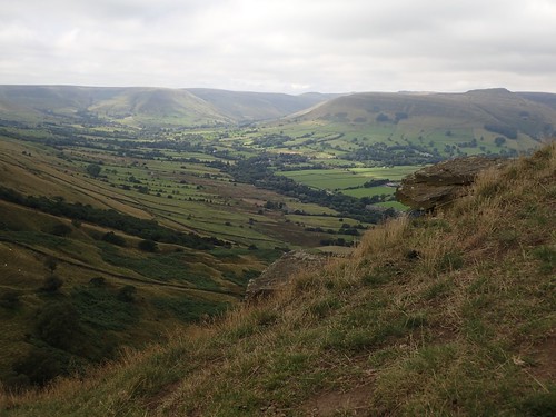
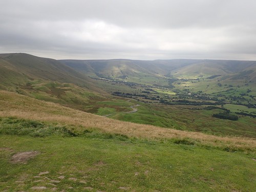
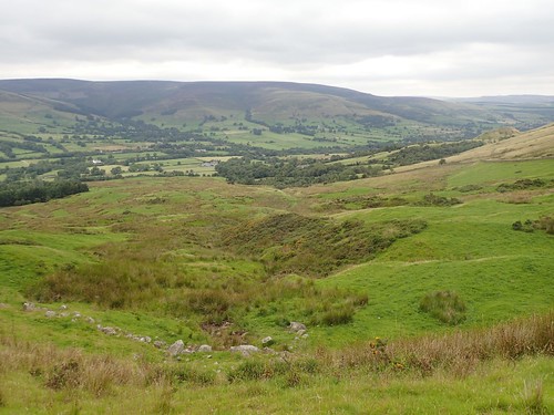
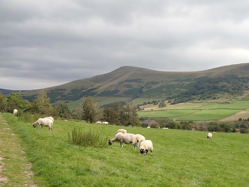
To my right, as I walked westwards, the Vale of Edale began to grow.

This is known as The Great Ridge and is also regarded as one of the most popular walking routes in the whole of the United Kingdom.
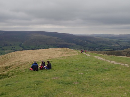
At more than 400m above sea level, it’s a great landscape for walking. although not ideal when you’re looking for a sheltered lunch stop.
This was Back Tor and, before descending to continue along the ridge, I found shelter on the north side of a large rock; sat slightly precariously on the slope of the tor but more concerned with the minefield of sheep poo all around me.
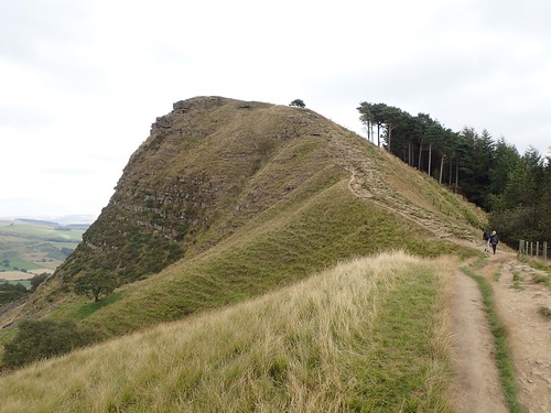
Looking back at Back Tor post-lunch; the large rock to the top of the hill and in the centre – I was sat on the left-hand side of it for almost half an hour.
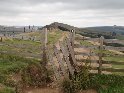
Ahead of Barker Bank is a point where the right of way crosses over a fence to continue in the same direction along the other side. I don’t know when or if this has been redirected over the years but looks as though someone (if only sheep) has created their own way forward.
Maybe the land here is in danger of erosion? This is a very popular walking route.
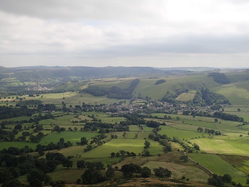
Another awesome view of Castleton.
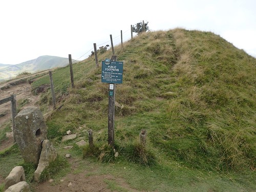
I continued beside Barker Bank and on to Hollins Cross, where I arrived at a junction of footpaths.

I’d like to refer to this point a a ‘toposcope’, as the contoured top surface suggests that it represents some form of the local landscape.
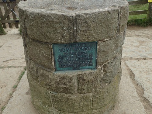
I cannot find any further information on Tom Hyett of Long Eaton but, to just think, this has been standing here for over half a Century.
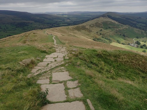
From Hollins Cross, there’s an unmistakable limestone walkway leading to the summit of Mam Tor. Again, to think of the time and effort volunteers must’ve invested towards creating this.
I find the climb to be tougher than I’d anticipated, at less than a hundred metres vertically. Maybe it was the rocky steps. Or, the peaks I’d already bagged beforehand!
To the north, a stunning view overlooking Edale. You can even see the road that divides Mam Tor from the next ridge.
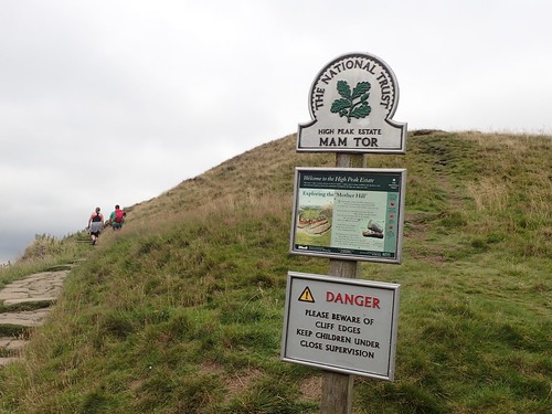
Mam Tor is also known as “Mother Hill”. I only realised, moments before writing this, the correlation between the terms ‘Mam’ and ‘Mother’! But I always thought that a tor wasn’t a ‘Tor’ unless it had a rocky summit… But then, what about Glastonbury?
Peak/Pike. Tor/Hill. Hill/Mountain… I still have much to understand!
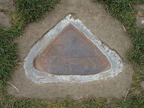
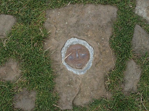
There are a number of symbols and images embedded in the land surrounding the trig pillar.
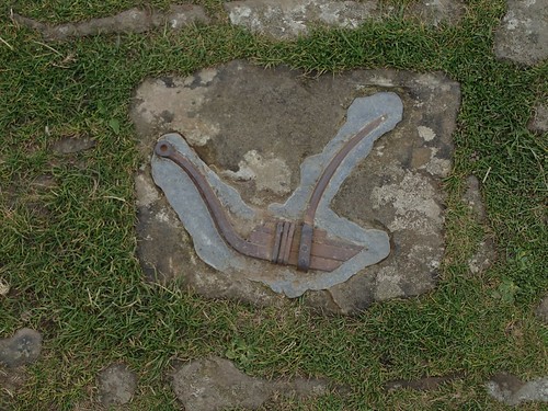
I would presume this relate to the tor’s former existence as a hillfort and the civilisation(s) that would’ve made this space their own.

I’ve always admired the Mam Tor trig point from the photographs of others:
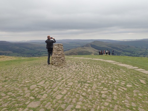
Unlike most concrete structures, this one has apparently been made from stone, almost like a drystone wall… Just, not very dry. Snowdon’s trig is another one that interests me and I hope to visit that one on a not-too-busy day in the spring.
There’s a man, not dressed for the outdoors, with his phone out taking panoramic shots in all directions. He’s there for a good five minutes or more – either, struggling with the technology or not truly appreciating his surroundings and space. I sneak up behind him to ‘bag’ this one with my hand (no time for a trig point selfie, sadly).
Jeans and a lack of a backpack are often a sign that you’re never far from a car park.
Groups of teenagers and small families occupied other corners of the summit but at least, their jackets looked somewhat water resistant. 517m above sea level and it was as windy as on Win Hill, if not more so.
I followed the obvious path down the western face of Mam Tor before arriving, inevitably, at a road with limited spaces for free layby parking. There was a National Trust donation box, in to which I dropped £1, maybe £2. The steps I followed on the descent were wide but also long – the kind where you need to take two or three steps along each.
From here, I’d initially follow the road down to Edale. Away to my left, I could see ant-like people following the ridge of ridge of Rushup Edge – one I’m saving for a return visit.
I think I was distracted by the presence of a motorhome from the Netherlands, broken down at the side of the road, as I ended up following this road too far and missed both opportunities to turn off along a footpath.
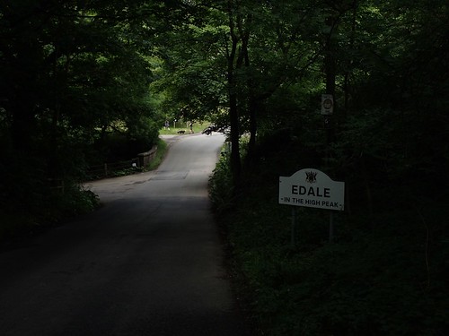
To retrace my steps would’ve meant to climbing uphill… Along tarmac and past the Dutch family once more. Needless to say, I didn’t and soon found myself walking in to Edale via a lane from Barber Booth (adding valuable extra miles to my walk, at the same time).
As I passed the train station, I reluctantly became the tail-end of a group of rucksack-bearing teenagers (possible DofE explorers, en route to the Youth Hostel). To the right is a pay-and-display car park that apparently charges £6 per day – that’s more expensive than Cheddar Gorge in Somerset!
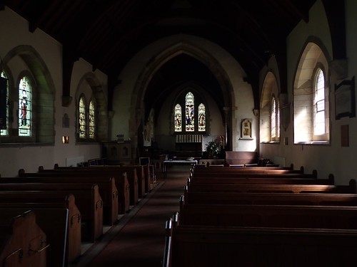
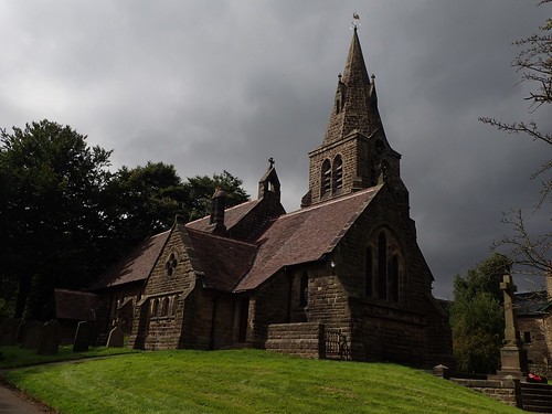
I was impressed with the architecture and design of the local church and also wandered inside. Very clean and well maintained. Is this where the parking charges are spent?!
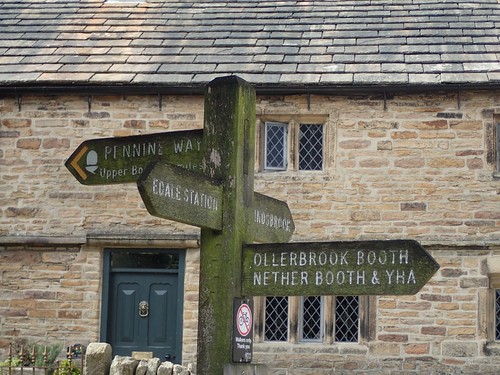
Just past The Rambler Inn, I knew I would pass the southern end points of the Pennine Way.
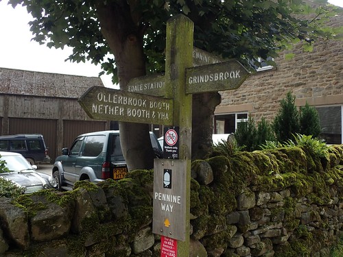
Had I not chosen this walk, I would’ve most likely tackled a circuit that involves Kinder Scount, Jacob’s Ladder and the Pennine Way. But I’m saving more of this moorland walking for my next visit to Derbyshire. Maybe I’ll even be ready to walk the full length of the trail by then!
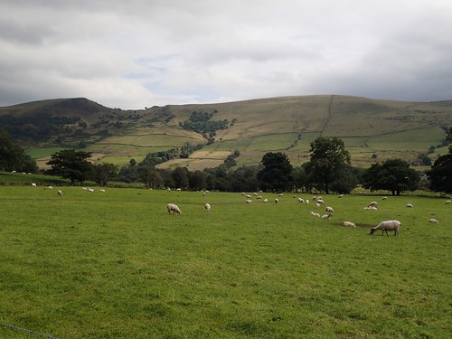
If I’d parked a bit closer, I might’ve stopped in the nearby café for a proper cup of tea and hopefully, a slice of cake. Instead, I began my eastward return to the car at Nether Booth, crossing farmland parallel to The Great Ridge.
What a fantastic day of walking this had been. I had achieved so much, avoided any heavy rain and parked without paying for it.

I’d been wearing my Salomon X Ultra 3 GTX trail shoes on this day, after two days of walking in the larger Quest 4D 2s. I cannot fault the X Ultra 3s for their comfort but, once again, I found the tops of my toes were left feeling damp.
I no longer own these shoes and returned them with a full refund, as I found that the shoes were de-laminating towards the heel (they were barely a month old, at the time).
I still believe that full ankle support is unnecessary for the majority of walking I do and I will be looking for another pair of lightweight trail hiking shoes (fully waterproof, this time) in 2018.
I don’t know if I’ll ever get around to exploring every spare inch of the Peak District National Park but I do look forward to my next visit.

The Vale of Edale is my favourite part of the Peak District. Some great walks around there and Edale is a lovely village. It is also the start of the Pennine Way, I’ve been doing a few stretches of that long path over the last few years from time to time, though I have only got as far as near to Littleborough a few weeks ago (the Pennine Way goes a couple of miles east of the town). I headed to Littleborough to catch the train home. Mind you it was 5 and a half hours late – reaching London at 3:30am as a result, which has slightly dappened my enthusism for going back! Perhaps I will drive next time.
LikeLiked by 1 person
Hi Jon – yes, I can certainly see the appeal of Edale. I like a lot of Derbyshire but this somehow offers something more. I would also like to walk the Pennine Way one day, even tackling it from start to finish in one hurdle…
What a disaster! I’ve heard that trains can sometimes be unreliable but wow, that sounds extreme and not at all welcome after several days of hiking, I imagine.
LikeLike