
Thursday 16th November 2017
I’d booked the day off work, plus a further three to follow. This Thursday was officially the start of my long-weekend away in Pembrokeshire – my first ever visit to this corner of Wales – and part of Brunel Walking Group’s annual “Christmas” Away Weekend.
Having booked my own accommodation away from the hustle and bustle of the Youth Hostel, I was travelling alone. Leaving my home in North Somerset by 9am that morning, I stood a good chance of reaching Carmarthenshire by midday.

Just past Carmarthen, I would leave the westbound A4 and drive south towards Llansteffan, where my walk would begin. I hadn’t needed a SatNav so far and, even with a navigational fumble that involved me driving on to a beach beyond warnings signs of “no cars on the beach”, I found my way to the blatant parking bays and not a single pay-and-display machine in sight!
It had been a typically “November” morning so far. Driving west along the M4, my day had been dry but overcast, until I passed Port Talbot… Clouds of vapour rising from the cooling towers… Each time I drive past here, the weather seems to turn suddenly and I’m travelling through a monsoon!
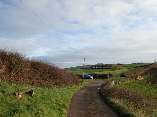
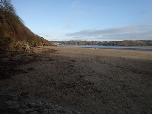
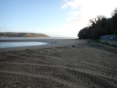
Grey clouds hung over Llansteffan as I arrived but the rainfall was minimal, by comparison. I couldn’t believe how empty this car park was, as I began to set off. Groundworkers were digging away, beyond the sand dunes and close to the River Towy. I’ve no idea what for. Other Welsh workers were enjoying a tea break in the car park nearby. I tried to listen to their conversation but all I could hear was “flub-a-dub-dub”…
It was more Bill & Ben than Fireman Sam.
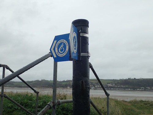
For the first time in a long time, I was walking a section of the Wales Coast Path! I find it staggering to think that this trail is more than one-hundred miles longer than the South West Coast Path.
I possibly trod on a few metres of the ‘optional’ route, inland from Barmouth and near Dolgellau, back in May. Before that, I reckon it was as far back as November 2015 and a group visit Great Orme, ahead of the long drive back to Somerset.
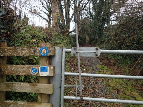
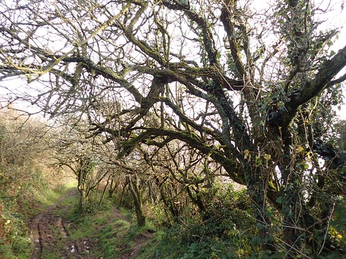
From the village of Llansteffan, I followed the Wales Coast Path up along the driveway of someone’s home to continue up a track, which gradually climbs the hill ahead.
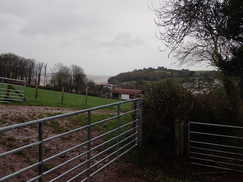
Turning back for a moment, I could see Llansteffan Castle on the headland. If I had time upon finishing my walk, I’d look in to paying a visit.
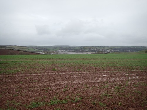
While I was following the official coast path, I’d like to point out that I was a good kilometre west of any ‘coast’ at this point. You can just see the River Towy (Afon Tywi), who source (along with the Wye and Severn) lies within the Cambrian Mountains. Apparently, it’s the longest river that is contained entirely within Wales.
I’m hoping it’s pronounced “toe-e” or “two-e”. Otherwise, it sounds too much like a trashy TV programme for my liking. Is there a book on ‘How to Speak Welsh Without Learning the Language?’.

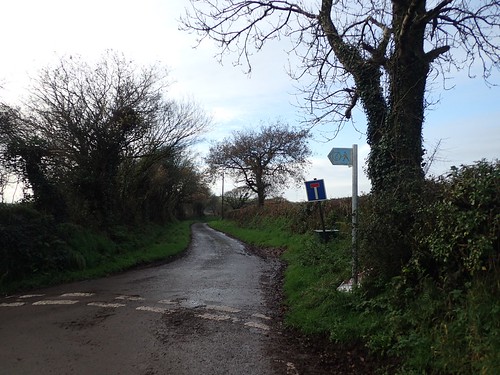
So soon after joining the trail, I would leave the Wales Coast Path at the road. Beyond these tired signs, it looks as though the coast path continues along way north before you can cross the river at Carmarthen. If it wasn’t for having to negotiate with nature, I wonder how much short the full-distance trail might be?
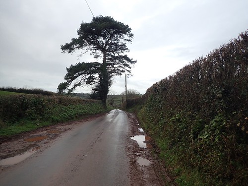
There was nothing eventful in my westward road walking towards the village of Llanybri. I gave way to the occasional car and tried to appreciate where I was and the days I had ahead of me.
It was in Llanybri that I first paid attention to the popular Welsh practice (???) of painting houses in different colours. It was a theme that would continue to be noticed across the weekend and particularly around coastal towns.
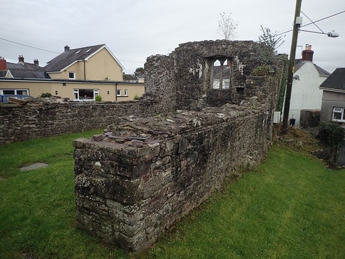
I wanted to investigate the ruins of Hen Gapel.
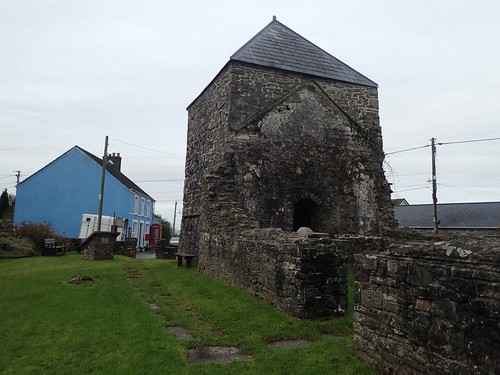
This chapel was built upon the site of the original Llanybri church but abandoned in the 17th Century.
I remember reading on an information board that it was used as a bomb shelter during the Second World War.
My OS Map suggests there is another church nearby but, I wasn’t to walk down that road and it wasn’t visible from higher up.
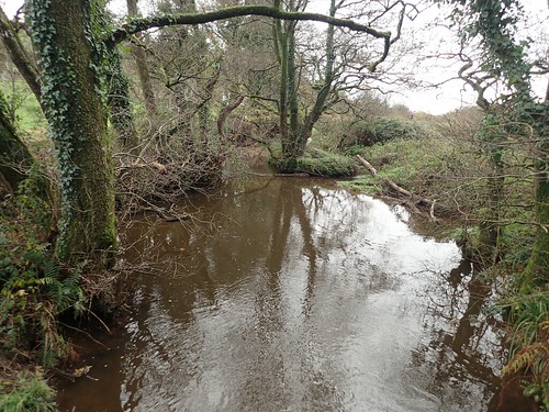
Back to the road walking and I would cross over this wide stream, just north of Pendegy Mill, that is in fact a tributary of the River Taf, which I was now walking towards.
You see, this circular walk takes place between two estuaries, where the rivers Taff and Towy flow out to Carmarthen Bay.
Now walking south and parallel to the river, I would rejoin the Wales Coast Path for the remainder of this walk.
If you were to continue walking the coast path west from here, you’d find the crossing point for the River Taf is only 3km to the north. Far more convenient than walkers contending the Towy must face.
Thirty-miles in length, the River Taf appears to run mostly through Pembrokeshire. It is not to be confused with the River Taff, further east in the Brecon Beacons.
I would soon cross that same tributary, before leaving the road at Mwche… Where one vowel is not enough for your average Englishman to pronounce!

I had also joined the Pilgrim Trail… No, I hadn’t heard of it, either. But I do remember seeing the Pilgrim Way down in Cornwall, last summer.
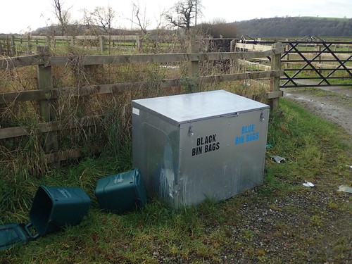
So, in this part of Wales, they appear to have two different colour of bin bags… I’m assuming the two discarded bins are for food waste. Is the blue bag then, full of recyclables? Meaning some poor soul on a conveyor belt somewhere has to sort through it the next day?
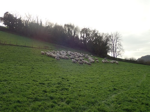
Carrying on down the farm track with over-confidence, I had completely missed the waymarked kissing gate at the top of the field and would have to turn back! Walking the right path now, I would unintentionally herd a large flock of sheep in to the far corner of the field.
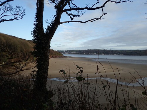
Across the Taf estuary, we have the town of Laugharne. Its Welsh name is ‘Talacharn’, which doesn’t help my attempts at correct pronunciation.
It is perhaps best known for the poet Dylan Thomas, whose Boathouse remains a tourist attraction. I can remember Ruth writing about this on her coastal walk through Laugharne… I didn’t know of Dylan Thomas but I knew of ‘Rage’ – possibly his most famous piece – from my obsession with the film Interstellar.
Continuing with the walk and I found my way to another series of roads beyond Pentowyn. Here, the official trail signs were faded but, the way forward was clear. I passed a couple of people making the optional detour out to Black Scar. If I had more time, I might’ve done the same.
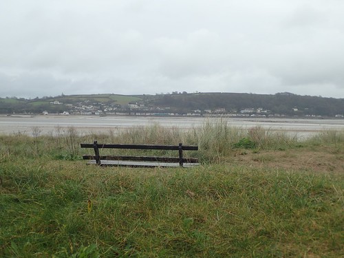
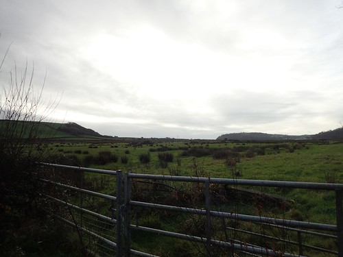
I followed a non-official-looking National Trust sign towards the parking area at Lord’s Park. Had I been required to pay-and-display down by the sands, I would’ve instead driven up here to begin my walk. There was only one car, a couple of dog walkers and, presumably, a landowner roaring up the hillside on his quad bike
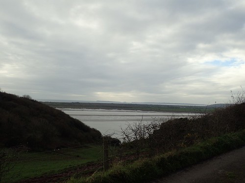
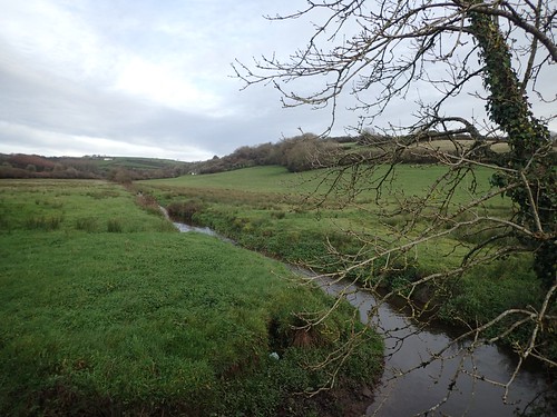
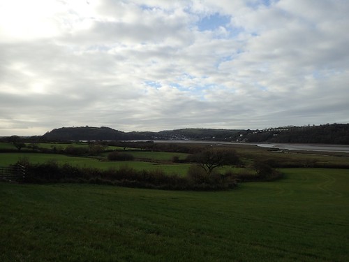
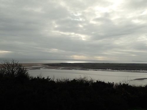
I sat on the bench to the left, looking out across Laugharne Sands (mud?). I did wonder if I could see across the channel to the North Devon coastline but I think Worms Head* near Swansea would’ve been the absolute most I could have hoped for.
*Looking quickly at a map now, I could probably devise a decent circular walk around the coast, there, next summer.
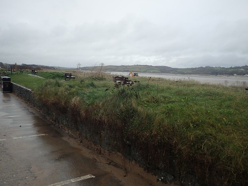
Sitting on the south side of the hill, I was well sheltered from the Arctic wind. For the first time on this day, I noticed a stillness within my surroundings. It was almost as if a segment of life had suddenly ‘ended’ or gone out for lunch.
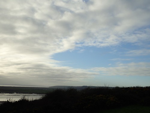
I’d been paying attention to the clouds above me throughout the day. Some of the scenes were as special as the coastal landscape now beneath me.
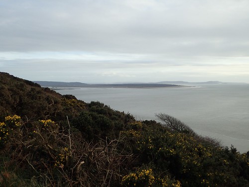
Worms Head and Rhossili Bay are possibly visible on the faint horizon, above.
Following the contour of this hill, I was gradually making my return to Llansteffan. Judging by the state of mud beneath me, this looked to be a very well used path!
A couple of other walkers (with poles) were heading towards me. Before we met, I overheard them trying to pronounce Welsh place names, while the man, I thought, made a good attempt at Laugharne… If only I could remember how he said it.
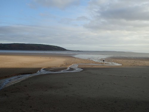
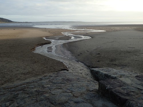
Eventually, I would drop down to walk on the beach; passing St. Anthony’s Cottage and then the well, which spills a stream out across the sand.
It was past 15:00 by this time. Sunlight was beginning to dwindle and I was wary of my intention to arrive at and find my accommodation before dark.
This did mean I would have to forgo any possibility of visiting Llansteffan Castle. I wasn’t too sorry, if I’m honest, as that would’ve required hiking up Castle Hill!
This was a great setting for the end of my walk – I would walk on to cross the point at which I’d accidentally driven on to the beach, earlier on.
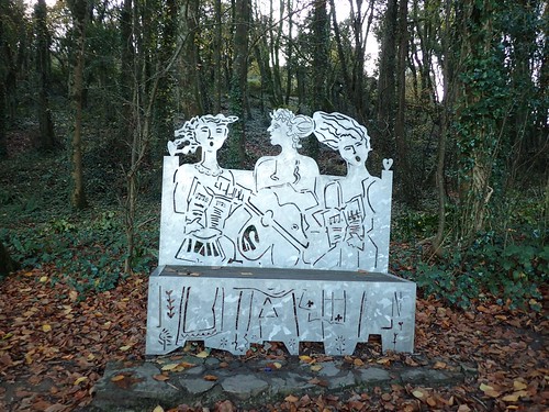
In the woods north of Castle Hill, I found this sculpture. It was here within The Sticks Woods that Llansteffan would host its annual Mock-Mayor Ceremony, while the image above relates to the singing of hymns.
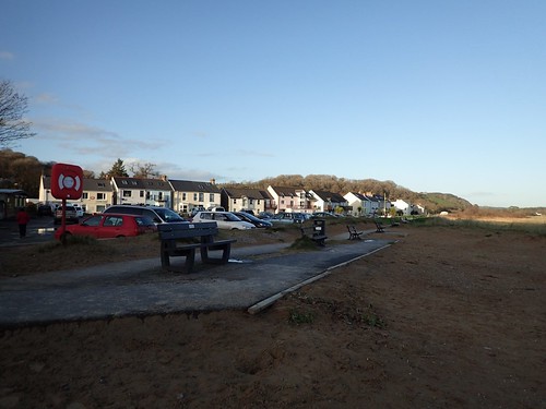
By the time I returned to my car, well, I’m pleased to say that others had decided to venture out, if only for a brief walk with the dog.
Construction workers had already gone home and I had a forty-minute drive ahead of me.

A great end to a good walk and positive introduction to my most recent long weekend in Wales.

We did this walk today. Very worthwhile. Good views and quiet on road walking. Many thanks.
LikeLiked by 1 person
Glad to hear the route is still accessible, David and that you enjoyed it. I hope to return and walk it again myself one day.
All the best and thanks for your comment.
LikeLike