
Saturday 20th January 2017
This was an opportunity for me to fill in one of the local gaps along the Severn Way long-distance footpath. In December, I’d walked north from Oldbury-on-Severn and in previous years, I’ve walked as far north as Aust.
It was the most encouraging of forecasts for the day but it must’ve been more promising than the predictions for Sunday!
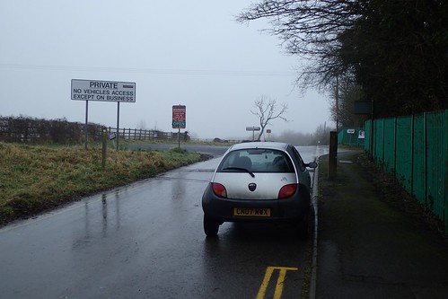
I drove north along the M5, left at Thornbury and continued to a previously-used car park in Oldbury-on-Severn, opposite the Anchor Inn.
From here, I would walk south, following an ‘inland’ route I had devised, before joining the Severn Way in Aust.

…I wasn’t kidding about the weather!
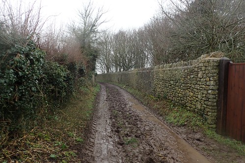
These conditions were perfect for leather boots and gaiters; perhaps hazardous for anyone without one or the other.
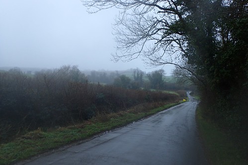
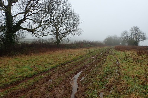
From the south, I’d walk south along a series of muddy bridleways and quiet country roads, occasionally passing the odd brightly-coloured cyclist.
I would briefly follow the Jubilee Way (a seventeen-mile long trail that crosses South Gloucestershire), heading west from Sacks Hill.
This would lead me in to Littleton-upon-Severn, from which point I’d leave the Jubilee Way and follow a route towards Cote Farm.
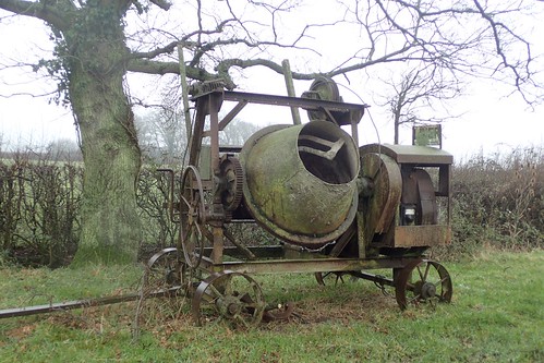
On the outskirts of the farmland, as I progressed on to the field paths, I encountered what appears to be an almost-historic cement mixer.
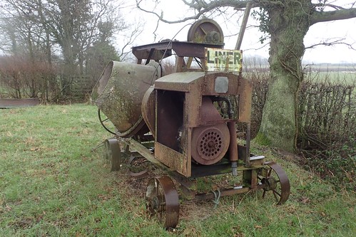
It was certainly an interesting contraption, although I could see no evidence of concrete nearby. Was it left her to decay? For conversational purposes?
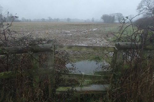
Around the edge of one wet field and I was about to set foot on to the farm yard.
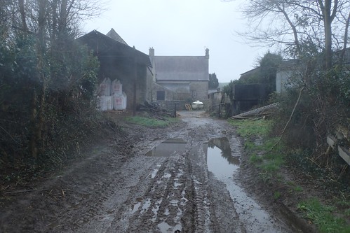
If you’ve been reading this blog for any length of time, you’ll hopefully know that I find this type of situation incredibly intimidating and even more so, when I’m walking alone. I tread forward carefully; looking for confidence within the green dashed lines of my Ordnance Survey map.
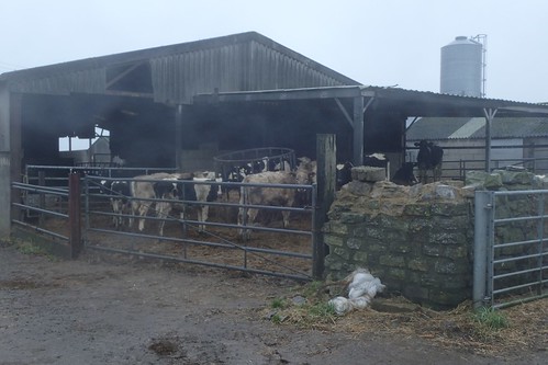
At least the cows were where they belong (…At this time of year).
At the next path junction, panicked as a 4×4-type vehicle pulled up at the road corner and a man began emptying items from the rear…
Was I about to catch a flytipper in the act???
…No, he was actually looking after a hive of bees, on the other side of the hedge. I was looking to follow a right of way across the field and beside him but there was no waymark for this direction and, well, I bottled it. I could’ve attempted to follow a route to my right and soon to pass through Manor Farm but, the gates (no pictured) were awkward and the field beyond was wet.

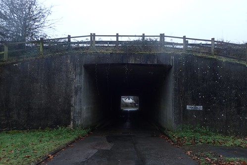
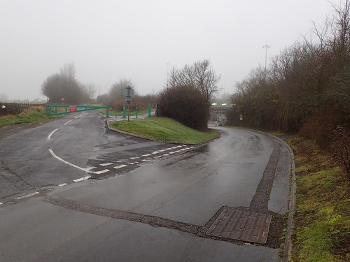
Sticking to the sturdy track, this led me on to the B4461, from which I could see the M48 traffic flowing ahead of me.
Having endured the grass verge and passing traffic for a long couple of hundred metres, I was grateful to duck down beneath the overpass and, hopefully, not far from the village of Aust.
In all honesty, I could’ve avoided the road walking by braving the second farm yard and joining the National Cycle Way, momentarily (although, this isn’t very clear on the map).

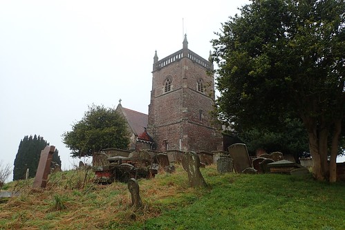
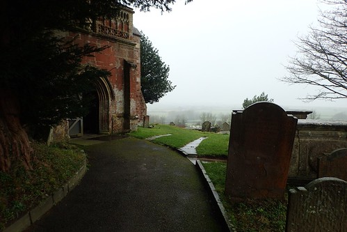
I always like passing this church in Aust. Not for the building itself but for the trees that act as a border from the passing road beneath it.
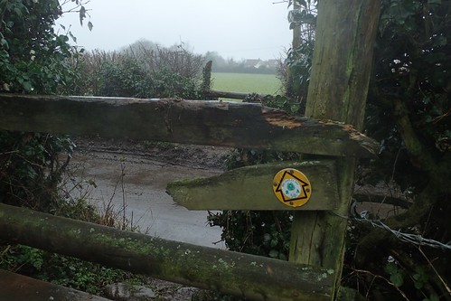
I crossed the A403 with care and I was on to the Severn Way!
Waymarking is good, here; whether you’re a cyclist or on foot. Take the wrong turn downhill and you’ll probably get told to turn around. Hopefully, in a polite manner!
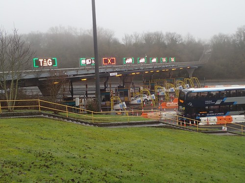
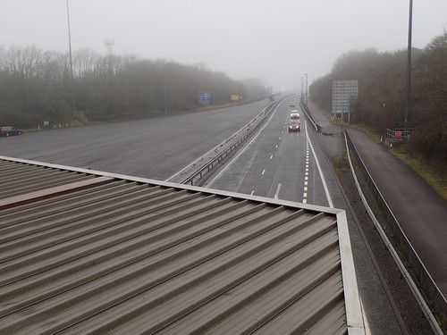
These are the toll boots for the M48, heading west in to Wales. The original of the two Severn Crossings… A sight to behold, perhaps, as the toll on both bridges is still on course to be scrapped at the end of 2018! [No, I won’t fully believe it until it happens, either!]
I couldn’t quite see where or how the Severn Way crosses the M48 from here but, crossing the motorway is precisely what it does; walking along the rooftops of the toll booths!

A cycle path runs along the southern side of the M48, meaning you can effectively travel to or from Wales without the aid of a gas-guzzling or electric engine.
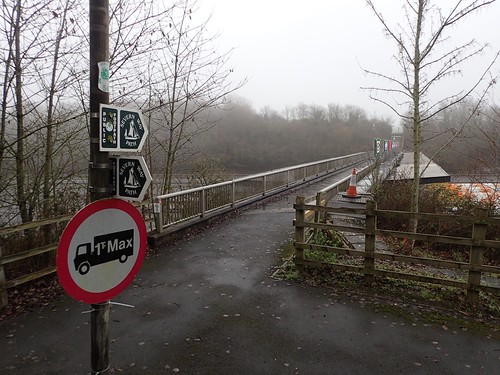
It’s a walk of more than two-miles that I’ve not yet done… Mainly because it can only be a linear walk; one way and then back again. Coastal walkers much know it well and be grateful for it. One day. It is on my list.
I could also see a path along the northern side but, according to my OS map, there is no right of way for cyclists or pedestrians. Perhaps someone reading this can correct me?

Ignoring the services and petrol station, I followed the Way up to a viewpoint… Which I should probably refer to only as a point, for obvious reasons!
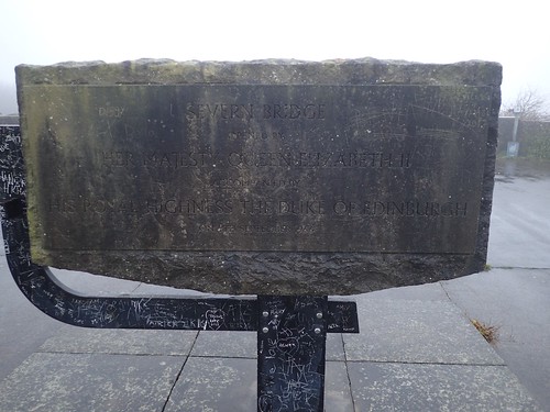
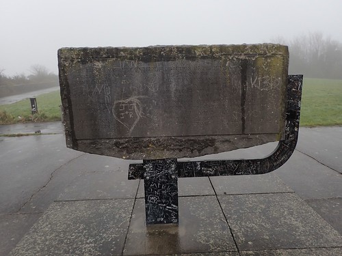
I’m not a ‘Royalist’ by any means but I find it sad that so many individuals have decided to leave their own mark on the Queen’s commemoration.
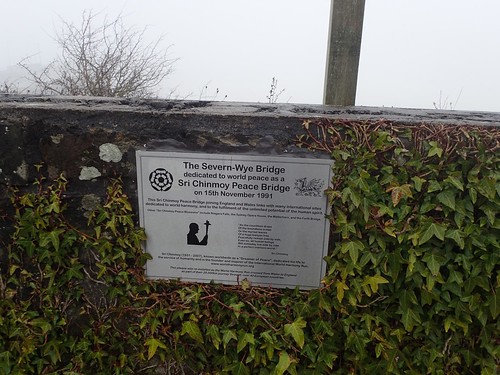
I’ll be honest: I had never heard it referred to as the ‘Severn-Wye’ bridge before.
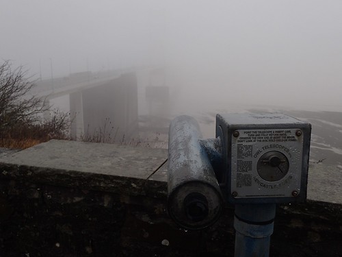
Neither did I bother wasting 20p on the lack of views to wards Chepstow. I used to see these near the North Somerset beaches as a kid. I find it warming to know that they still exist, in a world where modern technology is accelerating.

Even on a day of such dismal visibility, following the Severn Way was straightforward from here.
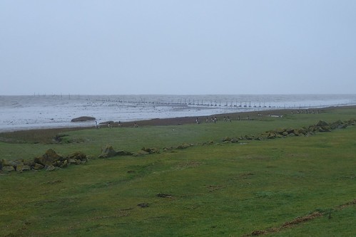
Much like a few miles south, between Aust and Severn Beach; the flats here are home to a number of birds.
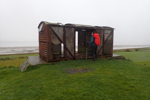
After a couple of hundred metres, I found this dilapidated hut. Possibly a shepherd’s hut, once upon a time? I’d hoped it was some form of sheltered bird hide, inside of which I could sit down and eat my lunch…
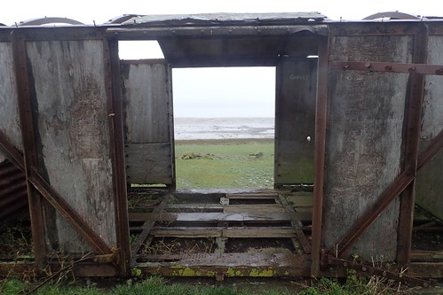
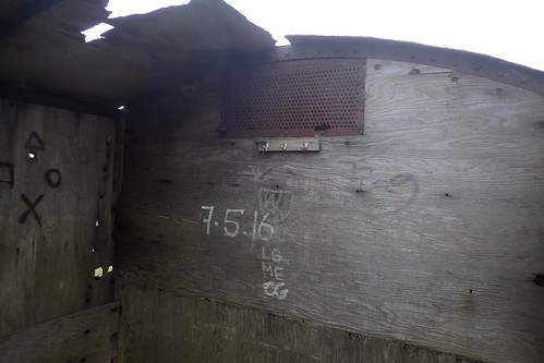
Sadly not. Although there was a place to hang a coat, beside uninspired markings and the Sony PlayStation symbols.
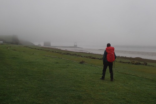
There wasn’t much to admire in the distance ahead or behind me, as I turned around briefly in search of the Severn Crossing.
I believe this was the second outing for the waterproof cover on my Lowe Alpine backpack. Again, it performed superbly and made no attempt to free itself. I’m warming to the red.
Continuing north along the coast, I pretty much soldiered on in reach of my end point, as the rainfall steadily increased. Lunch in the driver’s seat of my car, it would almost certainly have to be.
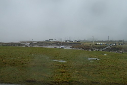
A view of Oldbury sailing club’s property and the many moored yachts, from Cowhill Warth.
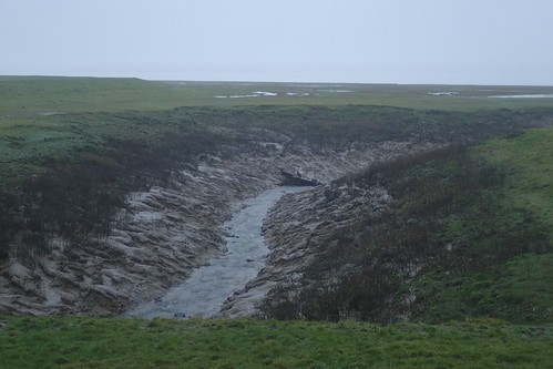
Here, the Severn Way does turn inland, as there’s no public right to cross over Oldbury Pill.
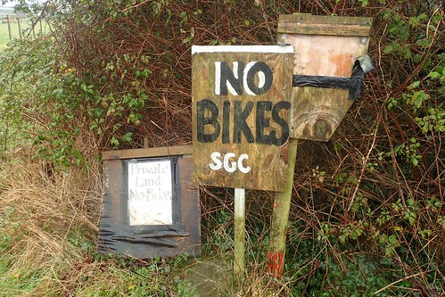
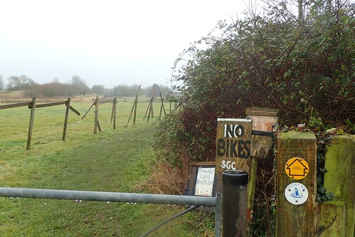
Also, if you’re a landowner and you sign your notice ‘SGC’ (South Gloucestershire Council), is that not an act of plagiarism?
I’m all for keeping cyclists away from single-use footpaths but better signs are available and, if any cyclist has been riding along the coast then, well, they’ve been abusing the Countryside Code thus far.
I couldn’t help but read this sign in the voice of Father Jack.
I didn’t take any photos of Ginger Bread Lodge as I passed closely beside it, before returning to the roads. It looked very welcoming, for anyone looking to spend time away and beside the muddy banks of the Severn Estuary.
Another four-miles [yes, only four!] of the Severn Way complete with this one, meaning I had, at this point, followed it all the way from Bristol up to Berkeley, equating to approximately 30 miles of the full 210 mile route!

There are definitely cycle paths on both sides of the bridge – I walked over (and back) a few years ago, although partly on the motorway itself as I was cheering on a friend running the half marathon. I think on that occasion the one path was closed off as there was also a cycling event on.
Keep meaning to head back down there but have yet to get around to it.
LikeLiked by 1 person
Thanks, Katy. Sounds like a ‘circular’ may be possible then. 🙂
LikeLike