
Sunday 18th March 2018
I find it hard to believe but, the Met Office are warning of freezing temperatures and possible snowfall over the coming Easter weekend… This would mean a third instance of snowfall for the southern half of the UK!
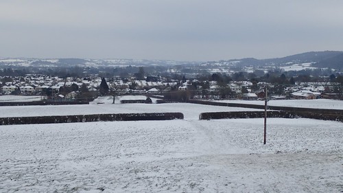
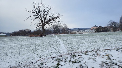
Bearing in mind that we hadn’t seen much more than a few flakes since 2013. During the return visit of the ‘Beast from the East’, I did manage a simple solo walk over to the neighbouring village of Churchill.
Whenever I plot and plan a local route from my doorstep in Wrington, I never venture out to Churchill. Occasionally, I’ll bypass it in favour of the Mendip Hills beyond. Or, perhaps, a portion of the Strawberry Line, which runs nearby.
But I had it in mind to stay local, after a morning of constant snow showers. After lunch, the falling had come to an end, while the cloud remained overhead. If I didn’t leave soon, I’d be resigned to having spent the entire day indoors and would’ve missed out on this rare experience.
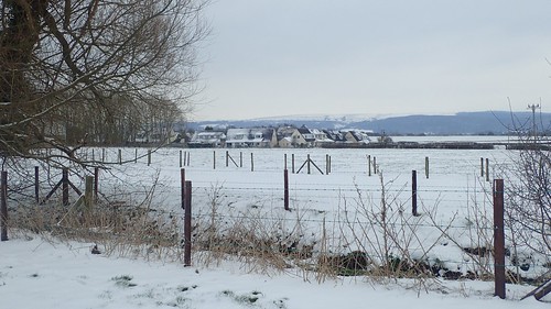
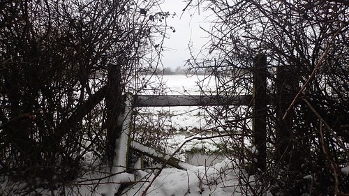
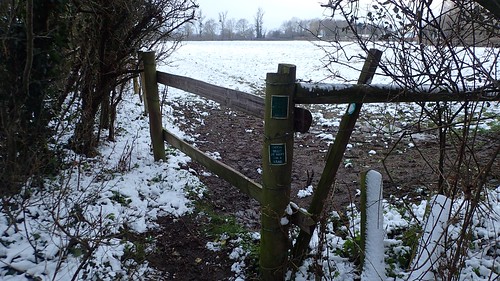
From the Two Rivers Way path near Court Farm, I left Wrington in a south-westward direction; almost immediately discovering a pair of metal kissing gates and a renewed footbridge. I hadn’t crossed here for almost two years, at a time when the stiles and boarding were in need of great attention.
Thanks to the volunteers of Woodspring Ramblers (and, I like to think, my action in reporting the issues to North Somerset Council at the time), this right of way is greatly improved.
My walk continue to cross the bank of what was once a light railway line, linking Blagdon with the (former) Strawberry Line near Congresbury. While the latter is now a ten-mile cycle path, I’d love to see this lost route receive the same upheaval… It would be great for safe access between villages, two and from the Mendips and away from regular road traffic.
Sadly, several landowners (though, perhaps not all) have always stood in the way of intention to form a new route for the public. More on the issue of landowners as we walk on…
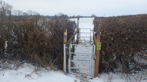
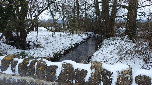
Another improvement and repaired point of access crosses the Congresbury Yeo. This was one of three footbridges I’d found previously and reported direct to the council.
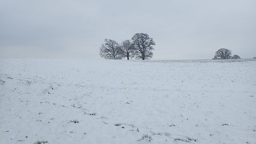
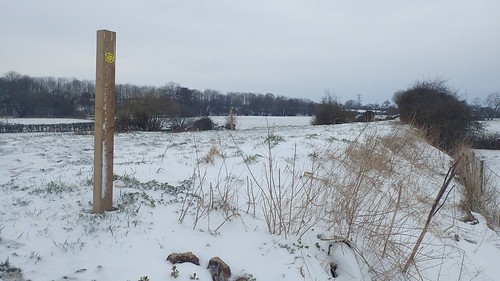
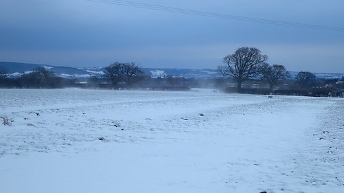
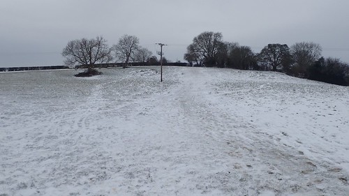
Nearing Stoney Croft House, I was surprised to find myself following in the footsteps of others, as I emerged out on to an open field. I couldn’t imagine other people venturing out this way and I’d only been here once previously, myself.

Navigation can be slightly tricky with or without snow on the ground.
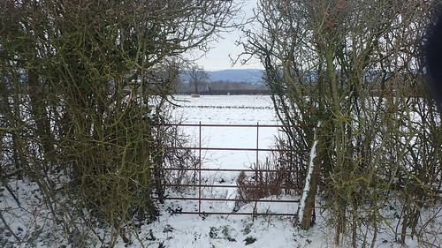
Ignoring the track that runs past the house and leads to the B3133, I met this ‘grate’ at the access point to the south of the field. It was locked and my only option was to climb over. There was also a lack of waymarking. Although, with a wooden stile visible in the hedge beyond, I was confident I was following the public right of way.
This is one of several incidents from this particular walk that I’ve reported directly to North Somerset Council. This week, I’ve received contact from one of their officers, who was already aware of this issue and several others I am going to share… Having conducted his own survey of the area and path network in 2017.
I find it very intriguing, that they haven’t just investigated a couple of footpaths or access points but conducted a survey on a wider scale… You could read a lot in to that!
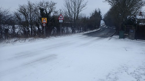
A part of me was pining for the Mendip Hills. Roads were much clearer than during the storms of two years ago. This might still prove to have been my last chance to meet the Mendips in the snow for 2018.
Now, I was looking to join the B3133/Stock Lane south of Stock Farm. Unfamiliar paths and wet conditions, even beneath the snow. I first deviated east to Lower Stock Farm, only to find a locked gate. Back in the other direction, I scrambled over a broken stile, beneath hanging branches and plodded on through the soggy terrain (the council are also aware of this).

[Image source: ordnancesurvey.co.uk]
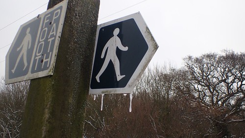
To the east of Stock Lane is a picture of known problem footpaths. It’s a situation that’s been known for several years.
Attempting to walk west along the northern side of the boundary, I soon met a kissing gate at the field corner… No waymark. It had been wedged shut with a pair of fence posts from the far side and no photo either – only because I was interrupted by someone shouting from across the way:
“Footpath’s over there…”
He directed me further north and towards Stock Farm, where I could at least cross a stile to reach the road. Had he been within arm’s reach, I’d contested my right to pass through, map in hand.
I don’t like being redirected when I’m actually correct and confident in that. Neither do I take kindly to landowners who believe they can interfere with non-permissive routes. I know that the council have begun discussions here, with the local owners on how to resolve these long-standing issues.
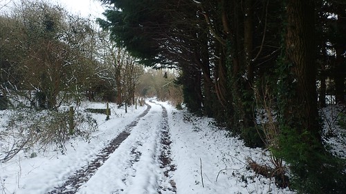
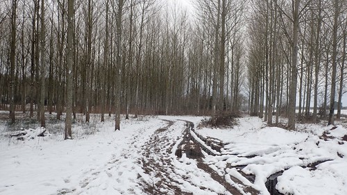
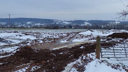
I’ll be investigating other access points in the surrounding area, soon. Meanwhile. continuing with this walk; I walked on down Duck Lane to pass Hope Farm.
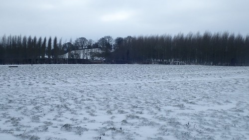
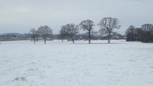
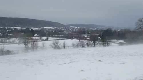
There were no issues encountered as I bypassed Langford. In the photo above, you can see Windmill Hill; my next destination and a space I’d only visited once before.
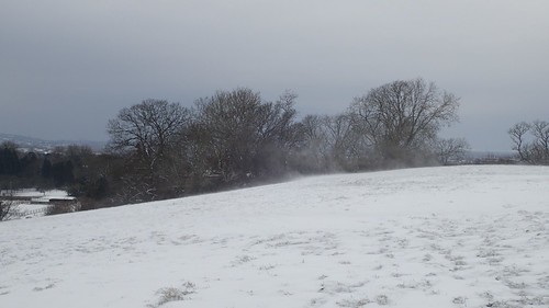
Although it hadn’t snowed for a few hours by now, the wind was fairly constant and the drifts were worth watching. Overheard, darkness still loomed within the cloud.
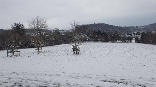
Last time I crossed these woods, I found pigs penned off near the centre. I guess it’s too cold for them to be out here, as with most other animals, who would’ve hopefully been moved indoors, by this time.

A short but steep climb awaited, as I continued towards the western point of Windmill Hill’s summit.
It’s never worth looking towards Weston-super-Mare and so, here’s a video looking back towards the woods standing over Wrington.
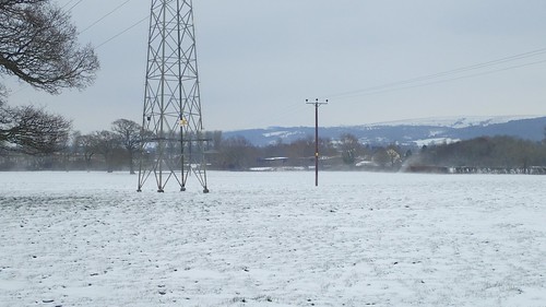
Across the A38, I could see Dolebury Warren of the Mendip Hills to my left, with Sandford Wood over on the right.
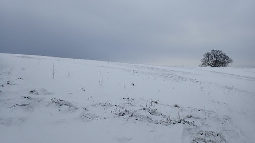
I’m assuming Windmill Hill was once home to a working windmill. Sadly, this space isn’t open access land. Footpaths are strewn across it. But I was surprised by the stark lack of sledgers on this Sunday… Perhaps, at no more than seventy-four metres above sea level, it wasn’t deemed to be high enough!
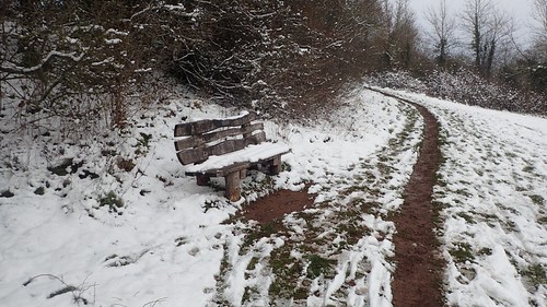
I did find a bench, though! This was a convenient place to pause for a cup of tea and some snacks for energy during my return journey (walking through snow of any depth is not easy). I do like how the more frequently-used footpaths remain clear through the snow.
As I took this photo of my seated view, a breeze shook the branches behind me and powdered the scene in a snow globe-like effect. Over to the right, I could see dark-coloured rabbits emerge from the hedge. Possibly looking for food. It must be hard for such small animals to stay safe in such conditions, with hungry predators never far away.
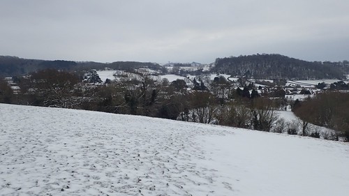
Walking east now towards Langford, I felt a definite sense that more snow was on the way. If only it had been enough to cause further chaos, clog the roads and grant me a Monday morning in bed!
Langford. A local village split in two by the A38. I am looking to move this year and, who knows; perhaps, somewhere down there, I could find my next home!
As I made my way down towards the village, I caught sight of the sledgers. Or, at least, those who had been determined enough to venture out in their minority.
Some people believe it can be ‘too cold for snow’… Presumably Flat-Earthers who don’t believe in the North and South Pole.
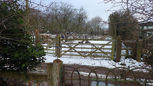
I followed a familiar path behind the mushroom farm and crossed the B3133 once more to take the familiar byway, from which I could follow the right of way that passes the university. On my left was a gate that has always been locked, for as long as I’ve lived here… Sadly, the right of way beyond has fallen in to ‘disrepair’ and remains a low priority of the council’s list. Which is actually understandable, considering it leads on to a dangerous part of a busy road, when this byway is alternatively available.
That doesn’t mean that the owners have any right to lock the gate, though.
Passing behind Bristol University’s Veterinary Science campus. If the university were to get ‘funny’ about walkers crossing their land, I could almost understand. But it’s the neighbouring farmers… For whatever reason.

Reaching the crossing point of Langford Brook, just south of Wrington and west of Stepstones Farm, I found another footbridge that had been repaired since my last visit.
Instead of crossing over, I’d continue north, following the brook towards Bakers Lane.
Accessing the penultimate field was a challenge, thanks to an absence of stile. Actually, you can see the remnants in the bottom-right hand corner… Was it broken and they couldn’t be bothered to repair it? Or is this another incident of the rogue landowner of Lower Stock Farm?
I was able to find my way on to Bakers Lane, while the actual access point from the field is several dozen-metres east of where it appears on the map and much closer to the brook.
Another right of way heads south-west from here and required future investigation. Although, it’s been suggested to me that the farm’s driveway can be used as an alternative “permissive” pathway.
Soon enough, I was crossing the familiar bridleway beyond Stepstones Farm to reach Havyatt Road and then follow Silver Street north in to Wrington.
