
Thursday 23rd August 2018
I was on my way to St. Ives for a long weekend of camping with Brunel Walking Group. As this was an early start to the August Bank Holiday, I left home at 7:30 with the intention of doing a walk along the way.
Cornwall has much to offer, in the way of outdoor opportunities and National Trust visits – some of which I’ve covered in the past. I decided to tread on to Bodmin Moor for the very first time.
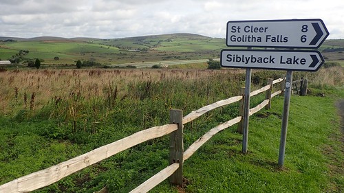
It had taken me a while to plan this walk, which I’d wanted to be a minimum of ten-miles in length. Bodmin Moor is less celebrated than Dartmoor. There appear to be fewer convenient car parking opportunities and the bare minimal of bridleways crossing the Open Access Land.
I’d found a reasonable-looking route on OS Maps that someone else had plotted was around ten-miles and I decided that I could extend it, if I wanted to.
Click here to see the route in OS Maps.
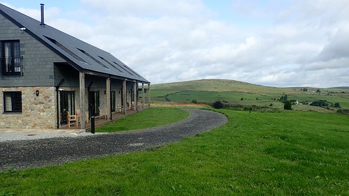
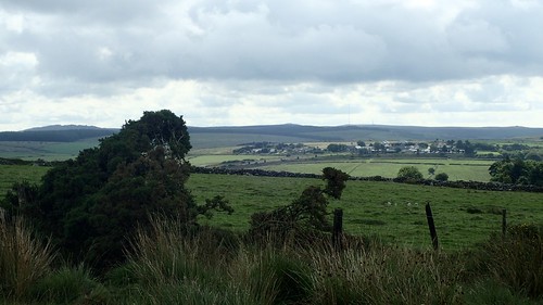
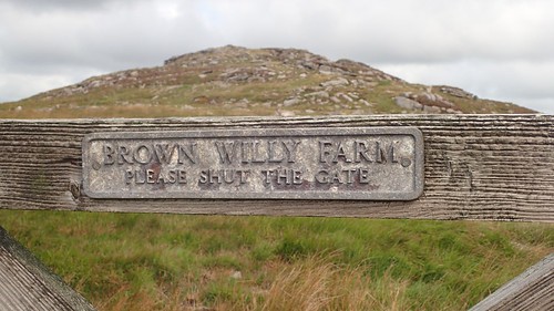
With no directions as to where to park a car, I took a chance on using the marked bays beside the Jamaica Inn, which also apparently houses a museum inside. It was at Bolventor and just off the A30, which meant I could complete the two-hour drive without requiring any form of electronic navigation.
Bolventor. Cornish for ‘Bold Venture’?
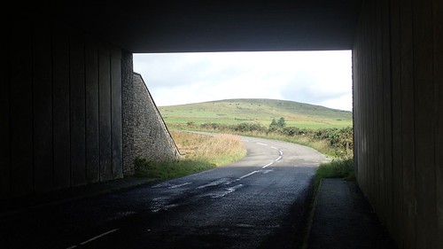
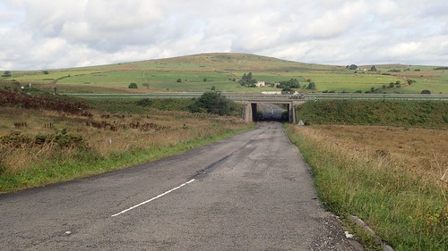
If there’s one downside to this plan, it meant slogging my way along tarmac and beneath the A30 before I’d come close to the moor. I’d then have to retrace these steps at the end of my walk.

Before following my first footpath, I continued further down the dead-end road, following a sign for the local church.
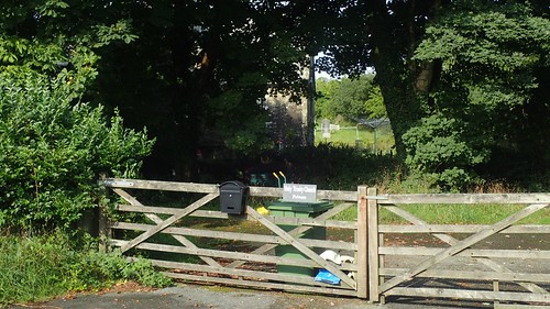
I was very surprised to find it lies beyond gates marked as ‘Private’ and I didn’t dare risk venturing beyond.
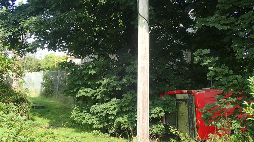
I’d never come across a private parish church before. I could see part of the south-western elevation had been fenced off, either for security or for safety. That red van, with its rear doors wide open, was an ominous site. On the tree beside it was a pair of satellite dishes… Was someone living in the van?!
Apparently, the church was closed several years ago.
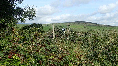
I retraced my steps briefly up the road to turn on to grass for the very time of this day. I chose to ignore the path of the route I was loosely following and used the westward bound right of way at grid reference: SX 181 767.
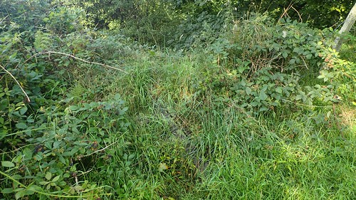
I almost missed the left-turn, where the stile had been toppled and was now disguised by the overpowering grass. It was quite a hazardous climb over this bank. I don’t know if the stile would’ve actually help to do anything more than highlight the way but a series of steps could just be found on the other side.
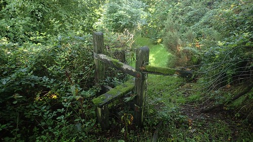
Crossing an unmarked stile, I hoped I was going the correct way.

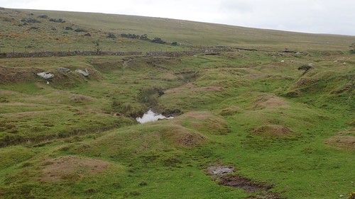
There was a momentary stream crossing beneath this, with an option of two bridges to follow and no waymarking in sight. Well, I found myself walking onward.

At the end of the next path, I met a wire fence that could be safely uncoupled. Still, nothing more to suggest this was the public path. Should I have passed through the gate to my right and in to this next field? I wasn’t about to turn back now. I could see a stone stile ahead.
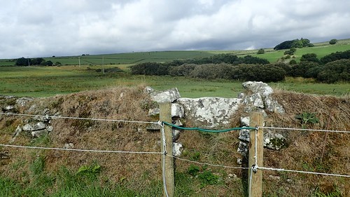
Climbing this obstacle presented yet another challenge. But I appeared to be on the correct line of the right of way.
I was supposed to pass through the hedge opposite but the ground was far too boggy. We’re talking ankle deep! I tried to evade the deepest parts and ended up following the hedgeline to the next field; effectively trespassing but, there was no farmer to be seen or heard.
Hopping across more bog and a couple of narrow streams, I reacquainted myself with the public right of way. At least, I found a waymark arrow! Albeit, on a post left to rot on the ground.
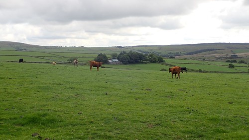
This dormant arrow did lead me in the correct direction across the field. My first interaction with cattle proved to be uneventful. There were barely interested. I’d read and seen that much of Bodmin Moor is used for livestock and grazing and I knew that I would quite likely encounter more of these beasts throughout the day.
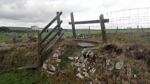
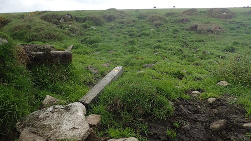
Another curiosity, in my attempt to leave this field legally. I wondered whether I had found my way back north to Somerset; a land where farmers generally don’t appreciate people rightfully walking across their field. I may it over this shambles of a stile in one piece. I’ve also reported it to Cornwall County Council (and via the Ramblers’ PathWatch app).
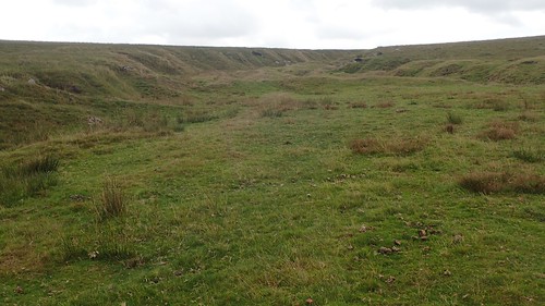
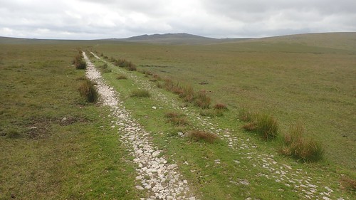
From there, I follow the right of way along a farm track, passing flocks of sheep to a point where the path terminates on the map. I turned right through the next gate, hopped over another and found myself on Open Access Land. Bodmin Moor! My adventure could begin.
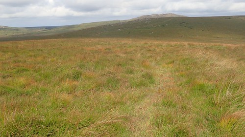
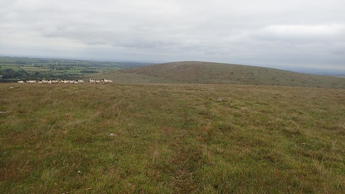
My first intention was to head north-east and to the summit of Tolborough Tor. True to the map between my hands, there was no path. While the grass was long and lumpy in places, the ground beneath was dry. Weaving my way through, I made it to the cairn on top.
Over the course of the weekend, I would be asked what I thought of Bodmin Moor and how I felt it compares to Dartmoor.
Although I’m not hugely experienced with either, I felt that Bodmin Moor was easier to navigate, as you can often spot houses, farm buildings and even the A30 from the higher points. On Dartmoor, however, you could walk for an hour or less and find nothing but hills and valleys in your surrounding. A navigational nightmare, perhaps.
From Tolborough Tor, I wanted to head north-west to Catshole Tor. I could see a faint path or vehicle track in the grass before me. Studying my map and aligning my compass, I felt confident I could follow it for much of the way.
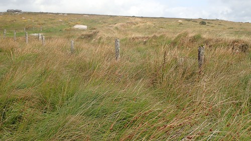
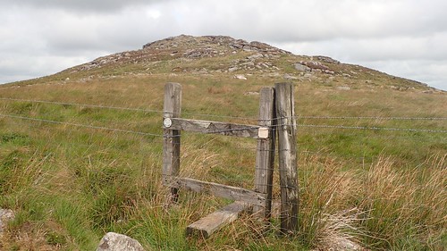
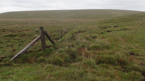
You’ll typically find more fences on Bodmin Moor than you would on Dartmoor. It is not advisable to climb them and, with a lack of access-detail on the Ordnanace Survey maps, it can take time to find the intended gate – or stile, on the rare occasion you’re fortunate enough to encounter one of those.
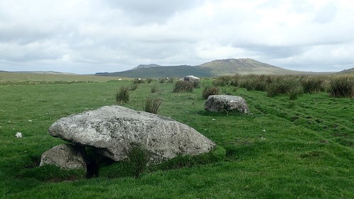
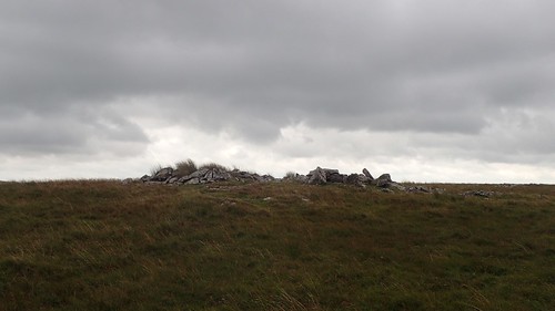
Through an unlocked field at the end of a track and another vague path on the ground led me up to Catshole Tor. Apparently classified as a tor cairn.
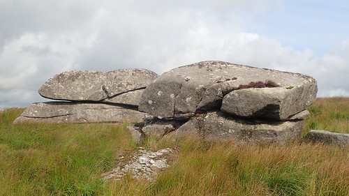
I was curious to know where the name derives from. We’ve all heard of the Beast of Bodmin (Best Goon Brenn) but I’m pleased to say there was nothing waiting for me around any points of these monstrous rocks.
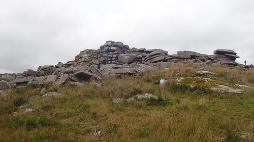
Two tors done. My next ambition was to head for the highest point in all of Cornwall…

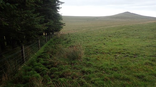
Brown Willy! This was less than a week after I’d lead a group up to Lord Hereford’s Knob in South Wales.

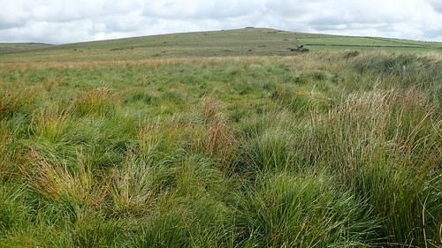
I continued in a north-north-eastward direction, to a point where I could pass through another five-bar gate and begin hiking up to the southern end of the ridge. There was no path. With patience, I could find my way through the grass and bracken.
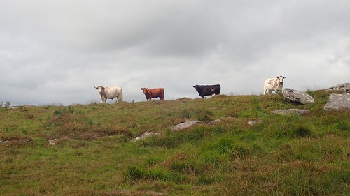
I was able to evade these curious, horned cattle near the end of my climb. If they could speak, they’d probably question my whereabouts and why I didn’t follow an easier route to the summit.
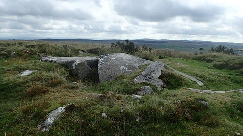
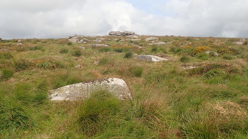
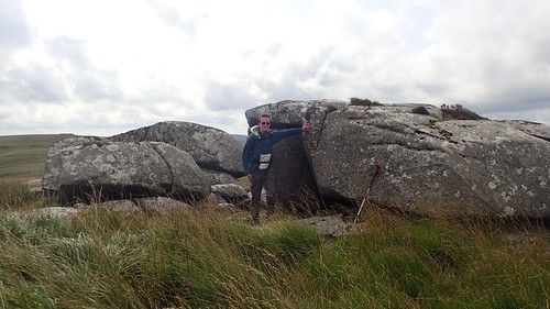
Large slabs of rock. A common moorland scene for the south-west of England.
I even found a stile, with waymarking for a permissive route to the top.
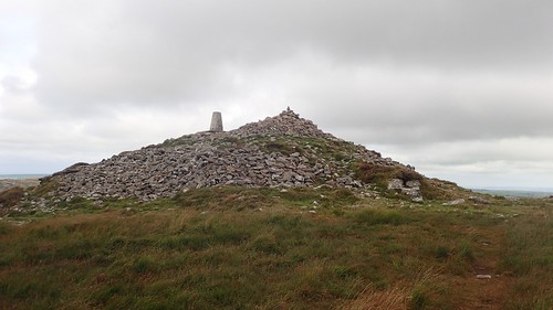
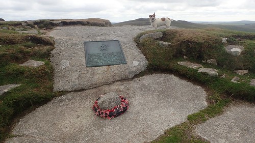
I was able to follow a trodden route to the summit cairn and trig point.

At 420m above sea level, Brown Willy is the highest point in all of Cornwall. Although far from a mountain in terms of elevation, it dwarfs the high points of several other counties, including Gloucestershire.
So far, I’d not seen another human soul. I often hear or read of experiences likes this over on Dartmoor. I’m not quite used to it in my local countryside of North Somerset. Even on a weekday outing, I’ll typically bump in to the occasional dog walker. Yet, here I was on the highest point… Alone.
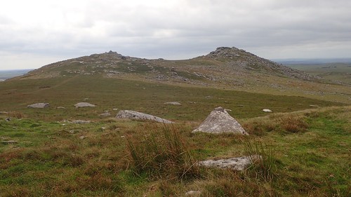
Next on my list was to head over to Rough Tor – apparently the locals pronounce it “Row-tor”. That’s ‘row’ as in an argumentative row. Not rowing a boat.
I followed a fairly obvious path across the De Lank River before climbing up to Rough Tor.
From a distance, I had seen there were a couple of people already up here and I had noticed that it’s within fairly close proximity of one of the few marked parking areas around the moor.
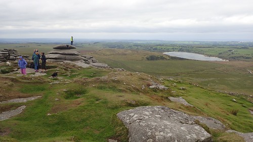
But still, it was busier than I’d anticipated. Why were all of these people here, on a Thursday morning? Why weren’t they heading across to the highest point?

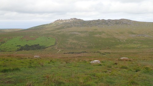
There are some interesting rock formations on Rough Tor, similar to images I’ve seen of Cheesewring, which is on the other side of the A30.
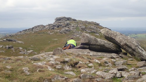
Between Rough Tor, Little Rough Tor and Showery Tor, there was someone on each stack of rock. Each person wearing a hi-visibility vest.
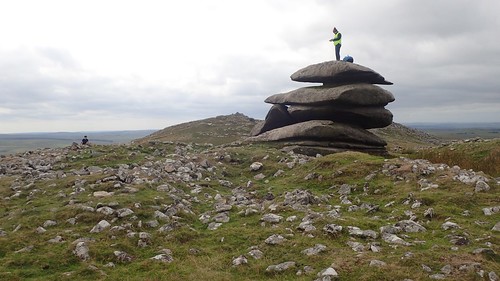
I’m only guessing that some kind of event, open to all ages, was taking place.
My thoughts of stopping here for lunch had diminished with the presence of others and the fierce westerly wind.
I continued north to the cairn and then on to the Roughtor Plantation. Through which, the route I was following appears to pass through… But I found no gate, no stile or any point of access. So, I followed the hill down to the edge of Roughtor Marsh.
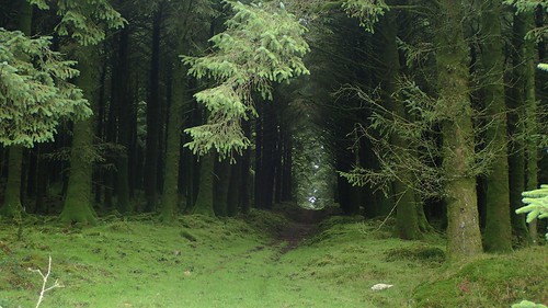
To the north of the marsh, I was able to enter the plantation through a gate at its south-east end. It was dark, forever green and mostly sheltered from the wind. A number of trees had already fallen around the woods. I found a spot on one of the soggy banks and sat down with my lunch.
After lunch, I would continue to head east across the moor and handrail my way towards the next summit of Buttern Hill.
Handrailing is a genuine navigational technique and one that can be practised quite freely here, as opposed to on somewhere like Dartmoor, where fewer man-made boundaries exist, in proportion to the rest of the land.

Climbing to the top of this next hill, the landowner or farmer had driven past in his off-road vehicle; bouncing and bumping his way across the terrain.
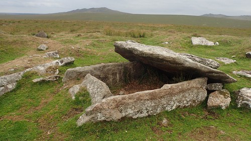
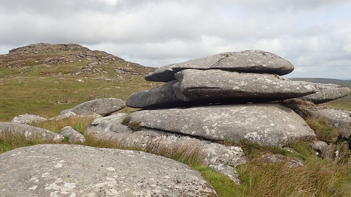
Of the few scattered cairns upon this summit, I was most interested in this coffin-like structure. Had it been excavated at some point? Who would’ve been laid to rest here, above ground, when so many are buried below?
With sheep still scurrying at the sound of a diesel engine, I could make my way further east to cross yet another valley and head up to Bray Down.

This was an entirely optional step for me and one that doesn’t feature on the route that I had used for inspiration. With the promise of a trig point at the top and no certainty as to when I might return to this northern point of the moor, I decided it was going to be worth it.
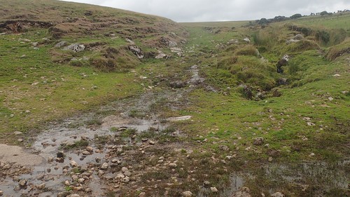
Once I’d located the gate near the south corner of the field boundary, I was faced with a couple of streams to cross. Each of which was just to wide for me to confidently attempt a jump across.
In many places, I risked losing my walking poles as a depth gauge. There was no way I was going to risk placing my leg in afterwards. I was fortunate to find one area of solid rock, with running water above no more than ankle deep… It was safe enough and I crossed without incident.

I climbed eastward along the southern boundary line, where the vegetation was at its most minimal. From the top of this climb, I could trek north across rough terrain and on to the trig point; now standing 346m above sea level at Bray Down.
Not wanting to tackle that stream again, I continued south; crossing the boundary at a point where I felt it wasn’t accurately represented on the map and down to the valley beneath Leskernick Hill, where examples of earthworks could be found.
At the top of Leskernick Hill – my final high point of the day – I found yet another cairn at 329m above sea level.
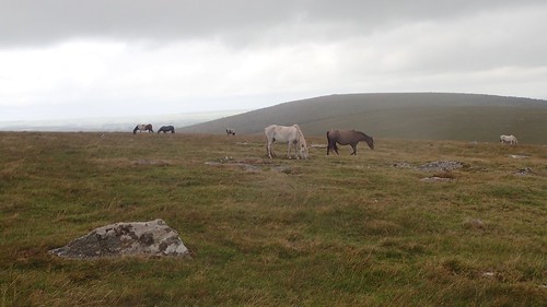
Horses roam the land nearby, as I began to contemplate my return to the car as the heavens finally began to open.
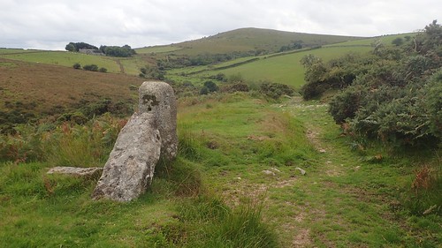
My plan from here was to head south-east, passing two stone circles and looking out for a stone row, from which I could follow a bridleway and exit Bodmin Moor…
I found the bridleway easily enough, or so I thought.
But, as I realised things weren’t quite marrying up with the map in front of me, I activated the GPS on my phone to find that this track leads only to Leskernick Farm and not Blackhill, to where I should’ve been heading. So, this blatantly obvious path doesn’t feature on the map. At all.
The actual bridleway I’d been looking for is much harder to spot, although it does soon pick up the boundary line before leaving the moor.
Suddenly, I found waymarking. There was a pair to choose from at one point and I faced no great challenge in navigating my way along the intended route.

There was just the one ford crossing before I would follow the roads back to my car. Large insects could be seen thriving in the depths.
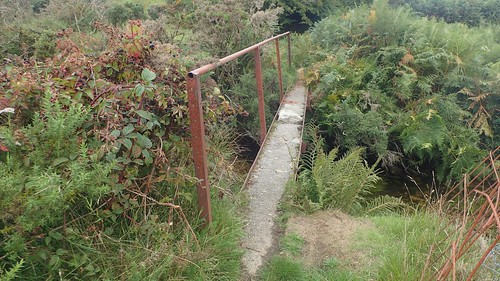
There was just the one bridge to provide safe passage across and it didn’t come without its own warning sign.
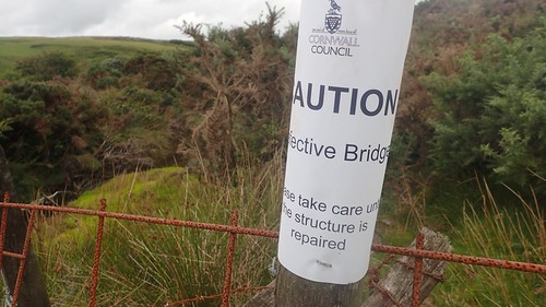
In Cornwall, they don’t close things that need repair, they just advise you to ‘take care’ along the way…

Passing back under the A30 and I’d return to my car at Bolventor. A little less dry than a few hours earlier but only an hour’s drive away from pitching my tent near St. Ives. I was pleased to have completed my first walk and navigation around Bodmin Moor and without major incident. I wonder when I might ever return to explore some more?

Sounds like a great walk, and well done for navigating without decent paths, stiles or way marks. 😄
LikeLiked by 1 person
Thanks, Ruth. That was always the one thing that I was most concerned with (apart from the presence of cows). Next challenge will be to delve deeper in to Dartmoor! 😉
LikeLike