Until very recently, I was the nominated Footpaths Representative for Brunel Walking Group in Bristol. My duties were few, while I was mostly responsible for recording and reporting incidents we encountered along the local public right of way network, to the relevant authority.
It’s fair to say that very few group members (from an active membership of four hundred-plus) got in touch to inform me of obstructions or interference they may’ve encountered on their own walks (obviously, I can be on every group walk all of the time). But one of the more recent reports led me to undertake my own investigation across the Mendip Hills and in to East Somerset.
I would be heading for a field on land within the parish of Doulting, just east of Shepton Mallet. The person who’d reported this to me was unable to provide me with grid references, as they did not carry an OS map but instead worked from a written guide book (the author of which, funnily enough, lives about half-a-mile from me). So, with a couple of the route map and its description, I was able to plot my own way forward.
Now, I wasn’t going to drive for forty-five minutes, walk around a field, take some photos and head home again… Using the car park at Shepton Mallet (which used to be free on Sundays), I’d created a circular walk of almost ten miles that would satisfy many of my needs.
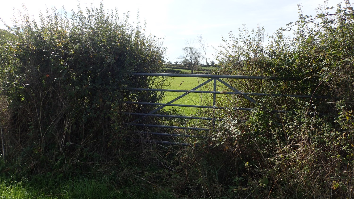
I was about an hour in to my walk when I arrived at the north-western end of this problem footpath. OS grid reference: ST 649 422.
Looking through the stile and from the road, I could immediately see the electric fence that was the reported cause of complaint.
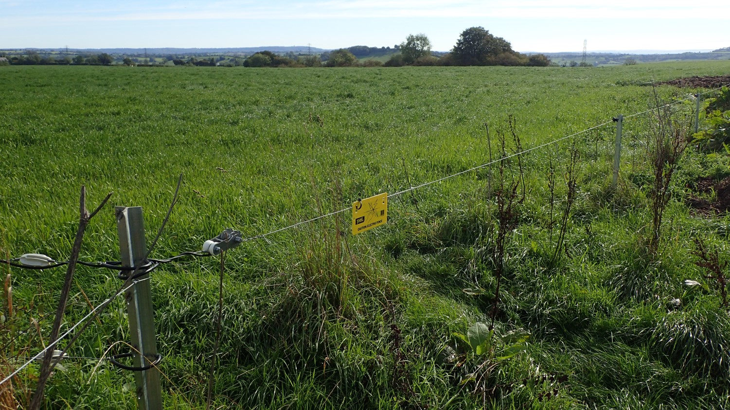
At least it had a warning sign (as the landowners are legally required to do), as I’ve encountered a number of fences that do not and you have to listen for the ‘tick’ in order to tell whether or not it’s live. In actual fact, this fence wasn’t live at the time and no grazing animals could be seen or heard.
But the landowners are legally not allowed to obstruct a public right of way. They own the land but not the footpath. Even a diversion cannot be put in place without the say-so of the local authority.
On this occasion, I was able to follow the vehicle track from the road and take a slight diversion from the right of way and to a point where I could safely unhook the fence, pass through without torture and then reattach the line behind me.
In most situations, I’d expect to find this feature beside the stile.
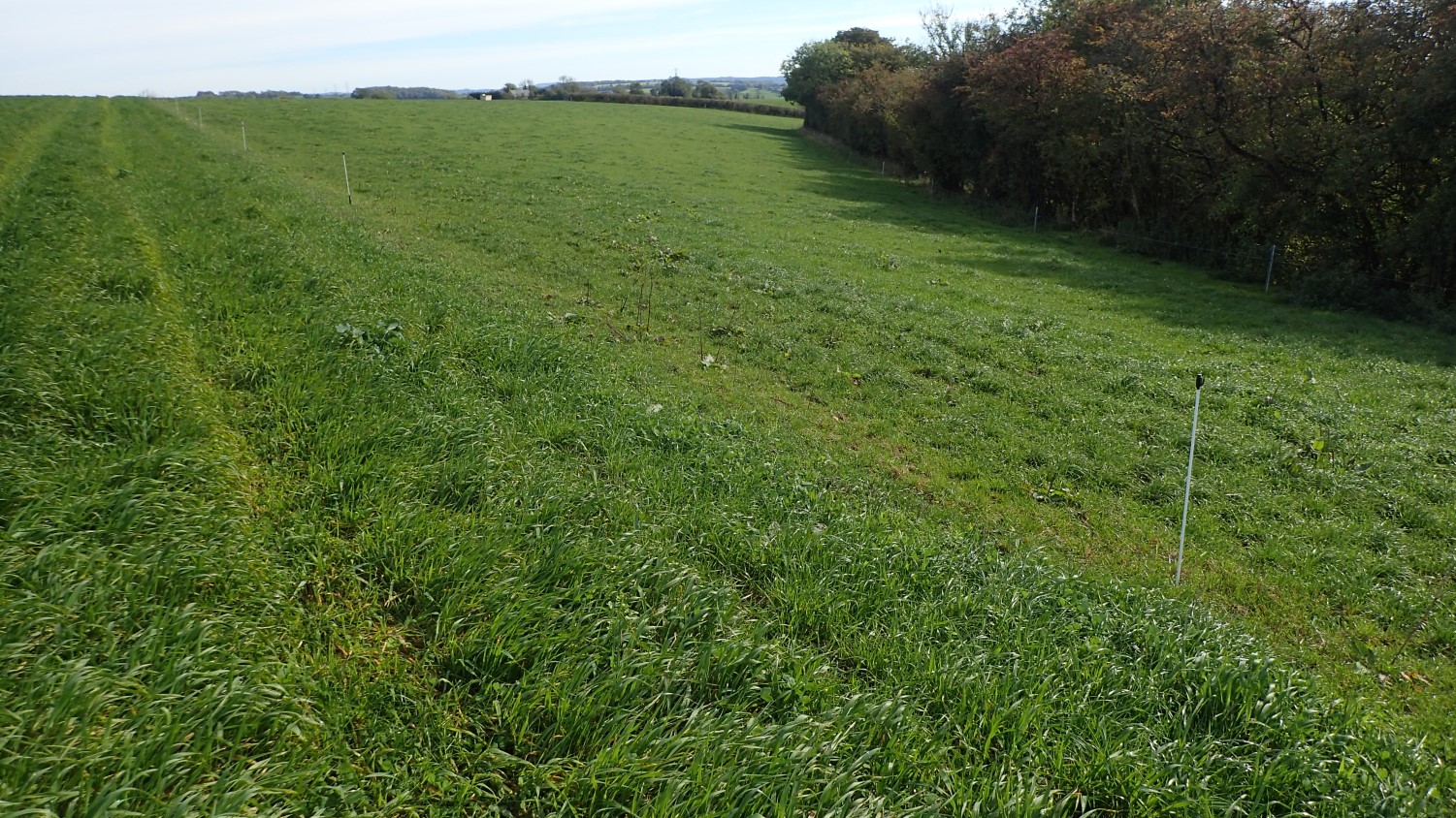
I thought I was making progress, until I came to another wire fence struck randomly down the length of this bisected field and impeding my effort to follow the public right of way towards and parallel beside the line of trees to the right.
I walked up and down but there was no means to unhook this one. No stile and not way for anyone much less than 6ft tall to safely step over. An approximate grid reference would be… ST 651 421.
While I do not recommend this practise; in group situations, I’ve known people to carefully remove one of the plastic posts, allowing all to step over, before reinserting it in to the ground. But the first port of action should always be to make a note of the location and to later report it to the local authority (in this case, Somerset County Council) and ideally, also through the Ramblers’ Pathwatch app (which you can also do from a PC).
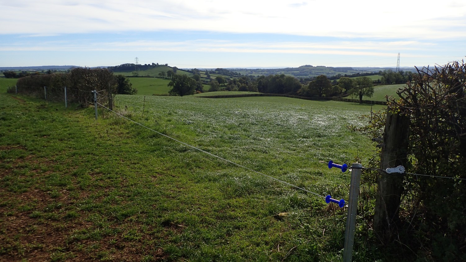
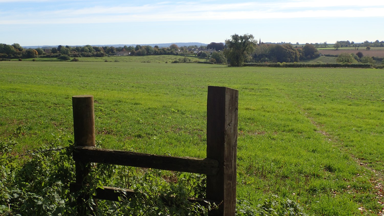
Moving forward with my walk, I was able to unhook the next line of fencing and pass in to the next field. Although the actual entry point is slightly east of where it appears on the map, at OS grid ref: ST 653 420.
Continuing down across this field, I was ready to believe I’d survived and that I’d soon reach the track I was heading for.

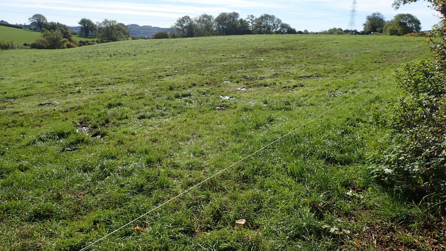
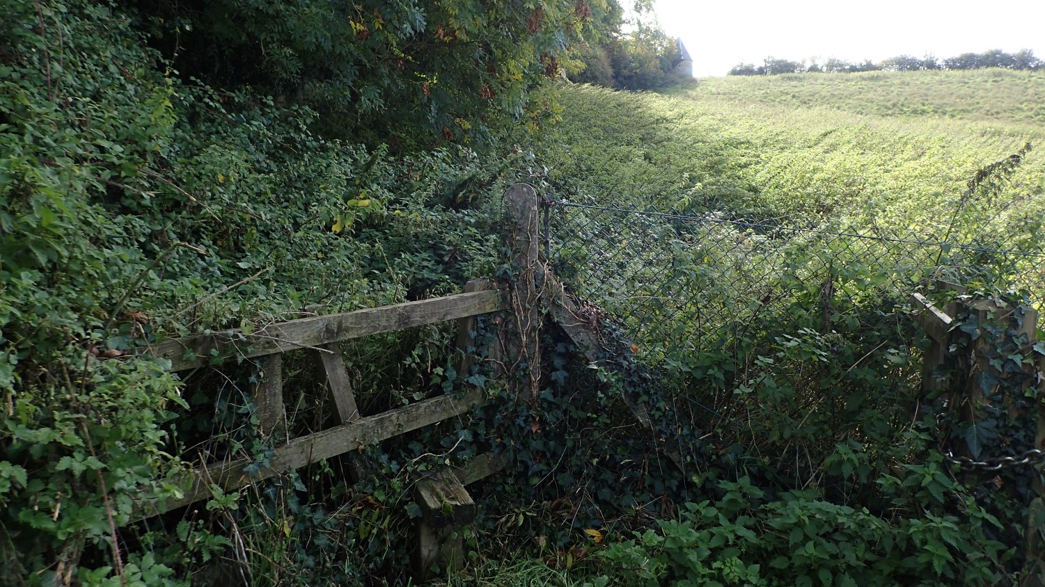
It looks as though a fence had been in position ahead of the stile that would see me leave this problem field. Fortunately, the wire was absent on my visit. I wonder what happened there?
Legally, a member of the public is not allowed to cut wire or remove any obstruction beyond trimming a few overhanging branches, perhaps.
Over the track and, at ST 654 419, I almost tripped over yet another wire, crossing the stile in to the next field. If this was is ever live, there was no warning sign to be found and, yet again, no means to unhook or safely climb over.
Sometimes, a landowner will leave a length of garden hose or insulation on top, so that you can climb over without receiving a very undesirable shock. I sometimes use a folding foam sit mat on top of a barbed wire fence, when I need to climb over something hazardous.
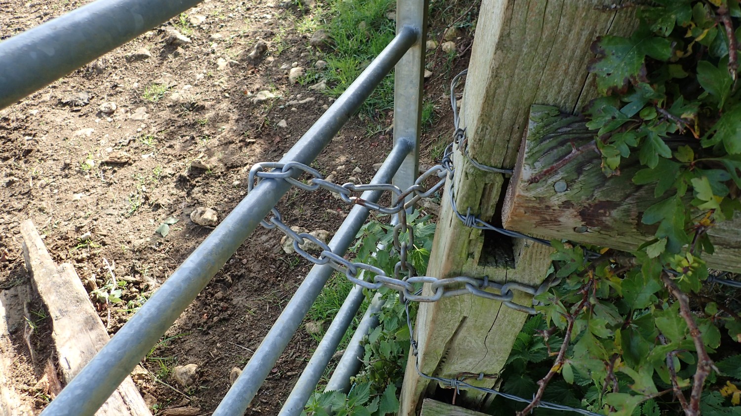
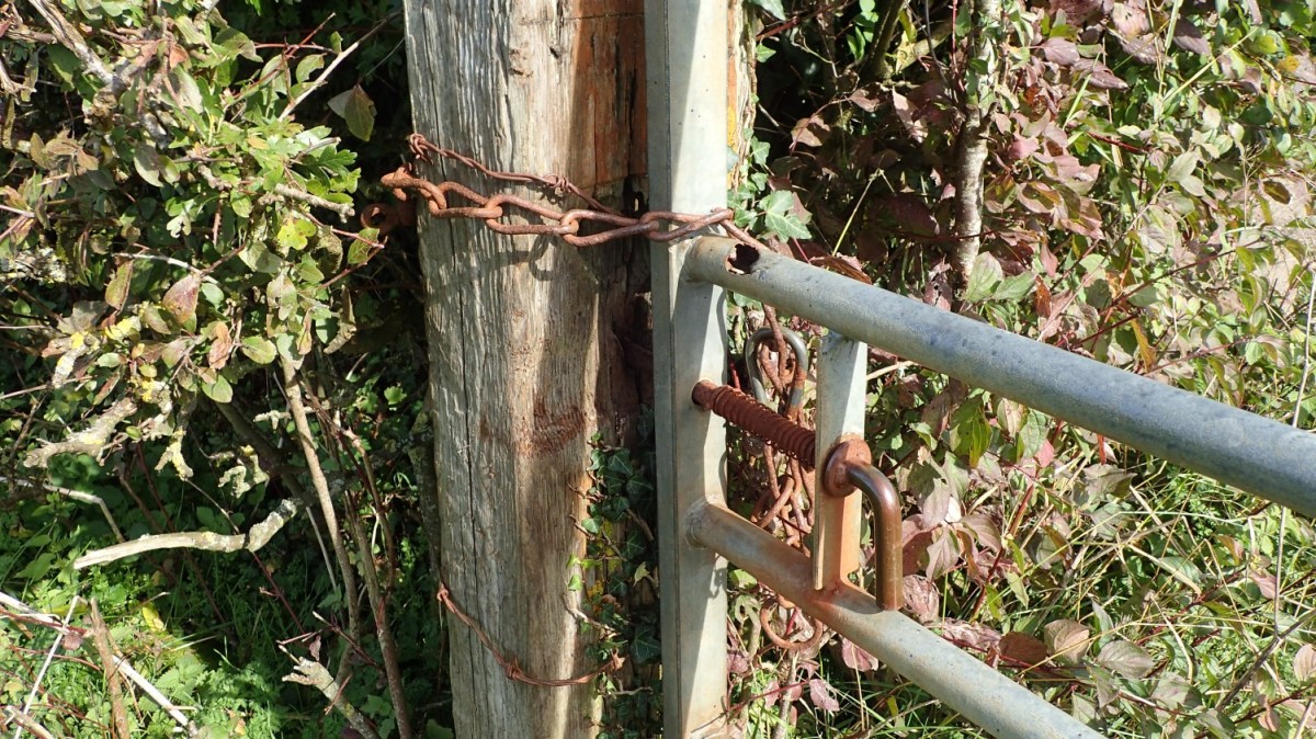
Waymarks were present on either side of the gate posts across this field, while the gate itself had been chained shut. Although the chain can be released thanks to a carabiner, I wouldn’t say that this was the most ideal solution and that people may feel more inclined to climb over (as I did – and always at the hinge-end).
A more convenient solution would be to replace this gate with one that incorporates a small kissing gate at one end. As I understand it, the council will contribute towards a landowner’s expenses when maintaining a public right of way.

Another chained gate sat further on, as I followed a fingerpost to reach the next road of Winterwell Lane near Chesterblade.
Moving on, I would follow the roads heading north towards Cranmore… Not through fear of encountering more electric fences but because I was trying to follow the given route as close as was practical.
It was between fields just south of Cranmore Station, at grid ref: ST 666 428, As far as I could see, there was no convenient way to open the gate, thanks in part to the overgrowth on either side. Climbing over was my best option; ignoring the thought of walking around the hedge, which technically means trespassing as you leave the right of way.
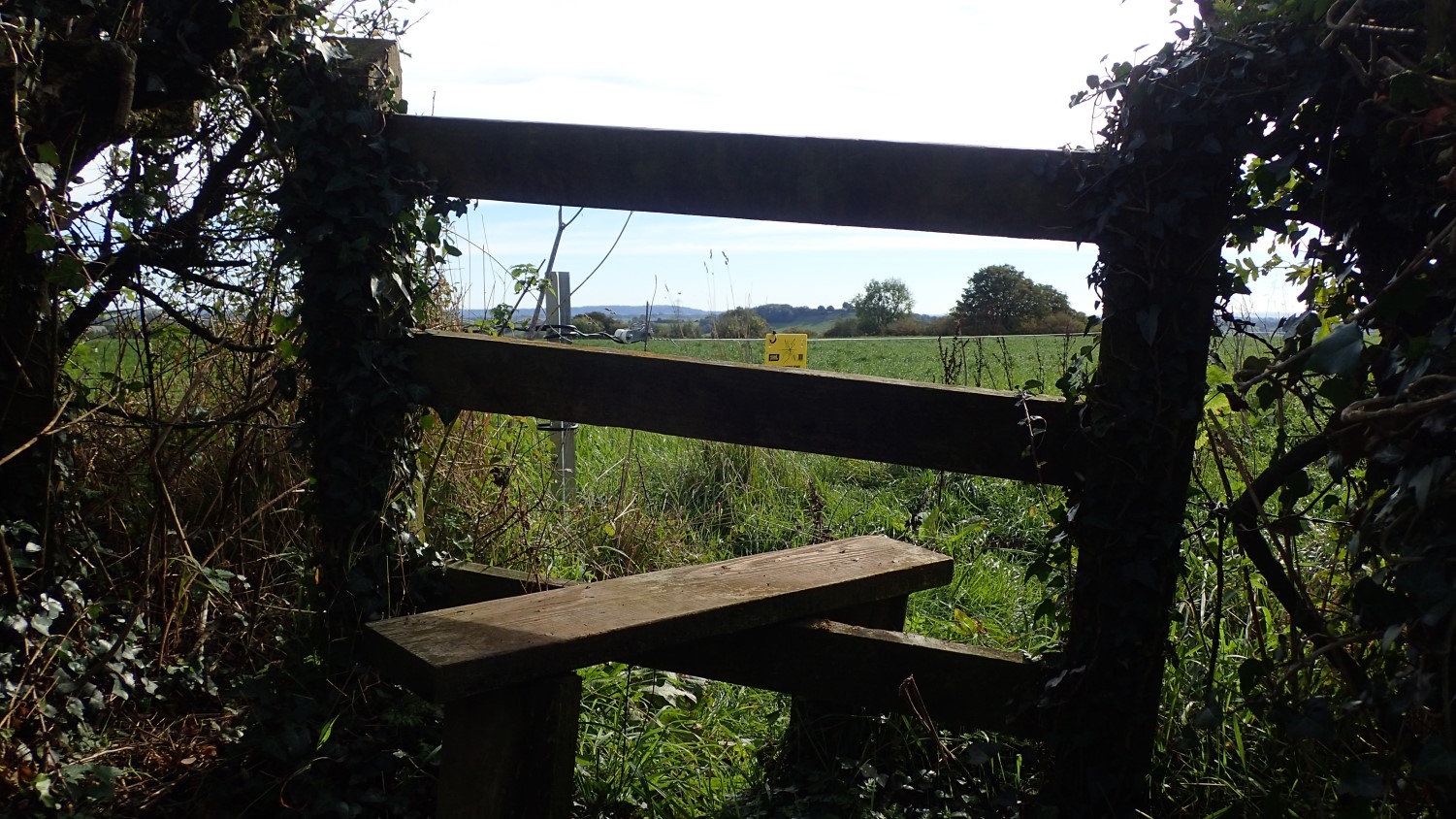
By then, my day of recording incidents and obstructions was pretty much done. In the photo above, you can see a stile without its waymarks. A right of way does exist beyond this and you can see that quite clearly worn in to the ground.
But the presence of a stile doesn’t always indicate an unsigned public right of way… Likewise, many waymark symbols and fingerposts ‘go missing’ in rural parts of the country, Always carry a map and, if it’s more than a few years old, check your route ahead of time using the OS Maps app or similar.

Crops are often a problem between spring and autumn, in that time of year we occasionally refer to as summer. Again, the farmer or landowner is required not to restrict to public’s access while, in my experience, it is very rare to find a situation where a definitive path has been cleared… Especially in Somerset!
Legally, you do have a right to follow the line of the right of way through or over crops. Some walkers are more respectful though (too respectful?), and prefer follow the edge of a field boundary where practical.
Walking alone, I’m known to stomp my way across anything that attempts to grow… With a larger group in tow, I will normally opt to try and walk around.
If I encounter a problem on a walk and don’t make a note of it and report it, there’s no guarantee that the next person passing through will do it. In fact, it’s impossible to know when (or if) another human will encounter this same situation. Especially in more rural areas. I’d say a dog walker is less likely to bother and would just carry on in another direction… It is only map-bearing hikers like myself who would stop to make a note of it.
In the example above (ST 644 432), it seems entirely plausible that this route could be classified as ‘lost’ over time. It merely provides a direct link between the historic site of St. Aldhelm’s Well and the A361 road. A tarmacced, alternative route passing around the local church is also available.
I know of another example like this only a couple of miles close to home, where North Somerset Council have informed me that the route is as good as ‘lost’, as it leads to nothing more than a blind bend on a busy road and a safer, more convenient alternative is available.
Ramblers’ Pathwatch
Rights of Way and Accessing Land
OS Maps
Basics of ROW Law
ROW Maps
What is a Public Right of Way?
If you’re interested in maintaining your own path network both close to home and as far as you may travel, I’ve added a few links above that may be of interest.

Are you planning a return visit to see if these problems are resolved?
In my experience the Council often won’t bother with “problem” landowners such as this one and the obstructions remain. After many years I eventually managed to get Dorset County Council to resolve a problem with a landowner obstructing the path (the landowner claimed the path had been legally diverted, but they could produce no evidence of it and nor did the Council have any such records) and had created their preferred “alternative route”, which is the one they claimed the path had been diverted onto. The Council insisted it was low priority to resolve the problem (for years) because there was an “alternative route” (unsigned), but the land owner had begun obstructing this too. It was only with threats of legal action, sending them lots of photos, and doing an FOI request of the definitive route (as otherwise they charge you for an extract from the map) and entering numerous complaints I (eventually) got the Council to do something about it. But it is very time consuming!
LikeLiked by 1 person
Hi Jon,
I will revisit the area in time. Now that you mention it, I’ve yet to receive even the automated response that Somerset County Council usually provide!
I’ve previously had decent results with North Somerset Council and Bath & North East Somerset Council, who are usually quite attentive towards these issues. I’ve seen fingerposts replaced and overgrowth cleared in only a matter of weeks. There’s a problematic farm and landowner only a couple of miles from home that North Somerset Council are well aware of… Last time I spoke to them about this, they told me they were ‘discussing with’ the landowner to come to an arrangement, instead of using their powers to have the right of way accessible as it should be. While I was grateful for the personal response, I did feel as though they were letting him get away with blocking off kissing gates.
Normally, Somerset County Council will send an automated response along the lines of ‘the issue has been resolved’… When later revisiting the area in question, I find that nothing has been done!
Both South Gloucestershire and Wiltshire councils tend to log reports without ever getting back to you (there’s a serious problem near Bratton that I’d love to revisit). I reported something to Cornwall County Council in August, only to be told that they couldn’t prioritise it, due to the lack of funds, available staff and the fact that it was of no threat to public health. I imagine that most of their funding, if any of it, goes towards maintaining the coast path access.
I’m pleased to hear that you did eventually make good progress with the council in Dorset. It really shouldn’t be so hard, should it? That case sounds very similar to the one I encountered in Wiltshire last year, where a landowner had illegally obstructed part of the White Horse Trail but installed his own (unofficially signed) diversion around his property… I sent photos and all but never heard a word back. He even personally directed us around that “path” and we each had to force our way beyond a series of falling fence panels to reach the stile.
In a simplistic way, I like to believe that councils could fine the owner and then use that money to fund further services. But I guess it costs a certain amount of money to do even that much and most councils are too preoccupied with making cuts to services and building houses, these days.
LikeLike
This kind of thing annoys me so much. I especially dislike it when paths are planted over, and unlike you I try to lead big groups through them wherever possible!
LikeLiked by 1 person
I’m glad to know you understand this frustration, Jonathan. Even more so that you’re confident enough to lead people along the legal right of way, regardless. 🙂
LikeLike