Sunday 24th February 2019
Coming to the end of the second month of this relatively new year, I decided to head out and tackle my next section of the Severn Way. On the previous day, I’d attended a fairly ‘undemanding’ group walk around Somerset. While it had been be nice to meet with people and experience the unseasonal shine of the sun, I was craving a bit of alone time and at least one hill, before returning to work the next day.

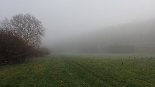
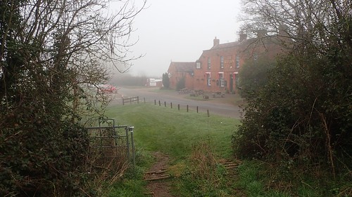
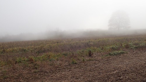
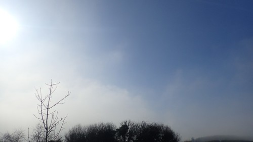
I was destined for Gloucestershire once more. Driving north, I would encounter thick fog on the way around the edge of Bristol. These conditions would maintain all the way along the M5 and, even an hour later, my visibility was impaired by the fog as I drove through the city of Gloucester.

Eventually (and with some mis-direction), I did arrive at my intended car park; the other side of the hedge from the local church in Sandhurst.
I remember that I was absolutely bursting for a wee by the time I was putting my boots on. With no public toilets nearby, I had one thought about trying to find a secluded area of hedge in the churchyard… But a lady (and owner of the other car in the park) was present in the churchyard.
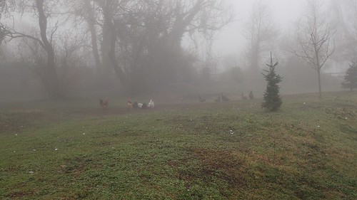
In some ways, this fog was a blessing, as it would allow me to ‘go almost anywhere’ with a reduced threat of being seeing by approaching motorists or outlooking home-dwellers!
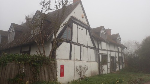
Somewhat relieved, I continued south along the road, soon passing this Tudor-style house (I didn’t see many others like it) with a postbox built in to one wall.
My original plan had been to negotiate a series of cross-field paths and minimise the road walking to reach the point at which I’d previously left the Severn Way… But with such poor visibility present, I decided to keep things simple, if less comfortable underfoot; stepping aside for only the occasional car.
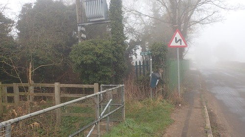
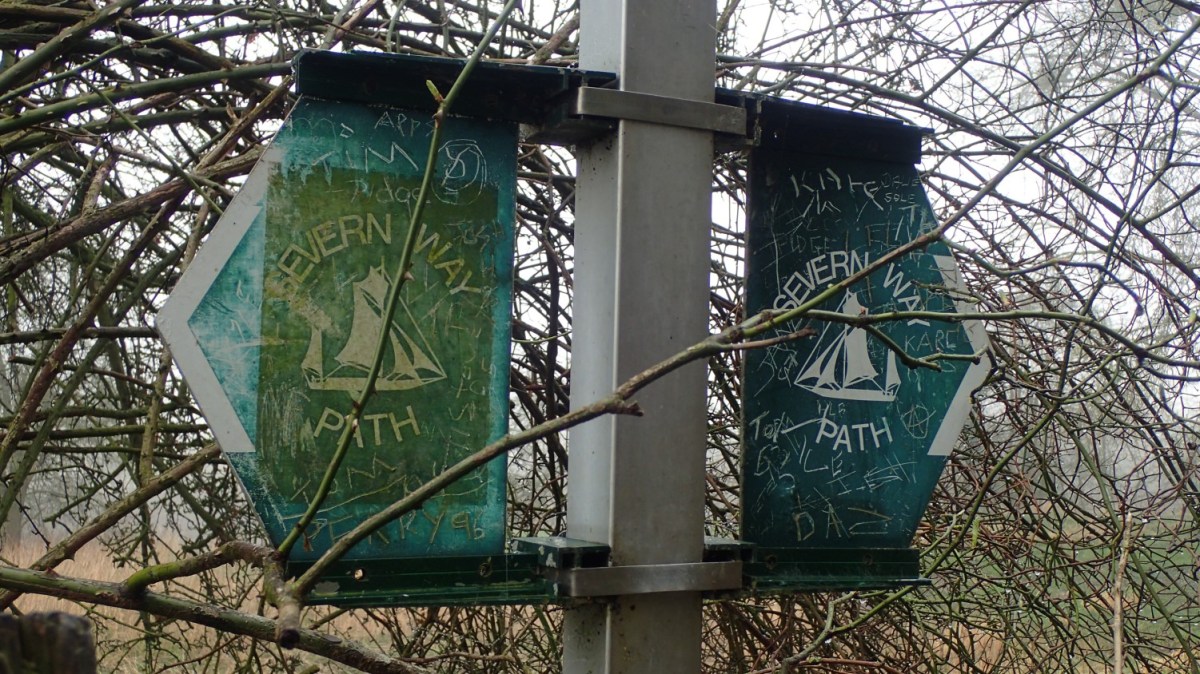
It was next to an outfall, beside the north-south road, that I would rejoin the Severn Way, for the first time since early December, as I recall.
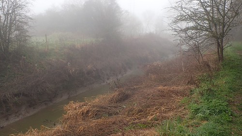
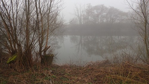
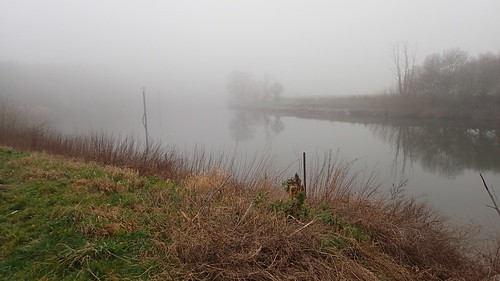
Initially, the route follows the East Channel of the Severn, on a partially-wooded and elevated path.
A bit further on and I would this channel to its Upper Parting with the West Channel. As I’d be walking north, I would effectively see these two channels join and continue along the River Severn as a whole.

If I wasn’t following a riverside path, I might’ve struggled with navigation on this walk!

I could see on the map that I was approaching some kind of ‘works’… Possibly sewage? As I drew closer, I could hear vehicles in operation.
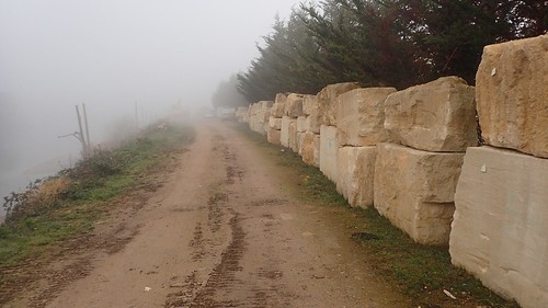
I opened the first gate with a sense of trepidation. From my map, I could clearly see that this was the public right of way. But with a sudden lack of waymarking on the same gate, I felt less confident and at greater risk of being challenged by someone working on the otherside of these great stones.
From what I’ve seen on Google, this looks like a bit of a reclamation yard with stone masons on site. I did’t knowingly make eye contact with or face confrontation from anyone.

But I wasn’t best pleased with the configuration of gates at the other end of this path; having to take one large step over one gate, where a stile or perhaps even a hinged gate would’ve been more appropriate for public access.

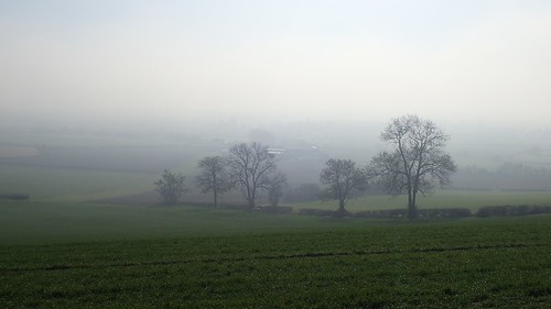
Waymarking soon returned, as I walked on in to the mist.

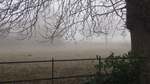
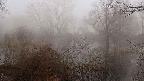
Following the riverbank, there were several moments where I could see shapes through the mist but was uncertain of how bovine they might have been… Until I was close enough to see that they were only sheep.
I remember passing a pair of women, who had somehow spawn from the fog. They were as surprised to see me appear.

Later in the evening, I was disappointed to learn that elver fishing has nothing to do with Lord of the Rings… It’s a term used to describe premature eels. Or ‘water snakes’, as I think of them! Do they taste nice?! I can’t imagine why anyone would want to catch one.

I’d made good progress following the Severn before pausing for my first stop of the day. From across the water, I could hear the detached voices of invisible people. Almost spooky.
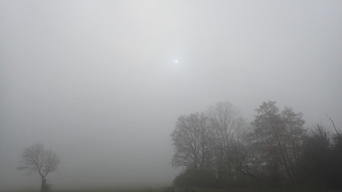
This was about as much sunshine as I would see all morning. Elsewhere in the west country, I would later learn that the fog had been far less of an issue; giving way to bright sunshine, as on the previous day.

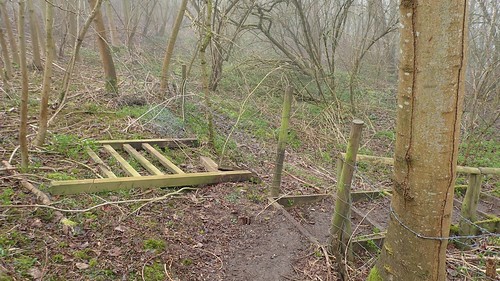
I felt grateful not to have to negotiate this pair of squeezer stiles, as the gate was wide open.

Neither did I have to cross over this footbridge with its pair of gates, thanks to a discarded boarding bridging the potentially-muddy gap beside the tree. Emerging from the other side, I’d meet another pair of walkers and I believe they also followed the ‘easy’ route through.
I could just see the woods of Norton Hill breaking in to view.

This was the first Severn Way marker I had seen since I left Sandhurst Road, thirty minutes in to my walk. Sadly, it has been tarnished by people who have felt an urge to write their own names.
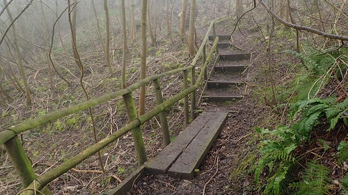
I followed the eerie woodland path. occasionally gaining height and soon crossing paths with a family of walkers.
It appears as though the stile has been removed from the top of these steps, at some point in the past. Quite rightly too, I imagine.
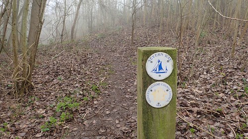
It was also in these woods that I found my first (and perhaps only) waymarker specific to the Severn Way.
From the edge of the woods, I would descend towards a road, with The Red Lion pub sitting opposite. Someone [Katy, if you’re reading this] had recommended this place to me on Twitter some time ago. I wouldn’t be stopping for a meal on this occasion and wouldn’t normally without company.
There’s also a campsite next door. I had one idea, before Christmas, about completing these final two walks of my Severn Way challenge in a backpacking effort; stopping at this campsite overnight. Had I done that, I would’ve soon missed out on climbing Sandhurst Hill.
Alternatively, I realised I could’ve parked and camped at the camp site and then heading off on a circular walk each day to achieve the same goal… But my decision has been made and, to be honest, I quite like the idea of reaching Tewkesbury sooner.
Google StreetView images suggest that the green space opposite the pub used to act as an overflow car park. I’m sure if this remains to be the cases, even though the gates and ‘private’ signs appeared to have been removed when I walked past.

A short distance up the road and I reached the point at which I would turn back from the Severn Way for this time and resumed on my final walk to Tewkesbury. I have previously walked a few of the miles towards Deerhurst.
But I saw no point in continuing any further today. I hope that my final walk will be within greater visibility and I still had that one hill to climb on this day.

Turning back to pass the pub once more (any dwellers inside must’ve wondered whether I was lost), I walked over the grass to inspect this memorial on a gate… I hope that no-one lost their life nearby. Maybe it’s left over from Valentine’s Day?
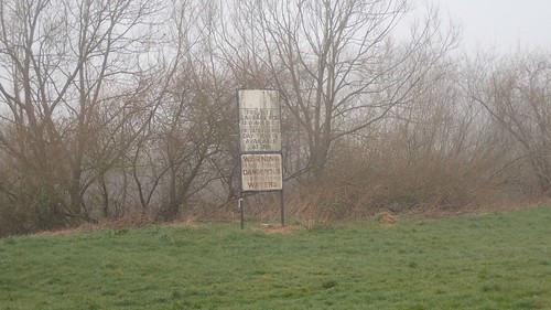
Tall signs adorn the River Severn in this area, advising wayfarers to ‘keep right’ on their southward journey.
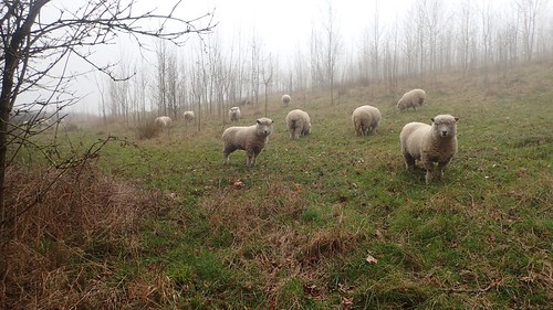
These sheep were as surprised to see me again as I was exhausted in climbing this relatively-low hill. My original plan had been to walk back along the road before taking an alternative path to the top. But that road was steep and with no suggestion of a pavement on either side… I decided that the grass was preferable.

I don’t know why I was struggling so much. It may be related to a work-related injury on a tendon behind my left leg. But I had done more enduring and challenging climbs in recent weeks without much complaint. This hill sits less than 100m above sea level!
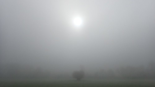
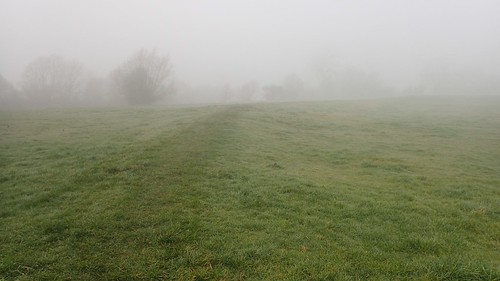
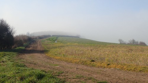
Visibility on top of Sandhurst Hill was no greater than what I had experienced closer to sea level. I could see the wet cloud crossing the hilltop in front of me.
But the trig point soon came in to view. Perhaps you can also see it, in the photo above.

At eight-six metres above sea level, this is by no means the highest point in Gloucestershire. But the sight of a vacant bench was a good one. Should more mountains and hilltops be set out like this?

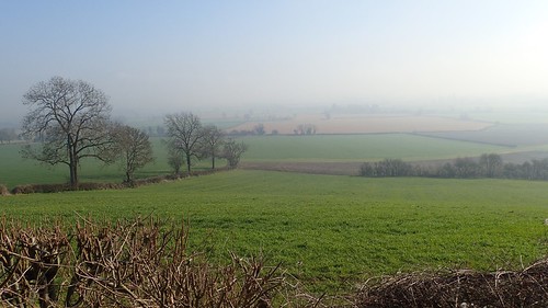
It was now somewhere between 12:30 and 13:00 and, as I sat down to eat my lunch, the fog would begin to burn off and clear, making way for the sunshine. Just as forecast. If also a little late.
After a good thirty minutes of warmth and relaxation, I begrudgingly began my homeward journey down towards my car. Truth be told, I didn’t want to go home. I didn’t want to face work the next day. But I knew I couldn’t stay here and I had a good hour of driving to follow.
While the rising fog opened views of the surrounding countryside that had been lost all day, this would also make my drive a little bit easier, being able to read and anticipate road signs before driving past them.
I believe there are parts of Gloucester’s road network that work quite well. I mean, the routes I’ve typically used (and outside of rush hour, I must admit) almost follow a circuit around the city. Where Bristol appears to have it ‘wrong’, with some of its common routes running through of very close to the centre… Or it may just be that ‘New London’ is forever expanding to consume the surrounding streets.
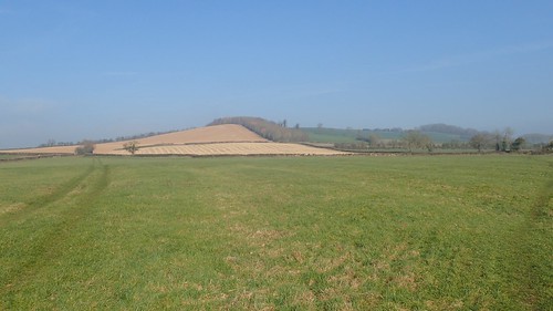
Looking back at Sandhurst Hill, it really didn’t look like much of a challenge. I’d barely felt the descent in my knees.

Following a series of clearly waymarked paths, I was back at the church in less than thirty-minutes. Time to head home and to one day prepare for my final walk along the Severn Way, finishing at Tewkesbury.

