Sunday 10th March 2019
When was the last time I did a walk in the Cotswolds? I can recall one or two group walks from 2018 but I cannot pinpoint the time of year in my mind. Was it all the way back in June, in the midst of my ‘failed’ attempt to complete The Ridgeway within a defined five-day block?
A few months ago, I wrote of my intentions to walk more of the Cotswold Way this year and perhaps even, to complete the National Trail that’s never been more than an hour’s drive from home. Well, a group walk came along in an area I’d not often explored before… I got in my car and drove.
After meeting up and arranging lifts in Bristol, we were heading north up the M5 with the destination of Crickley Hill Country Park. I should know this as I elected to be one of the drivers. It was a straightforward route by car; from Junction 11A, follow the A-road east and then the way to the park is highlighted by brown road signs.
One of those pleasant occasions where you know you’re not going to need a SatNav!
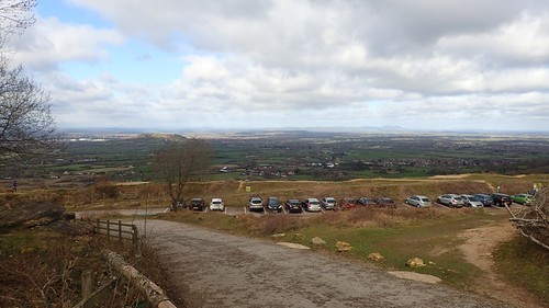
Each driver paid £3 to park here. While the land is owned by the National Trust, the parking bays are not and so, discounts are unavailable. I was impressed to find the Contactless payment option available at the parking meters – many city and town centres do not offer this and yet, here we were, high above Cheltenham on the western edge of the Cotswold escarpment!

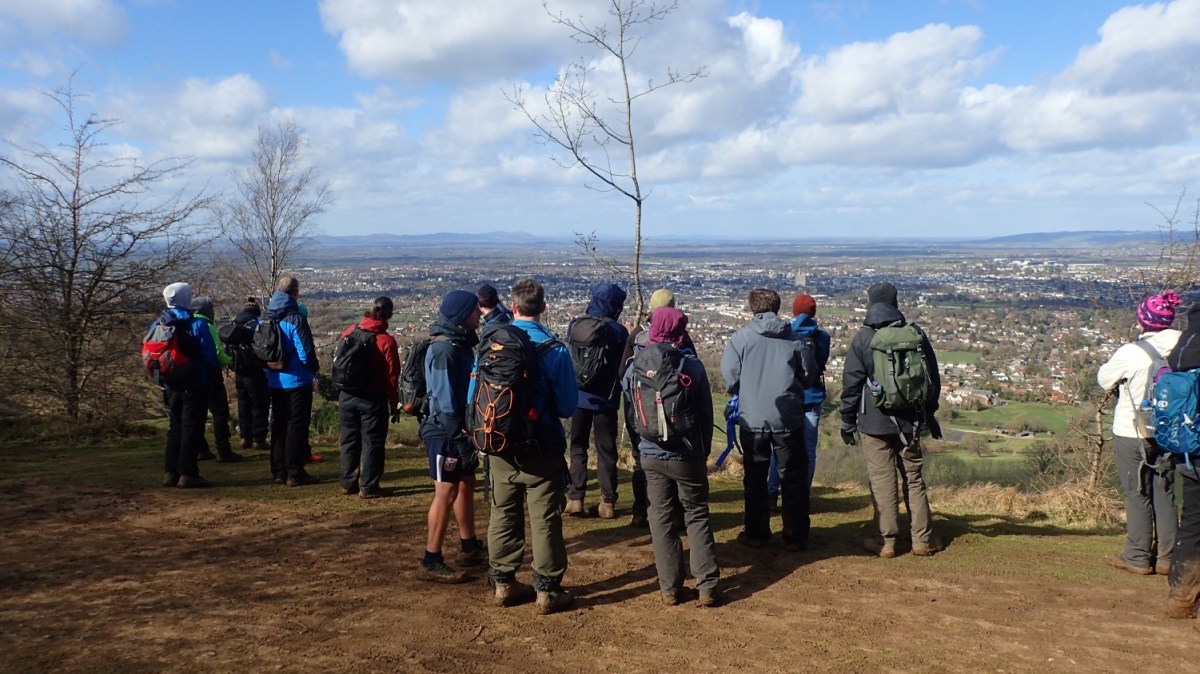
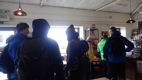
…Which also explains why around fifty per cent of our nineteen-strong turnout headed in to the on site café (and I include myself in this) before the walk would begin… On a weekend where wind gusts were forecast to exceed forty miles per hour in the local area – and, for once, the meteorologists were correct.
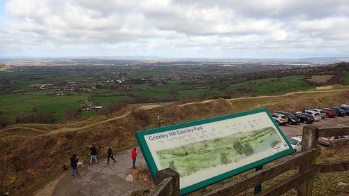
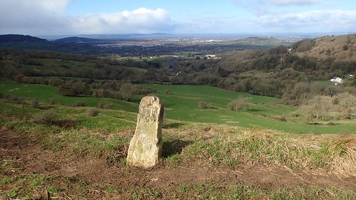
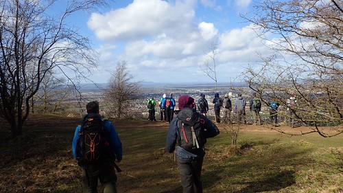
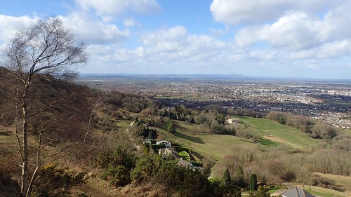
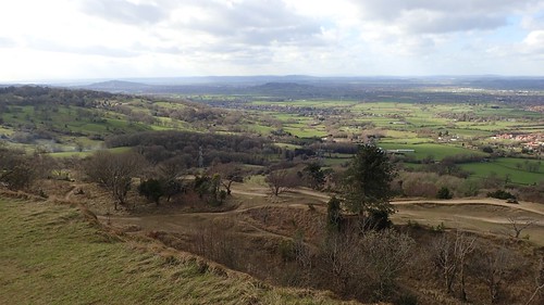
With views stretching across Gloucestershire, Worcestershire and beyond the Malvern Hills in to South Wales, you can imagine that the car park here is often filled close to maximum capacity.

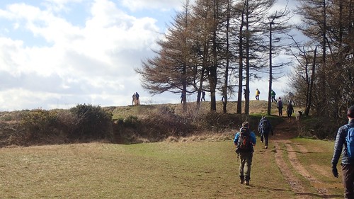
Wrapped up for the return of winter, our walk began along the Cotswold Way, heading in an eastward direction, barely able to break away from the breeze.

Hood up or hat on? That was the only quandary I was wrestling with, once I was able to fight the force and steady myself for a few photos of these mighty views.
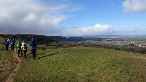
There were moments throughout the morning where nature taunted us with the prospect of a shower or two. My memory suggests that nothing more than a few drops fell each time and that it was largely the ferocity of the sideways wind that made for an unpleasant feeling.

Heading inland and having crossed the very busy A417, we would leave the Cotswold Way and look to join the Gloucestershire Way, somewhere between Birdlip and Cowley.
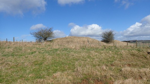
This was the long barrow above Coldwell Bottom and just outside of Coberley.

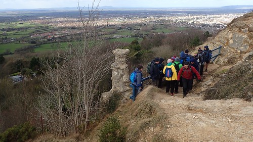
As we followed the right of way beside the local school, a select few of our group could not pass on the opportunity to further a belief that age is only a number.
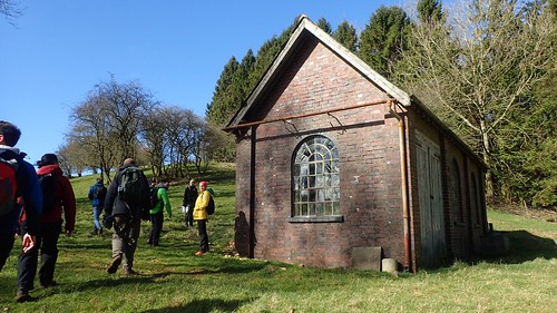
We’d already stopped for one break by this point; tucked in to a small valley in an effort to escape the persistent gales. It was beside the unspecified building above that we would stop for our second lunch. Beneath Hartley Hill and almost allowed to feel nothing more than the pre-spring sunshine.


After lunch, we would brace for a final and prolonged exposure to the elements that would see us through the final hour of our day’s walk. Passing Hartley Farm and its ruins, we’d begin the climb back up on to the Cotswold Way.

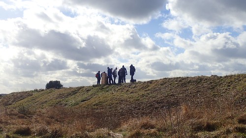
Without having to gain much in the way of elevation, we’d reach Charlton Kings Common and the somewhat familiar landscape would broaden ahead of us, once more.

Despite the fact that we were standing at more than two-hundred-and-seventy metres above sea level, we hadn’t lost or had to regain any great amounts of height throughout our day. In short: for a walk in the Cotswold HILLS, this was one of the least physically demanding that I’ve personally experienced.
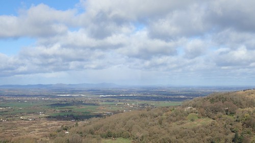
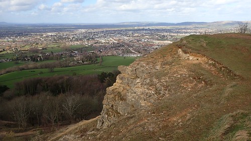
Next stop on our list was Leckhampton Hill, the highest point of our route.
Like many other high points around the UK, this one bears its own concrete trig pillar; a hark back to the days long before GPS and satellite innovation…

This particular pillar has been given a rather “Marmite” decor. From the limited information I can find online, it’s likely this was done towards the end of last summer. No-one seems to have stood up and claimed the credit, while it’s certainly not the work of Banksy!

If you have a penchant for Scandinavian flags and would like to own up to this paint job… Please leave a comment below and explain yourself.
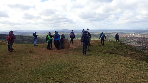
Away from the trig point, there’s a toposcope offering directions and distances to other sometimes-visible highlights, including Sugar Loaf, the Malvern Hills, May Hill in Herefordshire and more.
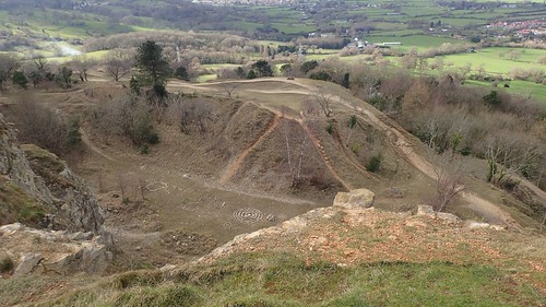
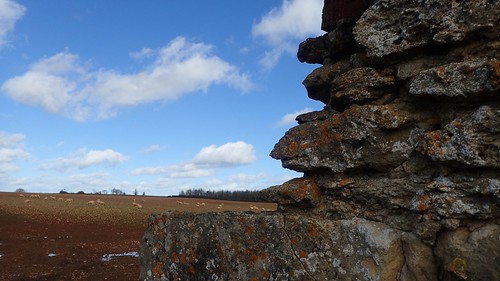
A bundle of disused quarries sit beneath the higher ground of Leckhampton Hill.
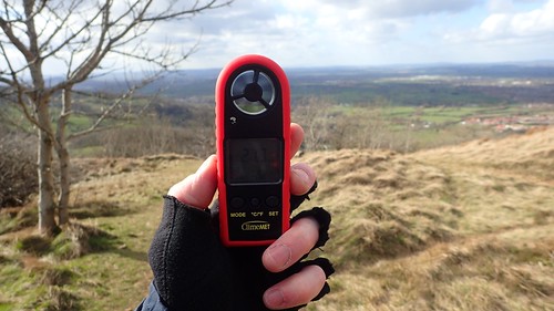
A few weeks ago, I was fortunate to win this “wind-o-meter” [not the scientific name] from ClimeMET in an online competition. I’ve been using it on walks with friends, where we stand to guesstimate the given wind speed before referring to the device for an answer…
On this wild day in the Cotswolds, it didn’t seem able to keep up with the forty mile-an-hour gusts. It does make for a good talking point, though and it’s a refreshing change to seeing someone taking a selfie with a smartphone.
Before departing the hill, we’d stop to stare at the Devil’s Chimney. A limestock stack of unknown origin. Possibly mined for a laugh; potentially formed by an unusual form of erosion.

It may even stem all the way down in to Satan’s Underworld…
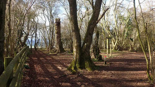
Upon leaving Leckhampton Hill, we followed the Cotswold Way along what felt like a very long but quiet road before joining the path that would lead us back to the start.

From the shelter, shade and shadows of the trees, we would have to embrace the breeze once more, in a dash to get our footwear swapped a take a short drive down to a local pub that is set to be demolished to make way for a redevelopment of the A417 (here’s the news story).
A good day was had by all. New members, new hills (to many of us) and the panicked bar staff even managed to find a private alcove to seat all nineteen of us without complaint.
