Saturday 25th May 2019
Suddenly, the time had arrived. Not even since I began or completed The Ridgeway, I was to being following the South Downs Way National Trail. After a bit of deliberation and some suggestions from others I know who’ve walked this way; I decided to begin in the west at Winchester, to finish one-hundred miles on in Eastbourne, five-days later.
Typically, I was late leaving home, with a car journey of almost two whole hours to follow. On the one hand, I was impressed that I’d been able to rise before 5am. On the other, I found myself emptying and reorganising my rucksack, having baulked at the reading of my luggage scales… In all of the extra time it took – bearing in mind that I’d deliberately packed the night before – I managed to save only 200g in weight.
I’d be setting off with a pack weighing 18.1kg, including food, kit, water and all. Last year, I left for The Ridgeway with a 20kg load and came home injured on the second day. Having switched to a pack that was 1kg than my previous model, this suggests that I’ve only managed to shed 1kg.
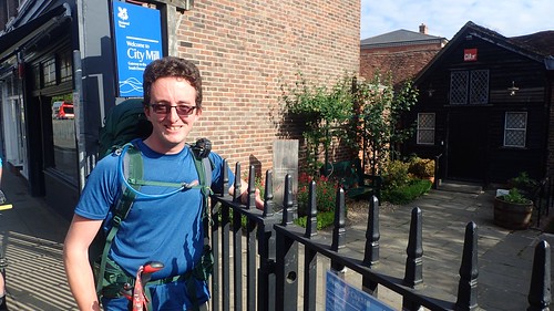
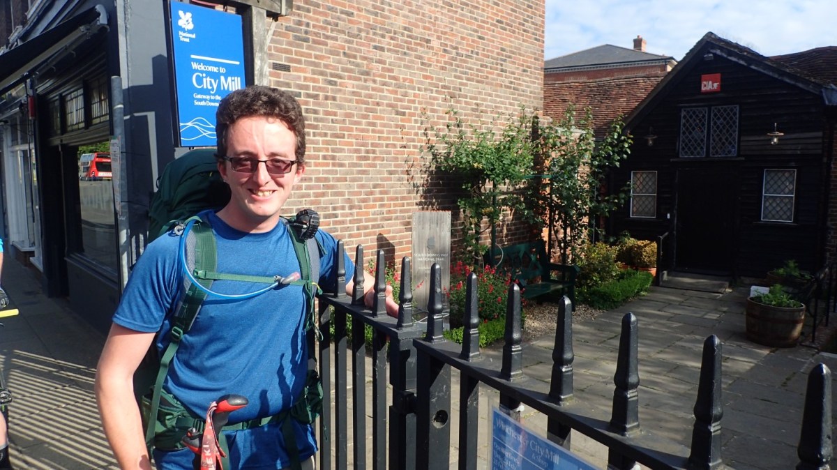
It was with the help of John that I was able to discover the official start point to the South Downs Way, beside the City Mill (gates were still locked at 8:45am).

Historically, some would depend on the statue of Alfred the Great or even Winchester Cathedral itself (a site I hope to explore on a dedicated return visit, one day). I had all of my bases covered, as they say.

My way forward seemed obvious; initially following the River Itchen along a clear cycle path. There was a point further on where the path bisects in two and, to my eyes, the Way was suddenly less obvious… I still ended up on the right road (even resorting to the use of GPS and OS Maps software less than a mile in to my six-day trek…). I was otherwise in danger of following the Itchen Way.
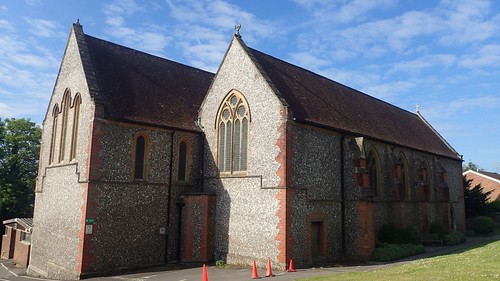
I passed this chapel, following the SDW east from busy Winchester. Little did I know that I would barely see another church or place of worship over the coming days.

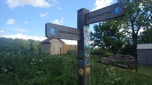
Following the bridge over the M3 motorway, I went through a transition in my journey. From the fast-paced city of Winchester, I would suddenly arrive in the countryside. Six lanes or speeding traffic set the boundary.

Reaching this signpost at the other end of the bridge, a familiar voice rolled in on his bike…
‘That guy was right!’
Back at the City Mill start point, a cyclist had asked John whether we were at the start of the South Downs Way. John suggested that the cyclist should get a move on or I’d be overtaking him… As I had! It turns out that he’d also become disorientated and taken a wrong turn. We both joked about it and then he was off. My last “familiar face” for the next ninety-nine miles.
At this junction is a choice of two paths from which to continue following the SDW… On the left, a walker’s only footpath. To the right, a bridleway open to both horse and bike. Another pair of cyclists appeared from behind, asking if we were okay… Ironically, they both turned left and cycled along the WALKERS-ONLY footpath route!

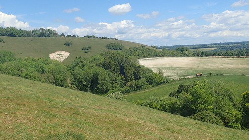
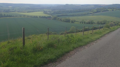
Following a chalk-path along the tops of fields, I could frequently turn around to see the scale of Winchester diminishing. I had no thoughts of turning around myself. A larger group of ignorant cyclists would join this walkers-only path from the other end at the road. Honestly, a small number of cyclists sometimes lend them all a bad name.

At a bend near Chilcomb, I began following a signed right turn for a ‘bridleway’, which apparently crosses a firing range…

As strange as it did seem, I soon realised that this was not part of the South Downs Way and that a fingerpost had been broken off. When following a National Trail, it can be easy to ‘switch off’ and follow the direction in which you are being led. Across the next few days, I would encounter several cyclists unsure of whether or not they were still on the Way!

In most instances, the signposts and waymarking are excellent; clearly depicting for whom each route is available to.


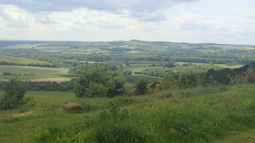
I wasn’t too sure of what to expect from this trail. I’d heard that it follows an undulating route, yet not perhaps as challenging as a trail that crosses moorland and mountains. Early on, I could see that it might remain a scenic affair.

Chalk was likely to be a recurring and almost-constant theme beneath my feet. That same substance which almost plagued the western-half of The Ridgeway last year… Only, free or motor vehicles and devoid or serious rutting.

Crossing the A272 near the top of a hill, I saw an opportunity to bag my first trig point of the day, at Cheesefoot Head.

From the nearby car park, there was no obvious route or access point to its location. It looks like private land on the OS map (not Open Access) and yet, the trig is also marked as a viewpoint.

Returning to the trail, I found my way through; having to limbo under a wooden rail bridging a gap in the hedge and then, stomping my way to the top.

My walk continued north through the woods of Temple Valley, where I met a group of tired teenagers bearing large rucksacks; keen to know whether there was a car park up a head and how soon they may be able to reach it.
While it’s often good to see kids out on this expeditions, training, working as a team… I get the impression that very few seem to enjoy the experience!

Turning east past Keeper’s Cottage, I passed the site of a tank-driving experience centre, where it appears you can do anything but pull the trigger. They were moving at a considerable speed and it did look quite fun.

For a sunny Saturday on a Bank Holiday weekend, I’d already seen my fair share of other path-users. Mostly cyclists. Being a bridleway, it’s expected that you’ll encounter many of them on a weekend – this was something I was aware of and not completely unlike my time on the western-half of The Ridgeway.

I was surprised to find a multi-lingual sign adorning the gates to this sign near Ganderdown Farm. Does the South Downs Way attract interest from across the continent?

Crossing the A272 again, I arrived a Holden Farm. They host a campsite for anyone looking to stay the night and also have a café or shop on site, which I decided to bypass (otherwise, it couldn’ve been a good excuse to carry fewer snack items in my overloaded rucksack).

Beyond the farm, I would pass the first convenient pub along the South Downs Way and just south of Beauworth. It wasn’t far off lunch time by my watch and I’m sure this would’ve made a sensible stopping point for the more weight-conservative backpacker. I’d made a decision to be ‘self-sufficient’ along this trail, where I didn’t quite pack enough food for my first day on The Ridgeway.
From Wind Farm, I found myself also following the Monarch’s Way, suddenly. A trail crossing the southern-half of the UK that also explores my native Mendip Hills.
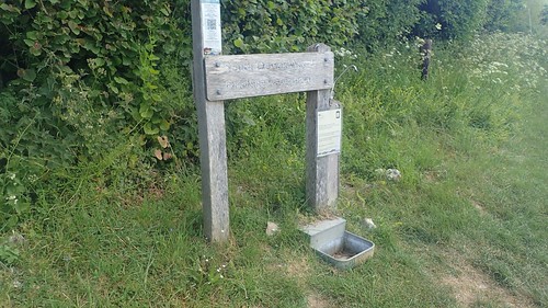
I’d been looking forward to this water tap at Lomer Farm, even though I’d read something about it online before heading off on the trail… My plan had been to carry no more than one litre of water at any time; using the frequent water taps of the South Downs Way to keep myself hydrate and minimise the kilograms in my pack.
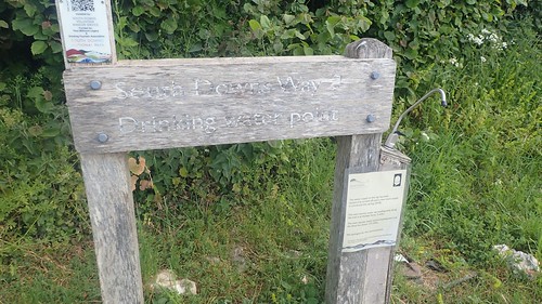
…Well, I’d overpacked, with a good 1.5 litres of water and with some good reason, as this tap has been “temporarily” turned off since early 2018, due to water quality issues.

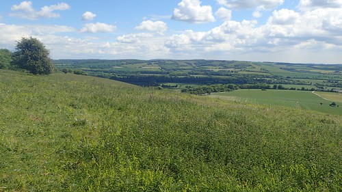
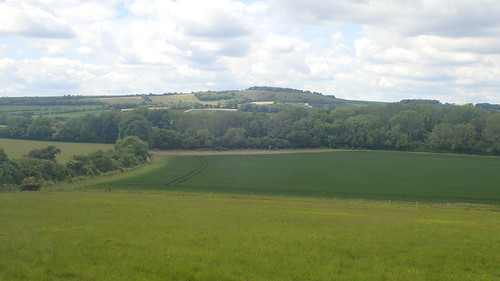
Moments before reaching Beacon Hill from the road, the Monarch’s Way veers off to the north-east. I’d earmarked this spot as the halfway point in my day’s twenty-two mile journey and the opportune space to stop for lunch.

There’s also a trig point to bag (barely visible in the centre of the photo above) but I was unable to officially claim it with two other hikers (each bearing a decent sized rucksack) were using it to rest their backs. As I passed within six metres of it though, I feel I can tick it off of my metaphorical list!
I’d waited until mid-morning to apply the suncream to my face. Like many people, I don’t particularly like the necessary substance. But I don’t like wearing hats, either. I felt grateful not to be walking this trail in another July heatwave.
Continuing down from Beacon Hill, it was only when I turned around that I realised I’d passed a floor-standing torch that would’ve once been lit up (although, it’s probably a replica). Probably to warn of a Spanish invasion. Albeit quite far inland from the south coast.
I settled down along here with decent views of the countryside beneath me.
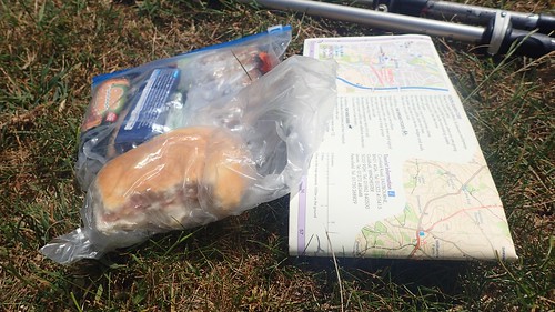
My daily rations would mostly consist of breakfast bars, home-made flapjack and a chocolate wafer bar from here on… But on this first day, I’d packed the last bread roll from my fridge and a full-size chocolate bar. Somehow, I’ve forgotten the banana. None of which I might sample again for another six days!

Having missed out on that tap at the farm, I was half-tempted to stop off at the next pub in nearby Exton. But the Way didn’t pass close by it (unless I missed it) and, to be honest, I still had plenty of water (and weight) in my rucksack.

This had been an enjoyable walkers-only stretch of my journey. I’m not strongly against cyclists but having to frequently look over one’s shoulder detracts from the joys of a long-distance walk.

This was possibly the last church I would see for several days. Where as, on The Ridgeway last year, there were times where I might pass three in one outing.

Crossing the A32, I could’ve rehydrated from this pool of water, had I packed a filter. In a situation (like winter) where the taps might be turned off, water sources can be very few and far between along the South Downs.

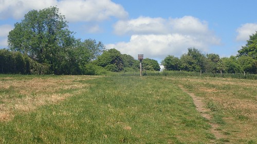
Progress! Having walked sixteen-miles (and, apparently, in no more than five hours…), I knew that I was more than two-thirds in to my walk with just six miles until I’d reach the campsite.
My dad had begun with a recurring fear that my left leg was going to ‘give way’, just as it had done in June 2018. Each time I felt a slight burn or ache in either leg, that thought rose to the top of my mind… But, I kept on walking, as much as my heavy pack was riding hard on my hips.

Another optional detour led me to the top of Old Winchester Hill, after a brief chat with a small group of passing walkers about my own intentions for the day.
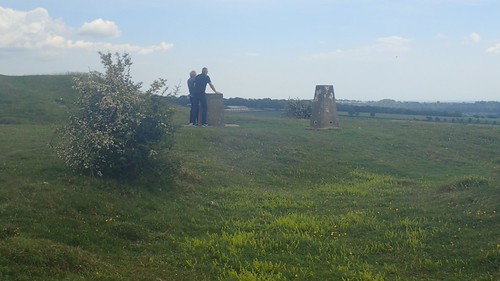
Had I read the contours on my map properly, I’d have saved myself a heart-thumping approach from the west. Most importantly, I wasn’t going to miss out on this trig, even though I’d have to wait a short while for the families to disperse.


I’d also briefly rejoined the Monarch’s Way which crosses this hilltop. Overhearing another conversation, I learnt that I could see both the Isle of Wight and The Solent from here.

Retracing my steps to the South Downs Way, I followed the path anti-clockwise around the hill and to a point on the eastern edge, from which I could’ve approached the trig point in a less-vertical manner.

From the next road, I began to descend towards Whitewool Farm. I think there’s also a campsite here.

This water tap outside of the car park (grid reference: SU 655 215) is not mentioned in any SDW guide that I’ve seen. I certainly made use of it, having passed the not-too-busy café advertising ice cream, metres earlier.

I drank almost a litre of water before continuing on; also keeping some in my 600ml bottle.

Another tap exists within the grounds of the Sustainability Centre and it’s a rare one, as the water tap is signposted (much like you’d expect to find along The Ridgeway but not here). They also have a café.
I’d originally enquired about staying here but they were fully booked. The next evening, I would meet a couple of fellow hikers who had spent the night at their campsite. Apparently it was quite busy and compacted… One person was even refused access to their pitch.

With 18kg behind me, I was feeling the strain, now; psychologically knowing that the end to this day was nigh. Several times throughout the day, I had to re-tighten the shoulder straps of my rucksack. I don’t know whether this is a design flaw or if it’s because I was carrying in excess of the recommend 18kg limit… It was quite annoying to suddenly find that weight sitting on my backside.
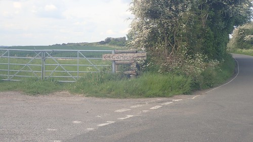
Across Hyden Hill, Tegdown Hill and I would soon reach the road from which my day’s walking would end. At the bottom of this final hill lies Upper Parsonage Farm. I’d not officially booked a camping pitch here but was told, in advance, that they’d probably be able to find a space for me, even though they were likely to be busy.
It’s not the kind of hill or situation you’d want to have to turn back from… A sensible option might be to phone ahead before descending for almost a mile.

One thought on “South Downs Way: Day One”