Sunday 20th October 2019
This would be my first walk on Exmoor proper since all the way back in February, when I helped someone explore the National Park for the very first time and led them to the highest point in all of Somerset.
That is excluding a walk I did more recently along the coast path because, although it does cross Exmoor, I consider it to be more of a ‘coastal’ scene that anywhere close to the heart of the moorland.

I actually plotted the route for this one many months ago and quite soon after that walk in February. It started off as eight miles and had already grown to more than twelve before I set off in my car, one Sunday morning.
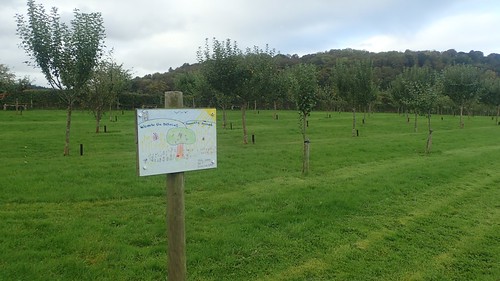
As a National Trust member, I was able to park at Dunster Castle (which is worthy of one day and several hours on its own) and print my ticket off for free. Elsewhere, you’d be expected to pay around £5 to leave your car in Dunster for the day.
I’d anticipated that I’d be able to start off backtracking north-east along the driveway I’d used to arrive from the main road. But I found a signed permissive footpath (not recorded on the maps) that led me on a more direct route to the non-National Trust car park, with the convenience of free-to-use toilets.

Crossing the A396, I followed a footpath towards Butter Cross. This was the first day I’d worn gaiters in several months… Possibly going as far back as a trip to Snowdonia in early May. I was also wearing my fingerless gloves. A sign that summer could not be expected to return anytime soon.

Up to my right, Conygar Tower (a folly) could be seen poking just above the trees. I’d been there once before; on a group walk all the way back in 2013. My very first footsteps on Exmoor. I wasn’t following the route too closely on that day but I anticipated revisiting one or two familiar places on this day.

Butter Cross would’ve once stood towards the southern end of Dunster’s medieval market. As of the 18th Century, it was moved out here, some several hundred metres west and beside a quiet rural road.

English Heritage didn’t offer an explanation as to why it might’ve been moved.
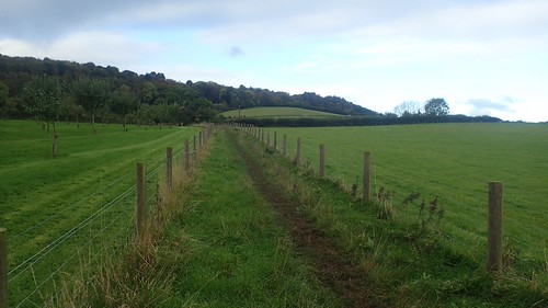
South along this road, I picked up the Macmillan Way West and followed this beside a school, past the site of Commonwealth War Graves and then an allotment.
As I’ve often found on Exmoor, the waymarking was excellent.

Gaining height, I followed the Way through woodland and up on to Grabbist Hill.

But for a pair of wide worn tracks, this area – like many on the moors – is an open space where bracken and heather can thrive.

Down to my right way Minehead, home to the start or end point of the South West Coast Path. North Hill’s clearly visible and defined.
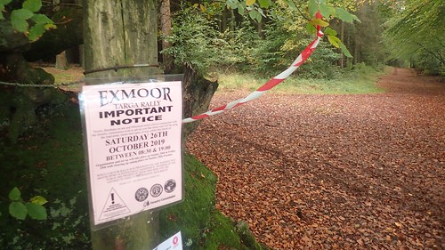
I continued west along the Way for several miles. Maintaining height. Several signs warned of a rally race that was due to take place the following weekend. I hope it went ahead without incident.
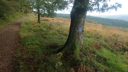
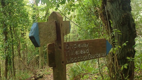
As I discovered on Twitter recently, few people recognise the coloured markings left on trees and the occasional fence or gate post. Blue indicates a bridleway, while other colours are used to identify a public right of way. I’ve seen this most frequently on Exmoor but it must also happen in other parts of the UK.

One final push and I’d arrive at the top of Wootton Common, having seen or passed not a single soul while walking these paths.

I arrived at a junction where I’d need to follow the Macmillan Way ‘left’ and continued downhill to the next village. But I’d also spied a trig point and, as I had calculated, it was to the ‘right’ of the boundary line.

Despite sitting at 295m above sea level, you can imagine why the occasional cyclist or runner may pass by without realising its presence.

As I returned to the route now, a flurry of bib-bearing runners overtook. Followed by another crowd… This would continued as I walked on; giving way when and where convenient. Many of these runners were both grateful and courteous. They were participating in the Exmoor Stagger!
I paid attention to their shirts. Some were from Tavistock in Devon, one group came over from Minehead and I noticed a few representatives from my local Weston Athletic Club. They were all taking part in the Exmoor Stagger; sixteen miles of trail running and I believe this does include the highest point! Through social media, I also learned of someone who’d travelled over from Kent for the day.

Following a descent in to Wootton Courtenay, the Macmillan Way West would continue all the way up Dunkery Hill to its 519m tall summit at Dunkery Beacon. It’s enough of a challenge for most people to walk it but to contemplate a trail run up there…
I wouldn’t be heading that way on this occasion. I’d seen elsewhere on social media that work was underway to restore and repair the large cairn-like stone monument on top of the Beacon, which was fence off during this process.

My next aim was to head south-east to the wooded top of Croydon Hill. From this point, it seemed so very far a way. Many acres of flat land lay ahead.

On my way through Wootton Courtenay, I passed a pair of volunteers supporting a checkpoint for the running event, next to the only mountain of bananas I have ever seen! It would’ve warranted a photo in passing.
A few hundred metres south down the road, I would begin to follow a footpath heading east and signed for Timberscombe. A sign almost as convenient as one that would direct traffic along a road. Almost as if people would frequently walk this distance between villages… It’s entirely possible they once did.

Another fine example of how paint marks the way of many routes across Exmoor. If you come to an unlocked gate but don’t see a splash of colour… It’s possible you don’t want to be passing through it.


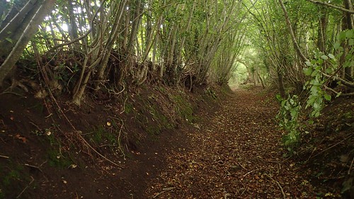
From a brief wooded combe beneath the roots of ancient trees, I broke out on to a series of fields; following the left-hand boundary here; crossing through the right-hand side there… Always keeping in check with the water running its course.

This led me to Timberscombe.

As I was told back in… 2015; it is incorrect to pronounce the latter half of the name as “coombe”. I’ve driven through here a couple of times and I had passed close by on that group walk in 2013. Not that anything looked immediately familiar.
I began my inevitable climb up on to Timberscombe Common and with Croydon Hill beyond. Dunkery Hill visible further behind me now.
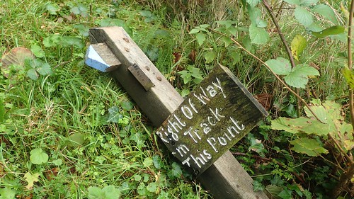
I passed a friendly family of dog walkers – my first human contact in over an hour, since I’d given way to that trail of runners. I met confusion at one path junction, where the sign was not only upended but also broken – part of a very important message was now missing.
Using my map and compass, I was able to determine that I did need to leave the main track at this point and take a slightly narrow path heading up through the trees.

One last view of Dunkery Hill, as I crossed Timberscombe Common. A series of bridleways breach this land on the map; not all of which are clear to follow on the ground.
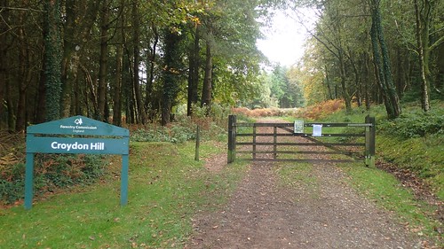
I took the direct route on to Croydon Hill. But for one runner (who passed me twice), I wouldn’t see another soul in this area. Soon crossing a quiet road and knowing there was a car park only one mile away, I was surprised by the stark absence of human life.

I then left the bridleway briefly to follow probably-private tracks towards the highest point of the hill… Which must sit somewhere within the untouched green haven of this wild woodland.
Uncertain that I could find a safe passage to any cairn or marker that may or not lie waiting for me, I decided not to venture in. What I really hoped for was a bench. It was already past lunchtime!

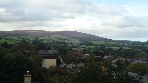
Returning to the bridleway, I would soon leave it at a path junction and head for the high-ground of Withycombe Common. Above, you can see views looking north-west towards the Severn Estuary and a place I call home.
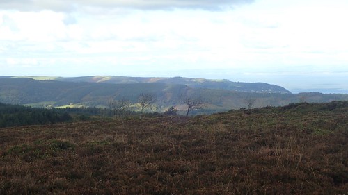
Ahead of the coastline was the formidable North Hill, sitting proud of Minehead and the northern terminus of the South West Coast Path. A heart-pumping introduction for anyone beginning their 630-mile journey to Studland.

A second trig point was on the cards and, at 381m above sea level, it would be the highest point of my day’s walking.

I’d arrived here in hope of finding free space upon this ‘common’ land. Somewhere to sit for lunch. Perhaps even a bench…

Not wanting to obstruct the track, I settled in on a small mound right beside the trig. Like one of those selfish trig-hoggers I pass every now and again through the summer months. But with no-one else around, I felt that I was somehow morally better than them… Until a cyclist arrived, slowed and then passed, before waiting awkwardly on his frame some twenty metres away, as if I was going to move away at any moment.

While the visibility was quite excellent and I could almost pick out peaks of the Brecon Beacons, there was bitingly cold wind, as if winter was many weeks premature. I stayed for almost half an hour – by which time, I was in need of moving on to warm up.

I crossed the brief vale ahead of me to reach Withycombe Hill and, having rejoined the Macmillan Way West for the final time on this day, my final miles would be straightforward.

Crossing Withycombe Hill Gate to Bat’s Castle (the second of my walk and site of an ancient settlement), I met my first Exmoor Ponies of the day and couldn’t recall seeing any of them on that coastal walk in the summer.

I was certain that we came up here, somehow, back in 2013. I even recognised the information board. I believe it was also somewhere around here that we passed a herd of red deer. I quite often see them on my solo walks across Exmoor but it was no to be a feature of this outing.

Darkening clouds developed overhead. There was no threat of or forecast for rain but the temperature decreased further, while South Wales remained unseasonably sunny.
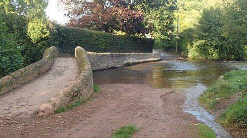
From Gallox Hill, I descended towards Dunster and the crossing of Gallox Bridge, which made for a safe passage over the substantial ford.

But to the right of this bridge, a signpost directs the way to ‘Dunster Car Park’ along a path that’s nothing more that a black dashed line on the map.

While I didn’t get to cross over that bridge, I was able to follow a road-free route along the eastern edge of the Dunster Castle estate.

There was one river crossing before I arrived at grassland beside the National Trust car park. A pleasant way to end the day, with water rushing fast beneath me.

We made our way up to Conygar Tower on that walk back in 2013. I remember slippery sections going up the hill but there’s no admission charge. It’s a folly that you can explore for free; walking around the floor inside, gazing up to the sky above.

I don’t know when or where my next Exmoor walk will be. I hope to get one in before the end of 2019 and have tentative plans for another route with two friends, depending on circumstances. Wherever I seem to head across the National Park, it’s a special place to be.

One thought on “Exmoor: Dunster and Around”