Monday 13th July 2020
In my self-imposed efforts to ‘stay local’ with my walks this summer, I’ve sometimes felt as though I’m running short on new ideas when it comes to exploring the Mendip Hills. I’ll often end up revisiting the same old haunts; making slight alterations to familiar routes.
East Harptree is an area I’ll often drive past or close to but I hadn’t walked there in over a year.

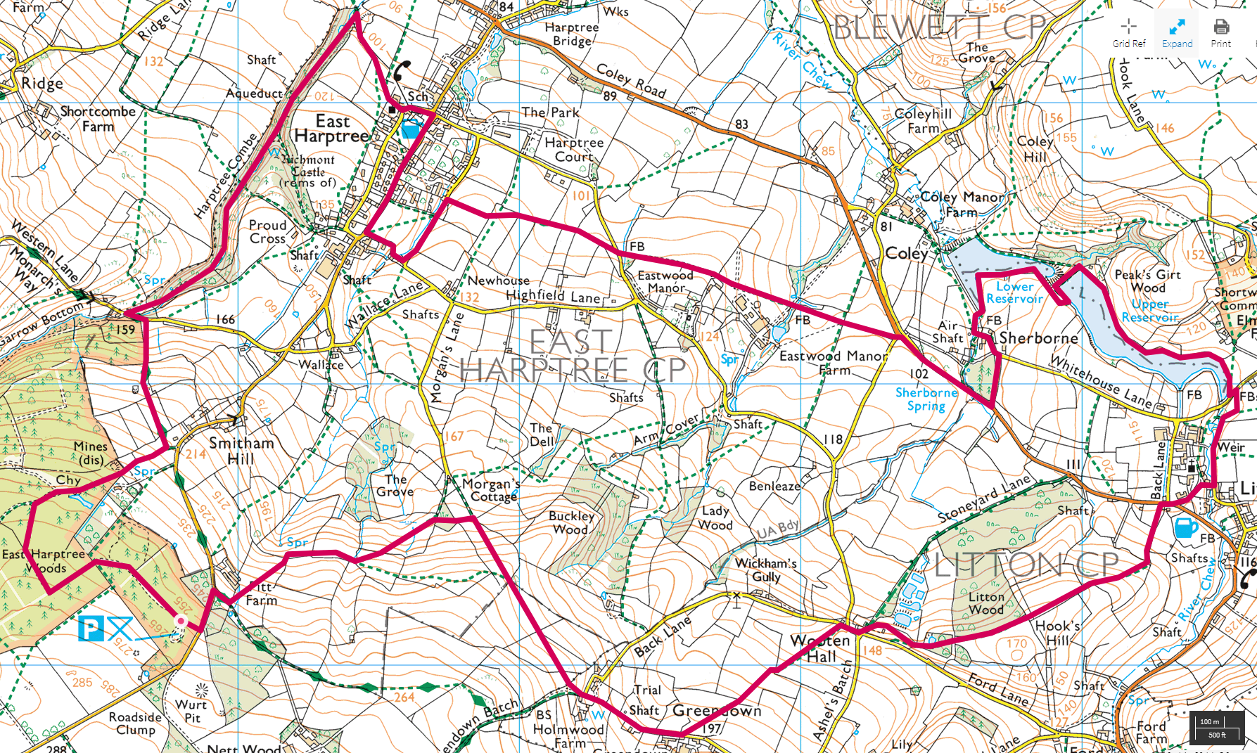
I left early (by my own standards) on a Monday morning and was off and walking shortly after 9am. I knew the car parking areas at East Harptree Woods could fill up quickly and I was keen to avoid people, if at all possible.

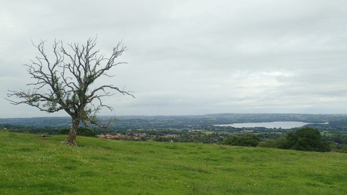
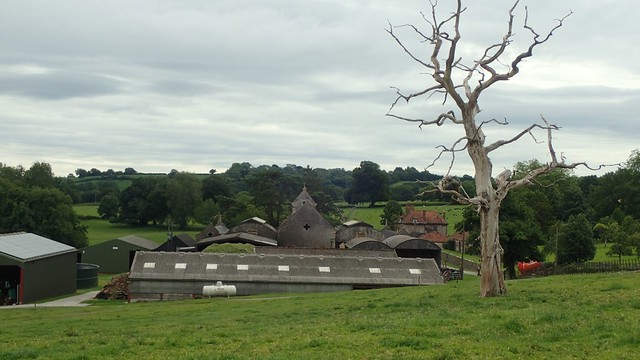
My previous walk as part of a group walk, in the mid-to-late winter of early 2019. In places, it would be very wet underfoot! I’ve no idea what trees have been removed here or the reasons why. But issues such as Ash Dieback and Dutch Elm Disease are prevalent across the UK.
Elsewhere on Mendip, young ash trees were cut down in 2019 to prevent any future issues.
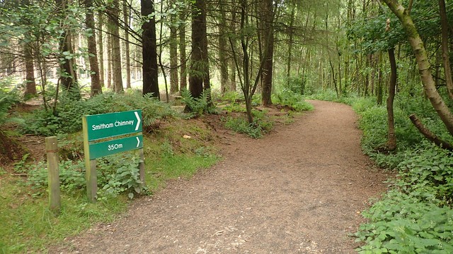
Dog walkers may know these woods and its paths better than I do as I always seem to end up following the obvious signs towards the chimney and pond.

Smitham Chimney was used for lead mining, back in the day. Various parts of Mendip were mined for ores and minerals, at the time. This is the only example of a chimney I can think of (unless you also account for the obelisk structure on Breach Hill, above Chew Valley Lake).
I’m currently planning a trip to the Yorkshire Dales and it looks as if that area was once excavated and pick-pocketed on a far greater scale.

I passed a couple of talkers (yes, talkers) on the far side of the pond, with many dogs between them. I was out to do a bit of filming on this walk and the man spotted my microphone, asking what I was hoping to capture and then immediately deciding it was some form of bird I wasn’t familiar with!
I find it funny, how someone can focus on the microphone but not the camera, as if I’m not seen as a ‘Potential YouTuber’… I guess he’s more of a nature-lover/wildlife-spotter in himself and only saw what he knew.

Leaving the woods swiftly and in the hope of avoiding further conversation, I followed the path toward Smitham Hill, keeping an eye open to my left for a turning on to the Monarch’s Way.

This Way leads down to another road, from which you can soon gain access in to Harptree Combe. Some had recently messaged me on social media, asking if I knew the way to the combe as they’d had failed to find the way in… That was another reason for why I’d decided to walk here.

Turn left along the road and look for a signed footpath on the right, soon after. I made the mistake initially of following the “obvious path on the ground”, which is a separate right of way that takes you up and away from the entrance.
Instead, you want to aim ‘right a bit’ from the gate in to the field and basically, follow your way down in to the head of the valley that forms Harptree Combe.

Inside and further on, it is one of the most wild places you could hope to find on the Mendip Hills. I’m pleased to say that I walked the full length of the valley floor without seeing or hearing another human.

At any time of year, it can be wet under foot. In the winter, you almost need wellies as gaiters and ankle-high boots may not be enough. On this day, I’d made the mistake of wearing non-waterproof running shoes.

In the northern half of Harptree Combe you’ll find Mendip’s only example of a working aqueduct.
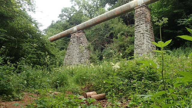
It was completed in 1851 and runs for about 11 miles underground, to two reservoirs just outside of Bristol (I’ve always assumed it’s the two near Barrow Gurney although, Chew Valley Lake is much closer). Still in use today and those supporting piers are made of limestone; no doubt quarried from some part of Mendip.
On the cliffs above this were said to be the ruins of Richmont Castle, which was demolished in the 16th Century. I’ve looked in the past but have been unable to spot anything.

Out the other end and I climbed gently up a grassy path, soon heading for the church of East Harptree village.


None of which I had seen before! Except for an odd occasion where I might’ve driven through in the hope of finding a pub.

I followed a series of footpaths heading east from the village. One field was inundated with sheep.

This was one of several signs I spotted nearby; each one discarded, lying on the ground. In hindsight, I should’ve picked each of them up (a part of me wanted to believe there was a plan in place where the person(s) who installed them would return to collect…). These would’ve been installed back in March, as we all entered Lockdown in the UK.

I continued east, towards Coley, Sherborne and Litton.

I would soon arrive at a moderately busy B-road, which links the A368 at West Harptree with the A39 at Chewton Mendip.

I followed the signed right of way over the road, down a driveway and towards a house… But I couldn’t find the path from then on. It’s possible I missed something. I didn’t want to faff around with the GPS on my phone. So, I returned to the road, followed it on a bit further (while dodging the occasional car) and followed a minor road towards Sherborne.

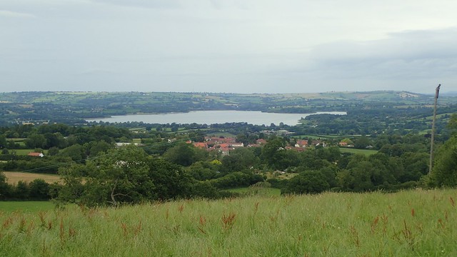
From there, I was able to pick up a familiar right of way (one I’d walked some time before) that would lead me to the two reservoirs.

Whether you know them as the Coley or Litton Reservoirs, they come as a pair; one Upper and one Lower. Both were built around the same time as the Harptree aqueduct and permit-holders are allowed to fish here.

Having first arrived beside Upper Litton, I stopped for a late-morning snack and cup of tea, here. Across the dam, I would pass a family who had set up for a picnic, overlooking Lower Litton.
Oddly, the “grandmother” from that family wandered over towards me, stopped, looked at me and then walked back. She must’ve thought I was someone else or doing something illegal, with my back turned to them!

My walk continued along the northern edge of Upper Litton and on towards the village. Across the water, I could see cobweb-like forms of… Algae? I’d not seen anything like it before.


Over the next road and I’ll admit to using the GPS on my phone to determine my bearings. There are paths either side of the River Chew and I always struggle for orientation in a small patch of woodland not marked on the OS map.
It was also an hour before my preferred lunchtime and I still had a good hour’s walking to get back to my car… Having not packed much food for this one and assumed I’d be back in time, I could say it hadn’t quite gone as planned!

I met some impressive views from my walk across Hook’s Hill. I had probably walked here a few months ago but, aside from the field of cattle further ahead, it didn’t seem too familiar.

Above, you can clearly see the right of way. Many would be intimidated by their mass presence. But I recognised that they are young. If they approached or followed me (as they did), I knew that they were only curious, poorly-sighted and unlikely to want to attack me or cause harm.

Cattle are often more afraid of people than some realise. A bit like spiders, I guess!

I continued past Litton Wood, climbing any gates there had been tied shut and on to a road junction at Wooten Hall.

My next footpath – over a stile and in a hedge – was a little hard to spot (and scrambled through)…

An open but grassy hill lay ahead, on my way towards Greendown.
From Greendown Batch, I chose to ignore the Monarch’s Way, having covered that section before. Instead, I followed a near-parallel line of paths heading towards Morgan’s Cottage and then on to Pitt Farm.

I’d not quite been here before and got so carried away with the views… That I accidentally continued all the way down to Morgan’s Cottage (passing a pair of walkers), where I should’ve turned off sooner and not sacrificed my elevation.

But then, I found a public right of way not marked on the OS map, which leads through unnamed woodland and rejoins a climb towards Pitt Farm.
This final ascent to the farm was a little bit tricky, with portions of the land fenced off. Had I not spotted a footbridge away to the left, I might’ve attempted crossing through a private gate. But I don’t believe there was a clear way to access it. I had to step over some of the aforementioned fencing. But from here, I could momentarily rejoin the Monarch’s Way, head up the road and return to my car.

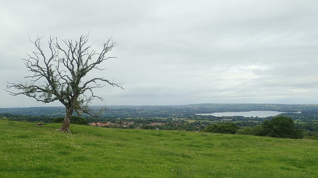
Looks like a nice walk, though the first picture made it look a bit like winter until I spotted that tree does still have a few leaves. I guess it’s dying.
“In my self-imposed efforts to ‘stay local’ with my walks this summer, I’ve sometimes felt as though I’m running short on new ideas when it comes to exploring the Mendip Hills.”
Not sure you have imposed this on yourself? I’d get to different places if you want whilst we are still allowed to, especially if you are running out of ideas.
LikeLiked by 1 person
Hi Jon,
Quite a few trees have been removed or cut down since I was last there.
I am slowly pushing my own boundaries with travel. Looking to spend more time on Exmoor and Dartmoor; made it to the Quantock Hills recently. I’m hoping to get to the Yorkshire Dales next month but wary of what’s being imposed around West Yorkshire, Preston and Manchester.
LikeLike