Sunday 22nd November 2020
I was born in Bristol and have grown up in North Somerset. Since 2012, I’ve been roaming the Mendip Hills along with other parts of Somerset. But I’d not previously been down to the Polden Hills… On the Somerset Levels, just south of Street and Glastonbury.
I think my inspiration for this one came from a brief discussion with someone online, who mentioned the Polden Way. Prior to this, I’d only been told that the Polden Hills were popular with people who are in to DOGGING – yes, apparently so!! With that in mind, I would only be passing through in the day!

I did a bit of reading online and found that the Polden Hills cover an area approximately 10 miles long, beginning to the west of Bridgwater and ending just outside of Somerton, to the east. While the Polden Way is only about 6 miles long and fits in between those two towns.

My drive down from Junction 21 of the M5 lasted only 30 minutes, as I arrived and the free-to-use parking area for Walton Hill – very close to the western end of this trail.

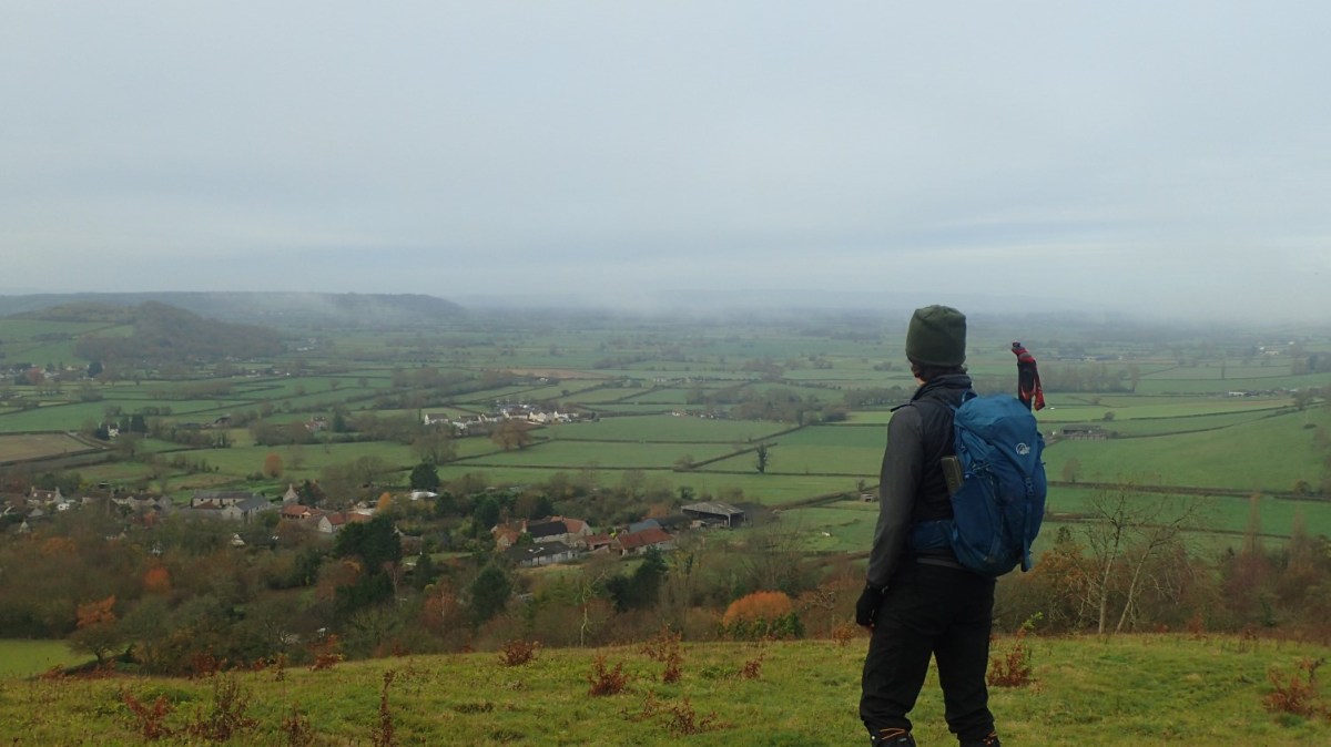
As you’ve already seen, there was something special about this day, with a dense fog lingering over the Levels beneath this ridge, standing barely 100m tall in places. Walking east and uphill, I soon passed the toposcope on Walton Hill.

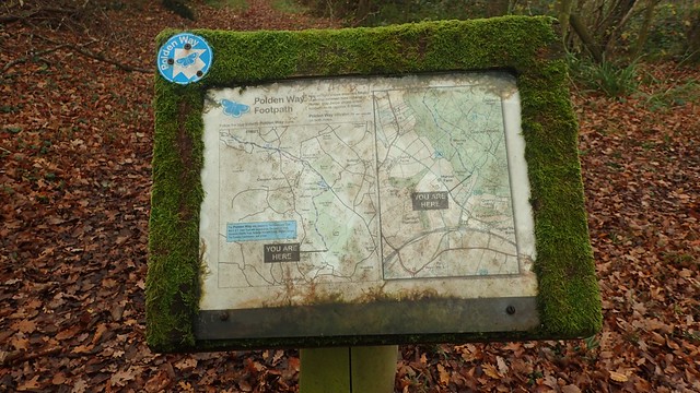
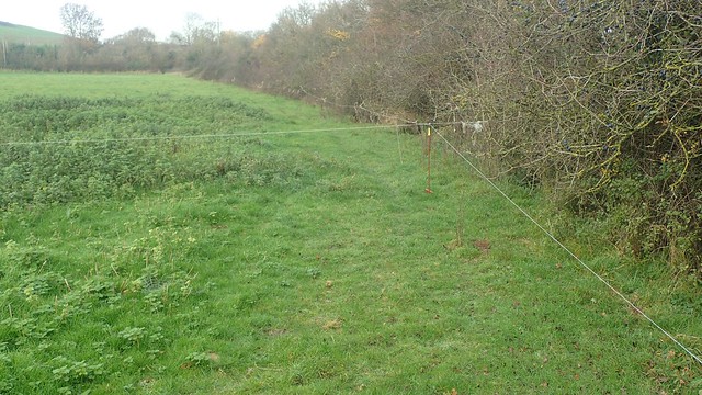
But, you see, the Polden Way isn’t a trail you can find marked on any OS Map… Yet the National Trust and others have made an effort to install waymarking along its length. In short, I didn’t really need to worry about following it too closely on a map.

I mean, there aren’t even any rights of way or paths marked on the map, here. But if you stick to the blue arrows then, it’s quite easy to follow.

As mentioned earlier, this walk passes just south of Street – which I’ve read is the largest village in Somerset – and Glastonbury Tor; one of the standout features on the Somerset Levels.

Large slabs of stone stand upright beside this kissing gate. I saw no inscriptions but wonder, whether these would’ve once marked a way or avenue towards the tor.

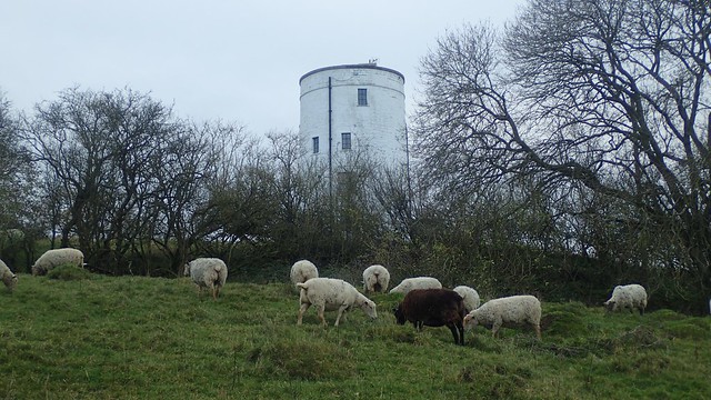
Behind the car park on Ivy Thorn Hill sits the Street YHA. Apparently the oldest youth hostel in England and Wales that’s still in operation today… So much history along this walk already!

After crossing the B3151 at Pages Hill, I would now join a public right of way and, for the first time on this walk, encounter a notice asking for the whereabouts of Lawrence Kemp, who has been missing since August.
These signs would become more frequent throughout the day. Campaigns have been launched on social media to help find him and I believe the Police have even carried out at least one search… But I fear his family would’ve had a less than happy Christmas.
Back to the Polden Way…

While the waymarking is currently very good, it’s also worth noting that maps of the route can be found every so often. If you were to compare them to an OS Map, you’d see that the Way continues further through the otherwise private woodland.

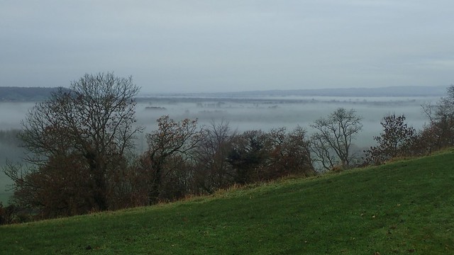
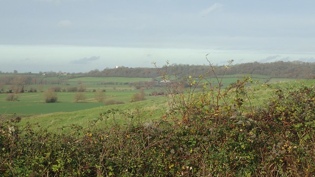
As I climbed over Collard Hill, the cloud beneath me and to the south began to rise and burn away.

This also meant that I could just about see the Hood Monument, poking through the trees of Windmill Hill, straight ahead.

This column is a monument to Sir Samuel Hood. There was once an avenue of cedar trees that led from here to the Hood family home in Butleigh.

There was also a doorway in to the foot of the column but I’ve read that it was sealed in 1990.

My walk continued along Hatch Hill, with dramatic views down to the right and then, in to the woods Combe Hill.

There’s a car park near here that allows for visitors to stop for a shorter while. Meaning it also suddenly became quite busy on this walk.

You can also find examples of poetry along the way and, towards the far end… Another poster asking for information on Lawrence Kemp.


I found it somewhat ironic, that this bridge and the local project had been supported by a company that utilises landfill as a means of waste management.

I soon broke free from the woods and on to Gilling Down, with good views looking out and then back, where I could see the Hood Monument again.

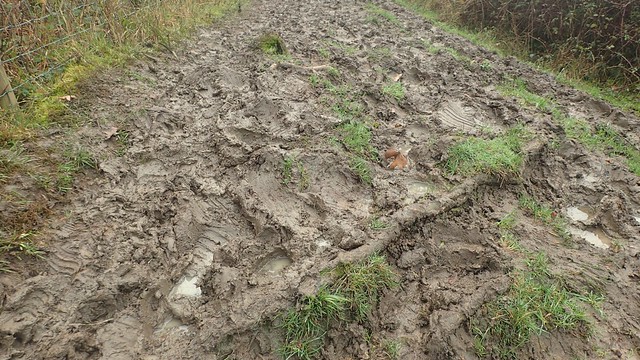
I’d left the dog walkers behind. Up ahead was. without a doubt, the muddiest stint along the Polden Way!
At the end of this treeline, I would arrive at the eastern end of the Polden Way, as according to this sign.

A marker on the stile, however, argues that the Way continues on to the edge of Somerton.

Before plunging down towards Hurcot Farm, I stopped at the top of the hill, rested and had something to eat. It was mid-morning by this point and I was about to leave the Polden Way.

From the bottom of this hill (where the right of way has been redirected, in contrast to the map), I would walk north-westward, passing Hurcot Farm and then Charity Farm, with the Polden ridge now up to my right.

Waymarking wasn’t bad but I had to keep my eyes open and be prepared to hop over a wire fence or two, as I found that Charity Farm was less welcoming towards walkers and less respective towards public rights of way.
This led me to the B3151 near Littleton Hill and without a pavement to stand on. I’d only need to follow the road for a few hundred metres but it was busy and I had to jump in to the hedge on a few occasions… I don’t think I’d walk this way again – and certainly, not with a group in tow.

From Littleton, I found my way up on to West Hill, now heading north.

Some of the stiles through here were largely ‘absent’, although any diversions around the true right of way were easy to follow. But it does further support my own personal findings, that landowners in more rural parts of Somerset – away from the National Parks and AoNBs – care less for public footpaths.

Ahead of me now were two mounds. On the left was Lollover Hill, where I was intending to have lunch. To the right of that was Dundon Beacon or Dundon Hill – an old hillfort that appears to have limited access to its summit.

I gave Decoy Farm a wide berth and instead followed a mud-free Peak Lane in to Dundon.

Finding the start of my next footpath was easy enough and, in the field beyond, handles were available to disconnect and safely pass through the electric fence that was keeping horses contained.

Through the top corner and in to the next field, my fortune began to change. While it all looked straight forward on the map, I found myself confused and wandering in the wrong direction through land that belongs to the Earth Spirit Centre… I doubt the people there would’ve minded much and I did, through another field, meet the track that I was hoping to reach.

For some reason, I got carried away in following this bridleway to the west, where I had intended to head east on a much shorter route to the top of the hill.

On to the footpaths and I had to crawl beneath this fence in order to reach the stile or gate beyond. It’s a bit ridiculous, really. There was no way to detach it and even I wasn’t going to be able to climb or jump over.

Then I saw a fogbow – and didn’t even know it was a thing!

Beyond another plea for Lawrence Kemp, I could see the former windmill on Walton Hill – not at all far from where I’d parked my car and a measure of how far I still had to work.

I was almost to the top of Lollover Hill which, after all of this, is only 90m above sea level!


It was time for lunch! I found a small patch of grass not engulfed by sheep poo.

For this final leg of the walk, I would head north across Street Moor; aiming to avoid the farmywards and follow the muddy paths where possible.

This “triple stile” provided quite the challenge!

I did find it was necessary to hold and study my map, as the waymarking wasn’t quite as up to scratch as on the Polden Way – even absent, on a couple of gates like the one above. But I did also spot a deer darting away in this field.

I would soon join the road between Middle and Lower Ivy Thorn Farm, sitting beneath Ivy Thorn Hill.

Quite a long walk along this road – close to a mile long – before I would turn right up a bridleway and finally ,meet the western end of the Polden Way. Compared to some of the other walkers I’d passed nearby, my legs and feet were by far the most filthy!
This was once a windmill towards the western end of Walton Hill and now, I believe, is someone’s private residence. A short walk along here and I’d be back at the car. I did see someone let their dog off the lead – as it chased these sheep around the field. Honestly, the actions of some individuals offer a bad name to all dog walkers. At least the farmer wasn’t around!

Glastonbury Tor, visible once again. This would’ve been around 15:00 and, such is the time of year, sunset wasn’t far away. A good end to the day and a good walk in the Polden Hills. I’ll try to repeat this walk at some point, perhaps when it’s dryer under foot!
Length of this walk = 14 miles
Thanks for reading.

Nicely documented walk, cheers! Interesting that one of my pet peeves, landowners who clearly don’t want anyone using the rights of the way on their land
LikeLiked by 1 person
Thank you, Gareth. I feel quite the same way – sometimes I’ll even avoid areas where I know it to be a problem.
Do you find it’s any more prevalent in certain areas?
LikeLike
Very interesting, as we have never dropped down from the woods into Hulcot and I hadnt previously known the name of “Gilling down”. I agree about land owners, Milfield have blocked paths near Glastonbury and the district council do nothing about it. Their staff even turn walkers off path claiming they “arent used any more”! You mention Lawrence Kemp, poor man was found dead on Wearyall hill last year. A very useful account of your walk thanks
LikeLike
Hello and thanks for reading. I’ve been meaning to revisit this area since I did this walk.
It is a shame how some landowners disrespect the rights of way network and ‘get away with it’. Reporting issues to Somerset County Council is, tragically, a waste of time (at least in my experience). I’ve seen it on other parts of the Levels. Some cases have been known for almost a decade! Up here in North Somerset, the council are more likely to act and respond (again, in my own experience).
I remember reading about Lawrence Kemp. How the Police were going to great efforts to conduct searches. Then indeed, that his body was discovered on that hill. I think someone left a memorial for him that was then defaced. His family must’ve surely suffered enough.
LikeLike
Stayed in Somerton last week and undertook several walks, including the southern half of the Polden Way. But, despite some enjoyable jaunts, several trips were partly spoilt by public rights of way being blocked, or having disappeared completely ( even a large section of the Macmillan Way twixt Langport and Long Sutton). I’ve had several conversations with SCC who choose to do next to nothing to tackle the problem ( with a county wide budget of £15k in 2024 !). No surprise that landowners are getting away with their actions.
LikeLike
Hello Stephen,
I empathise entirely. Somerset County Council are a disaster, at best! I’ve encountered and reported issues from all over the county, throughout the years. I can still recall being stopped by an overly-smug landowner near Westbury-sub-Mendip. When I looked up the history of that PROW, there was an outstanding history of reports dating back several years already.
I fear that the situation with this council is only going to get worse. I don’t know what we can say or do for the future of many of these mistreated paths around Somerset. A mass trespass, maybe?!
LikeLike
Hey Olly
Great review of a lovely walk. We run parts of the Polden Way but have never walked it in its entirety, living locally I think we will give it a go this weekend. Probably drop into Somerton for a coffee and a croissant at one of the various coffee shops. Subscribed to your YT channel too, great work, keep the walks and hikes coming.
Chris & Abi
LikeLike
Hi Chris and Abi,
Thank you very much for your comment and support! I hope you’ve since been out and walked the Polden Way? I did it again myself a few months ago but still need to return another day to capture it for YouTube.
LikeLike