
Monday 29th March 2021
Let’s get the L-word out of the way – this was my first walk in the wake of Lockdown 3.0. One the very day in which some restrictions were officially relaxed. Again.
I’d decided to keep it fairly local; keeping to the Mendip Hills. I would return to walk another leg of the West Mendip Way.
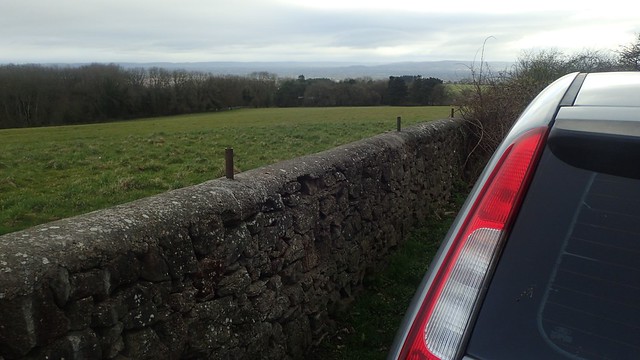
I drove to the top of Bleadon Hill (barely twenty minutes from home) and parked my car in the semi-circular layby just off the Roman Road. This was where I had previously left/turned back from the Way in my first journey from Uphill.

I joined the bridleway heading east and soon turning south towards Loxton. Through the trees, I could see what else was to come on this dull and windy morning.

Having taken part in the Mendip Challenge through six of the past seven years, I am well versed in heading up this bridleway. But to follow it downhill; that was new to me. I was even able to appreciate some of the views through the trees.

Just beyond the M5 motorway, I could see what I know as the “Road to Hinkley Point”. A remarkable project dividing many, many miles of Somerset and North Somerset countryside.

In June, I’m usually speeding through Loxton on my quest for the top of the hill and those final few miles to complete the ‘Challenge. But this time, I could see and appreciate that there are some nicely secluded seating areas around the tiny village.

I don’t remember this being a day in which rain had been forecast and neither would it fall. But I knew it would be windy up on Crook Peak, where I was headed next. It is ALWAYS windy up there. Even on a sunny day!
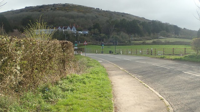
Having crossed the M5 motorway via the road bridge, I would then have to cross the “Hinkley Point Road” and its traffic lights. A couple of workers were clearly out in the road, laying ramps so that one of the off-road construction vehicles could negotiate the kerb on either side of the road it needed to cross… I just remember some feckless idiot in a silver BMW. Barely slowing down and speeding right past them with great impatience.

I had no such dangers in crossing the route myself. A left turn before the Webbington Hotel would help me along the Mendip Way. But then I then turned right prematurely; briefly leaving the Way to try a wooded footpath unknown to me. I would rejoin the West Mendip Way beyond; I’d just saved myself a few hundred metres of road walking.

This was my first proper hill in several months. A bit of a challenge but thoroughly enjoyable, after so many walks from my own doorstep.

Another view of the “Camino de Hinkley Point C”; almost following the M5 past Brent Knoll. Beneath this road is where they’ll bury and conceal many miles of electrical cabling that would otherwise be a visual blight upon the Mendip Hills AONB.

As predicted, it was incredibly windy on the summit of Crook Peak [‘Crook’ from the old English word ‘Cruc’, which also means ‘peak’… Nothing to do with thieves and robbers!]. So much so that I sought a break from the wind infront of the eastern face of the rock.

Marching on, I would then climb to the top of Wavering Down. Possibly the highest point of my day and marked by the only accessible trig point along this route.
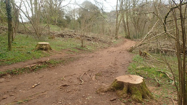
I then found quite a surprised on the way down through King’s Wood and towards the A38.
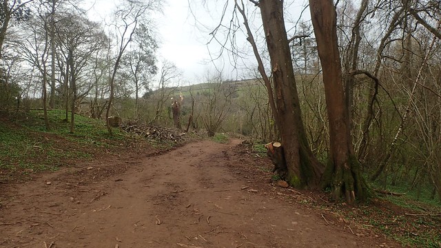
So many trees had been cut down, since my last visit sometime before Christmas. I was aware of the threat of Ash Dieback Disease and I’d even read that the footpaths through here had been closed for a time, so that tree-felling work could safely take place.
But to see it with my own eyes; I hadn’t expected the scene to look so open. It was as if the roof of the forest had been severed.

Over the A38 and I would continue up to and along Winscombe Drove. This is usually the muddiest part of the entire Mendip Way line. But today, it wasn’t nearly as bad as it can be. Even in June.

Further on and I would cross the busy minor road in to the village of Shipham.

This was my turnaround point. I wanted to find somewhere restful to stop for lunch.But between a farmer ploughing one field and the rows of houses ahead; I decided to march on.

I crossed back over the A38 and on to Shipham Lane, to the south of Sandford Wood. Walking west. Crossing the Strawberry Line north of Winscombe.

Then, I would have to cross the Hinkley road again.

Despite all of the information signs and boards, I was pleased and relieved to find the public footpaths remain open, just outside of Banwell.

Running out of options and, with time ticking on, I sat down quite randomly beside the hedge in what was an undisturbed field (of course, ten minutes later, two walkers would pass). This hedge offered sheltered from the wind and a visual veil of the construction work. I’ve probably had worse lunch stops!

As I crossed the road/track at one point, one of the hi-vis clad workers asked for my attention. I was wary he would tell me I’d done something wrong or question what I was doing and where I was going… But he wanted to ask whether anyone could walk through these kissing gates; keen to find spaces along which to stretch is legs while on lunch.
I do find it interested – and perhaps take it for granted – how many people aren’t as readily accustomed to the UK’s public right of way network, compared to regular outdoors-goers like myself.

My walk continued to cross this Connection Project one last time before passing Yarberry. Up to my right now was Banwell Hill; mostly private and off-limits for most of any year.

One final return crossing over the M5 motorway and I was almost – almost – back on Bleadon Hill.

I successfully dodged the worst of the wet and brown stuff around Christon Plantation.

Before long, I was back on that Roman Road and with views stretching out to the Severn Estuary beyond the Weston-super-Mare that I currently call home.
Length of this walk = 15.25 miles
Thanks for reading.
