Sunday 11th July 2021
It was forecast to be a wet day. I’d hope to have been able to spend it on Exmoor but, I wasn’t keen on driving as deep in to the heart of the National Park. Tired of all my local Mendip walks, I still wanted to get out and make something of my time. So, I devised a route that would take in lesser-known parts of West Somerset and a portion of Exmoor.
I think it only took me an hour to drive down to Washford, where Simonsbath and Exford would’ve demanded another thirty-minutes. I decided to park at Cleeve Abbey – it’s marked as a parking area on all OS Maps. But the signs state that parking is reserved for ‘visitors to Cleeve Abbey only’… I would’ve happily made a small donation or paid a fee had there been a box.

As it was already raining, I was able to park beneath the canopy of the trees. While I was getting ready under cover (full waterproofs on), several other cars came and went. Some drivers stopped and stared at me. Were they going to tell me not to park there? Were they going to return later and break in to my car?
None of this happened.

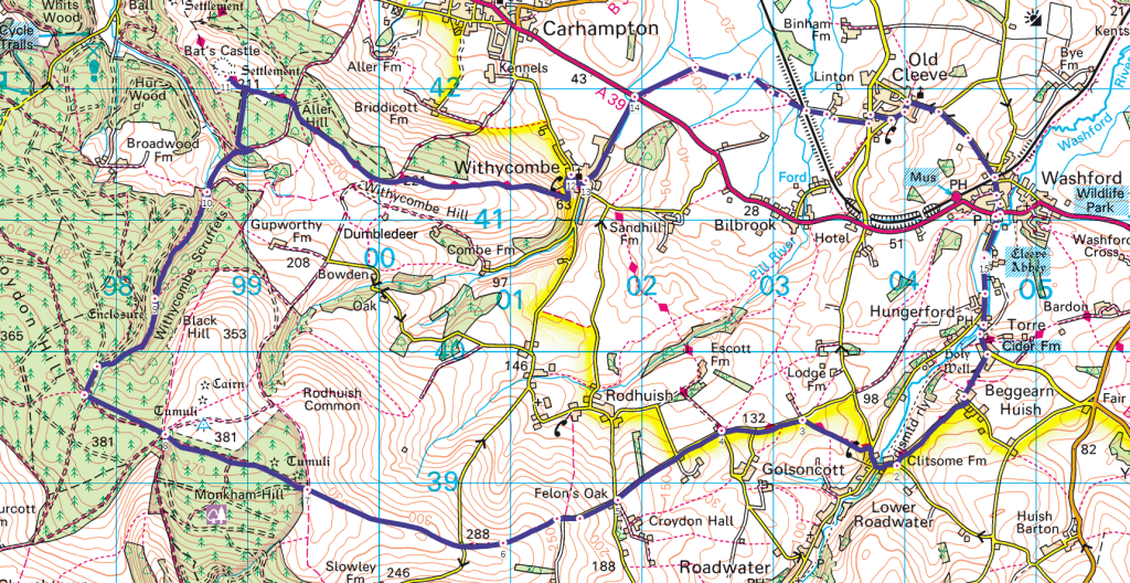
My walk began, following Abbey Road to the south and through Hungerford. Then south-west towards Lower Roadwater.

A stream follows the road along here, continuing north in to Washford River and then reaching the Bristol Channel at Watchet harbour.

Some of these roads were sunken beneath the tree routes, like old holloways.

I was following the MacMillan Way West and, from Beggearn Huish, I would meet the boundary of Exmoor National Park. I’ve met sporadic sections of this MacMillan Way in previous walks across Exmoor and the Quantock Hills. But I’d never realised it was a ‘coast to coast’ walk. To walk from Barmouth (North Wales) down to Abbotsbury (Dorset) or Barnstaple (North Devon) would be quite a challenge.
I once knew someone who’d walked it from Bristol to Barnstaple. But even walking from Abbotsbury to Barnstaple could be an option for some. Or, further north; walking between Barmouth and Boston (Lincolnshire).

I spotted an obscure ‘NO PARKING’ sign at a junction with Batallers Lane. Only a 4×4 or tractor could get in there today!

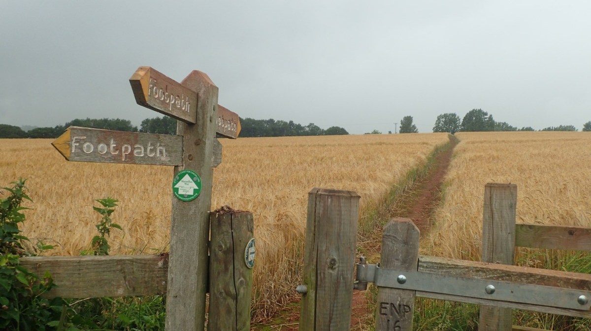
On to the fields and, for the most part, the Way had been kept clear through whatever was being grown and to be harvested from this land.

Then I was back on the roads and with the gradient increasing. From the north of Golsoncott, this would set my course for the next few miles until I’d finally reached the woodland.

It was quite mundane at times but this rain and drizzle looked determined to hang around.

Monkham Hill was still a very long way off.

I crossed a couple of roads. There was no doubt about the way forward.

Some people detest the rain but I like the vibrant colour it gives to some of our landscapes.

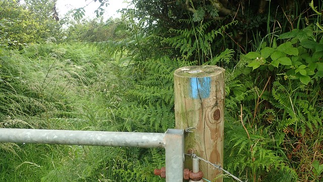
Exmoor National Park are really good at highlighting bridleways and footpaths. Even where there’s no fingerpost, you’ll often find a splash of parking marking the right of way. In this case, blue identifies a bridleway. Yellow would highlight a footpath.
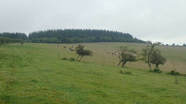
Across Monkslade Common, the final field before the woods, a number of cattle were present. But they caused no harm. Even those that were on the bridleway were happy to step aside and trot off.

From here you can clearly see the Bristol Channel. Usually, you’d also be able to see South Wales.

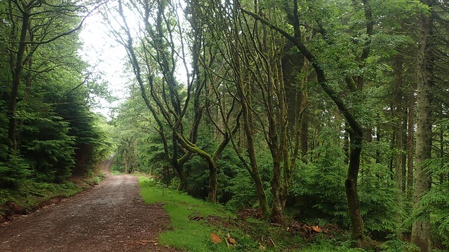
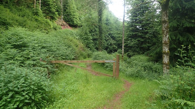
Broad forestry tracks line the ways through and around these woods.

I believe that these painted-on directions are only to direct the forestry vehicles in and out of the woods.

I’d hoped to find the fire tower, as marked on the OS Map. But I can’t find any direct reference to it online and it wasn’t obvious on the ground. Websites only refer to the nearby tumuli. It may not have been obvious. Or I might’ve missed it!

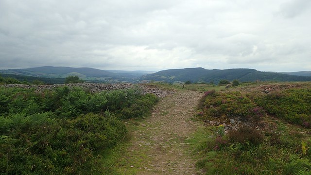
I left the woods for the trig point of Withycombe Common. I’d been here once before. In late 2019, before the pandemic kicked off.

I stopped here and enjoyed a well-earned cup of tea. Rain had decided to take a break, although it was quite cool and breezy up on these hills. July 2021 will probably be remembered as a wet month!

As I was leaving, a roar of thunder grew from the south. I’ve never been caught out in a storm before and I was keen to move on. Only last week, there was a story about two people who were struck by lightning on the summit of Snowdon in North Wales.
I then returned to the woods and followed a series of paths down towards Long Combe. Deviating from the course I’d plotted beforehand.

There were fewer waymarks heading down here. I did end up on the wrong path. Still heading in the right direction but I should’ve been lower, closer to the bottom of the combe. But I was soon able to zig and zag my way back on track (literally).


It was a peaceful and tranquil walk along these paths. A few wet water crossings but my leather boots did keep my feet dry.

From the bottom of one combe, the way forward was only going to head up!

I followed a permissive footpath through King’s Hedge Coppice (owned by the Crown Estate) and on towards Bat’s Castle.

Bat’s Castle is the site of an Iron Age hillfort. I previously walked here on the same walk I mentioned earlier, where I’d parked at Dunster Castle. It was familiar and yet good to be back.

Horses and ponies were grazing. A few other walkers arrived and passed as I ate my lunch. These were the first people I’d seen since I started my walk.

Looking along the Channel and back towards home, you can see the pier of Hinkley Point jutting out in to the water.

A deeper view in to the heart of Exmoor. Dunkery Beacon can be seen amongst other hills and the MacMillan Way West passes over there.

Next, I would head east across Withycombe Hill and back on the MacMillan Way.

Waymarks were present. Even though the wooden finger that I sought had previously been broken off. I was heading down in to Withycombe village.


A spectacular view of the Quantock Hills AONB, following the cluster from north to south.
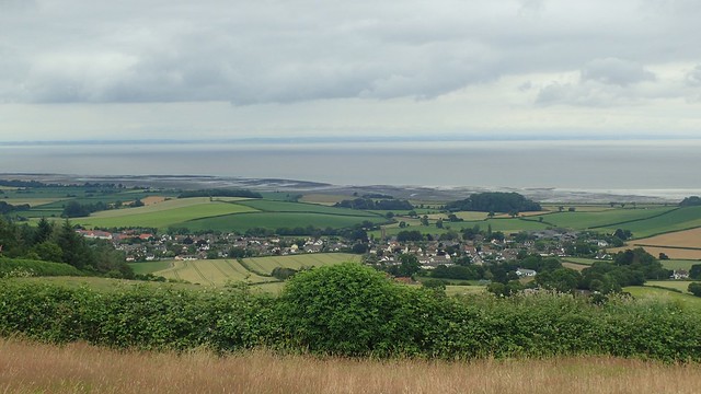
Overlooking Carhampton.

I left the MacMillan Way West in Withycombe and continued to follow the road north and soon crossing the A39 next to a bus stop.

Then I followed a restricted byway along Black Monkey Lane. BLACK was certainly the most appropriate word…

I had to pause for a moment inside this abyss, so that my eyes could naturally adapt. Branches and roots overheard had formed a near-perfect canopy. I didn’t bother with a headtorch; treading forward with slight trepidation. It did well to keep the rain off.


From the darkness, the route became suddenly overgrown. Insects buzzing past me in all directions. Mouth tightly shut, I pushed on. This is why I rarely wear shorts on a walk!

Then I arrived at Black Monkey Bridge. Far fewer insects and a greater sense of breathing space. Some mud under foot but I knew I wasn’t far from the next village.
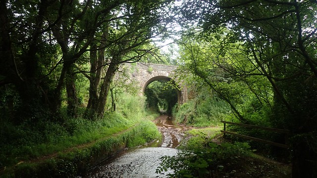
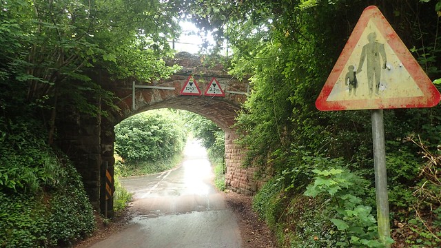
Overheard, the West Somerset Railway runs past, between Minehead and Bishop’s Lydeard. I think I stopped beneath the bridge to re-equip the waterproof layers.

More roads, heading east through Old Cleeve and towards the A39. There was no direct cross-country route between Withycombe and Washford. Hence, why I was walking this way.

I passed the first of two signs highlighting an inland diversion for the England Coast Path.
This is one heck of a diversion! Apparently due to another landslip near the unstable cliffs of Blue Anchor. It is said to be only temporary, while work is carried out to preserve a true coastal path. While the Hinkley Point diversion remains ‘long-term’.

I found it interesting how the edges of these roads have been lined with stone. Presumably, this stops water from tearing its way through. The less said, the better, when it comes to talking about the state of road surfaces in Somerset!
I crossed back under the railway and not far from Washford Station. I was then able to cross back over the A39 and walk the final road past Cleeve Abbey.
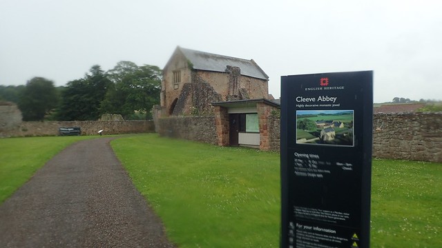
It was a miserable end, with the rain still falling. I pondered paying a visit to Cleeve Abbey. But I’m not an English Heritage member and I turned back when I read the line that ‘admission charges apply’.
It had been a good walk though. More road walking than I’d usually settle for and not quite as ‘wild’ or remote as my preferred Exmoor walks. But somewhere different. Paths and ways that were unknown to me.
Length of this walk = 12.5 miles
Thanks for reading.

I was looking for information on Black Monkey Lane and despite living here for several years did not know where it is. Thanks.
LikeLiked by 1 person
Hi Rwth,
Thank you for reading and I’m glad you found my post to be useful. Hopefully you can take a walk down there soon.
LikeLike