
Tuesday 24th August 2021
This would be my final walk of a three-day weekend down on Exmoor, ahead of my final night of camping at Halse Farm. I drove to Webber’s Post for the beginning of this one. I’d been up Dunkery Beacon many times but for now, I wanted to find a couple of named cairns from the OS Map.

If you pay attention, you’ll see that a £1 donation is asked for to park at Webber’s Post. To many though, it’s probably another ‘free’ place to park up for a few hours.

I crossed two roads to the east (including one I’d driven along) and then set off along the Dunster Path in the same direction.
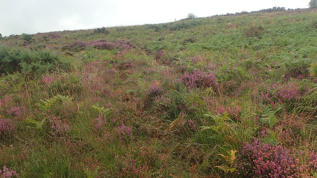
I know this route too well. So, I wanted to venture a bit further. I’d spotted ‘Joaney How’ and ‘Robin How’ on the map a few years ago… But the “paths” (black dashed lines) leading to them have been anything but blatant beneath my feet.

To start off with, I used basic map and compass skills to get going, on my way up Luccombe Hill. Measuring the distance and pacing to a specific point; following a precise compass bearing… These methods helped me to find an obscured path lined with stones.

But this going was never ‘easy’ to follow and there were more “paths” on the ground that what I could count on the map. Some paths appeared to in the ‘wrong’ direction while others (from the map) could not be found.

I’d resort to using the GPS on my phone for assistance. But this still left me beating my way through the bracken – another reason for why I rarely wear shorts.


With a sense of relief, I soon spied the first of several cairns in the area. I’d turned the phone off by this point and was happy to plod on with a direction – although not necessarily certain of which cairn I was passing first.

I’ve just ready that Joaney How is supposedly named after Little John, while Robin How would follow on from Robin Hood. Beyond that, I don’t know much else! I’d not found them myself before so this was a big personal plus – and it more direct to the rest of my route, as opposed to otherwise following the MacMillan Way to and then from Brockwell.

To be quite honest, I soon found that it must be much easier to approach this gathering of cairns from the south. Above, you can see one of the unmistakeable tracks leading to and from the nearby bridleways.

My walk continued, as I met the MacMillan Way West and could follow it over the road heading west and almost passing Kit Barrows cairns.

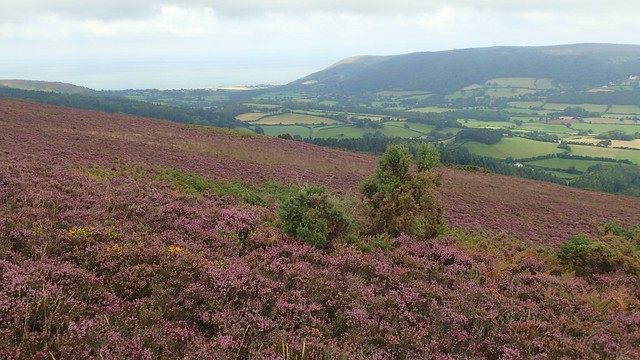
I’ve walked this way a number of times in the past already and I soon myself stood beside the mighty monument (not a cairn) at the very top of Dunkery Hill. At 519m above sea level, Dunkery Beacon is the highest point in all of Somerset.

I didn’t stop for more than a few moments and photos before plodding on. It was still a bit too soon for me to stop for lunch. I walked on west, towards Little Rowbarrow and Great Rowbarrow.


From Great Rowbarrow, I follow another track heading north-west to a road. Across this, I was on the edge of Stoke Pero Common and now overlooking a steep-sided valley. I was prepared to follow this road down and around towards the village… But a “path” existed beside it and without plunging in to the combe.
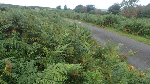
I managed to avoid the cattle and fought my way through the bracken to pick up the road closer to Stoke Pero.

I’d heard this was a nice area to explore, although I’d not already been and I found myself distantly following two other people on their way past this old church – which I’ve just read is the highest church on Exmoor and dates back to the 13th Century.

From beside the church, I left the road for a signed bridleway passing through a farmyard.

I almost followed a path away from the woods and towards Cloutsham. But then took a descent down through these woods, which I’d also not explored before.


At the bottom of this green valley, I would have to cross Horner Water. I found it interesting how they offer an alternative ‘horse crossing’ point to the pedestrian footbridge. But this wasn’t the first example I’d seen over the three days of my stay.
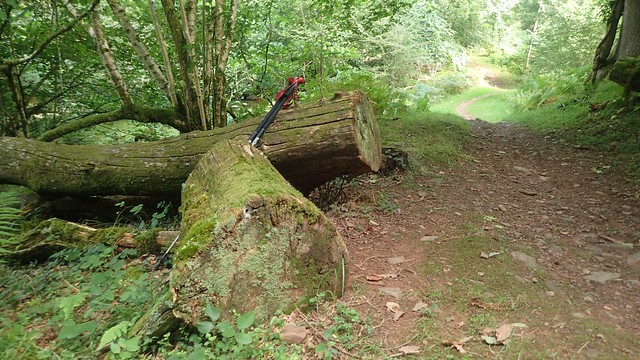
But before that, I made use of this fallen tree and sawn log to take some time out for lunch.

Across the water after lunch and I found the waymarking to be excellent – in spite of the fact that there are few official Public Rights of Way in these woods; just plenty of black dashed lines on the map.

Having dropped down in to this valley, I would soon have to begin heading uphill to escape it and return to my car at Webber’s Post!


Such a stunning and beautiful location.


I’d woken up in the morning with reservations about going anywhere in this day. Could I just stay in my tent and read? Was it worth driving anywhere to walk? I’ve already been here, there and everywhere?
But this had been a great little few hours out, if somewhat shorter than one of my usual walks in this area. No regrets! Unfamiliar paths walked. New places explored.
Length of this walk = 8.75 miles
Thanks for reading.

Well done Olly another great read.
LikeLike