Sunday 6th March 2022
I’ve walked around the Wye Valley on only a few occasions. Each time, it had been under the leadership of another person and, more often than note, we’d explore Tintern and climb up to the Devil’s Pulpit.
This walk would avoid all of that, starting just north in Brockweir. Another route from the Walk West series of eBooks and one that was brand-new to me.

There’s plenty of space in which to park at the beginning of this walk, although the nearest car park is for village hall users only. A slight incline is almost guaranteed once you’ve got your boots on!

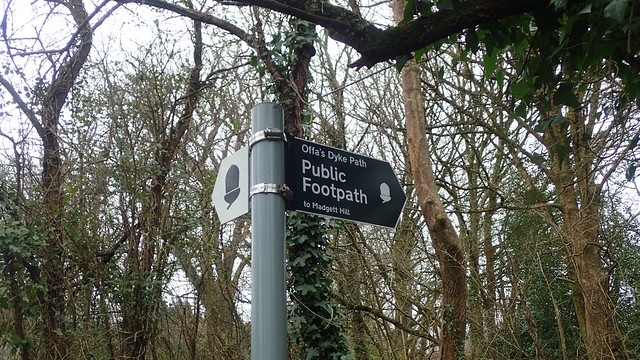
I passed a sign close to the village hall, for Offa’s Dyke Path. I say passed because I wouldn’t be following any section of that National Trail until later in the day.
I followed the bridleway track leading off from the car park. An approaching driver stopped to ask whether I was looking for Offa’s Dyke – apparently walkers do get confused here, in spite of the signage!

Signs of spring were just beginning to bloom beneath my feet. I gave way to an oncoming cyclist before I would reach the next road.

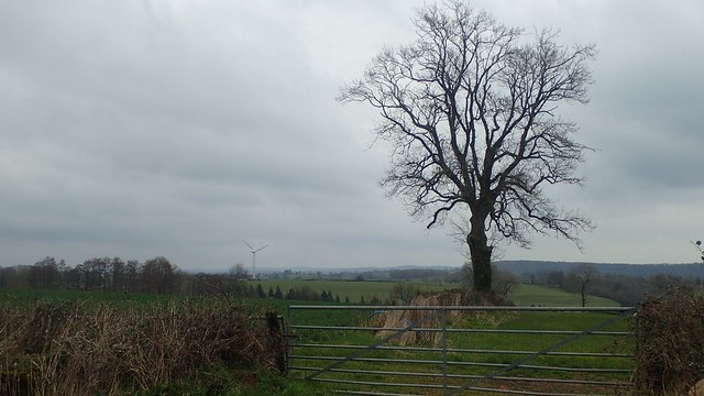
High and up to my right, the Devil’s Pulpit sits around the head of those woods. No doubt people would have been making there own ways there on this day.


I approached the very triangular church in the village of Hewlesfield. There’s said to be a yew tree in the yard that’s several hundred years old.


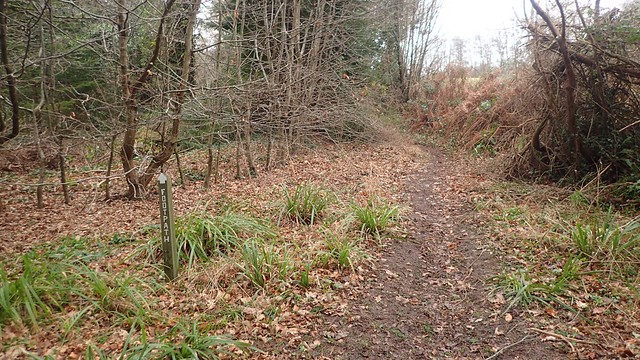
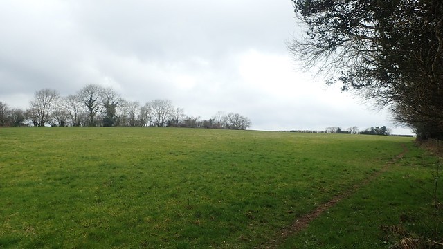
My walk continued along a line of footpaths running from close to Hewelsfield Court.


At the end of this peaceful stretch, where I did not pass another human being, I’d be walking in to St. Briavels.


I arrived at the site of the ruined castle. At one end there’s a youth hostel that I believe is still open to this day and must drawn in the visitors each year. But many of the castle walls had been fenced off, to keep people a safe distance from any loose or falling stone.
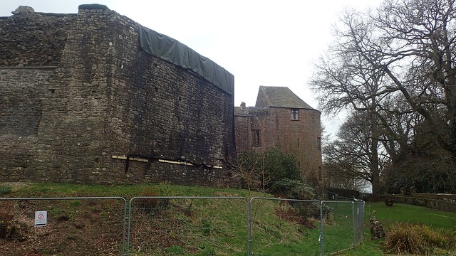


I made my way down in to the grassy grounds and sat upon a bench. After having a cup of tea and something to eat, I would walk on.


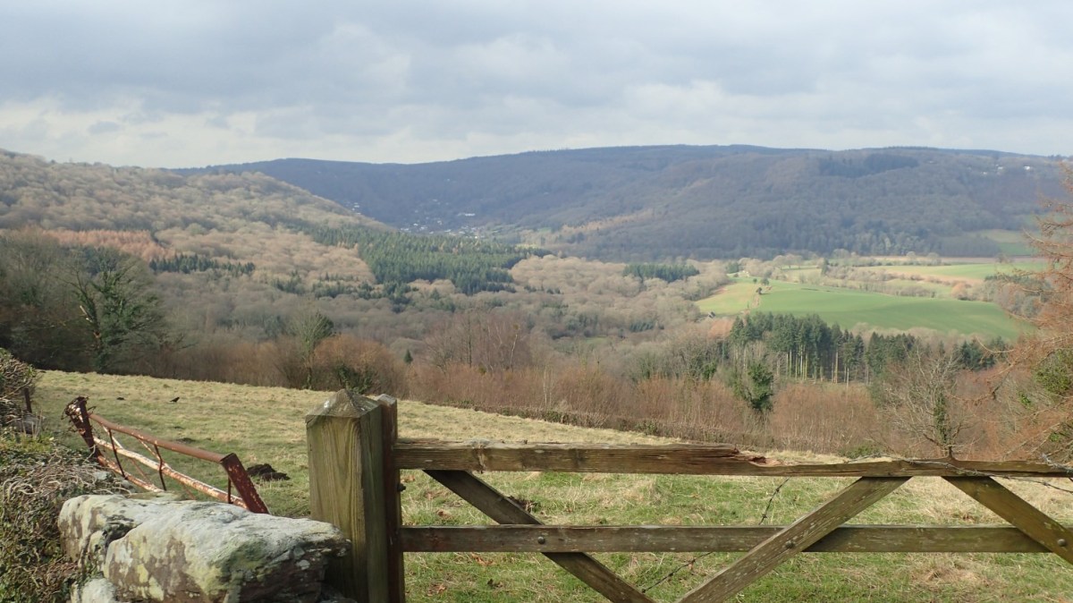
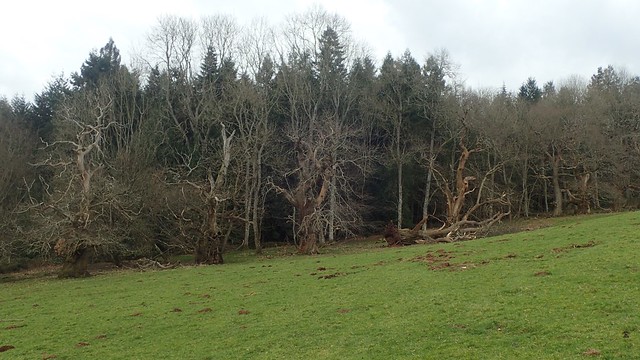
I was on the descent towards Lower Meend as this jaw-dropping vista opened up before me…


From the hairpin road, I followed a restricted byway further downhill. This led me close to two houses – almost sidesteeping ‘private’ signs in the process – and from the wall of one house, a defensive dog lept out behind me! Thankfully, he or she only barked and there was no ‘bite’ to compare which was worse.
It is very rare that I’ll encounter such issues with dogs. Had the owner been present, I’d like to have said something.

Another path alongside quiet and cattle-free farmer’s fields. I’d soon join the driveway beside Lindors Farm and this would help me on my way towards Bigsweir Bridge. Easy walking and I was over halfway on my route.


I wouldn’t walk out as far as the old bridge. I’ve possibly crossed it in the past… But from here, I followed Offa’s Dyke Path back over Mork Brook. This National Trail would be my guide for the way back to my car.

Remnants of the original earthworks and bank exist all over this land. They don’t always run parallel to the right of way.


A family of walkers were paying close attention to these wicked old chestnut trees that align the course of the dyke. My walk however, continued uphill and in to the next patch of woodland.


From fallen trees to large rocks up ahead. It was not easy going and always on the incline. I was pleased to spy the wooden steps towards the end. As much as they demanded further exertion!


From the next road, I soon left Offa’s Dyke Path and set off down in to more woodland. It appears as though the National Trail branches off in to two options from Bigsweir Bridge… One takes the high-lying route over the ashpaly-lined hilltops. But an alternative runs low alongside the River Wye (Afon Gwy).

I was heading for the riverside walk and, on my way down, met this entourage of sheep.
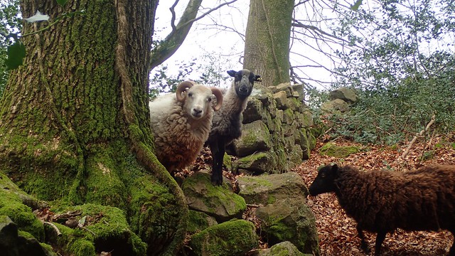
Most of them fled, climbing and leaping over the nearest wall. Only two remained, curious towards my presence and wanting to enquire.

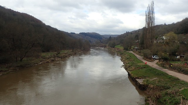
Fallen trees offered the infrequent challenge, as this footpath continued to narrow. But before long, I could see the river beyond younger specimens who had not fallen victim of any recent storms.


From here, there was no risk of getting lost or taking the wrong path. Unless I was to continue on beyond the next bridge! I realised that I could be back at my car in perhaps half an hour. Not wanting to end a pleasant walk too soon but I have enjoyed finishing earlier so far this year and arriving back home to have free time to relax in the afternoons.


With the bridge in to Brockweir in sight, I found myself closing in on a small troupe of leisurely Sunday walkers and just as the path had begun to narrow.
Is it polite to ask a group of people to give way and allow you to walk past? Even as a cyclist travelling along a shared path, I dislike having to ring my bell to warn others of my presence.

I hung back further, greatly reducing my own pace. Taking more photos and scenes of this spectacular (but polluted) river. On its own journey from its source in the Cambrian Mountains, down in to the Severn Estuary.


While it had been chilly throughout, I’d enjoyed my time in the Wye Valley. New sights and scenes. Very few other walkers. No crowds.

Length of this walk = 8.25 miles
Thanks for reading.

Nice pictures and comments too! 👍
LikeLike