Monday 19th May 2026
It’s been almost a year now since I completed the Cumbria Way and I’m keen to finish my write up on this, while also recounting other walks I’ve completed since. In short: I’ve missed blogging and had never intended to leave things this long.
This is actually my second attempt at writing this post today; having accidentally deleted this morning’s completed work, at the point of publishing!
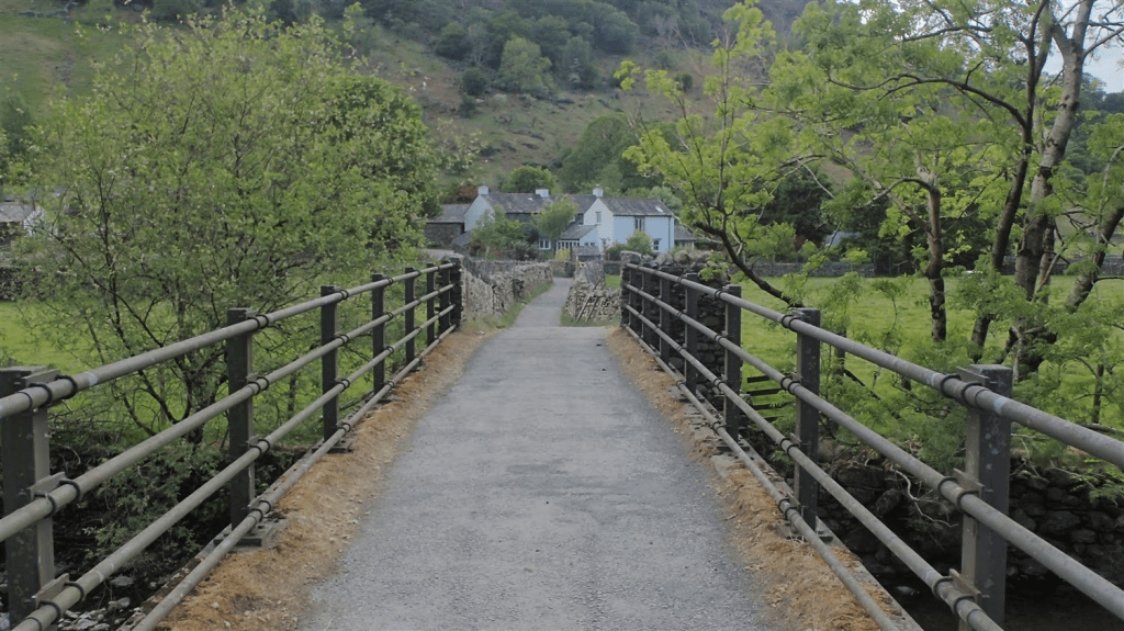
I was keen to leave Coniston Hall campsite on this morning. With so many people about, it hadn’t been my most relaxing night inside a tent. I was also planning to walk 21 miles on this day… In the Lake District. Carrying at least 16kg on my back. Less than twenty four hours after I was physically sick on the trail.
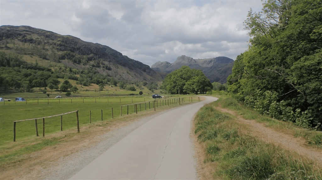
Beyond the road entrance to the campsite, find your way to Coniston itself is dead easy. Most of the other backpackers had already departed and, initially, I had the Cumbria Way to myself.
There must’ve been some form of Jubilee-type celebration going on (I’m often oblivious to such things). At least this was several months before Nigel Farage instigated the rise of the “flag-shaggers”!
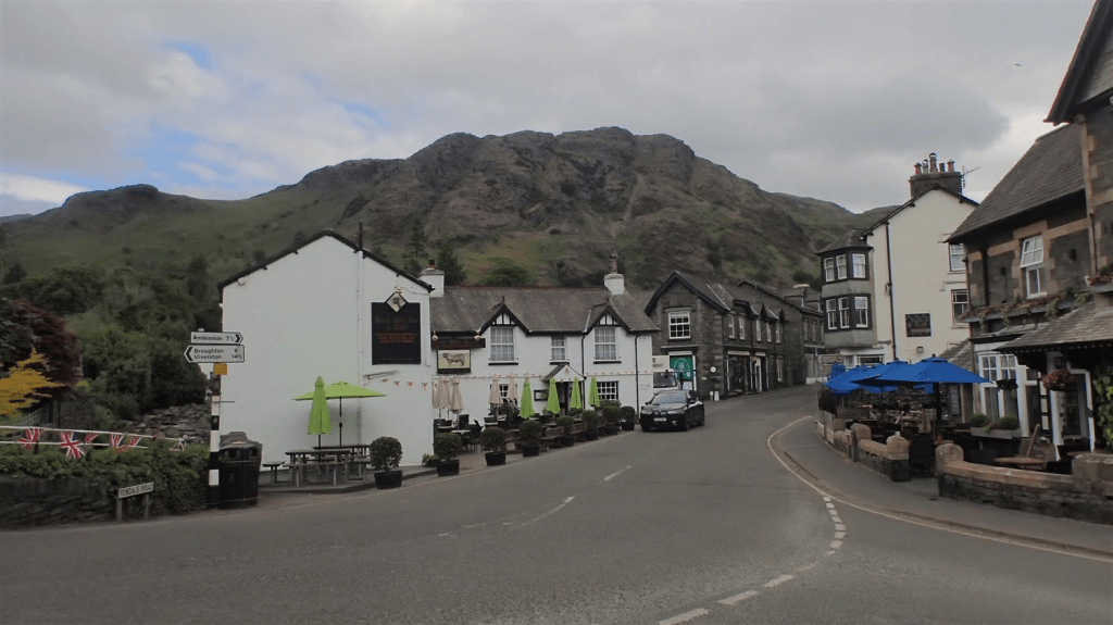
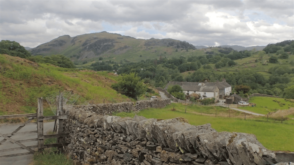
I felt a sense of anxiety in Coniston, with everyday people, cars and the noise of a typical Monday morning. What was a normal day for them, while I was already more than fifteen miles in to my seventy mile journey.
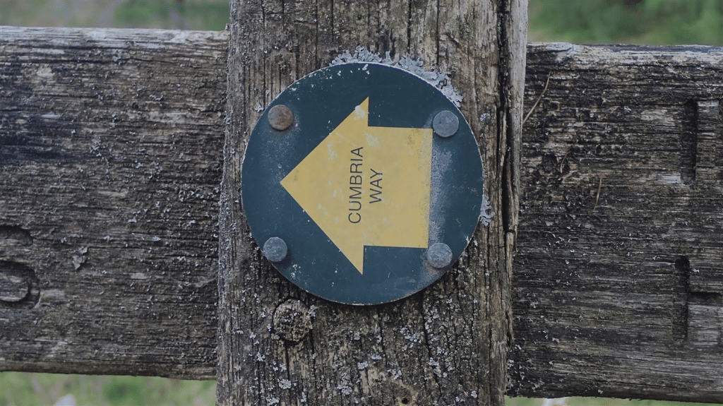
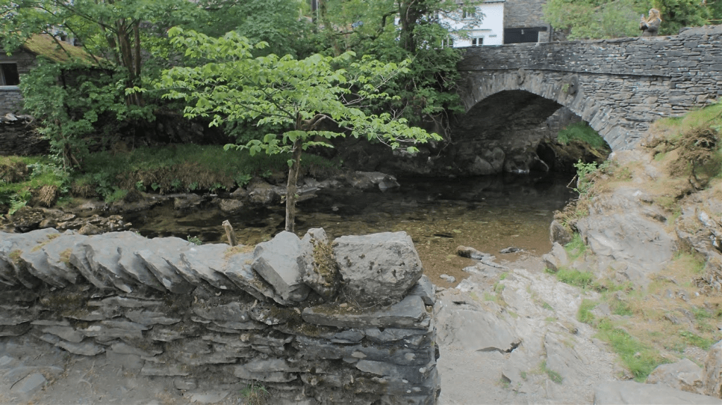
For the recurring absence of specific waymarkers, I could quite comfortable follow the roads, using my Harveys map as a reference. Although I did turn off too soon around Shepherd Bridge; entering a sports field with a sense of bemusement. Thankfully, one of the men responsible for the large group of children kindly directed me to the next crossing point, a few steps further up the road.
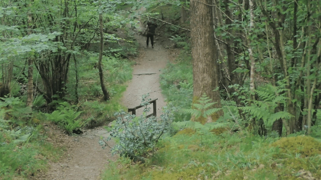
I was keen to escape Coniston, the presence of other human beings and find refuge amongst the trees. Some ascent was required and I passed a couple of other walkers heading the other way.
In the depths of Tarn Hows Wood, I would overtake the man and his dog, seen in the photo above. They were both walking the Cumbria Way and, rather sensibly, finishing in Great Langdale on this day. I’d meet another pair of walkers with an identical plan today, as I climbed the next quiet road between fells.
Let’s talk about the weather momentarily. It had been forecast that heavy rain would fall from sometime after lunch and continue in to the evening.
My trek to Borrowdale would involve having to climb up and over Stake Pass – one of the highest points between Ulverston and Carlisle. I was either going to get there in good time or, in the absolute thick of it.
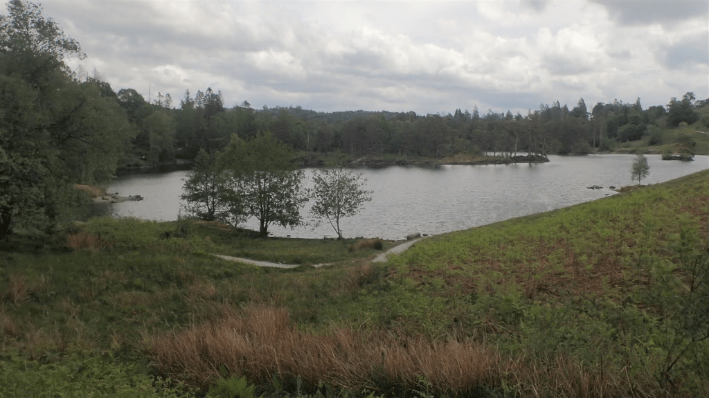
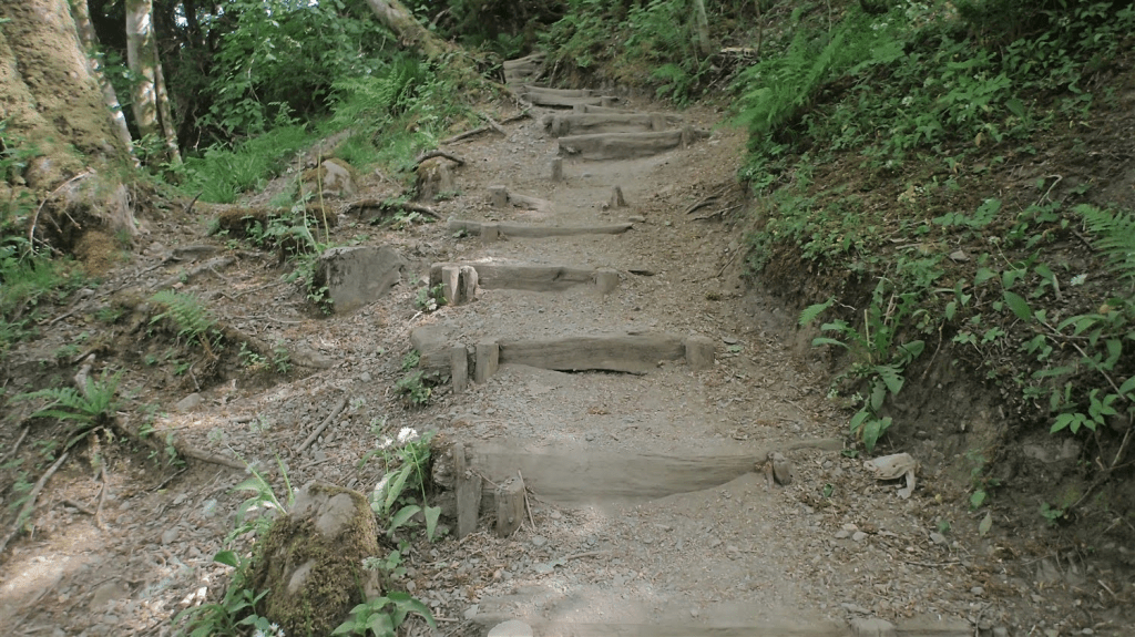
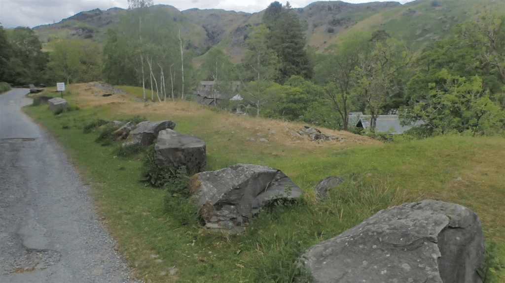
Next up was Tarn Hows. If you can ignore the National Trust car park and café to one side and the maintained path around the perimeter; I felt there was something ‘prehistoric’ about the presence of this mountain lake.
On day one, I’d passed Beacon Tarn before descending in to Coniston. A beautiful body of water, some distance from the nearest road. Not a public convenience in sight. However, I felt it was more tamed and “perfect” than what I saw before me here.
Had I not been content with the idea of reaching Borrowdale in one day, I’d have stopped here for something to eat.
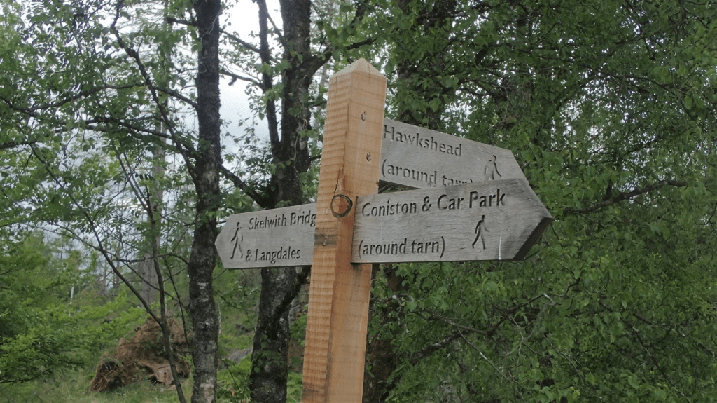
Finding my way out and onward was easy, thanks to the regular fingerposts. Although, the Cumbria Way-marker remained elusive as in many of the miles now behind me.
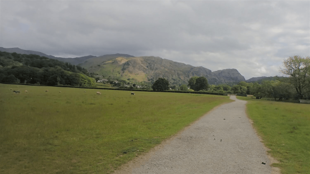
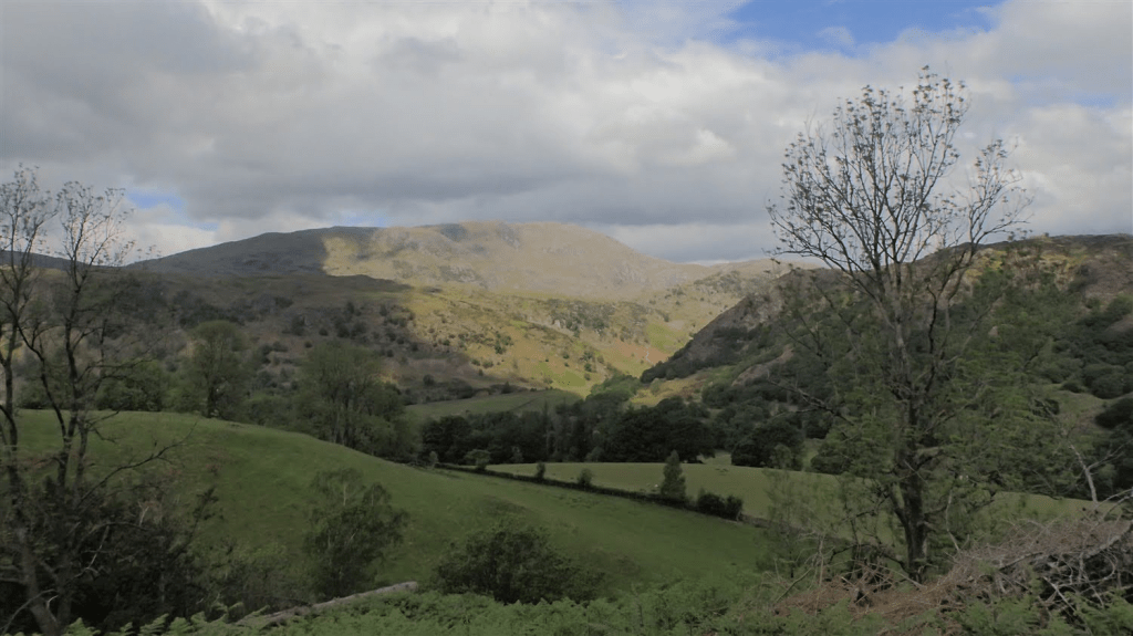
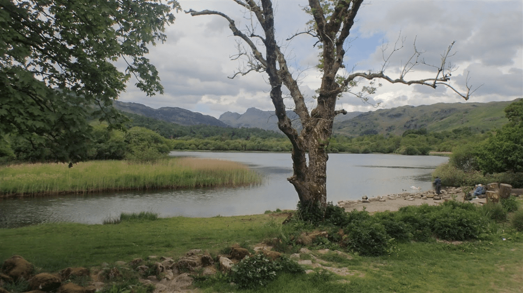
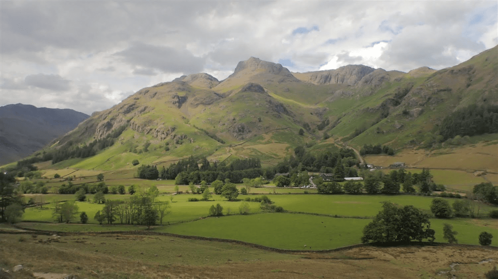
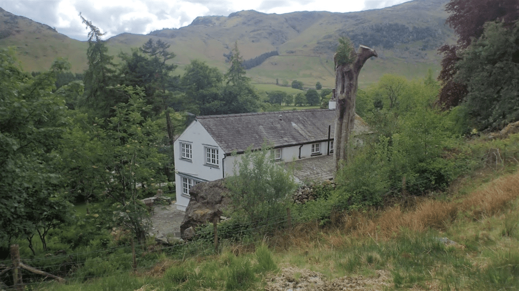
This was my first clear sighting of the Langdale Pikes. An area I’d explored in a day walk back in September 2022. Great Langdale was still some distance before them. Borrowdale, even further beyond.
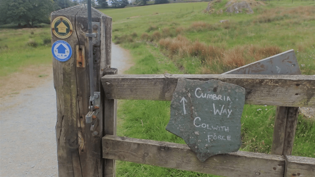
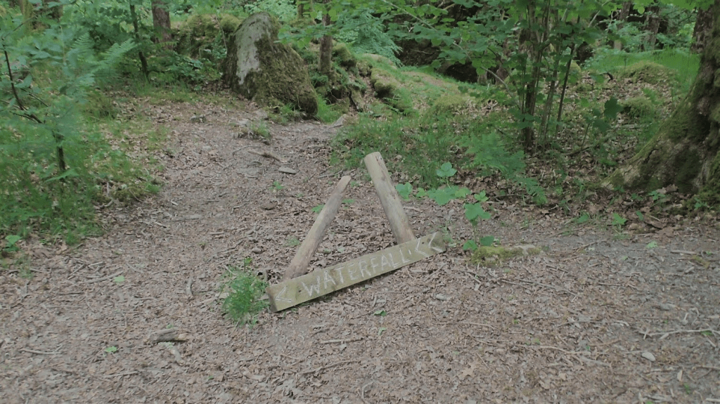
Over the A593 and I would enter woodland from High Park – where I noticed a sign for an in-house café.
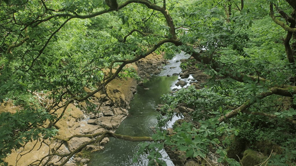
In these woods, was my first chance to spy a waterfall on this day. I noticed an option of two paths on the map and instinctively chose the lower option; imagining that the higher route would only have seen me miss out on this natural wonder.
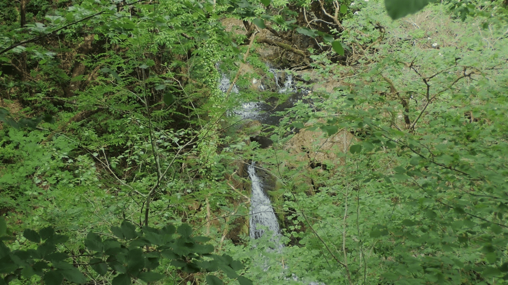
I doubt I’ll win any awards for this capture of Skelwith Force! I was glad to be down beside the water and soon passed a couple of “tourists”, dressed for a casual day out and no doubt searching for this feature themselves.
Out of the woods once again, I followed a driveway between holiday cottages.
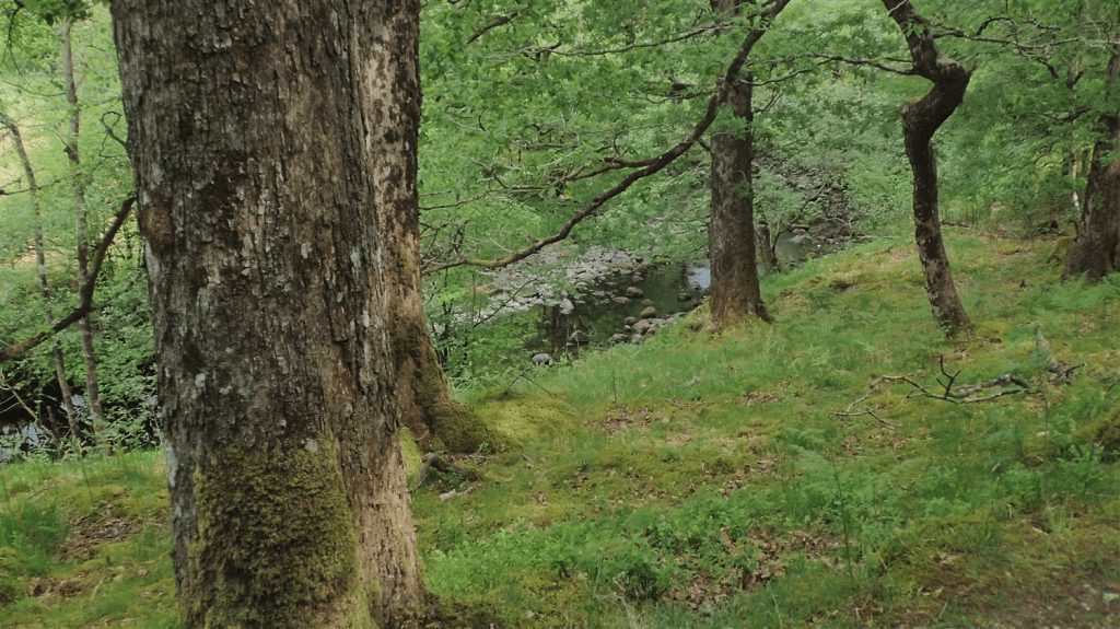
Entering the parish of Skelwith, I search back and forth; to and from the road but could not find a glimpse of Skelwith Force. It’s possible the water level was too low, as this was around the start of what became a summer-long drought for much of the UK. It’s also possible that I mis-read the scale of my Harveys map, where the 1:25,000 of OS might’ve helped me to pinpoint the precise location.
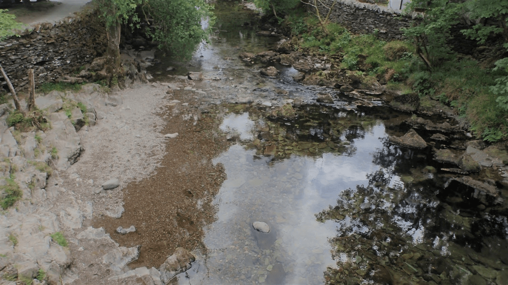
I’d already seen that water levels were running very low in places.
A friend embarked on her own Cumbria Way walk, four months later in September, when much of the trail was, unfortunately, under water! She had to end her journey prematurely but, from the photos and videos I saw, she definitely experienced Skelwith Force!
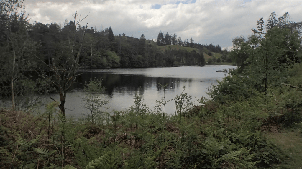
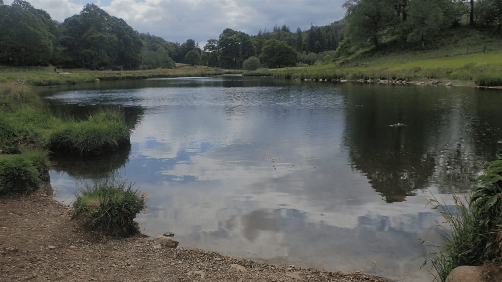
This was Elter Water, one of the lesser-known “waters” of the Lake District. I’d soon discovery a very touristy, easy access path along one side. Before the far end, I’d find a comfortable place to sit for a while, away from the trawl of slow-moving strollers.
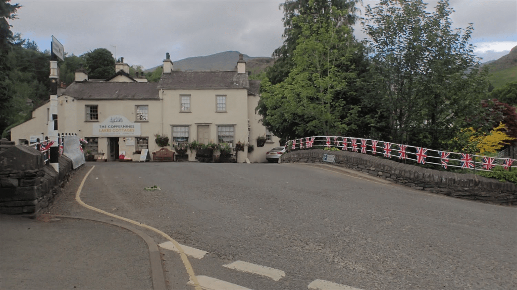
From Elterwater itself, with a local pub within touching distance of the Cumbria Way; I soon climbed out and around a slat quarry, obscured from my view.
Finally, I was coming in to Great Langdale and beyond here, stood the Langdale Pikes.
To the left was a convenient campsite, where I assumed the man and dog I’d passed earlier, would be staying. Two others I’d spoken to had reserved a room at one of the hotels further ahead. Clouds were already gathering over Pike of Stickle.
It wasn’t easy along this section, with rough, rocky ground to traverse. I passed another walker who had stopped for lunch. It was no later than 13:00 at this time and, for me, it was decision time… There was no way that I was going to finish my day at the campsite. I remained committed to getting beyond that pass.
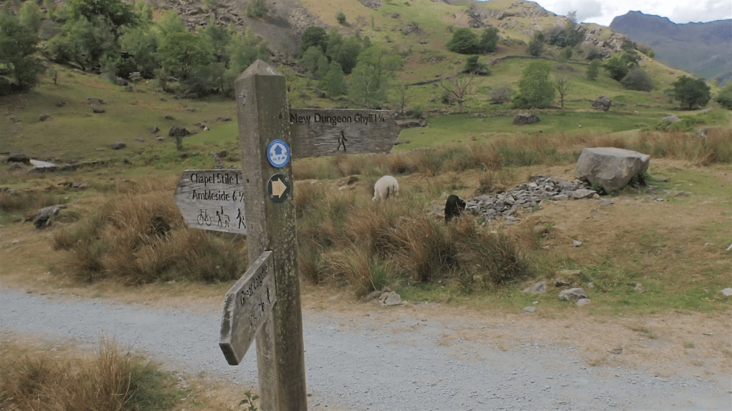
Crossing the B5343, I would arrive in the National Trust car park that I first discovered in 2022, on my way up to Stickle Tarn. From there and close to Old Dungeon Ghyll, I could retrace the tail-end of that walk but walking in the opposite direction.
A short but steep ascent was required to escape this area and continue west along the Cumbria Way. I was now walking in the shoes of three walkers I’d passed towards the end of my Langdale Pikes outing, less than three years earlier. Below this path, you can see the New Dungeon Ghyll.
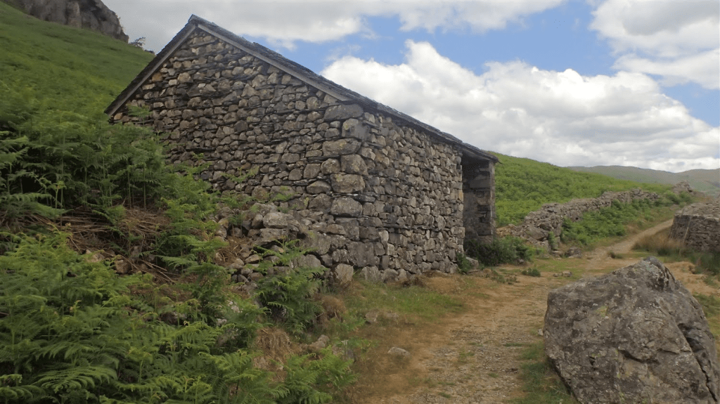
I stopped for lunch amongst this open land and close to a point at which some brave a very direct route up on to the fells. I also discovered an open stone shelter. Had the rain already started, I’d have been safe enough inside. Perhaps I could even have pitched my tent, had it come to it.
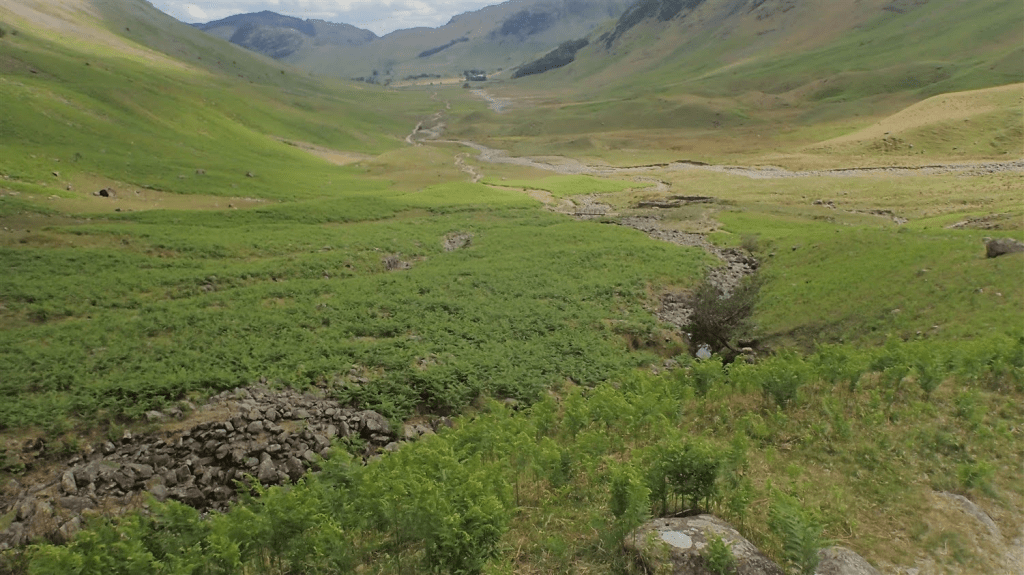
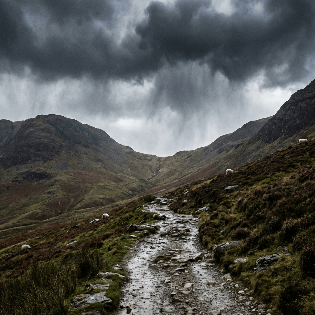
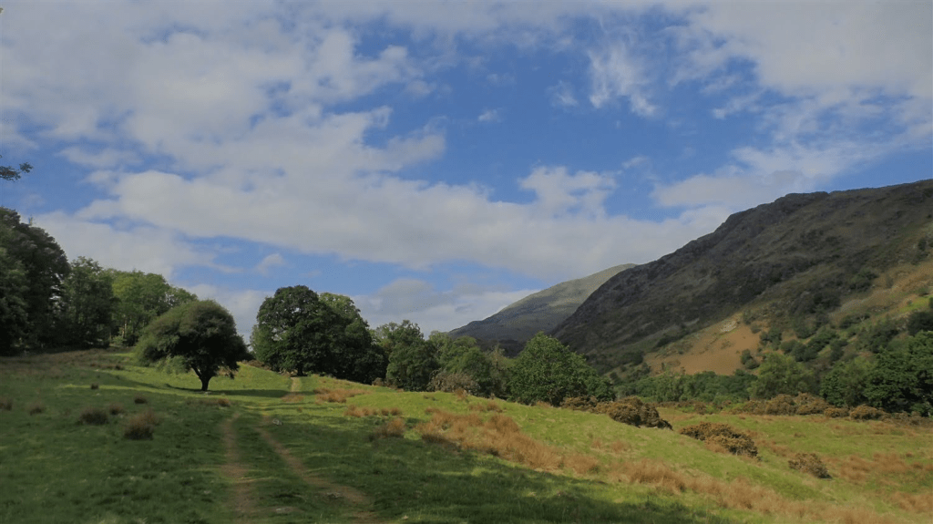
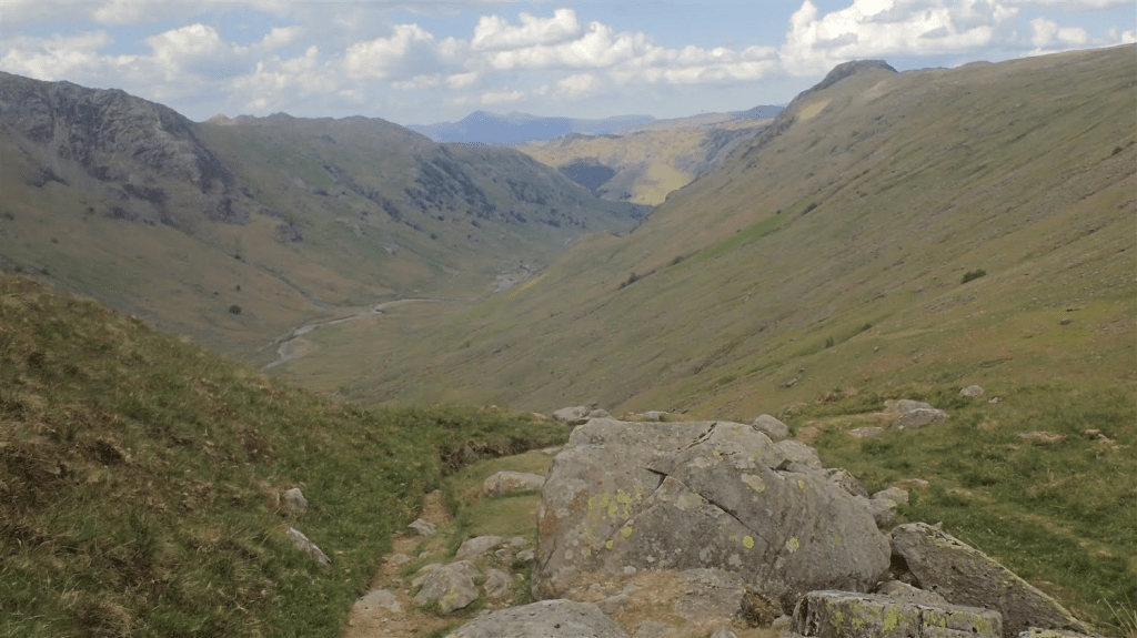
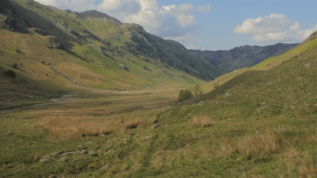
Looking back along the valley floor, from the point at which I reached the foot of Stake Pass. I still see a great resemblance to a Scottish glen, here.
I don’t wish to underplay how tough this next section was. Descending in 2022 was very tough on my knees. In the run up to this trip, climbing Stake Pass was the one section of the entire journey, that I was not looking forward to.
Other walkers might continue west from here, on a looking journey in to the Scafell range.
I wasn’t able to catch up with another walker ahead of me, as I zigged and zagged my way up this path. By the time I reached the top, he’d already vanished from my sight.
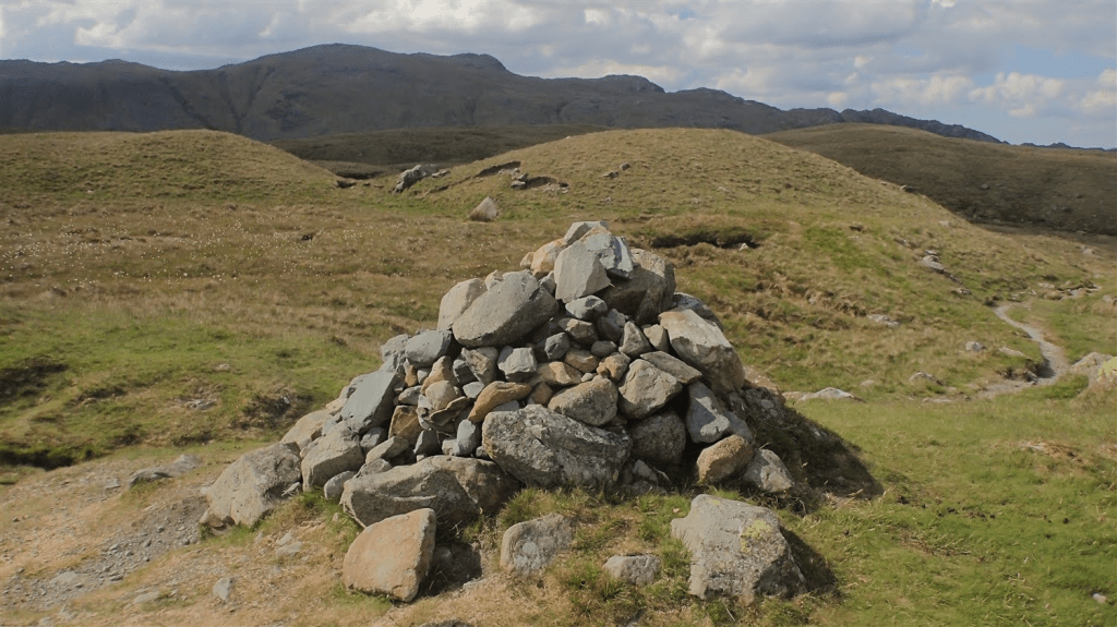
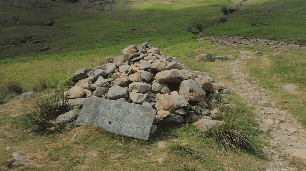
When you reach this pile stones, some 300-400m of ascent later, you know that you’ve made it!
I found streams on top, got my filter out and treated myself to cold, fresh water. They often say it’s better to collect it from as high a source as possible.
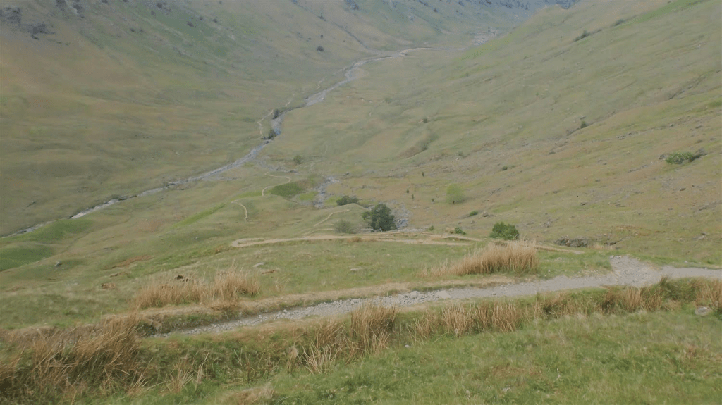
My journey now turned north and I soon met this incredible view with the descend immediately before me. Just out of frame, a pair of walkers were sat having their lunch, overseeing another glen-like vista.
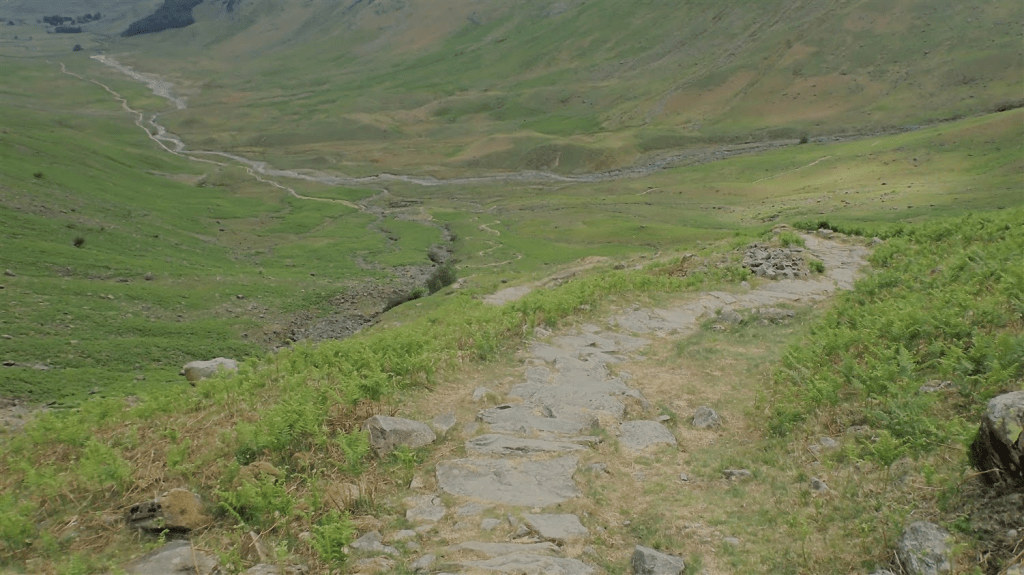
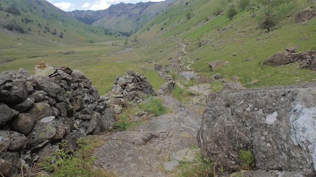
You can see the descent in to Langstrath, as if someone threw a length of string to the wind and where it landed, a path was created, weaving its way down the hillside.
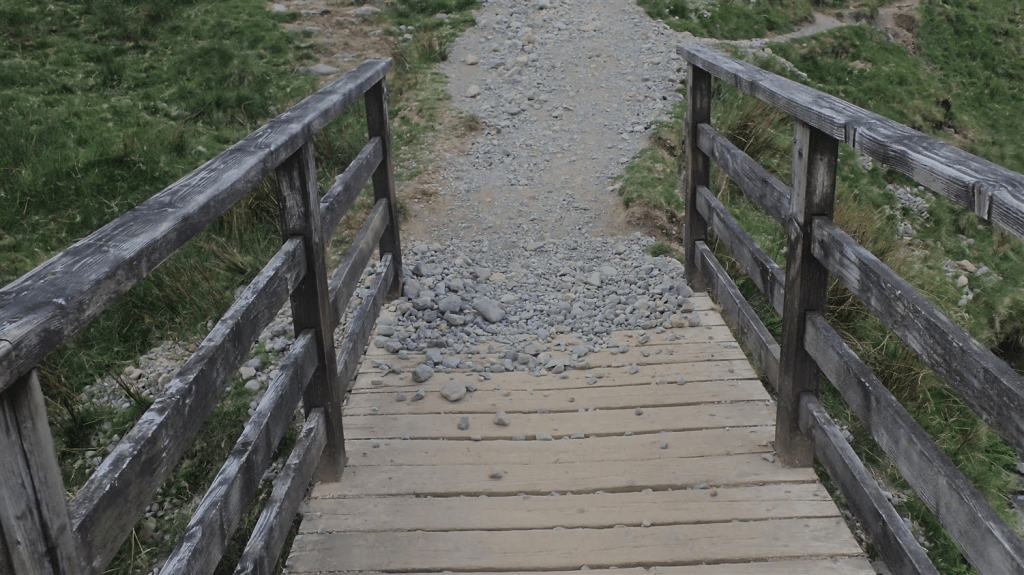
Relief was a feeling, as I eventually met the timber deck of this footbridge, where the loose rock and scree that had plagued my descent, could not continue. I had slipped backwards no fewer than five times. Please be careful, should you make your own descent in this direction.
With Langstrath Beck down to your left, it looks as though the next 2 miles of walking should be straightforward. Travel as far as I T-junction with the next valley and then turn left…
But the going here is incredibly rocky, between small boulders, over larger ones and it doesn’t let up until close to the end.
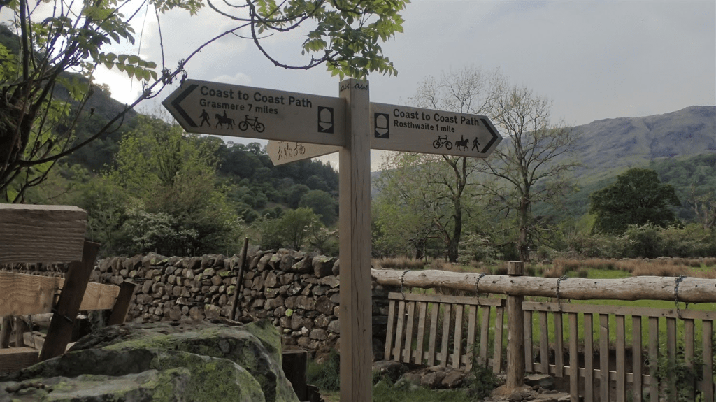
Eventually, I reached this sign at Stonethwaite Bridge – by the way, the Coast to Coast Path is now a certified National Trail. One I’d like to walk another time.
This is the point I’d leave the Cumbria Way until the morning of Day 3.
As I crossed the bridge and paused to admire the water below, I heard my first rumble of thunder, somewhere above the Langdale Pikes…
I hurried my way along the next road and toward Church House Farm. Each rumble arrived even sooner than its last. I met a rather jovial owner at the door and paid my fee – he also told me that I was the second person to have walked all the way from Coniston on this day.
Within moments of pitching my tent and climbing inside, the rain began to fall. It wasn’t to last all evening but the timing, it couldn’t have been more perfect.
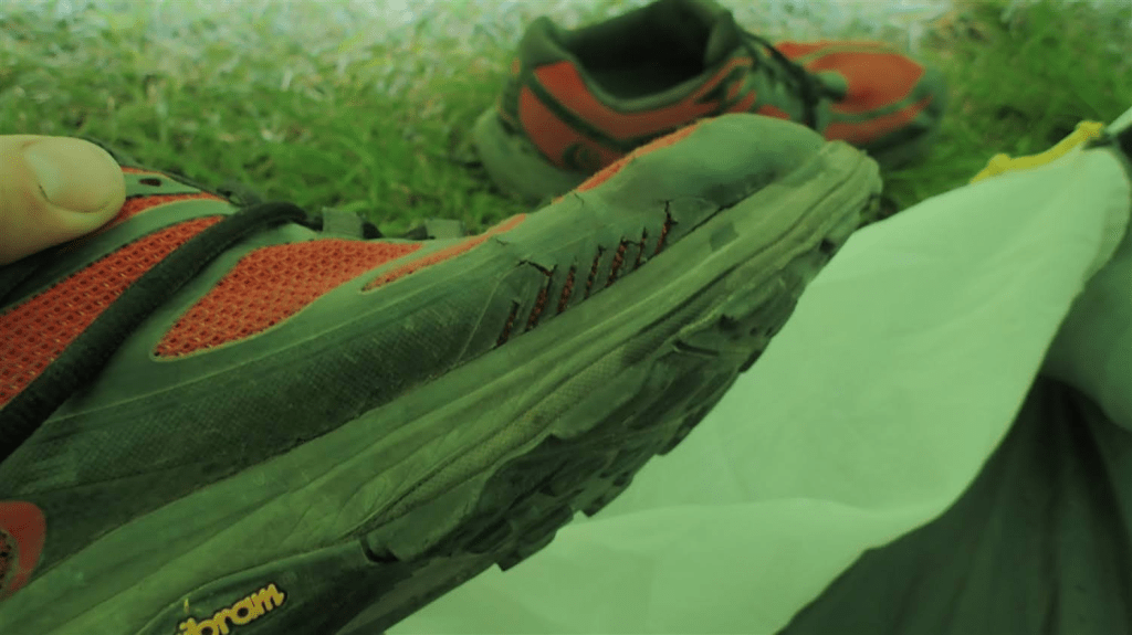
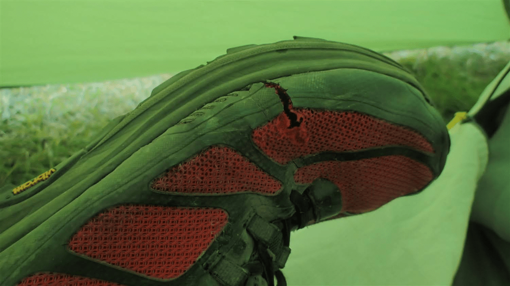
I wore my Topo Athletic shoes on this walk, knowing that I’d not be crossing much in the way of fells. I first bought this in 2021, for the Cleveland Way and they were already showing signs of significant wear after that 109 mile adventure in Yorkshire.
I wanted to give them one last outing. I had duct tape with, should it be necessary and, the very next day in fact, I’d be passing through Keswick, with its range of outdoor shoes and footwear to choose from.
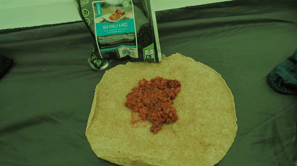
Another camping meal for dinner and, as I’d overpacked in wraps for the duration of my trip, I decided to innovate and make something more of my meal!
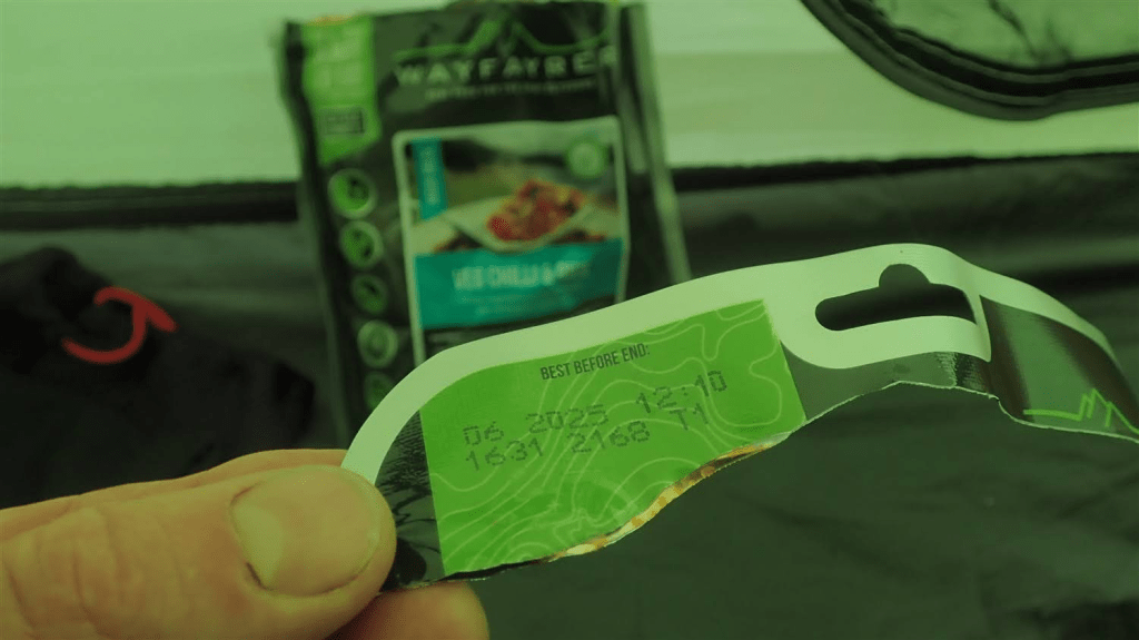
…With only a couple of weeks to spare before the expiry date on this pack!
Thanks for reading. Day 3 will follow.
