Sunday 2nd April 2017
As far as I’m aware, Cadbury Hill near Yatton is the one former hillfort site that’s closest to my home in Wrington.
For a number of reasons, I’d not been there since February 2013. On this walk, I’d set off from my doorstep, leaving the car alone to head for its summit.
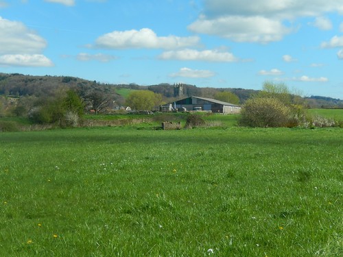
From Wrington I began, climbing Bullhouse Lane before turning west across familiar fields near Bracken Hill. This area presents a favourite view overlooking the village and Wrington Vale with the Mendip Hills beyond.
I continued in to the woodlands, initially following a known path down towards Uplands, before turning uphill on a previously unexplored route heading for Corporation Woods within the Congresbury Estate.
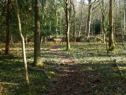
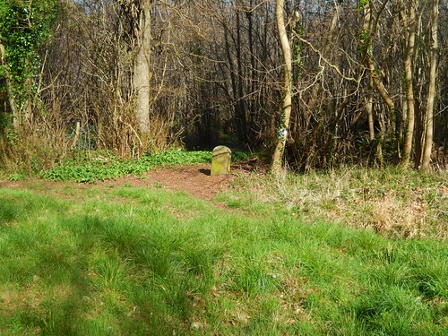
I soon found myself in familiar territory and passed boundary stone No.23, which I first discovered a couple of months ago (it’s on the right of the gap in the wall, above).
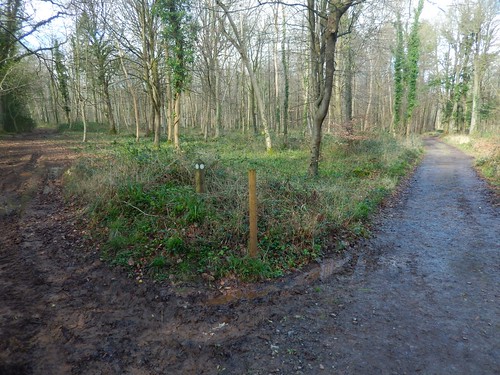
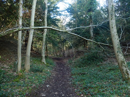
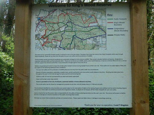
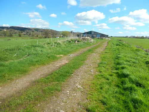
Continuing downhill past Woolmer’s and in to King’s Wood, I was looking to walk west – again, along paths I had not previously explored, despite having lived so close for many years.
There were a couple of path junctions here that I found confusing, along with waymarks that indicated not featured on the OS map.
Before leaving the woods, I would learn that these are ‘Private Paths’. You’re welcome to walk them in daylight but they may occasionally be closed. Hopefully, the right people would put a warning sign in place as I know a lot of pheasant shooting takes place in these woods.
I wonder why they couldn’t be made Permissive Paths and marked on the map? I intend to return and investigate further, as these routes may lead me to other boundary stones.
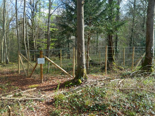
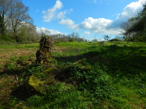
Off the track, I noticed several fenced off danger areas that apparently house unstable mine workings… Wild camping in these woods may not be a bright idea, it seems.
Then, to my right – and, as highlighted on my map – I found my next boundary stone.
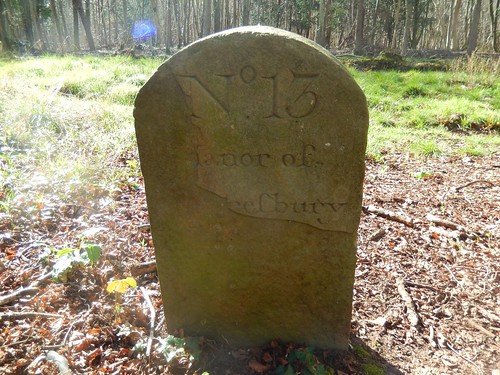
This is No.13 and you can see how much of the ‘face’ of the stone has already worn away. It wasn’t until I found this one that I noticed the ‘f’ used in place of an ‘s’ in ‘Congresbury’… This was an accepted practice, two centuries ago.
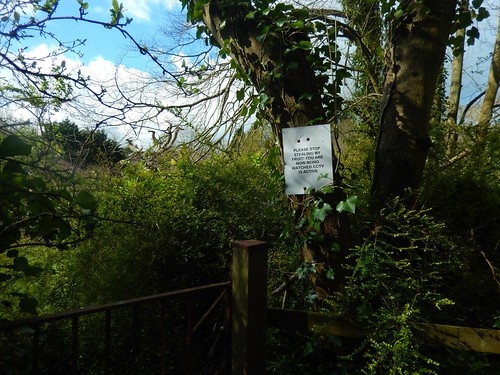
Nearing the A370 with the traffic growing louder, I found a stark notice from a private landowner, requesting that people ‘stop stealing’ his fruit. I didn’t see (or take) any fruit but they warn that CCTV is also active in the area.
Maybe they could fit a lock to their gate?

Across the busy road, I could see The Star through the trees. It’s a pub I know too well; part of the Fayre and Square chain and a place where I’ve eaten many meals. There was once a group walk that stopped for lunch here and nearly everyone had a roast dinner. Fortunately, the route was downhill thereafter!

I kept right of the pub and followed the path around its boundary; crossing fields in the direction of the wooded hill. It looked as if someone had cobbled together their own stiles, as opposed to buying a ready-made kit.
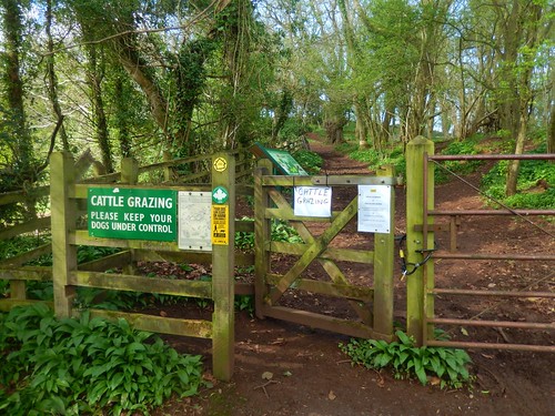
Approaching from the east, I could hear ‘angry’ mooing long before I read the signs.

Cattle was an understatement. They had horns! They were also walking towards me with some attempting to double-back and surround me from the path to my right.
I turned back.
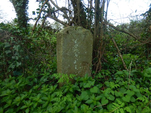
If I hadn’t done this, I wouldn’t have realised that I had absently missed boundary stone No.7: ‘Parifh of Congrefbury’. This seemed to me like a long way for the boundary to extend out to and there’s not suggestion of its location on the OS map.
This is now the fourth stone I’ve found (including one I’ve not photographed), which leaves twenty-seven left out there, somewhere… Or not.

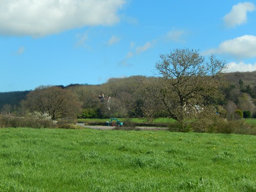
Here I was now, descending north towards Claverham, in search of an alternative route to the hill top. I found a waymark for the Round Yatton Walk, which I remember as a series of small circular loops. Anna and I first came across this on a “coastal” walk near Hewish in 2015.
There was a left turn available, leading through a field of thick, soft mud with dirty-looking cattle at the far side… Nope, this wasn’t my way forward.
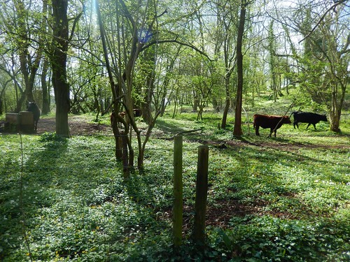
I retraced my steps to Cadbury Hill when I realised there’s a bridleway skirting around the summit. I felt foolish for having missed it and it led me most of the way around the semi-enclosed cattle before I would climb to the summit of the hill.
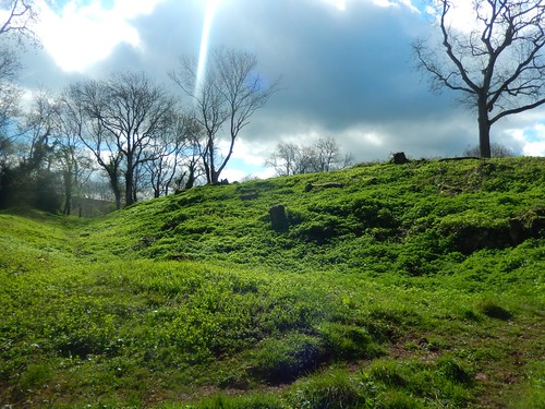
I’d only been here once before, in 2013 and now, it seemed much bigger than I had remembered.

Maybe we took a very direct route across, back then.
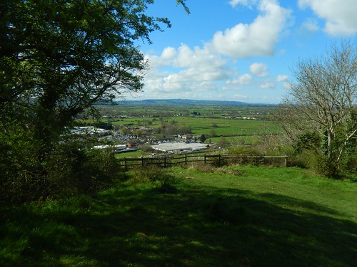
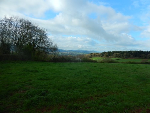
With trees surrounding, like many ancient hillforts today, it’s hard to get a clear panoramic view except from certain points. I had a cup of tea and my lunch close to the fence above, overlooking Cadbury Garden Centre and the moorland leading to the Mendip Hills.
I think this was one of my first walks of the year where I wasn’t wearing a jacket.

After lunch, I descended towards the Smallway road junction, following Wood Hill to cross the A370 and enter the village of Congresbury.
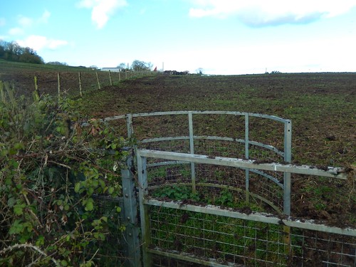
Via a series of roads (including one that was closed), I found my way beyond Cobthorn Way and on to the fields that are constantly under the threat of proposed housing development. The River Yeo lies at the bottom of these fields.
Higher up and towards the woodland, work is already underway to install the water and drainage foundations for what I presume are the dozens of houses North Somerset Council has already granted permission to build. This was only months after rejecting a similar application, while money-hungry developers aren’t giving up their own battles.
Honestly, we could build twenty-one-thousand houses in North Somerset over the next two decades and consume every inch of green space if we had to… But I believe there is still going to be a housing shortage.
Quick fixes to long-term problems.

Walking back in the direction of Wrington, I would now followed the River Yeo and the Two Rivers Way footpath. These houses, on a road behind The Plough Inn, are less than three-years old.
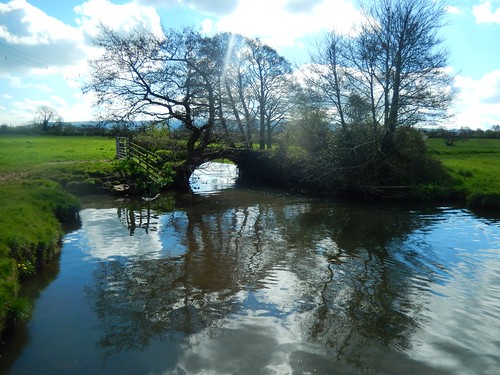
I always enjoy this local stretch of walking. It gets a bit sloppy in the winter and the river is prone to bursting its banks during heavy rain but the scenery is always stunning.
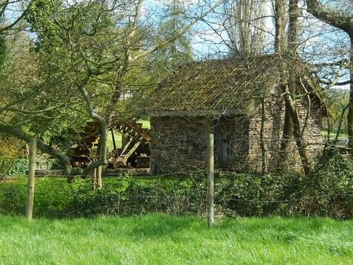
I continued across Iwood Lane and past Iwood Manor, where I’d not noticed this waterwheel before.
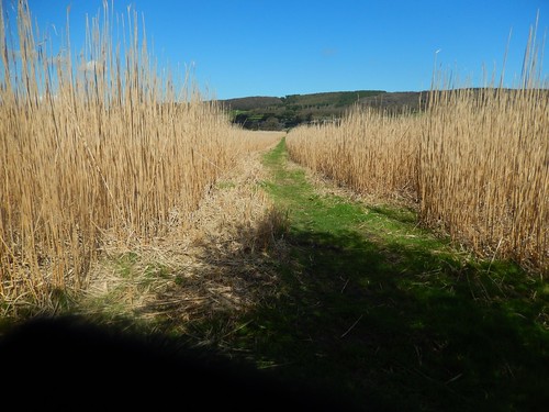
At a large footbridge crossing the Yeo, I turned away from the River Yeo to follow previously unexplored paths on an indirect return to Wrington. I was grateful for the clear path through what looked like bamboo from up close.
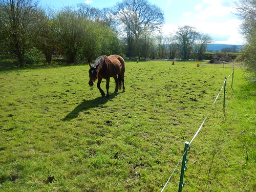
Continuing on to Stoney Croft House, the path was obvious and the horse didn’t mind me passing. Then, the waymarking stopped. A pair of gates lay ahead of me and I saw a track to my left, which I decided to follow…
“Excuse me, mate. That way’s private.”, a voice called out.
I don’t know, I just didn’t like his tone. I’d noticed warnings of ‘CCTV’ on the way down so, perhaps they’ve had troubled with thieves. He did direct me through the pair of gates and then left around a gate marked ‘Private’… Waymarking would’ve helped immensely. I find it really frustrating when it becomes absent like this and always very close to someone’s home.
Marching on to the east, I would enter a field with no clear right of way to follow and instead, I’d have to navigate a series of vehicle tracks to eventually find the desired stile.
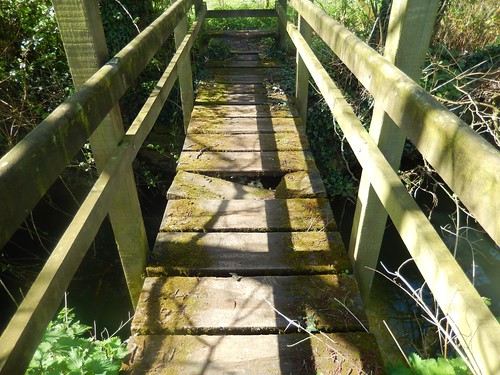
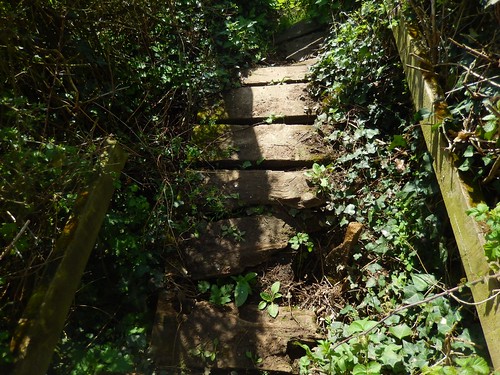
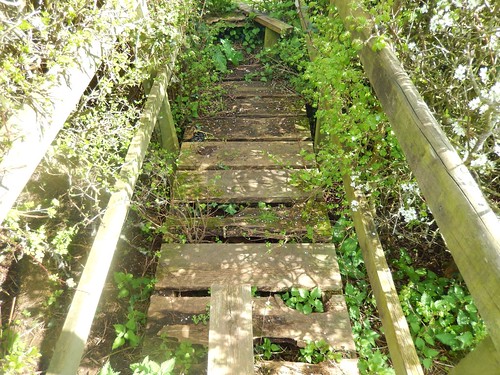
I would cross the River Yeo once more; some distance south of the Two Rivers Way footpath. This would also lead me to the first in a series broken footbridges. Each one was passable but clearly in need of repair.
This route also crossed over the raised bank of a disused railway line.
I’ve read about this… It used to connect the village of Blagdon with the Strawberry Line, south of Congresbury. There was talk a few years ago of creating a second cycle path here, branching off from the Strawberry Line.
Of all the places to create a public right of way, this bank is perfect, isn’t it? If the farm building wasn’t so close, I’d be tempted to venture off and see where it leads.
This is a reminder that I need to report each of these bridges to the council.
I made it over the final bridge and crossed the stile only to receive a whack on the shin, as it titled like a see-saw! Thankfully, I was now back in Wrington and had the kettle boiling within ten-minutes.
Distance of this walk: 8.75 miles