Saturday 15th July 2017 (continued…)

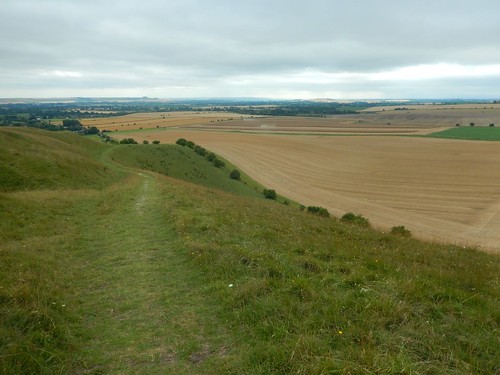
From the downland of Pewsey Hill, the White Horse Trail continues to the south…
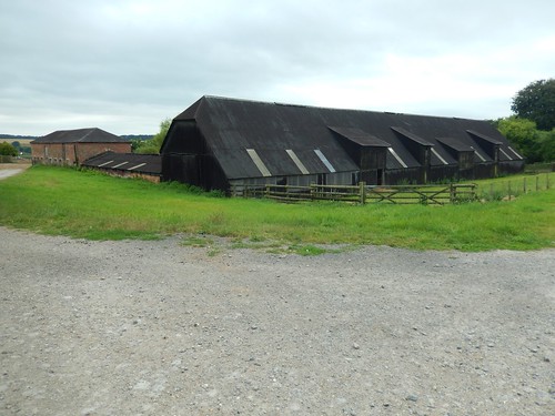
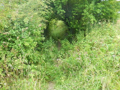
I found my way to a stile that provided a crossing point over the road near a bend. From here, I climbed up a slightly overgrown woodland path on the approach to Pewsey Hill Farm.
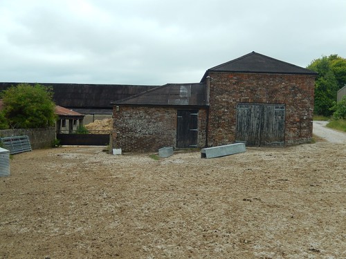
It was a Saturday afternoon. I’ve seen farms in much worse condition and yet, there was no-one around to be seen or heard.
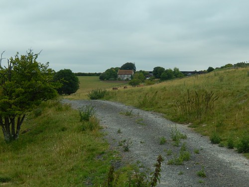
Following waymarks along the track that stretches beyond the buildings, I noticed a bull and one calf standing in my way… I gave them both a very wide berth before crossing the gate at the other end and turning back to take this photo from a very safe vantage point!

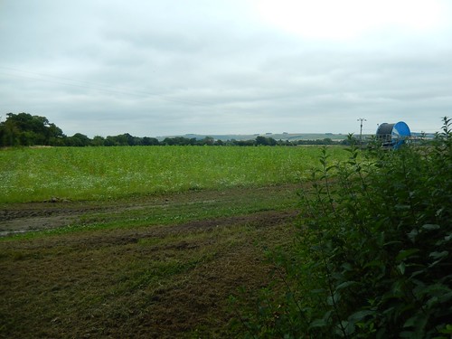
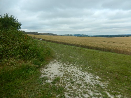
Further ahead, the way would turn north-west towards Manningford Bruce (every time, I think of this ELO song…). There was some long grass to negotiate but nothing to cause any pain and the way forward was otherwise clear. I was actively looking for a lunch spot but, with farm vehicles working nearby, I didn’t feel comfortable or relaxed.
Onwards, over the A345 and in to Manningford Bruce… Where a left turn off the road beside Lower Farm would leave me feeling completely confused!
I’d like to clarify that, as I do not own a 1:25,000 scale OS map that covers this portion of the walk, I was instead working from a 1:50,000 scale A4 print out…
Basically, I felt I didn’t have the necessary detail to confidently continue on across this first field. There were two gates – both secured shut and devoid of waymarking on each side. As for the arrow pointing in to the field, it was leading south-west as opposed to north-west!
So, I returned to the road after a good twenty-minutes of hesitation, walking back and forth. I officially missed out on a very short section of the White Horse Trail here, only to rejoin the route via an alternative footpath running past the village chapel.
My walk along the trail would continue north beside Manningford Abbots. Confusingly, there appears to be an alternative (maybe additional) route following the White Horse Trail that visits Manningford Bohune [no idea how you pronounce that] before climbing towards Wilsford and the MOD Firing Range.
Before leaving Manningford Abbots, I perched upon a stile beside one footpath and ate my lunch without being disturbed.
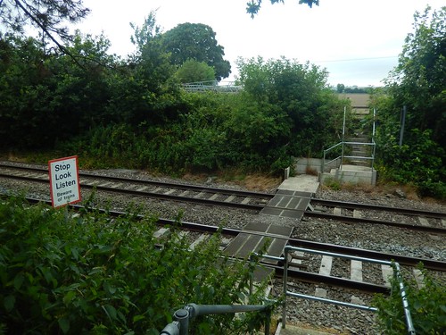
Heading north, I crossed over the railway line and not for the first time in this series of walks.
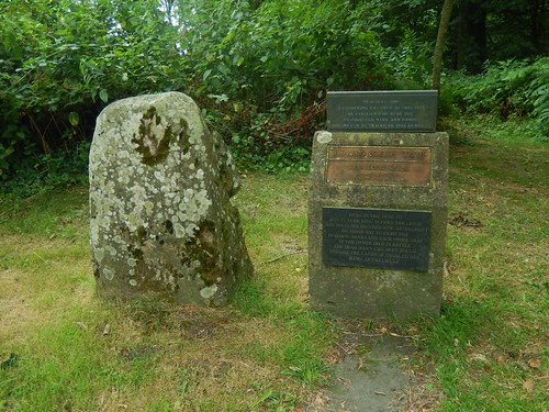
Reaching the next road, I found a stone marking the site of Swanborough Tump; a site where Alfred the Great once met and had a chat with his brother, basically.
I had hoped to find a long barrow or mound of some kind but, the surrounding landscape was ‘Typically Wiltshire’.
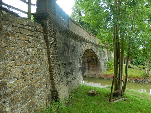
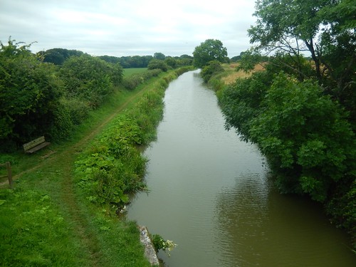
Once more, I arrived at the Kennett and Avon Canal. From Ladies Bridge, I would drop down to follow the towpath in a westerly direction.
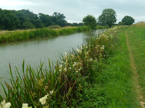
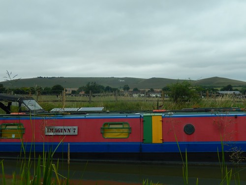
There were a few narrowboats gathered along the banks close to the bridge but nothing much beyond.
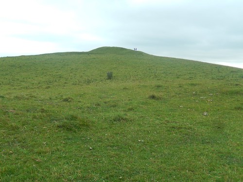
Up to my right (looking north), I could see two hills:
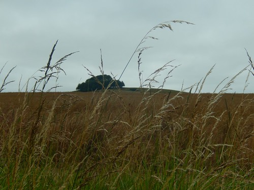
If I have this correct, that’s Picked Hill. Somewhere beneath those trees lies a trig point, if my map is to be believed.

Just west of that we have Woodborough Hill. A single public right of way leads up to the top and then down again but there’s no trig pillar to be found. I do feel like these hills may need to swap attributes…
At the next bridge, I must climb up and cross over to continue my walk along the opposite bank of the canal. A bench was also waiting for me… How could I not take advantage a few minutes’ rest?
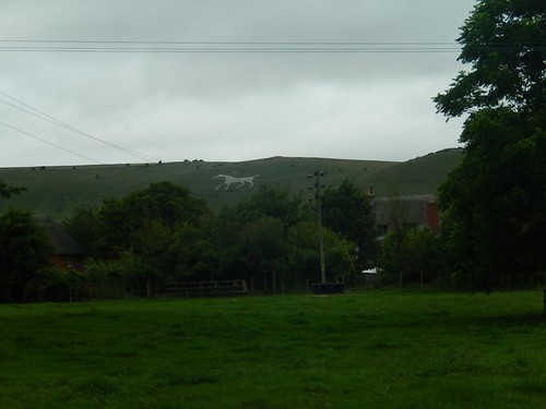
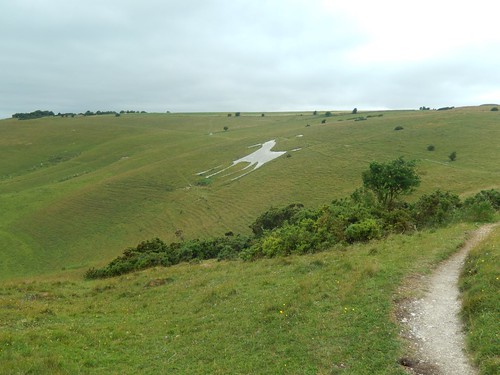
Plodding on towards Honeystreet (from which, a previous White Horse adventure had begun), I could clearly see the Alton Barnes White Horse on a hillside to the north. That pretty much signified my finish line for this walk. Still, it looked so far away.
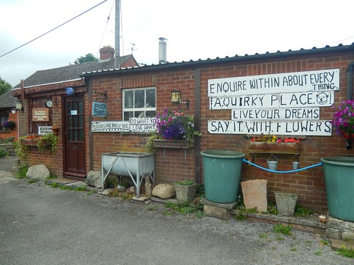
From Honeystreet then, I walked north up the road towards Alton Barnes, where I noticed this ‘quirky’ looking shop on the right.
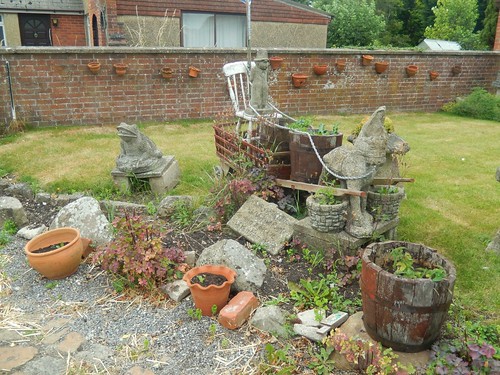
Ignoring the improper use of an ‘apostrophe ess’ on one sign, I marched on, also taking note of the scene in the garden.
Suddenly, the Alton Barnes White Horse appeared to grow nearer.
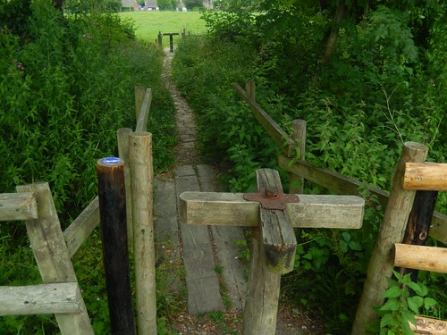
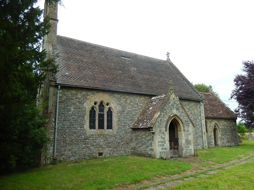
Following the trail in to Alton Priors, I passed through a sequence of fantastic wooden turnstiles before arriving at the historic church. I’d not seen anything like it before, in any of my walking, up and down the UK.

This is the All Saints Church, which dates back to the 12th Century.
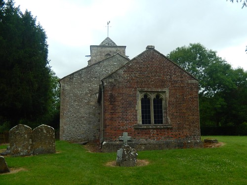
What I found most interesting was the ‘misalignment’ of the building along its full length, when viewed from the eastern end. Deliberate, I can only assume.

Moments before a road junction, I admired the thatched roof on this long building, which I can only imagine was a tithe barn, even if though it’s not highlights in italics on the map.
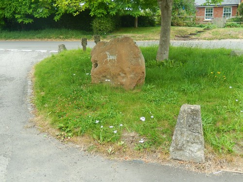
Also worthy of note: a White Horse painted on to the side of this stone. Somehow, I doubt it’s as old as the original hillside chalk figure.
I left the road to follow the way up towards an opening in the field, that would grant wide access around the other side of a hedge…
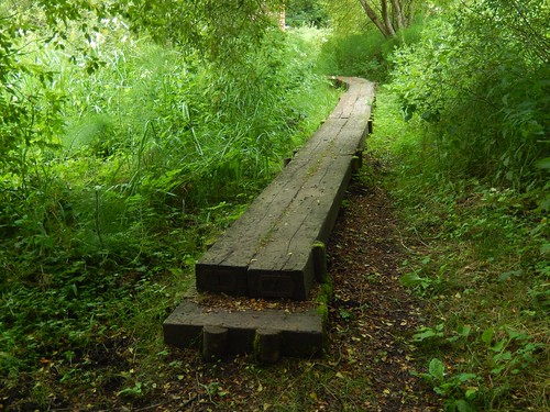
But, of course; I chose to follow the true trail way along a path also marked as ‘Ridge Way’ in italics. ‘Overgrown’ remains a theme of these White Horse Trail walks, after all.

Climbing another road quite steeply, I was soon up my way up towards the heights of Adam’s Grave, an ancient long barrow.
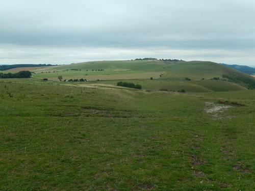
Already, the views from Walkers Hill were superb. Wiltshire may be extremely flat in places but, it’s the kind of spectacle you can only fully appreciate from an elevated plain.
On one hand, I felt an inclination to head directly for the car and end the walk. Alternatively, I could see the chalk hill figure just ‘over there’…
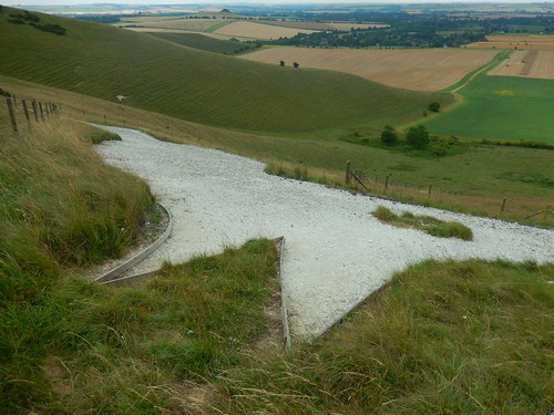
Of course, I wasn’t going to come this far without paying it a visit. From this close, you can see the timber boards that have been secured in place to maintain detail, shape and reduce erosion. This may explain why I’ve thought it looks slightly ‘fuzzy’ around the edges, when viewed from a distance.
Walkers, doing what they do best on Walkers Hill… As I plotted a more direct route to the car; climbing up the hillside and away from the worn footpath (this is open access land) to soon arrive at the finish line, with new cars in position and yet more afternoon-napping drivers in the front seat!
In spite of the title, this was my penultimate walk in the White Horse Trail series and it also happened to be my favourite and most enjoyable outing of the seven.
