Sunday 24th September 2017
Somewhere along the border between Somerset and North Devon, lies an Area of Outstanding Natural Beauty (AONB) known as the Blackdown Hills.

Driving up or down the M5, you’ve probably seen the Wellington Monument from afar. But this was the first time that many of us would actually walk in this area.
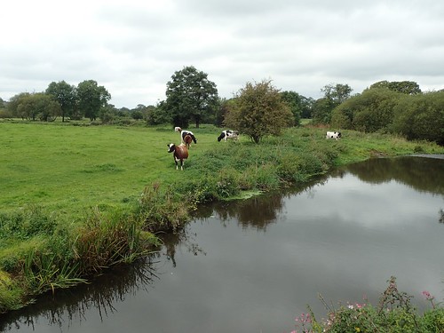
Our walk would begin in the village of Hemyock, just east of Culmstock along the Culm Valley. Somerset lies to the north of here.
It wasn’t long before we were climbing uphill and away from the valley. I’m certain we were heading south at this point, as we could see the Wellington Monument (a feature of this walk) moving further away from us!
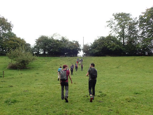
…As for the exact route, I wouldn’t have a clue! I don’t own a map of this area and wasn’t following the way too closely, while Jenny was leading.
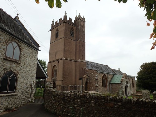
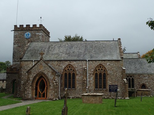
We passed this church, where the tower has clearly been rendered, while the rest of the building is built of stone. I wish I could tell you where it was and read more about it… I must be looking at the wrong point of a map because I cannot see it.
Confusingly, there’s a village called Abbey in this part of the world.
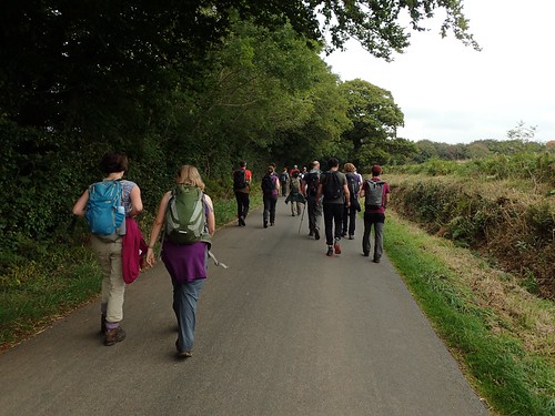
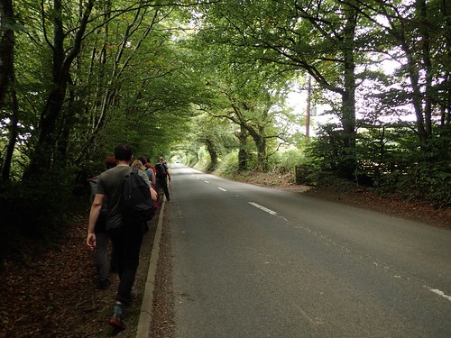
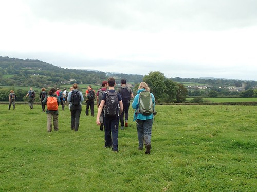
We’d walk through mud; we’d walk along roads. Jenny had made apparent the difficulties in plotting a circular route of reasonable length that doesn’t tread on tarmac at certain points.
Is this the real reason people don’t venture to the Blackdown Hills? Probably not.
Along one of the busier roads, I remember seeing a sign for a farm where some kind of event was taking place that weekend… Later, I’d realise it is the same venue used for the annual Buddhafield Festival (one that’s been on my list for a few years).

You’d be forgiven for thinking this walkway, with its ‘ancient’ towering trees was further north and on the Quantocks. There is a definitely similarity to an old drove road linking Triscombe Stone with Crowcombe.
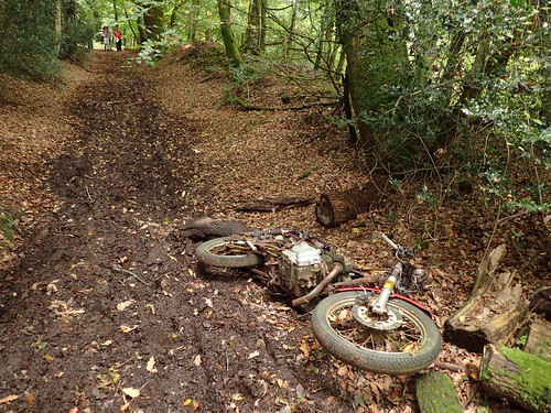
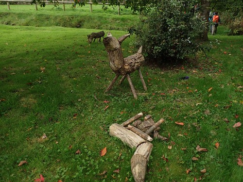
Part-way along the track, we passed a small group of other walkers (who appeared slightly hesitant over their exact location). But I’d like to know the story behind this bike and how it came to rest, here.
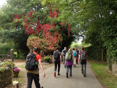
Autumn was really beginning to bloom at this point in the season and I don’t remember it being a cold day.
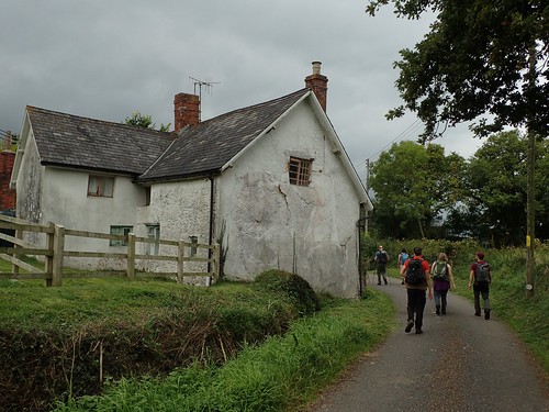
Shortly before we’d begin our climb up to the Wellington Monument, I noticed this building, with its render ready to crumble off. This was actual the first of several such sights that I would become aware of throughout the day.
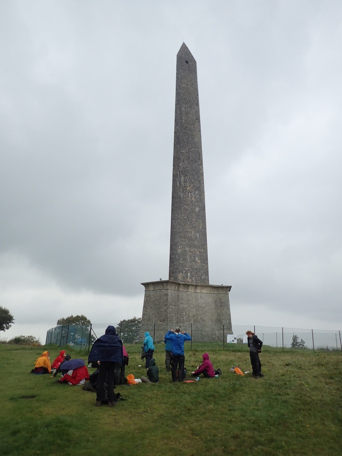
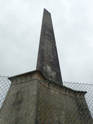
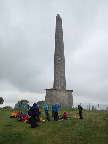
Having walked so far and, with lunchtime approaching, it was quite a relief to see the obelisk almost within reach, now.

As the gradient increased, gently, we notice a building on the left with a sign for ‘visitor’s entrance’… But no indication as to what one might find inside. I can’t find any information on a visitor centre this close to the monument.
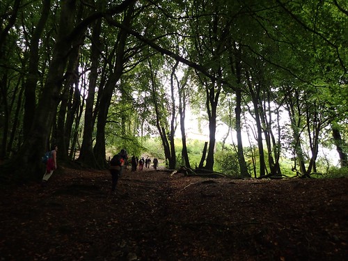
Entering woodland, the gradient began to rise more sharply. Up through the trees and we would break out on to the highest point.
At only 272m above sea level, it is dwarfed by Dunkey Beacon on Exmoor – the highest point in all of Somerset – and many mounds within the Quantock Hills range.
Here lies the Wellington Monument; a rare triangular-obelisk, standing more than 50m tall and built to mark the Duke of Wellington’s victory in the Battle of Waterloo.
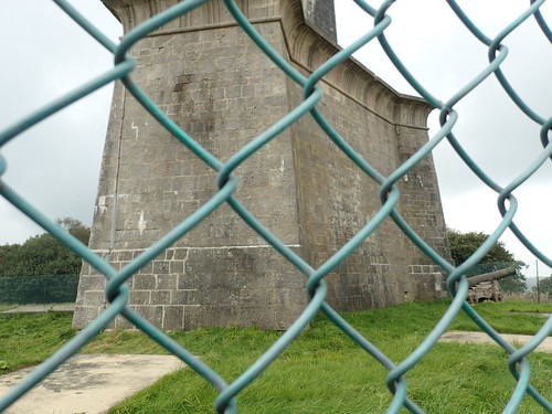
It’s been standing since 1854 and today lies within the care of the National Trust.
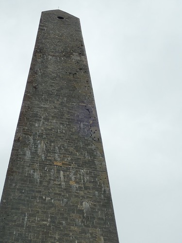
Fencing remains in place for the safeguarding of visitors, where strong winds and erosion have gradually drawn bricks away from the structure. Repair work appears to be ongoing.

It’s a similar story then, to the Lansdowne Monument in Wiltshire, which is also owned by the National Trust.
At this point, we’d intended to stop for lunch and, as soon as we sat down… The heavens opened up, in typical British fashion!
Cue a panic, en masse, of ramblers wrestling with waterproof trousers and wrinkled jackets.
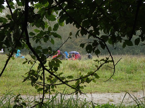
In a strange form of defiance against the elements, a greater portion of the group decided to ‘sit it out’, as the rain continued to fall and grow stronger! Meanwhile, a small number of us ‘more rational folk’ fought for shelter beneath a nearby tree.

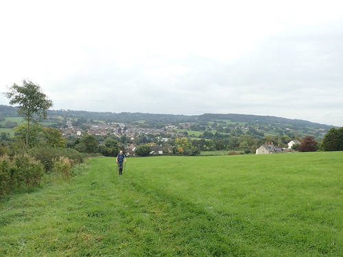
By the time our lunch break had ended, the rain clouds had moved on. There aren’t many views available from the tree-lined Wellington Hill but you wouldn’t know that the M5 motorway lies less than 1.5km north of here.
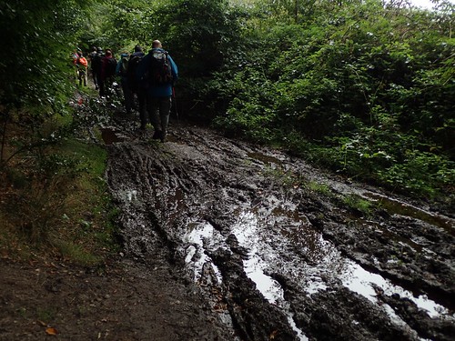
We must’ve been walking south-westward from here and on towards our next road… Which couldn’t come soon enough, as we slid our way along the muddiest section of the entire walk. I can’t even imagine this shaded path drying out for the summer.
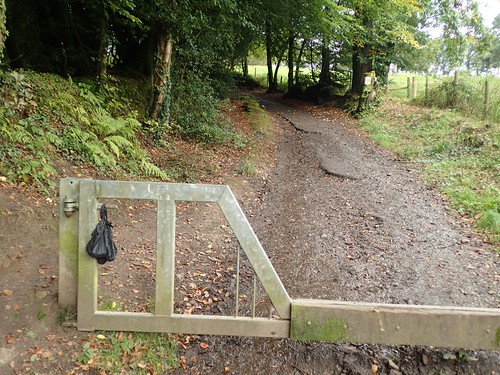
Walking west, we joined another track – much drier than the last – at Crossways Farm. It was the sight of the carefully abandoned dog poo bag that I found most distressing!
WHY???
When someone’s gone to the effort of bagging up their dog’s mess (the hard part, surely), why do they then go and leave it for someone else to dispose of?!?
I was recently informed that there are a small number of people who hang it up, only to collect at the end of their circuit. But, these people are in the absolute minority.
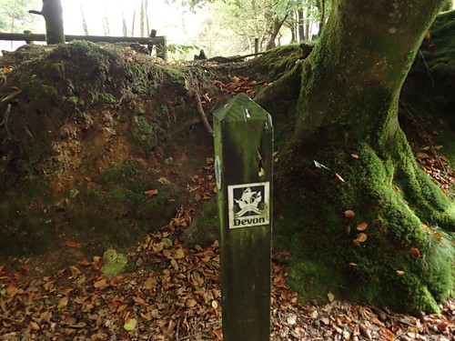
Following the woodland path through Broomfield Breach, we crossed the border from Somerset and returned to Devon. I wonder how frequent such posts are around the country? I really like it.

We crossed Black Down Common (not to be confused with any portion of the Mendip Hills) to arrive at Culmstock Beacon, which was once the site of a fire beacon, used to warn of the Armada’s presence in the region.
Today, a stone hut marks its position, where others no longer stand in other beacon locations. There’s also a trig point (250m above sea level) although, this is not the highest point in the Blackdown Hills.
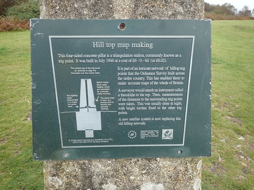
What I found most interesting about this trig pillar was the on-hand guide as to how this point was once used in mapping and surveying the landscape. So many people today wonder and do not understand… Personally, I’d like to see more of this on high points around the country (preferably, attached to a post or frame of its own and not the stone pillar).
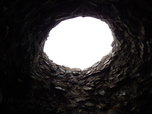
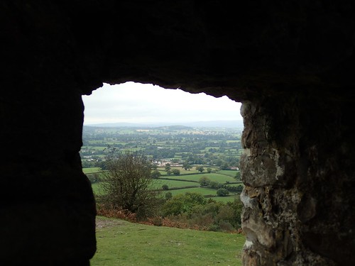
Inside the stone building, you can see from where smoke would once have risen.
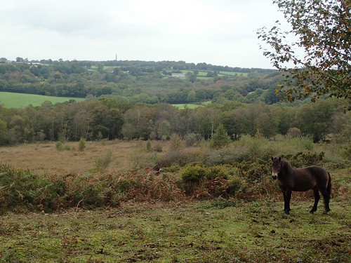
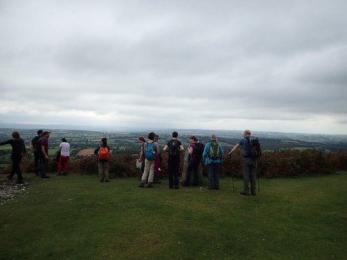
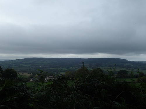
Elsewhere, the views from up here were quite something.

I may be wrong but, I believe I was looking south-west from here, with Dartmoor dominating the faint horizon.
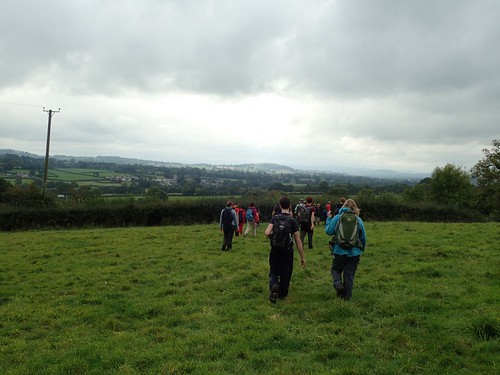
Without knowing exactly where we were, a few of us felt as though we were only an hour away (and no more) from the end of the walk and our return to Hemyock…
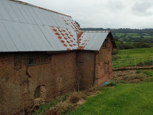
On another farm, somewhere, we passed another farm, with a building who’s facade looked like it was ready to crumble.
A church came in to view: ‘It must be Hemyock!’…
In actual fact, it was probably Culmstock! We soldiered on, crossing the River Culm.
It’s not often we see pigs in the countryside:

I presume the rocks are there to prevent the ground from becoming completely unusable. Around the corner, we met goats on either side of the stile. Truly free-range!
After a ‘last hill’ that went on for a while, we did arrive back in Hemyock. After ditching our muddy boots, we found a very welcoming (and tired) barman who was willing to re-open this sudden crowd of walkers and postpone his afternoon nap on an otherwise sleepy Sunday afternoon in Devon.