
Thursday 28th December 2017
One day prior to this walk, I’d seen numerous snow-filled photographs of the Quantock Hills and other high places, spread across social media. I had days to spare but didn’t want to wait too long in case it began to clear as quickly as it had arrived. So, it was down to the Quantocks, I would go.
This post is quite timely, as night-time temperatures have recently dropped below freezing in the UK and, down in Somerset, we’re being reminded of weather warnings and the constant threat of fresh snow.
My intention was to drive on to the Dead Woman’s Ditch car park that I think I’d used on my previous visit here. It has been more months than I was used to. I’d normally revisit the Quantock Hills quite often.
But I was wary of these rural roads and how they may be coated with black ice… Plus, I couldn’t remember the exact route from Nether Stowey! So, I continued west along the A39 and pulled over at the foot of Woodlands Hill.
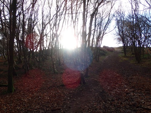
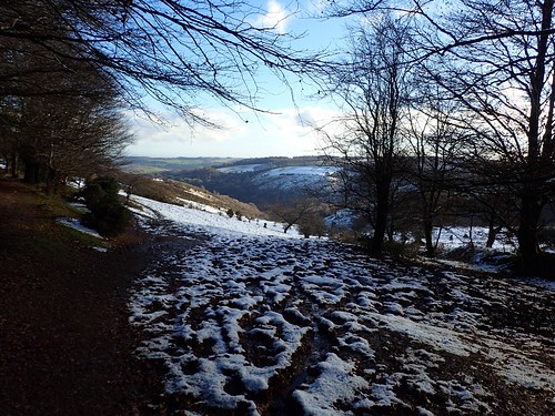
With boots on and a stick in each hand, I began climbing up through the woods. A strenuous yet familiar hike, following the Quantock Greenway (North).
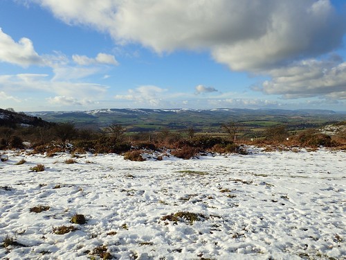
There was no snow to be seen, locally, as I climbed up to a height of 258m above sea level. Away to the west, I could see a mere sprinkling of snow across Longstone Hill and Black Ball Hill.
Looking back towards home, I could see very little sat upon the Mendip Hills – I think Wavering Down was the only summit to receive icing. I hadn’t seen anything at all on the drive down.

Perhaps I had missed it. Still, I would push on from the cairn to enjoy this walk along what used to be a regular route for me.
I would climb another 80m towards the summit of Dowsborough hillfort. I could’ve walked around it but, either way, I wanted to continue walking south.
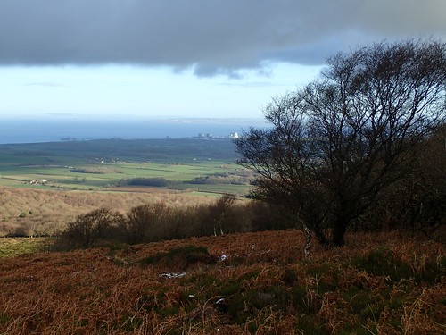
Hinkley Point C is slowly under construction. Sometime in 2019, the coast path behind is supposed to finally reopen. I currently find it hard to believe anything will be ready before then.

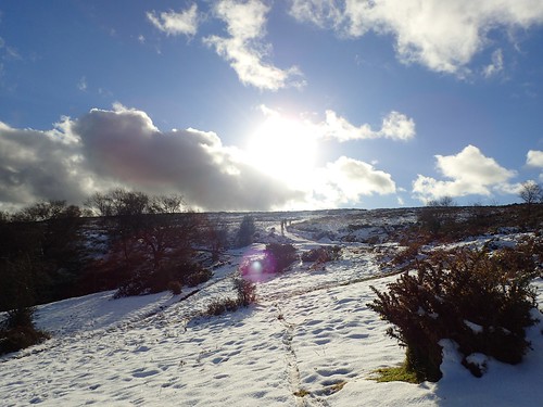
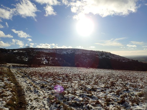
Dowsborough (or Danesborough), at 339m above sea level, had managed to retain some of its snow.
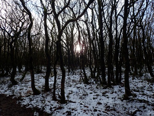
This was certainly more like what I was hoping to find. Heading east through the trees for about 300m, I practised my pacing, knowing that I would sixty double-steps in 100m. This would help me to follow the correct track down the southern face of the hill and not one of the alternative routes without a legal right of way.

Snow and sunshine on a walk. Already, this was quite a special occasion, for December.
As I met the road, I followed it south beside Robin’s Upright Hill and on to the Dead Woman’s Ditch car park. At more than 300m above sea level, I could’ve saved myself some of the ascent from earlier, had I braved the roads to park here.
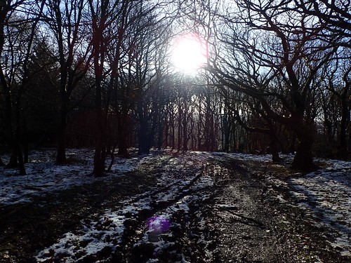
I continued along familiar tracks towards Great Wood, climbed part way up Quantock Combe and then off to cross the top of Cockercombe.
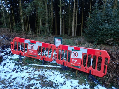
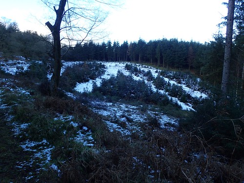
One of the mountain biking trails near to The Slade had been closed off. There was no explanation as to why. Fallen trees? Path deterioration? This is a very popular area for mountain biking.
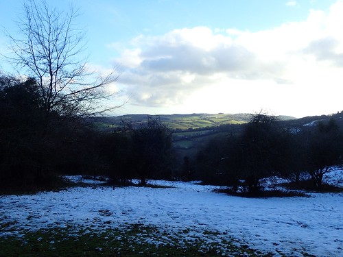
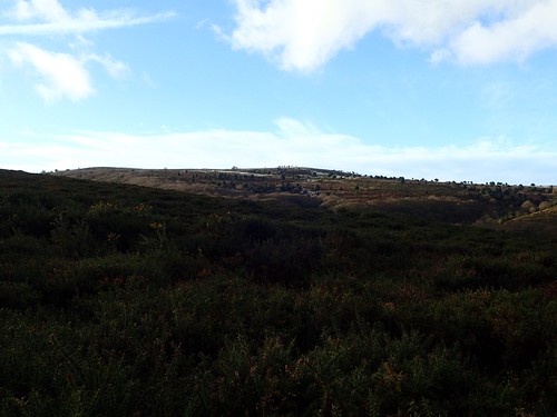
Eventually, I would break out from the woods and on to land above Aisholt Common. Beyond Lower Aisholt and Broomfield to the east, the landscape remain green. Almost warm-looking.
As I continued west, uphill and beside the woods, I passed more people than I would usually expect to see in this area. Was it the weather? The time off work? I didn’t feel it was an uncomfortable experience.
Although Aisholt Common is mostly access land, I stuck to the track, which made for an easier walk, heading uphill, than the soft snow that was no more than a couple of inches deep.
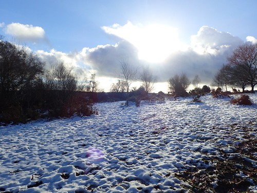
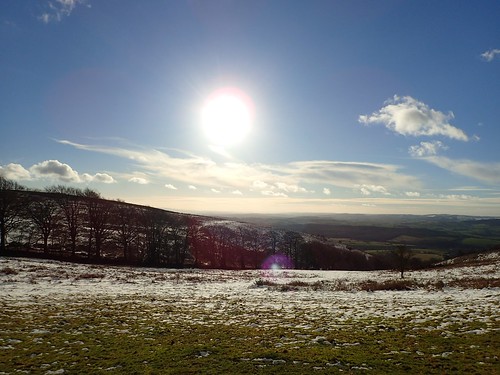
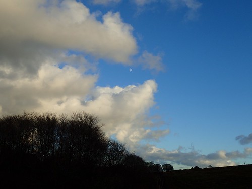
Nearing the head of the valley between Middle Hill and the common, I saw an opportunity arriving for photography.

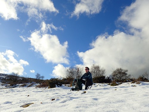
Gaining a few more metres in height and, closing in on the ridge that would guide me on to Wills Neck, I found the snow to be ‘softer’ and less interrupted. It looked smooth enough to sit on, without getting wet…

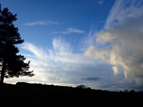
I did just that, with the aid of my WalkStool, which enjoyed a very rare outing. I also set up my Wonnie action camera, using one walking pole as a monopod. I was able to capture the cloud crossing in front of the sun, in a timelapse covering a period of ten-minutes, while I enjoyed a snack and cup of tea.
You may’ve also seen that I now have another method of mounting any camera to my Leki walking pole.
A couple of mountain bikers passed me, among others, while I sat for a moment. Apart from the unavoidable beep and click of my camera, this was quite peaceful.
There was no wind. It was so quiet hear, that I overheard one of the bikers comment on the fact that I was filming with a ‘GoPro’. I’m really anal about that sort of thing, when someone uses a brand name in reference to a type of product.
After my short break, I hoisted the Osprey on to my back, placed a Leki in each hand marched onwards in my Salomons…
On this occasion, I didn’t take even a single photo of the Wills Neck trig and summit (384m above sea level). There were at least half-a-dozen others up there, including the two bikers; all of whom looked intent to hang around.
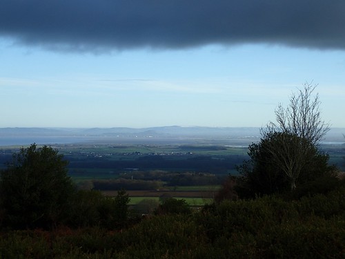
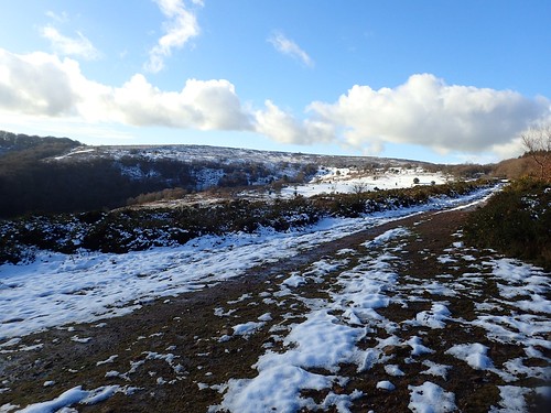
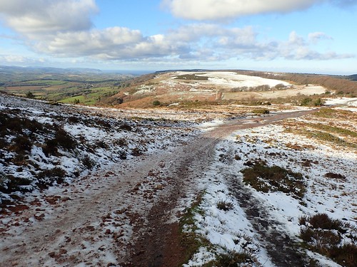
I continued along the MacMillan Way West, walking northwards. Further west, I could see the snow-topped summits of Exmoor, with a great vale of green land between here and there.
From Triscombe Stone, I continued north-west across access land, walking parallel to the ancient drove.
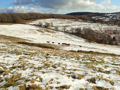
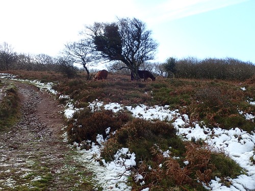
Faced with options, I decided to venture out to the top of Great Hill, as a herd of Highland Cattle returning in the opposite direction.
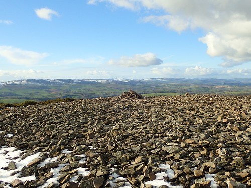
A low-lying sun had freed most of the stone cairn from the grasp of winter.
Heading north and away from what appeared to be the bulk of the snow, I found my way to Black Hill.
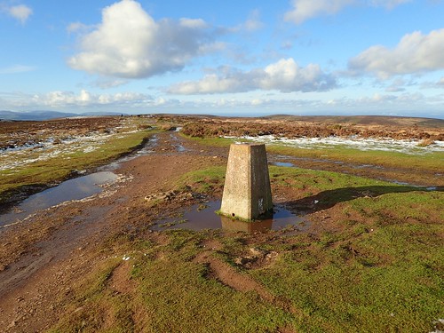
Here, the trig pillar was drowning in a pool of water. Snow was already depleting. I was pleased I had decided not to wait another day.

I know this part of the Quantocks well enough to be able to navigate without constantly referring to a map.

To the west again, Exmoor’s highest point – Dunkery Beacon – could be seen. It’s also the highest point in the whole region of Somerset.

My final stop was at the top of Beacon Hill; one of the northernmost summits of the Quantock Hills, overlooking the Bristol Channel. Minehead can be seen, quite clearly.
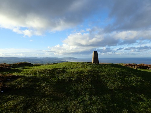
This trig point is only 310m above sea level. It’s not uncommon to find other people here although, in my experience, it’s never quite as busy as at Wills Neck.
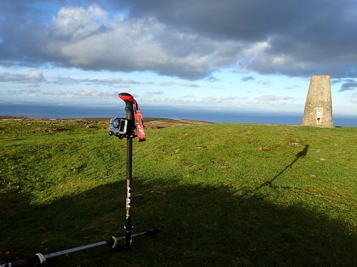
I set my camera up for another timelapse here, while I sat down once more and finished the rest of my lunch. This one wasn’t quite as dramatic, without all the snow.

As I began to descend, the sun was heading in the same direction; casting a low light through the memorial trees close to New Ground.
Sure enough, the temperature would quickly drop as the light continued to recede.
From Holford, I found my way back to the car, crossing over the busy stream that ran fast and strong like a river; feeding its thirst on the fallen snow.
