
Sunday 31st December 2017
I hadn’t been out walking for a few days, despite having a lot of time to myself. I may refer to this time as ‘chilling out’, when in fact I was probably binge-watching Dartmoor-themed videos on YouTube!
Here I was though, standing at the close of 2017. Not willing to join the walking group on a windswept, snow-beaten trek up Pen Y Fan that evening… I decided to stay close to home and rediscover the Mendip Hills.
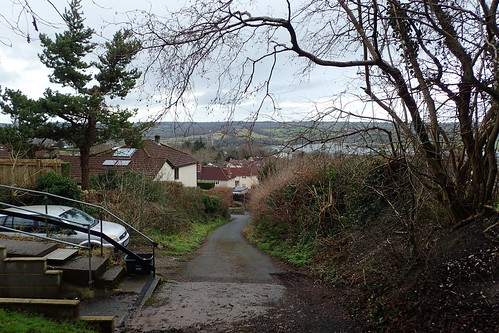
I parked up near the bottom of Burrington Combe. Usually a busy place on any weekday, with easy access to the hills in one direction and a pub and toilets to the other. I normally head south from here but instead turn west, climbing up Link Road and in the direction of Mendip Lodge Wood – although, I wouldn’t be walking as far.
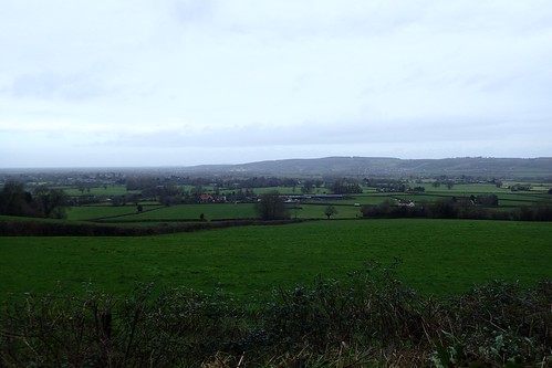
I could look back across Wrington Vale and towards my home of the previous four-years. As much as I love this area, I’m looking to move in to a better quality of home. Wherever I do go, I hope I don’t stray too far from here. I will miss this. Especially as portions of the land lie under threat of housing development and “garden villages”.
Leaving the track, I was heading south and climbing steadily uphill, on to the heath of Black Down.
Across the combe, you can see the ridge of Burrington Ham. An ancient settlement had existed there. Walking in an anti-clockwise direction and the reverse of my more regular route, I found this to be a more enjoyable experience. Almost as if I was exploring somewhere new.
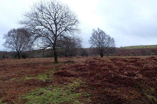
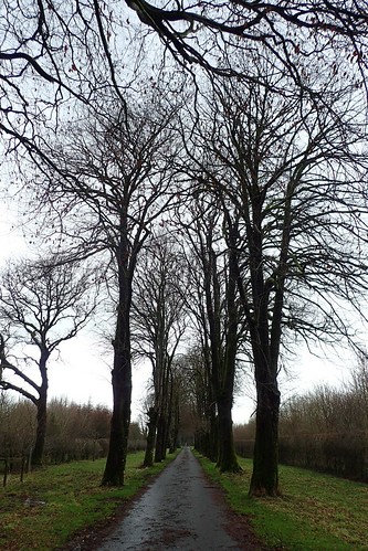
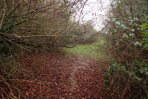
Occasional birch trees led the way.
This was only three-days after my walk on the Quantocks. In less than ninety-six hours, any snow that had settled here had already melted.
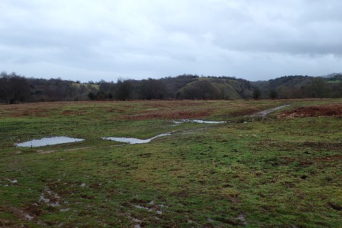
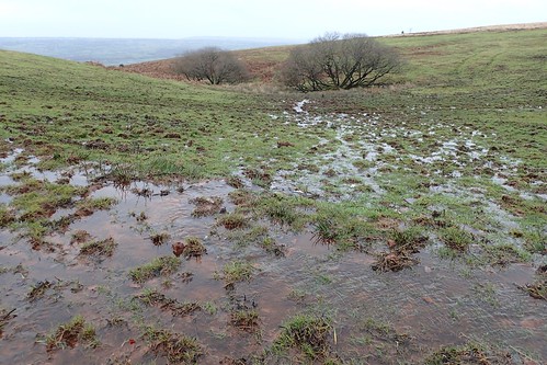
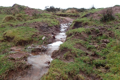
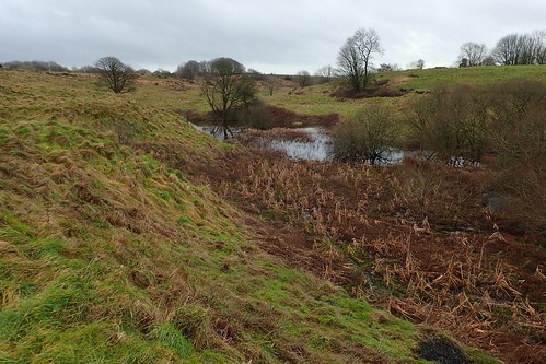
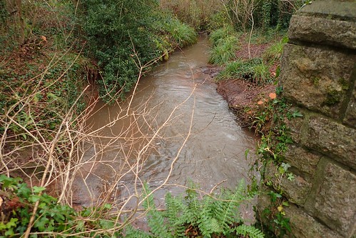
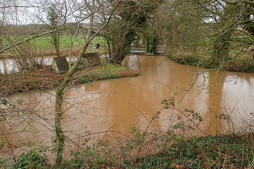
It was a challenge, to circumnavigate the source of West Twin Brook, which runs down the brief valley towards Goatchurch Cavern. My regular route in this area crosses the same brook but further north and down towards the road.
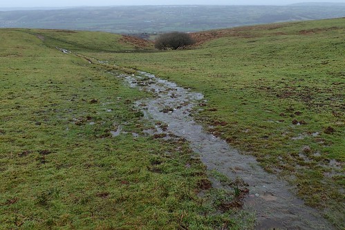
Water continued running off one of the main paths crossing Black Down, running east to west, from the trig point and on to Rowberrow.

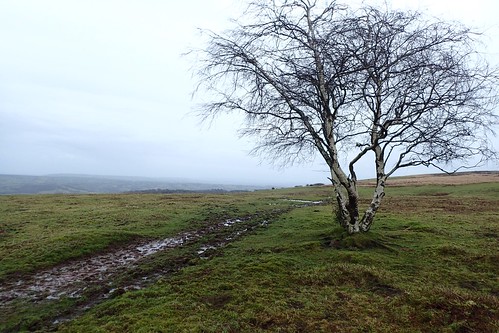
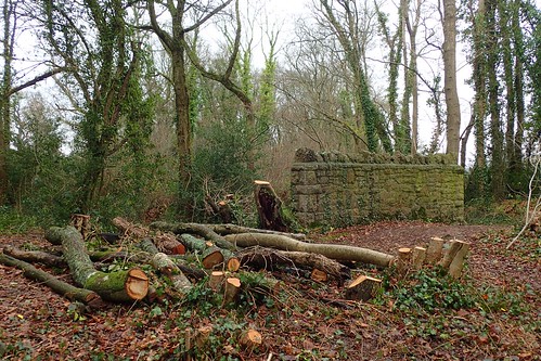
Although still wet under foot, my route was now elevated, as I would walk along the highest point of my day. This path used to resemble a 2m deep V-shaped ditch and was only restored less than eighteen-months ago. I hope that the volunteers’ hard work remains in place for several years now, before the inevitable footfall of multi-vehicle tyres, toes and hoofs takes its toll once more.
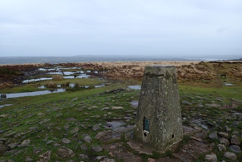
I soon reached the trig on Beach Batch. 325m above sea level; the highest point in all of the Mendip Hills. I was surprised that no-one else was here; saddened to find that the top of the pillar appears to have suffered a crack.
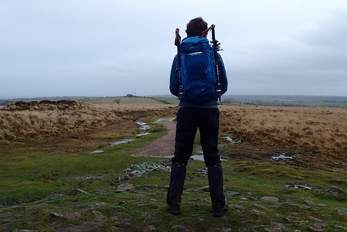
A couple of others were soon approaching. I wouldn’t linger too long. This was also the first walk I did with my new backpack – the Lowe Alpine Airzone Trek+ 35:45. I’ll tell you more about that in another post.
I continued walking east towards the wireless station and its iconic twin masts.
This path was mostly underwater. I was pleased to have equipped myself with leather boots and gaiters.
There was no guarantee that an alternative route would ensure a dry and safe passage.
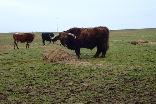
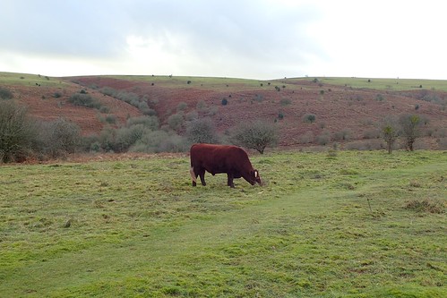
I’m pleased to say that I was able to avoid all of these. As much as Highland Cattle are renown for being docile, I wouldn’t fancy stepping in to any field shared with this guy.
Heading south-eastwards, I soon found my way down to Blackmoor and Ubley Warren Nature Reserve. This place was almost-bustling with the young families and kids that I’d expected to see earlier.
I took a seat on a large rock, using my Compact Kumfie Multimat for insulation.
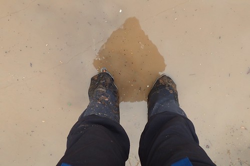
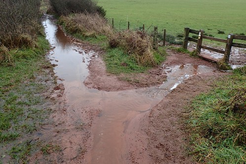
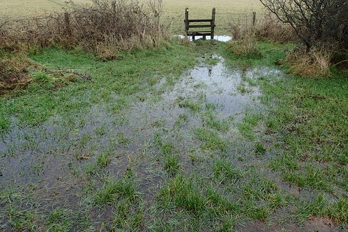
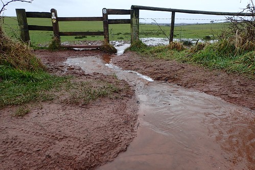
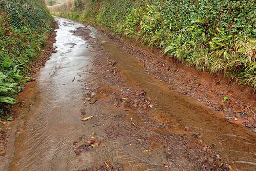
After a snack and warm drink, I continued east along a byway towards the B3134. This path was, by far, the wettest I had experienced thus far.

There really was no way to walk around it. For once, I was in envy of other visitors wearing wellies. While my feet did remain dry, I never fail to make a mess of my kitchen when cleaning boots and gaiters.
Over the road and I continued my descent along the Limestone Link, heading in the direction of Compton Martin. A familiar route, thus far.
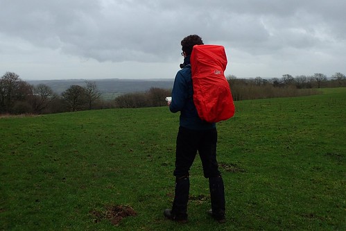
As I left the Link path to take a more direct route on towards the Monarch’s Way, it started raining. I felt very self-conscious of wearing something so clean, obvious and… Red. My previous experience with backpack covers is that they only come in a luminous yellow or green.
It certainly did the job. There were no issues in stretching it over my walking poles and no-one else was around to comment.
I crossed the A368 and continued north to join the Monarch’s Way, on a lane that was, of course, watery.
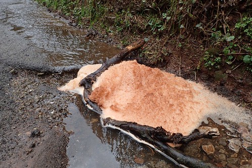
I thought I’d finally found a sample of snow for my day but, no, this was a mass of foam emanating from within the drain.
A cyclist overtook before I would come to cross the River Yeo (Congresbury Yeo). It actually rises near here, before flowing west through Blagdon Lake and on across North Somerset.
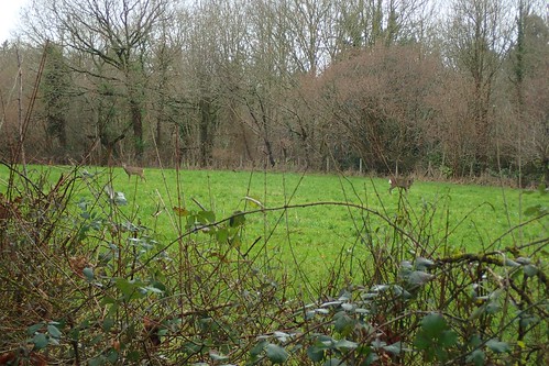
As I reached the road just west of Bickfield Farm, I would turn left and continue on towards the village of Ubley. Off to my right, I spotted a pair of deer.

From the centre of Ubley, I was looking to continue walking west and past the southern edge of Blagdon Lake. Although, not as close to the water as I have done on a walk a couple of years ago.
From Ubley Farm, I was looking to follow a right of way network that ran between Lag Farm and Holt Farm. If you’ve been reading my posts for any amount of time, you may be aware that I I’m uncomfortable walking close to farms – particularly yards and buildings.
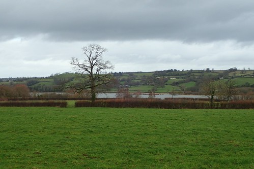
This started well, with a path that was fairly easy to follow and good view north to Blagdon Lake.

After navigating the farmyard stretch, I would be looking to climb up and out of the Yeo Valley, on the return to my car.
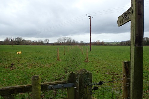
Nearing Lag Farm, I was delighted (and greatly relieved) to find the right of way so unmistakably defined. I felt as though I’d be happy to walk on with two-hundred curious cows on either side of this walkway!
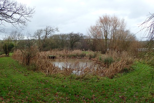
I passed a small pond area, which would probably make for a good rest stop, in the company of others.
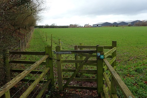
Ahead of this was another gratefully defined walkway, with the buildings of Holt Farm to the right.
More on Yeo Valley.
Another pond area lay ahead. Unlocked kissing gates appear to provide access to this area, even without a right of way or ‘keep out’ signs.

I continued, climbing gently away from the confines of wire fencing, along a field edge where the mud was slick beneath my boots.
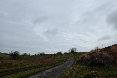
I crossed back over the A368 from Blagdon, now climbing steeply in the direction of Rhodyate Hill Farm.
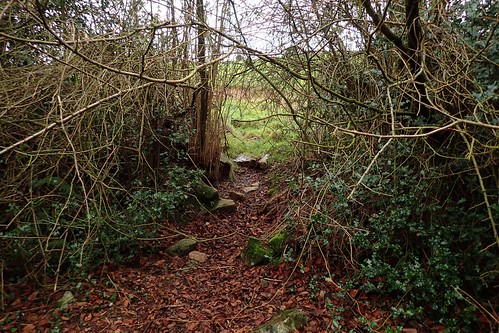
My walk continued up through the woodland and on to a point where the waymarking suddenly ceased. After many moments of hesitation, I chose to walk on through the branches you see ahead… It did look like a path had been formed, by something or someone…
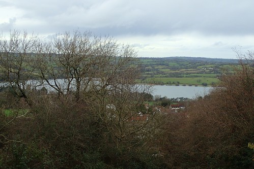
Another cracking view of Blagdon Lake, while I came to the conclusion that I had wandered off the path. Back in to the woods I would go…
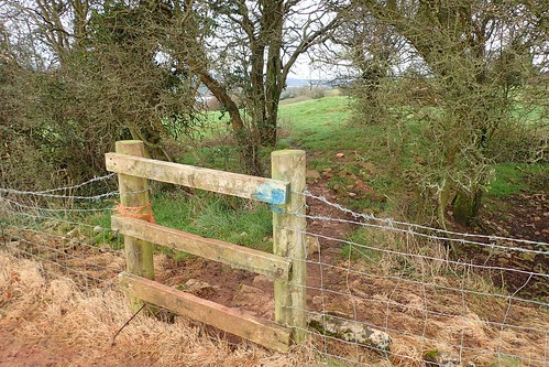
This was the path I should’ve taken, instead of fighting through branches (twice, now). Perhaps the stones were a giveaway.

It wasn’t entirely clear cut from here on, either. I failed to recognise this land feature on any portion of my map.
But I did eventually find the stile (which appears to be missing its tread). Following the field edge would lead me on to Two Trees lane, from which I could join Luvers Lane and then walk west on to Burrington Ham.
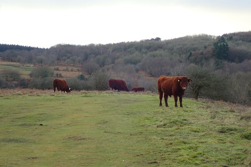
A few dog walkers, groups of friends and couples were present on this easily accessible land. I stood strong in my way, as I passed this growing herd of red ruby cattle. They’re known to occasionally head down on to the road of Burrington Combe. Although, I’ve never seen it with my own eyes.
Across the combe: Black Down – the feature of my morning’s walk.
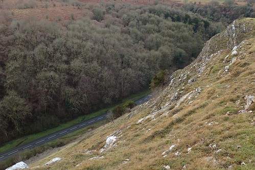
From here, I usually attempt to follow the steepest and most direct route back to the car park. But, it’s no waymarked at all and I haven, on at least one previous occasion, failed to find it. In fact, my very first discovery of this path came about by accident.
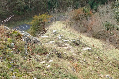
In fear of not finding my way through the woods ahead, I briefly contemplated a reverse-scramble down the landscape you see, above… But I’m not an experienced scrambler and there’s no telling how severe the drop may’ve been at the road-end.
Maybe I should speak to the Mendip Hills AONB about improving the waymarking of this path?
I returned to my car safely, ready to enter a new year with many miles of walking to follow.
