
Saturday 6th January 2018
My first walk of 2018 would be a positive effort towards completing the East Mendip Way – one of the goals I set out in my ideas for the year ahead.
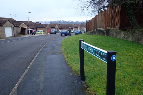
Having plotted a large circular route, I decided to park in Nunney, which is reasonably close to the midway point of my walk and offers ample free parking near the castle.
Cranmore Tower was the point at which I last left the East Mendip Way – some 6km west of this chosen start point.

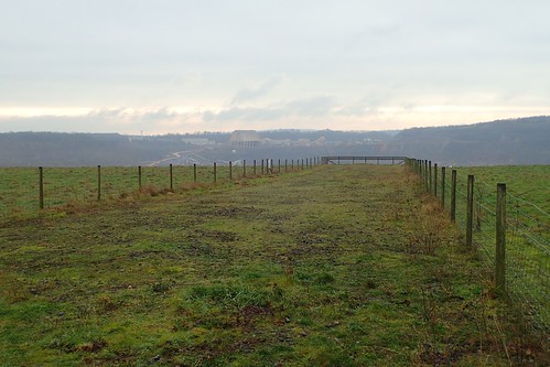
I set off along the roads, walking west-north-west and not expecting much traffic… But these roads were busier than I’d anticipated! This is the kind of information an OS Map can’t always provide. A grass verge came in handy, until the option to turn off the tarmac down an unmarked track on the right.

I probably saved myself the final couple of hundred metres of road walking, not that there was as much traffic about by this point. Still, it was to be descending in to the unknown.
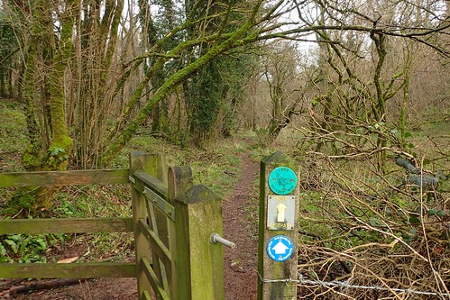
Although not designated as a right of way on the map, waymarks at the other end inform you that walkers are welcome.
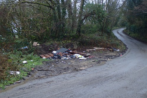
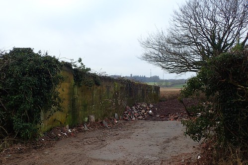
Emerging on to the lane at Dead Woman’s Bottom, I found that someone has been treating it as less than that… I will never, ever understand or sympathise with the why.
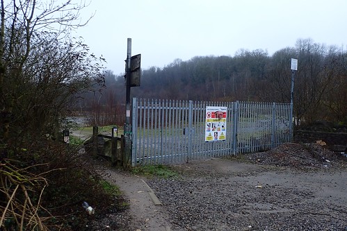
Crossing over the road, I made my way beyond the intimidating gates of Westdown Quarry.
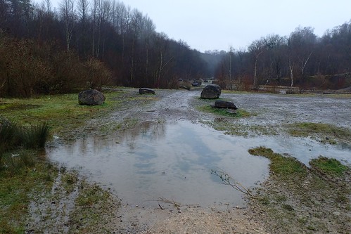
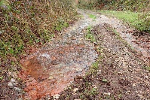
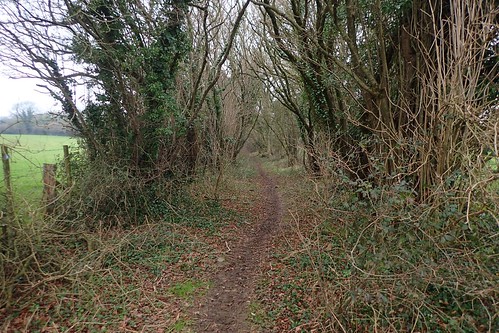
It was clear to follow the bridleway, with large boulders marking the way. Large puddles of water caused a slight issue initially.
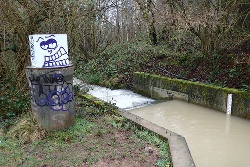
This bridleway is a good 2km long and runs between two rather unremarkable points with minimal signs of civilisation. I do wonder, when I see grafitti in places like this, why they bothered. Who else is going to see it but me? …And I don’t care for it.
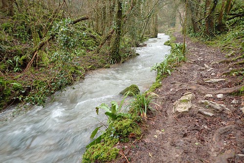
An unnamed stream ran down beside my left. I wouldn’t fancy drinking this water,even after boiling, as it looked as though there was something in it… Silt? This was next door to two former quarries.
There’s supposed to be a right turn near the other end of the bridleway that leads you up from Tom Tivey’s Hole on a direct route towards the brick works. I must’ve missed it. I don’t think it was well signposted.
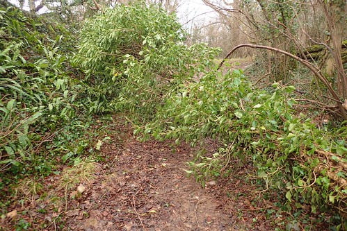
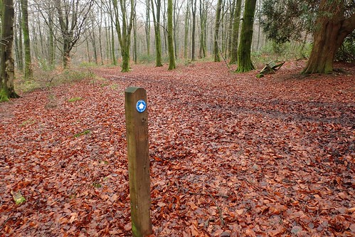
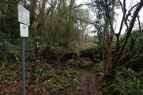
So, I continued on past Leighton Hanging, up and around through the woods; passing my first of the day’s fallen trees.
At the other end of the path I’d hoped to follow, it is clearly marked. I didn’t want to go wandering off across such a large site for fear of losing the path and facing a confrontation (even though, as I’ve now read, both Westdown and Asham quarries are disused).

Another fallen tree to cross, on a path that snakes around the Brick Works.

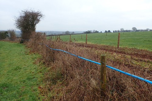
Passing New Manor Farm, I began following a bridleway behind Ashley Farm. Part-way along, I want to turn left and steeply uphill. No waymarking and the gate was trick to open (and close).

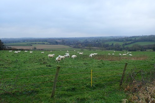
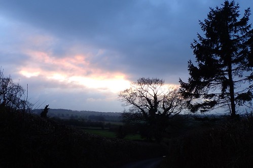
At the top of this brief climb, I was almost overlooking Merehead Quarry. There was colour within the clouds – something you don’t see much of at this time of year.
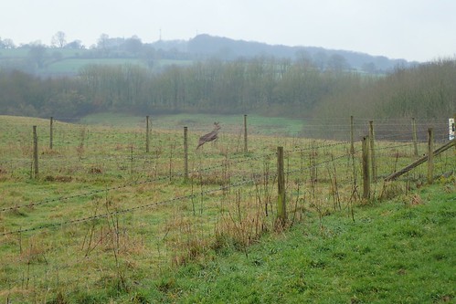
I continued to follow the path around the western edge of the quarry, when this deer jumped in to view.
There’s a point at which you could probably walk along and peer down in to the quarry… If masses of limestone are really your thing.

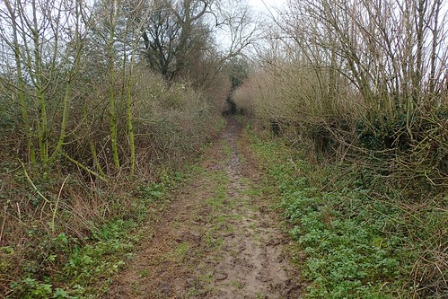
From here on, I faced a slow 1.5km of walking downhill through watery mud… There was no going around it. Oh, to have been a horse. If not for my walking poles, I’m sure I would’ve painted my backside in a shade of donkey brown.
I was quite relieved to reach the next road – from which, I could just make out Cranmore Tower. I’d been walking for almost two hours and yet, despite my best-laid plans, I felt like this walk was already dragging on.

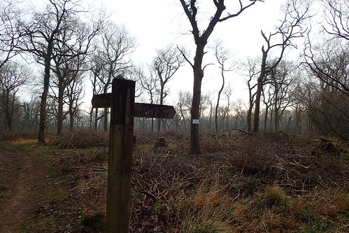
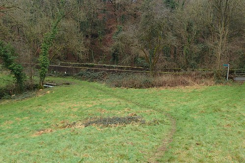
I climbed Furzeclose Lane to eventually joint the East Mendip Way within Cranmore Woods. Above, you can see the route heading west…
My route was about to follow this Way heading east, along a more clearly defined path. Once I’d stopped for an overdue drink and bite to eat.

From the woods, the path heads north-eastward and out on to open land. Such a relief and not too wet under foot, either.
I’m glad I didn’t challenge the waymarking and follow the map… Which appears to show the right of way running down this confined space… Which soon tapers down to a dead-end.
Before reaching the farm, I was able to rinse my boots off in the overflowing water that consumed the drive. Waymarking was very handy here, or else I’d have probably wandered on to the farm itself.
At the next road, I was only 200m north of the bridleway that had earlier led me up and around the quarry! I don’t like walking back on my own footsteps, you see.

My walk continued past the northern edge of Asham Wood and through Shearmoor Wood. I was so pleased to be back on the East Mendip Way; heading towards its terminus, several years since I first discovered the path.
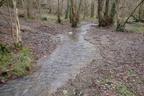
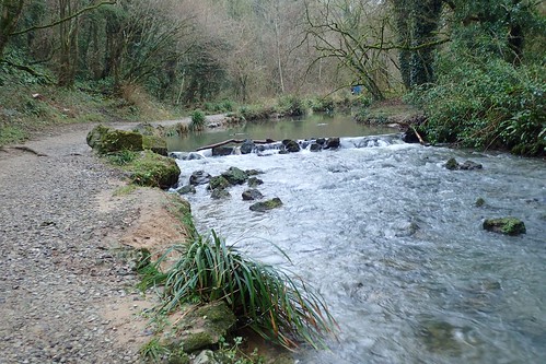
I passed a parent and child – perhaps my first social interaction of the day. There was a ford to cross, ahead of the gentle climb up to the next road.
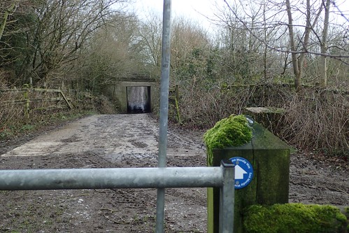
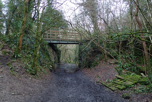
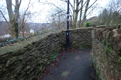
This led me to an underpass – although, not as exciting as it may seem.
Bypassing Chantry, I’d eventually head in to the woods that border Whatley Quarry. It was along here that I encountered my first serious obstacle; the first tree I had not been able to walk around and it was a challenge to climb over.
I’m sorry to admit that I haven’t yet reported this directly to the relevant authority… It’s down to laziness on my part, even though it has been marked on the Ramblers’ Pathwatch app.
Without studying the map, I was expecting the path to breach out to and briefly along Railford Bridge. But, there’s no right of access to the road surface from these fields.
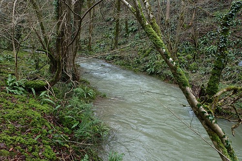
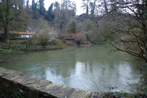
My disappointment soon wavered as I continued down to Railford Bottom. Blue, grey, green and beautiful. This would become a recurring highlight of this portion of the East Mendip Way.

A series of unforgiving steps would help me up from the valley, as I ducked beneath yet another fallen (falling) tree.
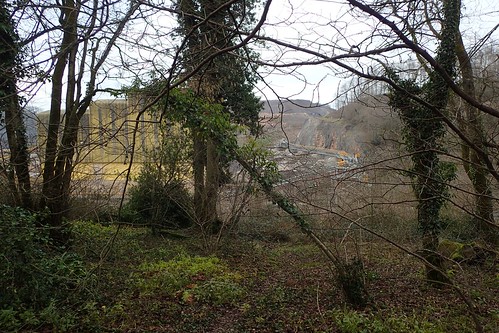
Away to my left, now: Whatley Quarry. I’d walked along this path once before. Possibly as far back as 2013.
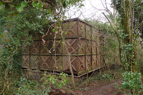
This large storage tank was a familiar marker. Did it once house water? I doubt this, as the floor was missing. Holes had worn through the metal sides. Now, it just sits, in a slow and gradual state of decay.
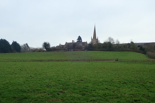
I crossed the road with car, to continue along the East Mendip Way. Whatley’s local church could be seen away to my right. I didn’t recognise it at first but, last time I was here, a small pack of barking collie dogs deterred me from venturing further.
I overtook a young couple with their child; the mother of whom was peering over the fence, making comments about the ‘train track’ visible far below… There’s nothing, according to my map.
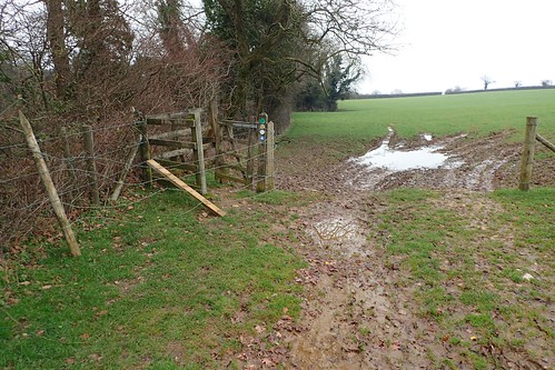
I met two successive gates – with which, at least one fence post had been removed and the barbed wire wrapped around the kissing gate.
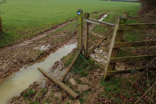
Technically, I guess it doesn’t fully obstruct the right of way. I decided it was worth reporting as the loose wire could be a hazard.
Then, I found myself walking along Murder Combe…
I wonder whether this bridleway is in danger of being lost?
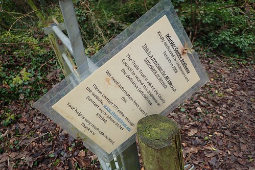
I’ve previously read about the ‘need’ to record all public rights of way but this was the first time I’d encountered any such statement or activity in person.
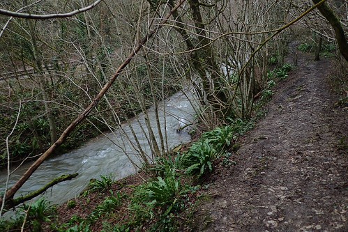
From the bridleway, I descended a steep footpath (which hopefully won’t become a shared bridleway; it’s far too steep) to return to the bank of Fordbury Water at Fordbury Bottom.
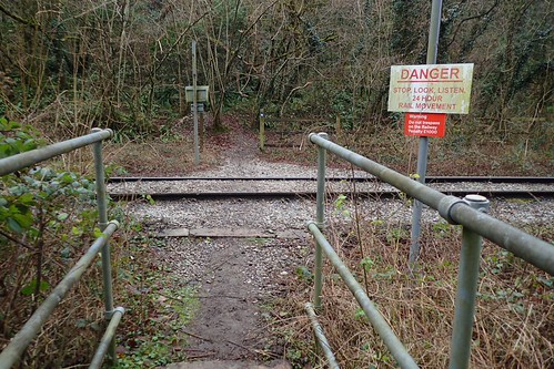
Lo and behold, there was a railway line to cross, as I turned north towards Great Elm!

It genuinely does not exist on the Ordnance Survey map.

Further along the water’s edge, I found a log that could be used as a bench, where Mells Stream receive Fordbury Water. Around here, I found the East Mendip Way waymarking to be a little scarce. Even though I managed to navigate my way.

Soon enough, the waymarking returned. I knew I’d be at Frome within the hour.
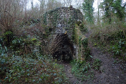
Beyond yet another fallen tree, I passed what I can only presume is some form of limekiln. I’m sure there’s a lot of history along this trail. Without information and sign boards, I wouldn’t really know where to look.

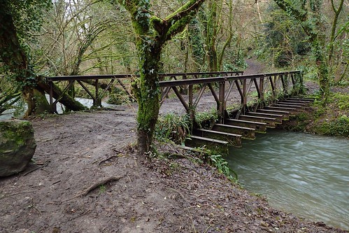
There were some substantial footbridges to cross, as I continued alongside Mells River.
More people could be found, seen and heard. Although, I’ve done well to crop them out of my photos.
This had been quite the pleasant end to the Mendip Way, even if I’d yet to reach the eastern terminus.
I left the river to climb open farmland, barely one mile from the centre of Frome.
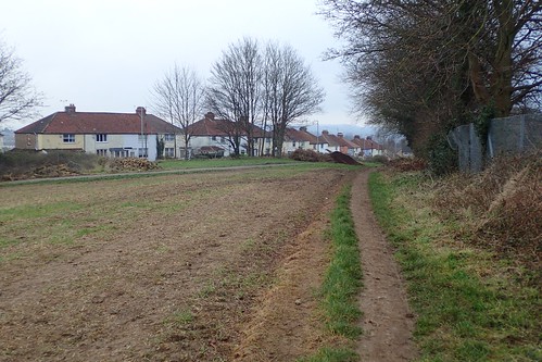
I wasn’t looking forward to returning to civilisation. Sound of passing cars, revving engines and people chatting, could already be heard. I had walked this far.
I was very impressed with the frequency of waymarking in this urbanised area.
At 1:25,000 in scale, you don’t really have enough available detail of the road layout to be able to follow it with full confidence.

Having followed all waymarks thus far, I found myself walking ‘blind’. I couldn’t accurately locate myself within the map and I just kept walking… Up and down cobbled streets; occasional and spontaneous shortcuts; using my nose to determine the way of the town centre…
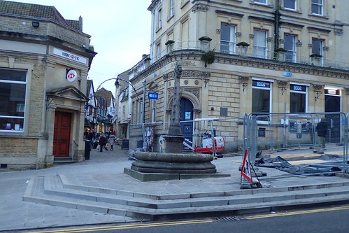
Despite being the only person around with a pair of walking poles, I was able to find Boyle Cross. According to my OS Map, the East Mendip Way ends right here.
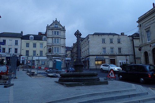
But, according to the East Mendip Way guide, the end point is at the Cheese and Grain hall; maybe 200m away and across the River Frome. Wherever you choose to end this walk, there is no official plaque, unlike with the West Mendip Way in Wells.
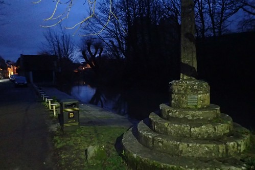
As you can probably see, the night was beginning to draw in and I still needed to get back to my car…

Nunney was three-miles south-west of here and I had no more than one hour of daylight remaining… It was going to be close!
I felt assured in my ability to navigate from the map for this final stretch. As I trod along the pavements, picking up my pace, an occasional glance at my compass revealed I was heading in the right direction…
But, ultimately, along the wrong road! Some 800m off the mark, in fact! I was able to get back on track but my risk of walking back in the darkness has increased dramatically!
From Critch Hill, I could choose to either brave the golf course or play it safe along the road…
As said road was a direct route in to Frome, it proved to be busy and there was no suggestion of any pavement along the way. It was up the drive of the golf course and towards Crtichill Farm… Where I found the signposting to be quite brilliant and incredibly helpful!
It was growing darker. More so than my camera can demonstrate. Successive fields were wet and slippery with mud. A group of other walkers passed me. I wonder where they were destined?
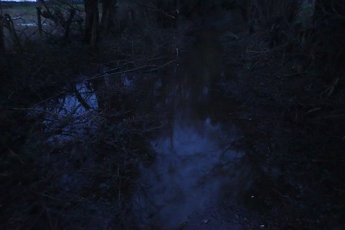
I found my way alright. In the dark beneath a cover of trees, my boots were bathing. There was no escaping around this one. As I reached dry(er) ground, I paused to whip out and equip my headtorch; savouring my night vision for as long as possible, until it was absolutely essential to illuminate the way ahead of me.
I was relived, on my return to Nunney. Yet somehow disoriented, as I began walking in completely the wrong direction!

It didn’t take me long to realise and only a few self-inflicted swear words to get myself back on track. Put my on a mountain and I’m fine. But in a built-up area and I almost required GPS (I did use the GPS on my OS Maps smartphone app to establish my lost location in Frome).
I’m not sure what went ‘wrong’ on this walk, as I’d anticipated finishing a whole hour earlier and with time to revisit Nunney Castle. Another visit beckons, I guess! I am pleased to be able to say that I’ve now completed the full Mendip Way. 🙂

Thanks for posting this, it looks an interesting walk which I’m also hoping to do later this year (though I hope when it will be drier!). That railway line you found is (just) visible on the 1:25000 OS map but it is not obvious. If you look in the 1:50000 map oddly it is much more obvious, it seems to serve one of the quarries.
I share your frustrations about navigating in towns and cities with an OS map, because it’s not really detailed enough and most streets are not named. Though I’m pleased to see here the signage looks to be good. I used to sometimes carry an A-Z map around with me too sometimes when I was on a walk with some of it in a built up area but thankfully these days Google Maps can largely do the same job because a phone is much lighter to carry than an A-Z map.
LikeLiked by 1 person
Thanks, Jon. Good luck with the Way when you do it. The bridge crossing the River Frome (in Frome), which I didn’t get to see, is supposed to be unique as it has been built upon.
It’s interesting how 1:50,000 scale can sometimes offer more detail. I’ve noticed this (using OS Maps online) with regards to place names, particularly woodland and downland areas.
LikeLike
I did this walk today from Shepton Mallet to Frome, though I stuck to the main road through Frome rather than the slightly more meandering route the way follows through the north western suburbs of Frome. My planned outward train was cancelled leaving me late starting and so very short of time to get to Frome in time to catch one of the infrequent trains from there. As a result I didn’t want to risk getting lost in residential streets where I feared there would be no waymarkers. I see from your post this section is actually well signed, which is good, though this paid off so I did catch my intended train home.
The last countryisde part through those woodlands and that old lime kiln (I also wondered what it was) is especially lovely. Though I’m glad I waited to summer. Even with the lack of rain we’ve had recently, there was a few slightly muddy sections, and I could see that it would be very wet and muddy in winter. Nice views after the initial climb out too though I did encounter one farmer who had obliterated the path with crops (the path was supposed to go straight across the fields, which had been planted over).
I hope to close the gap and do the last bit from Shepton Mallet to Wells later in the year.
LikeLike
Hi Jon,
I’m pleased to hear that you were able to get on to the East Mendip Way at last and that you were also able to meet your return train in time. There have been many reports of disruption to the train lines in the region recently.
I am surprised to hear that sections of the route are still wet at this time of year. Some people I know did the whole Mendip Way over Easter – some didn’t survive day one of three due to a failure in their waterproofs. That field you speak of was possibly the same one I encountered… I hope that your final section of the EMW goes well when you get around to it. 🙂
LikeLike