Saturday 14th April 2018
Following a two-month absence from the trail, I returned to my walk along the Severn Way long-distance footpath, which I’ll be following as far north as Tewkesbury.
This walk would begin at Frampton-on-Severn in Gloucestershire, which isn’t precisely where the previous walk ended but, reasonable car parks are hard to find, as someone who doesn’t know the area overly well. I can fill in the brief void of towpath another time.

I’d intended to park at Splatt Bridge and pick up the trail from there. But, as you’l see above; the tiny car park was already packed with the vehicles, to the point where a white van had been left at the road corner. Out of show was a people carrier pulling up infront of the van.
This was all in spite of the fact that I’d arrived much sooner than 10am on a Saturday morning.

Through hesitation, I missed a reasonable parking opportunity in the middle of the village. I would drive on to the next possibility; only to leave my car outside the industrial estate, as the car park beside Fretherne Bridge was also full.

My walk finally began with the on-foot crossing of Fretherne Bridge. I made the mistake immediately to pick up the canalside towpath heading north-east… Moments before correcting my mistake.

From a quieter road, I picked up the Severn Way; immediately following a woman and her two dogs along an exceeding muddy and shaded path.

This would soon break out in to a more spacious setting, with views out towards the River Severn,

Concern awoke within me, as I spied this waymark arrow conveniently covered up by a piece of timber across the stile…

One of the stiles beyond here had clearly seen better days. I hope I reported it using the Ramblers’ Pathwatch app, as I’ve sent reports direct to the local council in the past, only to receive nothing more than an automated response each time.

Here, the Severn Way appears to follow a path inside the boundary line, with the waymarking in position to indicate as much…

But the walkway was hideously overgrown. I fought my way for only a few metres before turning back in admission to my defeat.

Current OS Map editions stipulate that the path runs on the outside of the boundary line, which goes against the waymarking on the ground… With a dog walker seen walking far from any right of way and my reluctance to follow of other option of turning back; I proceeded to walk around the overgrowth.

Walking around the fence then, I could look across the Severn towards villages to the east of the Forest of Dean.

I wasn’t the only one out this far from the village, as a couple of others could be seen. Although, they didn’t appear to have any intention of walking anywhere and remained in position until my line of sight exceeded them.

This wasn’t a cold day and, without a doubt, it was set to be my driest walk following the Severn Way, since I began the challenge in December. But the views to the other side of the river would remain hazy for much of the day.

Looking inland, I witnessed the early signs of spring.


By the time I would’ve followed the Way through Long Wood and Smith’s Wood, I would’ve passed no more than three other people, out with their dogs. For much of the rest of my day, I would barely meet another soul.


Continuing westward in a clockwise direction, I would begin following a route known as the Arlingham Horseshoe. Navigation would be easy; staying close to the water’s edge, with the river as my guide, down to my left.

Just south of Arlingham itself, I would pass beneath these pylons; suspending electrified cables on their 500m journey across the Severn. A headache quickly developed – just as I had experienced walking beneath similar power lines at Hinkley Point, towards the end of 2017.

Thankfully, my headache soon passed. Although, confusion remained, as I encountered not my first riverside gas bottle while following this trail.

Across the water, I could see the church standing proud of the riverside village of Newnham. There is a public right of way (and A-road) that follows the opposite side of the bank, although it’s not designated as any form of trail.

Above, you can see Bullo Pill Dock and possibly the Rubber Mill building – both of which get a mention on the OS map.

Passing the church and Newnham, I passed the sight of a pill box. I’ve seen these alongside the River Parrett in Somerset and I’m surprised I haven’t already seen more of these structures while walking the River Severn.

North of my location, I could see hills. I believe that the most prominent (just left of centre, although faint in my image) could be May Hill; a summit that I have previously spotted from other walks to the north of Gloucester. It apparently lies on the border between Gloucestershire and Herefordshire. I must get around to climbing and exploring it, one day.

I continued along Arlingham Warth. A real calmness to this section of the Severn.

Just before reaching a footbridge, each of Slowwe House, I passed this ‘shack’ which was being used by people practising the “art” of shooting… Something. Although each bang could be felt with a shock, the public right of way passes from a safe distance.

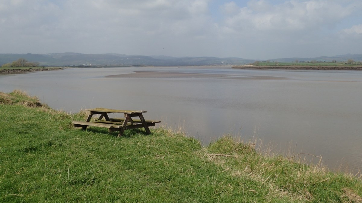
A random picnic bench can be found just east of the gun shots. There’s no car park nearby and no indication as to whether or not this feature is for the landowner’s sole use.

I do wonder, whether the barns here come with free electricity…

I was making good progress; marching through the odd muddy section before arriving at a quiet road bend, leading in to Upper Framilode.

My mind was searching for a lunch stop. But, the local churchyard (slightly over-run with greenery) didn’t appear to offer a single bench amongst its shaded resting bays.

It was with this final view of the River Severn (and a rumble in my stomach) that I would leave the Severn Way for another day. My return route would follow the canal paths and I’ll save that for my next post.
