
Saturday 28th April 2018
This walk began in the village of Chew Magna, where free use of the car park is available, provided you get there early. It’s an area I’m quite familiar with and a popular ‘commuter route’ linking the A38 with the A37 and beyond.
Bearing in mind this is less than a thirty-minute drive south of Bristol, it commands appreciation. My walk was to begin by following a portion of the local Three Peaks Walk, before looping back along previously unexplored footpaths.
As I’ve mentioned on this blog in the past, the circular Three Peaks Walk is not to be mistaken with or compared to any circuit bearing a similar name in the north of the UK. It’s highest point sits less than 200m above sea level and, as for the peaks themselves, they’re certainly not the highest or most significant within Somerset.
But the idea of following such a route may draw you away from the common desire to head for the Mendip Hills, to follow the Bath Skyline or one of the many riverside trails within the region.
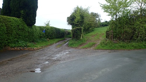
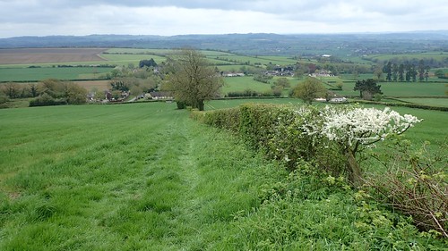
I joined the Three Peaks Walk at a road which then lead me up to this junction. I normally follow the Walk in the opposite direction; darting through a gap in the hedge and using the dead-end lane as a means of avoiding the overgrown field beyond… On this occasion (albeit in late April), I didn’t need to worry.
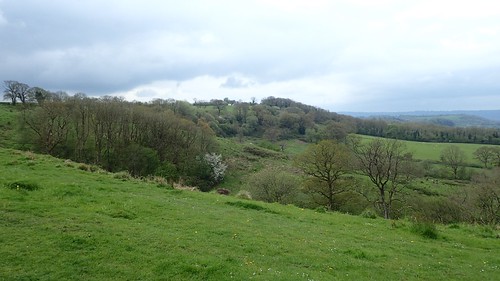
Having completed the full circuit in a series of circular walks (why I didn’t do the full thing in one go, I’m not certain), I can say that this section is probably the most strenuous; on a constant climb up to the eastern edge of Dundry.
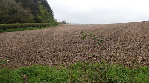
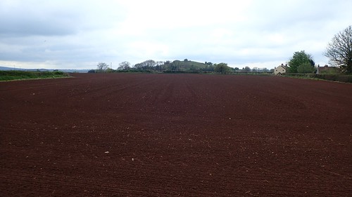
Farmland awaits. Barren, at times. But largely devoid of the ever-hungry heifer.
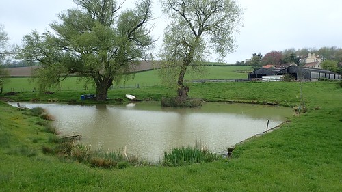
There’s a point at which the Walk diverts away from the driveway of Manor Farm (which is also a public right of way) and skirts past this private pond. It can be easy to miss. I think the waymarking could be improved but, as always, I carry a map.

Rapeseed. Oil-seed rape. Whatever you like to call it, this is beautiful. One of the warm and welcome sights to curtain any British winter.

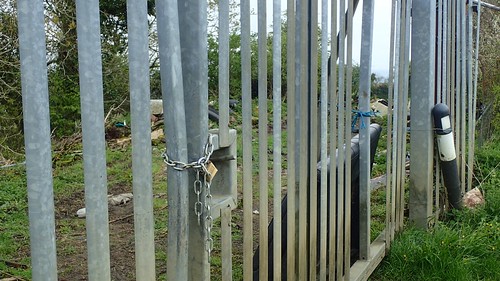
Above North Wick, the path climbs to reach a road, via this almost-steampunk gate. This section of the walk follows the road on its elevation and also a portion of a route devised by Bristol Ramblers.
I do wonder whether said gate was made from scrap material left lying at the roadside… This area, including East Dundry just west of here, is a known habitat for flytippers to lay their waste.
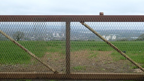
On the north side of the hill lies Bristol. A city that appears even bigger from such a vantage point.
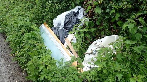
Sadly, the law-breaking continues to accompany my walk before reaching the next footpath.

It is suggested that this is the work of ‘Van Men’ who offer to take your waste away for a fee. While the local councils have reduced the opening hours and increased fees for the use of recycling centres, this criminal act has been happening for years.
Will it ever end?
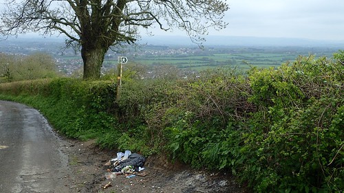
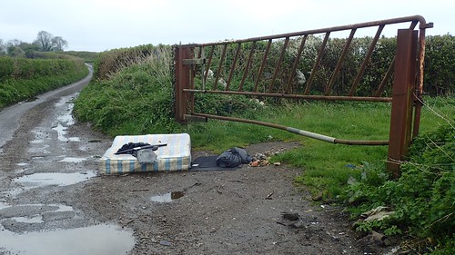
Eventually, I was able to leave the roadside. As if the fingerpost wasn’t enough, someone had dumped a bag of all sorts to mark the way.

There’s an historic feel to this section of the Walk, with the sharp descent towards Bristol’s south-eastern suburbs.
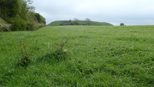
Around the bend and we arrive at Maes Knoll, a hillfort believed to have been built around 250 BC. It is one of the Three Peaks and, in my opinion, the best.

Another bin bag lurked nearby. This time, it appeared to have been fastened to a post… Was it a local person’s effort to keep this space clean? Did they return each evening to remove and replace it? There are no parking options within a mile of this high place. I can’t imagine many make the venture up for an afternoon picnic.

From the top, you can find what I’ve always believed to be the greatest view overlooking the Chew Valley and its lake.

To the east of the tump, the flat plateau of land would’ve been covered with stone cairns, to prevent enemy craft from landing during the Second World War.

Also, the historic Wandsdyke (a man-made earthworks) would’ve run west from here but also south-east and straight across Wiltshire, where several miles of this defence works still stands.
From here, a sharp descent down to Norton Malreward awaits.
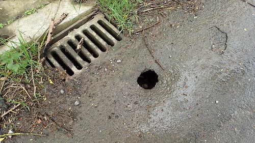
While I’m usually recording instances of obstructed footpaths, my only action following this walk was to report this large hole in the road to Bath and North East Somerset Council. I don’t think Norton Malreward receives much in the way of heavy traffic but, I don’t think it would take much for an oversized vehicle (of which there are now too many on our roads, in my opinion) to find its way in to the drain beneath the surface.
I didn’t hear anything in response to my report but I’ll be revisiting this area soon.
Crossing a former airfield and the B3130, the Three Peaks Walk drops down in the Pensford, passing beneath the infamous viaduct; damaged during The Great Flood of 1968.

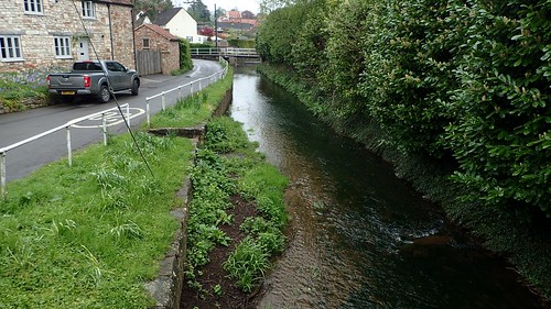
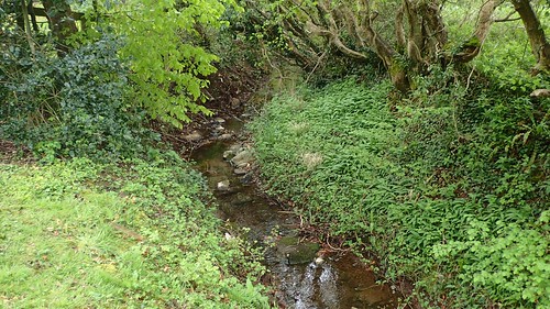
I could briefly follow the River Chew. On the opposite bank, the Two Rivers Way path runs parallel, for twenty-miles between Keynsham and Congresbury. I’ve had thoughts about leading that one as a group walk, taking a bus to and from each end.

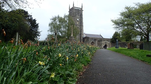
Pensford has quite a stumpy looking church but I was more concerned by the potential chaos of the private car park before me. Even excluding the red van, I wonder how many people require the use and heavily-restricted access of this space?
Crossing the A37, I would soon leave the Three Peaks Walk near Publow Leigh and now follow a right of way towards Whitley Batts.

I crossed the A37 once more and descended to the bottom of the valley, across which the railway line (once utilising the viaduct) once ran. It’s hard to see any evidence of the track bed today although, I took this photo having passed beyond.

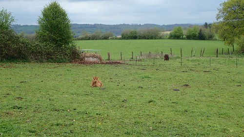
A steep but familiar climb up to Stanton Wick came next. Turning south, I crossed the A368 and picked up a right of way on the east side of Stanton Wick Farm. It was hard going across this field, with thick, smooth grass reaching up for my hips. It wasn’t dry, either but, my combination of gaiters and waterproof trousers worked quite well.

A climb beyond Honey Gaston came next.
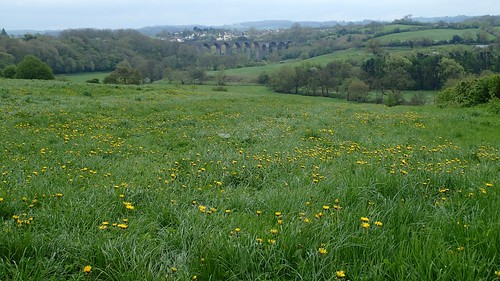
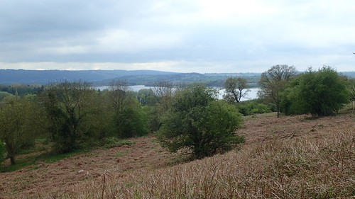
Over the next road, I stepped in to Folly Farm Nature Reserve…
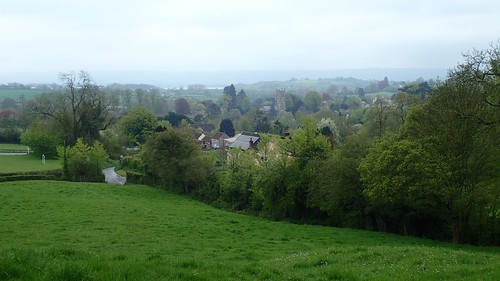
What a view! I don’t think my photos quite serve it the justice it deserves. This now has to be my favourite view overlooking the Chew Valley, from a place I’d never heard of and, on a Saturday afternoon, there was no-one else to be found!
A welcome bench provided a lunch stop ahead of moving on. With some reluctance.
Such an inviting space.

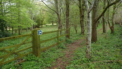
There may be guided paths other than those highlighted on the OS map. I found it was surprisingly wet (not muddy) underfoot towards the end of this first section. Fortunately, someone had installed these stepping post to reach the kissing gate.
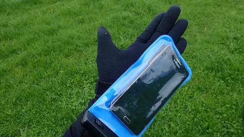
I cannot remember the significance of why but, this was possibly the first time I’d put my phone inside a waterproof case… It wasn’t forecast to rain. Perhaps this was simply because ‘I had one’ and hadn’t been using it?
Either way, the phone has since died and been replaced, while I’ve also upgraded the waterproof cover to one that’s a heck-of-a-lot easier to open and close than this cheap item.
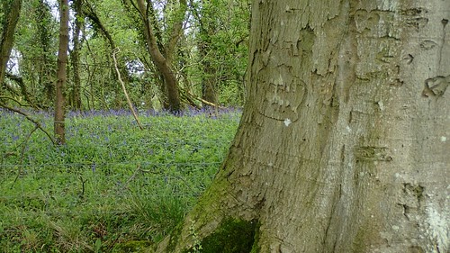
Bluebells lit up the private woods to my left, as I followed the fence line downhill.
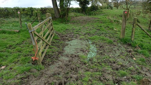
Waymarking would’ve been helpful, here. I managed to navigate my way down the valley and on to the field’s end – I did even use the GPS on my phone to double-check my location. Once again, I wonder how the local dog walkers would manage, without a map and compass? Maybe they don’t bother.
My next ambition was to locate the ‘waterfall’ on the map, heading north from Stowey to follow the clean-looking bridleway signs.
But, if there is a waterfall, it’s one that can only be seen or accessed from a private driveway. I could certainly hear it but I wasn’t prepared to trespass beyond a set of large double gate.
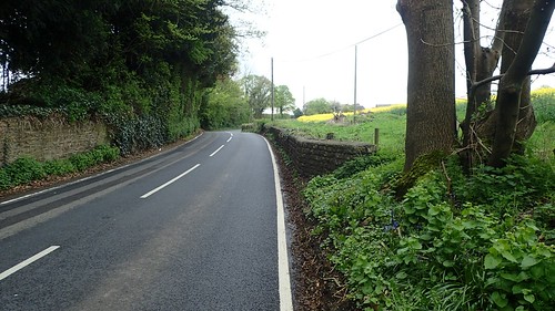
This was the portion of the walk I hadn’t given much thought to, as it meant walking north along the busy A368, for what felt like a long quarter-of-a-mile. Even now, I can distinctly recall stepping in to a hedge to give way that at least half-a-Century of bikers! Plus the occasional car.
I followed the minor roads west until I could depart for Knowle Hill – another one of the three peaks and, by comparison, the one I’m not visiting on this particular walk is not a “summit” I would long for.
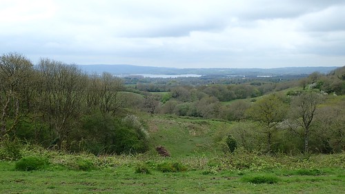
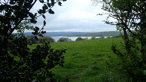
While Knowle Hill can only look up to Maes Knoll, it offers a decent view and scale of Chew Valley Lake.
Every year in the late summer, there’s a festival called Valley Fest that takes place somewhere near here. Much of this mound is open access land.

I took a familiar walk back to Chew Magna, soon rejoining the River Chew. As I reached my car, I was by far the muddiest of all walkers heading home for the day. It’s almost as if the others had put their ankle-high boots on, only to stroll up to the church and then back down to the pub…
