
Sunday 3rd June 2018
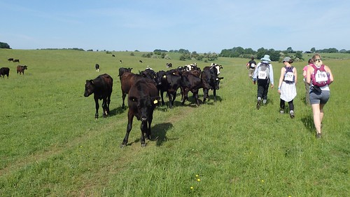
For the fifth year running, I had signed up for Weston Hospicecare’s Mendip Challenge event. I read that over nine-hundred people took part this year, walking anywhere between five and thirty-miles on the day. I was set for yet another thirty-miler and hopped on to one of the four coaches laid out for our early start.
This walk follows the West Mendip Way, with the ten and twenty-mile variants starting in locations further west. My day would begin in Wells, England’s smallest city. Although, the drop-off point for this year’s event was slightly different to the previous four years, so we had to first follow the Mendip Way across the green in front of Wells Cathedral, before reaching the plaque and original start point of the West Mendip Way.
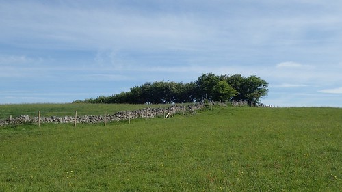
From here, heading east across Somerset, the East Mendip Way runs as far as Frome.
On the approach to Wookey Hole, there is always the option of climbing up and over Arthur’s Point… Which I normally do, for the achievement and solitude. Most walkers will follow Lime Kiln Lane, as directed in the event guide.

There was great indecision amongst the crowd this year, although the runners (who were allocated spaces on the first two coaches to depart) had already raced on. I also like to make this detour as it provides a convenient toilet opportunity… Although, I had to stop short this year as I spotted a crowd of walkers walking aimlessly towards me!
Note: there are actual toilets available further on at Wookey Hole.
Heading down towards the village, I caught up with a trio of people. Neither of whom seemed certain of where they were going and would make a wrong turn upon reaching the road! Before that, one of them casually dropped his trousers in front of me and relieved himself in to the hedge… While I recognised another guy from each of the previous two years and was surprised he didn’t seem to know the way, as someone who was part-running the distance.
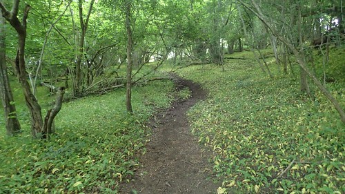
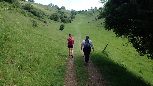
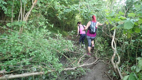
We walked on and up in to Ebbor Gorge, where I was pleased to see Ebbor the Cat looking more healthy than back in the winter. Even if she quite closely resembles a boar.
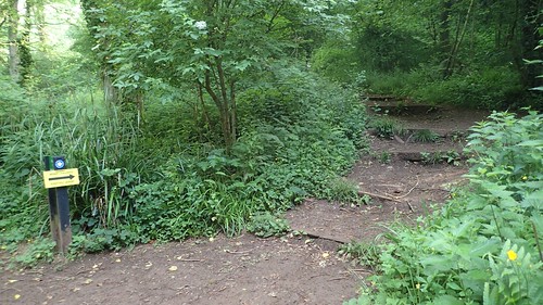
This is at the foot of ‘the steps’… If you’ve walked the West Mendip Way, you’ll know what I meant! I was pacing myself this year, which I don’t normally do and had allowed the greater mass of walkers to push on ahead. I’ve also returned to these woods since the Mendip Challenge and found that some of the lower steps have been reinforced with fresh lengths of timber and an improved surface for walking on.
It’s always a relief to break out and up on to the heights above Wookey Hole.
I talked briefly with ‘No.238’, who wasn’t as much of a walker as myself but was formulating a plan to walk the entire South West Coast Path with two of her friends, who were also present on this day. I was quite impressed with that.
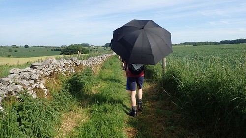
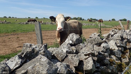
We passed through Higher Pitts Farm and followed Dursdon Drove before skirting around successive fields en route to Priddy. It was along Pelting Drove that I actually got to talk to ‘Umbrella Man’. As expected, he was wearing it mainly for the shade but, I’d also read of a shower than had been forecast for the afternoon.
I can be terrible at remembering names but we later found each other through Instagram, when he realised he had previously read one of my blogs about this event from previous years! I was pleased to hear that he managed to complete the challenge this year, after succumbing to defeat only five or six miles from the end in 2017.

Passing the second check point/water stop opposite the Queen Victoria Inn, we bypassed the green (which may’ve just housed the annual Folk Festival, as I write this) to continue walking west.
Checkpoints are only a few miles apart along this walk, which is very welcome for most. Water is almost always available and you’ll often find a selection of sweets or a bowl of crisps to help yourself to. Only a few checkpoints are compulsory stops where you must hand over your wristband and check in.
Knowing this was going to be a hot day, I loaded my 27lt backpack with about 3.5kg of water (one bladder and two smaller bottles). I’m always amazed by the ‘minimal’ size of some people’s backpacks (and I’m not referring to anyone in these photos). I overheard one woman at registration, saying how she wasn’t even carrying a pack because she was expecting ‘water and FOOD’ at each checkpoint…
I hope she wasn’t too disappointed by the lack of roast dinners and sandwiches available! Personally, I can only survive for so long on jelly babies and boiled sweets.
Later in the day, I’d find a couple of checkpoints that were temporarily out of water. Quite worrying, in this heat. I would also hear that a number of walkers would drop out at the twenty-mile mark (King’s Wood). Personally, I think people should be prepared to carry a bit more from their own tap, as they would do on any standard day walk. I also made a suggestion to the event organisers with regards to the number of plastic cups that were available and I believe it may be taken in to consideration for next year.
I hope my tone doesn’t sound a bit off here. I just thought it was quite worrying how unprepared some appear to be. 2018 just happened to be the hottest year yet.

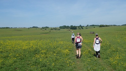
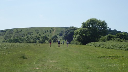
Priddy is often enjoyed for its scenery and the fact that you’re on a level walk, until beginning the descent towards Draycott.
There’s a mandatory check point (and portaloo) outside the cider barn in Draycott, which marks the ten-mile mark for those of us walking the full-distance and the beginning of the twenty-mile route for others. I also took advantage of the available picnic benches while refuelling with snacks. Pausing for long enough, two of my friends were able to catch up momentarily, which made a nice change to my usual fast-paced approach to this event.
Then comes ‘the climb’, to regain the elevation that had reluctantly sacrificed, minutes earlier. Even with the event signage in place, I still noticed people heading up the valley of Batcombe Hollow, where you’re supposed to turn right at the boulder and follow the right of way up and around the head.

I’m pleased to say that, for the second year running, I was able to tackle this without pausing once. Walking poles do help!
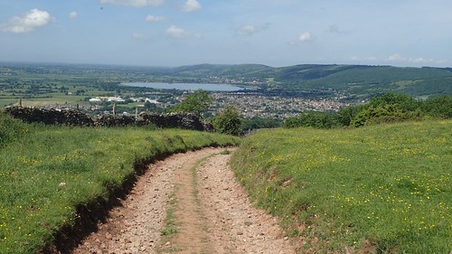
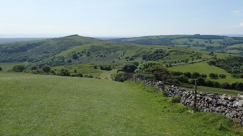
From here, you follow a track that appears to descend gently towards Cheddar and its iconic reservoir.

But, from Bradley Cross, the route turns uphill once more, around the edge of Mascall’s Wood and painfully up through Bubwith Acres Nature Reserve. It’s the ascent that many almost forget about, I think.

Soon heading downhill again, the route crosses Cheddar Gorge at Black Rock, where I found the checkpoint had temporarily run out of water.
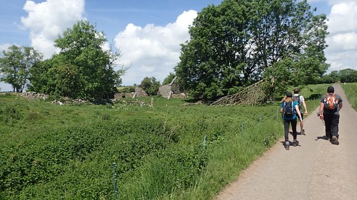
Up through Long Wood and passing Charterhouse Farm, I recognised this trio from last year’s event. I also overheard them speaking of other people they’d recognised from 2017, although they didn’t make any direct reference to me.
Another optional checkpoint awaits at Tyning’s Farm just outside of Rowberrow. Water and a portaloo were both available, here.

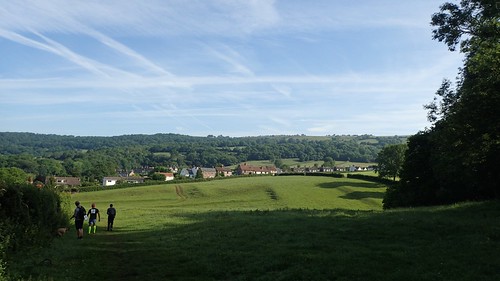
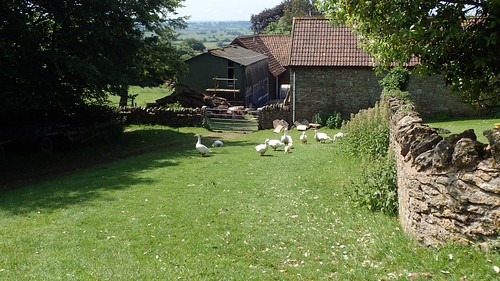
After dropping down through the woods, the route climbs up from the stream to reach Shipham, where people (and I’ve done this once myself) manage to miss the left-turn opposite the pink cottage and end up following the road to the next check point.
Winscombe Drove is often the muddiest section of the entire route. Even in the midst of summer, it can be very boggy. This year though, we had fallen trees and branches to contend with, in nature’s very own obstacle course.
Crossing the A38 (where some take a short diversion to the petrol station for an ice cream stop), the route enters King’s Wood (another checkpoint and start of the ten-mile walk) before climbing up on to Cross Plain.

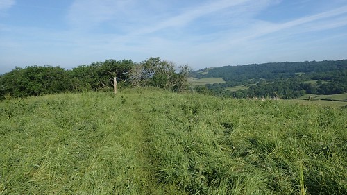
Next up is the short-but-steep ascent on to Wavering Down. One of the true highlights of the Mendip Hills and complete with its own trig point.
Descending once more, the Way skirts around the northern contours of Crook Peak.

I don’t see many people attempting the optional ascent to the rocky summit. It’s almost a shame the route doesn’t head up there. I haven’t done it myself since I first walked the Mendip Challenge in 2013.

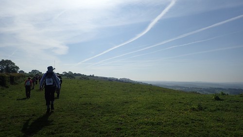
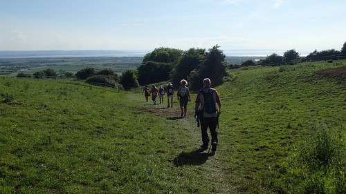
Crossing the M5, I reach that familiar feeling where I just want the walk to be over. From here, I feel I’ve personally seen all of the highlights and I’m very familiar with the remaining few miles from here on, where I often catch up with crowds of slower-moving ten-mile walkers and have to join the queue up and over Bleadon Hill.
There’s a Roman Road (as straight and true as an arrow) crossing Bleadon Hill, with a compulsory check point along the way. I felt compelled to be a bit ‘selfish’ and top up my 750ml water bottle here, even though I probably still had something left in my hydration bladder.
There’s one more ascent in Purn Hill – and a checkpoint to follow – before the crossing of the A370, which is often manned by stewards to ensure the safety of all.

From the main road, the route soon joins the Brean Down Way, a cycle path that runs part way towards the finish line at Westhaven School.
It’s only been one month and already, my memory’s failing me… But I believe I completed this year’s challenge in ten-and-a-half hours. My average has always been nine-and-a-half but, I did take it steady for the first ten-miles and I can imagine that’s where I ‘lost’ that one hour.
My aim for 2018 was not to try and beat my own record but to simply take part. I felt as though I’d already done it in a very good time and, without running or pushing myself too hard (skipping lunch, for example), I didn’t feel I was likely to beat my time by any record of significance.
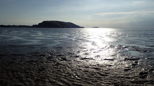
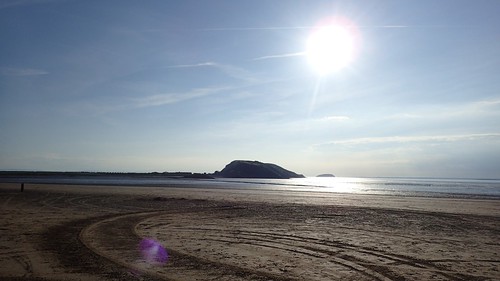
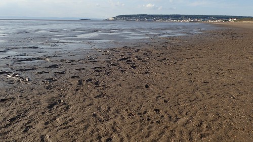
I made my way down to the beach at Uphill afterwards. I don’t often do that but, it was such a nice day. A shame about the teenagers pulling ‘doughnuts’ in their cars and the £70 parking ticket stuck to my windscreen… (Note to all: it’s not free to park on Links Road during the day. I’d intended to park on the beach but the gates weren’t open at 7am).
