
Thursday 14th June 2018
I awoke in my tent, after my first night of camping down in South Somerset. My intention for this day was simple: leave the car alone and go for a walk that explores the immediate landscape. I’d already highlighted a nearby river that I could use as a guide to lead me on to Langport and back.
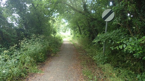
I turned immediately right out of the Brook Farm Campsite in Long Sutton to walk south along what appeared to be a dead-end farm track. I found it funny, how the National Speed Limit Sign was present. I could imagine anyone getting close to 60mph along here.
Soon, I would head west along Withmoor Drove – one of those ‘droves’ that today resembles a vague vehicle track following the edge of a field. A very small stream was drying up, down to my right. Using this as a guide, I could soon reach the River Yeo (also known as the River Ivel).
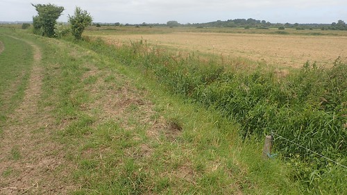
As I joined the river along its northern bank, I was pleased to find that the right of way had recently been cleared. In fact, a pair of tractors for harvesting the land behind me and to the east. I’d been woken overnight by a couple of passing helicopters and, not being far from Yeovil, it shouldn’t necessarily have been much of a surprise.

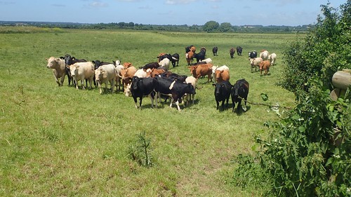
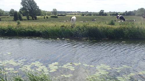
At the end of the second field, I almost came to a confrontation with a herd of cattle – but, they weren’t as overly curious as some breeds and I was able to hop over the stile safely, with a feeling of relief that I’d never have to cross their horns again.
I think I made it successfully across the next field, before the condition of the right of way began to deteriorate, if not disappear entirely.
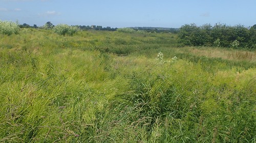
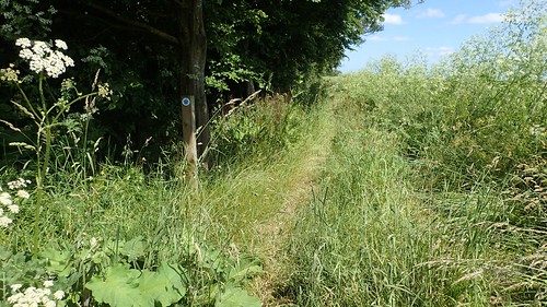
Long grass and all sorts of vegetation. Much of it was up above my knees. I’d deliberately worn trousers, having taken in to consideration what Somerset can be like.
It looked as though no-one had attempted to walk through here for months. What’s quite tragic is that this is also following the route of the Macmillan Way West; a long-distance footpath just over one-hundred miles long.
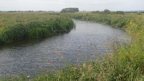
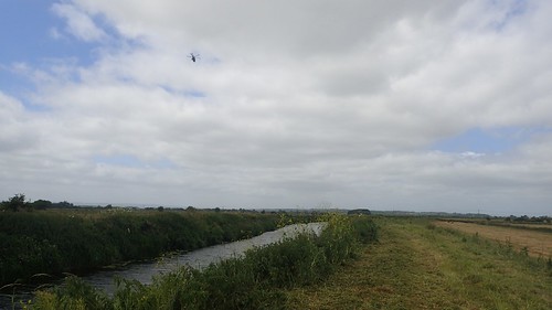
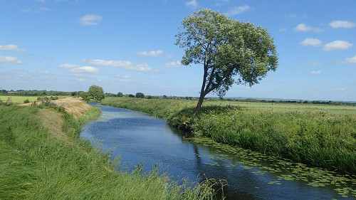
At least I could see the river. If only I could fight my way through a couple of fields like this, I’d surely be able to continue following its course and then, make my way back along the other side….
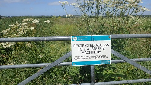
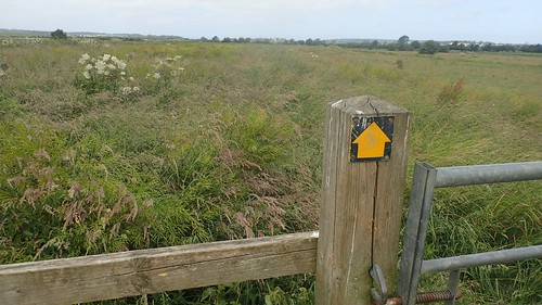
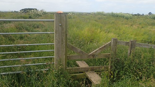
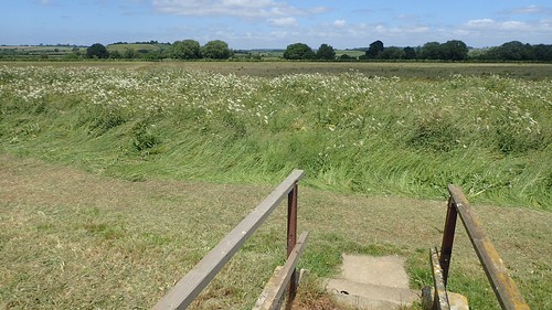
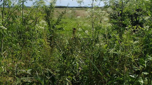
After battling through three fields, I arrived at this sign and I really wasn’t sure of what to make of it. Was this to mean that the public require permission to walk on from here?!

More pressing, the stile to my left had been lost to the overgrowth and the field beyond didn’t look any more appealing. There was no telling whether there would be an end to this untamed wildness.
So, I decided to trudge back across three fields and a ‘path’ I’d already forged with my own tired legs. This would mean altering my intended route but I was confident I could continue following the river in the opposite direction.
I haven’t reported any of this to Somerset County Council. Because I don’t like using their clunky ‘interactive map’ to record right of way issues and, from past experience, they only ever send automated responses claiming ‘the issue has been resolved’, even when it probably hasn’t. I will, however, be recording this through the Ramblers’ Pathwatch app.
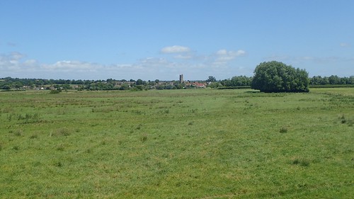
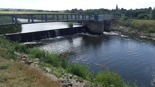
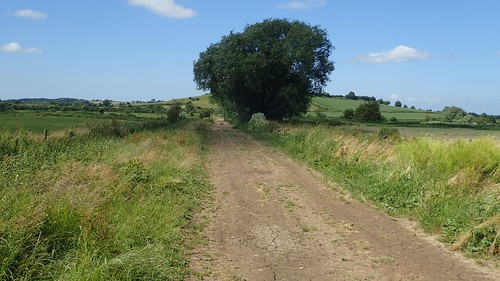
This wasn’t an easy decision to make, as I was only a couple of fields away from the weir that would’ve potentially allowed me to cross the river and walk along the other side. But, it seemed like the most sensible one. Above, you can see the church of Long Sutton in my sights, as I retraced my steps, defeated.
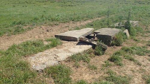
So, now I was following the northern bank of the River Ivel in a south-eastward direction towards Load Bridge. I did wonder whether this concrete structure had once been a pillbox or maybe just a shepherd’s hut.
It was clear and easy walking in this direction, towards Ilchester.
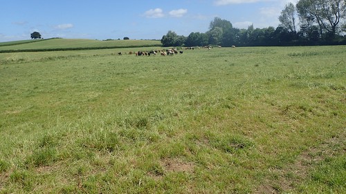
One herd of cows had spotted me from far across the field. Without running, I was able to beat them to my exit gate. I’d deliberately climbed the fence to access this field in the hope of not alerting them to my arrival.
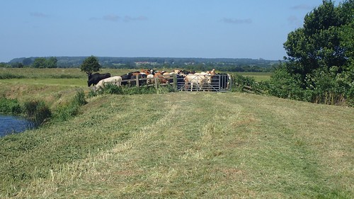
At least I wouldn’t be turning back through this lot. A couple from the herd seemed determined to almost try and walk around the fence, which would’ve meant getting their hooves wet.
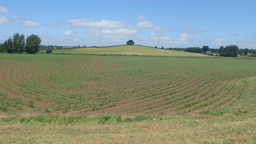
Or, perhaps, they could smell the crops slowly growing in this next field.
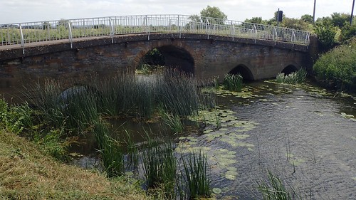
This is Load Bridge, which carries traffic from Martock in the south, up through Long Sutton and on to the A372. It is believed a bridge has been here since 1335.
Crossing the B-road, I had the option to follow a right of way on either side of the River Yeo, with a crossing point available further ahead. I chose to stick with the northern bank and avoid the structures of the sewage works.

This turned out to be a very smart decision. On my side of the river, I only had sheep for company, while cows looking on across the water, out of reach.
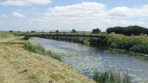
I was thinking of pausing ahead of this bridge for lunch, when I saw a man approach from the opposite direction and cross the river with intent. He was the first walker I’d seen all day.
From the elevated platform of the bridge, I attempted to scout out my intended route running north and away from the river. But, it couldn’t be seen through the undergrowth and I decided that I would instead stick to the water’s edge.

I paused here for a good half-hour; reading my book after lunch and having set my action camera up for a timelapse.
This was definitely the best direction in which to follow this river, as the paths ran on without obstruction. Peaceful and uninterrupted.
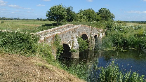
I followed the river as far as Pill Bridge, from which I would begin to make my way back in a westward direction.

Initially, I missed Kingsmoor Drove (another one of those ‘grass tracks’) and began following Pill Bridge Drove, which is more like the defined drove-track I’m familiar with.
I managed to make my way on to the intended route and, wouldn’t you know, it was a bit overgrown! Unlike what I had seen in the morning but not welcoming to anyone who might be wearing shorts.
My direct route from the lunch stop would’ve led me to this stile, which was about as easy to spot as the path that apparently exists beyond.
From here, I turned north to follow Driveway Drove (another actual drove), before Knole Hill Lane and Ilchester Lane would lead me around the perimeter of a golf course and to the south-east corner of Long Sutton.
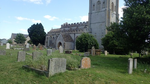
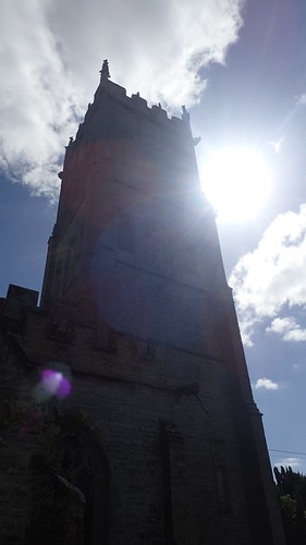
I followed quiet roads through the village to briefly explore the churchyard.
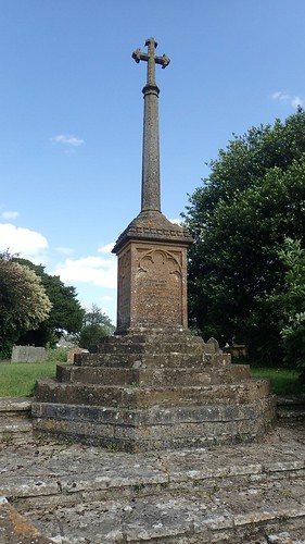

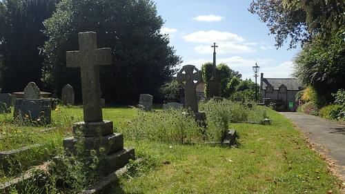
There’s also a war memorial outside of the main gate, beside which, someone has abandoned a single glove.
Crossing the B3165 one last time, I saw a coach of school kids pull up and unload. It was already that time of day and I looked forward to return my tent and boiling water for a cup of tea.

I spotted what looks like it was once a working well, beside the driveway to one house. I like that it hasn’t been completed removed and concreted over.
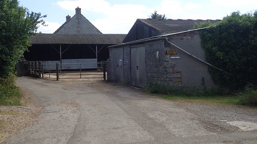
Brook Farm is hard to miss, as the signage is good. I’ll write some of my thoughts and experiences of this camp site another time. I was pleased to have walked a reasonable distance for this day, in spite of my mid-morning struggles.

Currently staying overnight in Ilchester and seeing the River Ivel prompted me to google it and found this article . Very interesting …Going to Montacute today so will look at your walks there.
LikeLike
Hello John,
I’m glad you found my blog and hope you had a good time down there. Sorry that I’d not seen your comment much sooner!
LikeLike