
Between Friday the 13th and Wednesday the 18th of July, I was in North Wales (an hour’s drive east of Snowdon) with three friends. If you follow me across social media, you may have already seen some of the photos from our adventures. With mountains on our mind, we had ambitious plans for our time.
Llandrillo
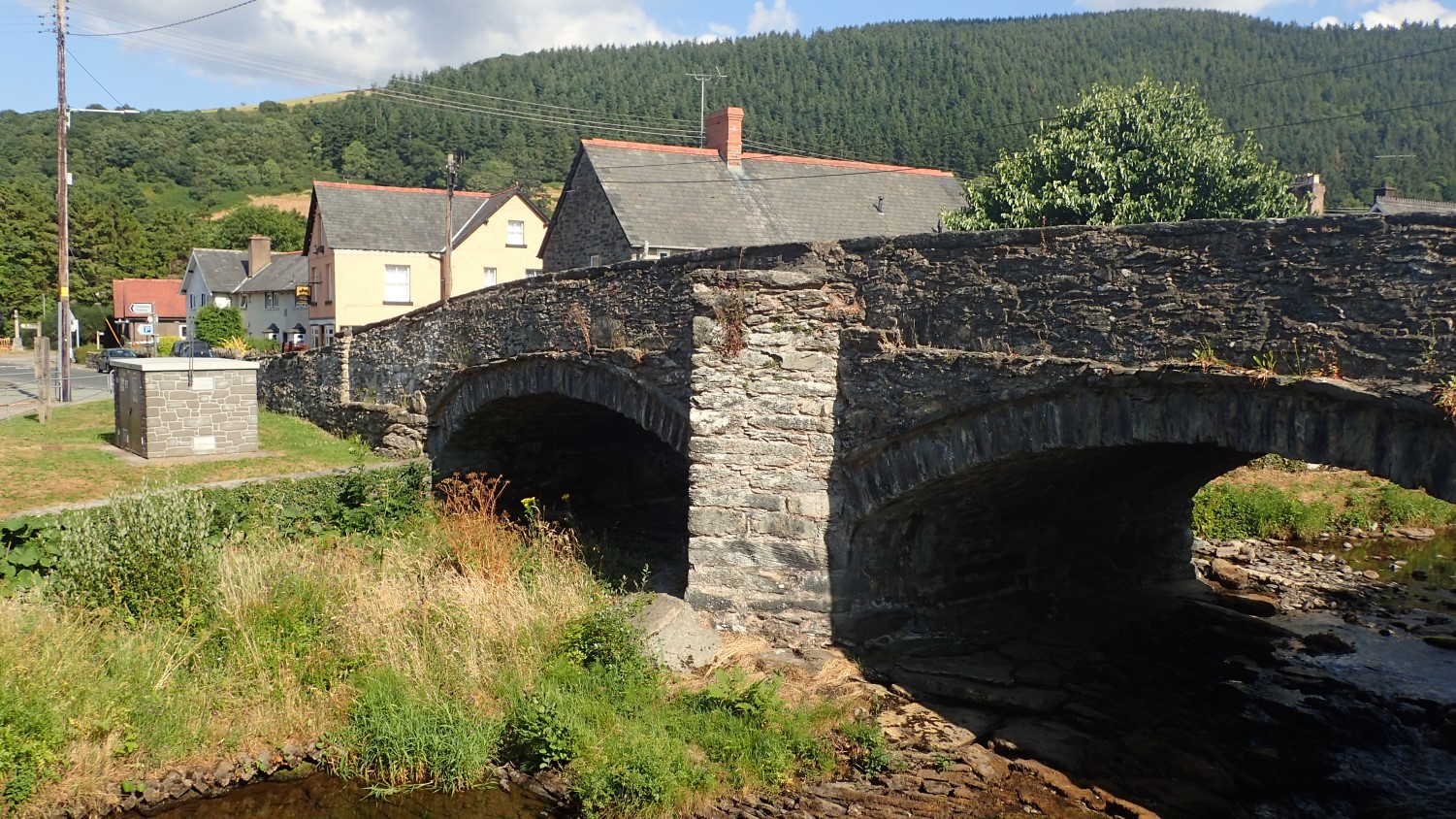
We set ourselves up at a cottage in the tiny village of Llandrillo, in “the arse-end of nowhere”, to quote another… A few miles south of the A5 from Corwen and only a thirty-minute drive west of Llangollen.
Our accommodation was free, owing to the fact that the cottage resides within the family of one of my friends. It is not available to let publicly and so, I’ve not taken or included any photos. It suited us just fine, although it apparently gets very cold there in winter. Most of our meals were eaten at home, although the local pub also provides food all day (except on a Tuesday, as we discovered).
Berwyn Mountains

As I mentioned earlier; we were situated almost an hour’s drive east of Snowdon and the heart of Snowdonia National Park. While we would ultimately be driving that way on at least one occasion, I realised there was much to be appreciated close to our short-term home.
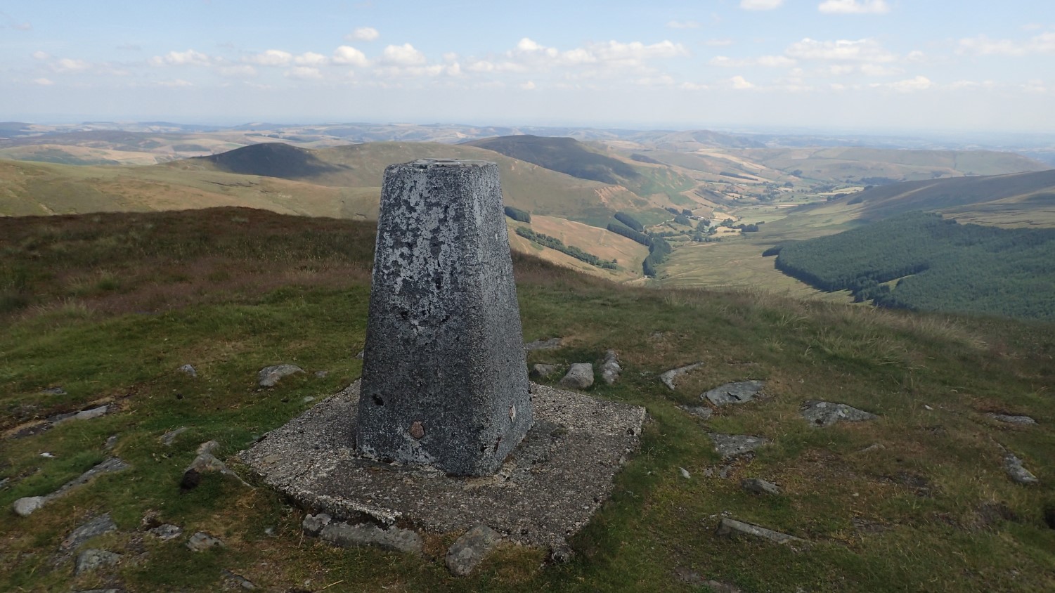
We’d all driven up on the Friday evening after work – I think it took me a good four-hours. Knowing that we’d be arriving late and likely to be tired in the morning, I suggested a walk up to Cadair Berwyn; the highest point in the Berwyn mountain range [well, almost… It has a trig point]. Naturally, I ended up leading this walk.
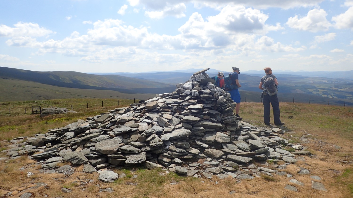
It took a long time to get up there and we followed a fairly direct and challenging route to the top, gaining several hundred metres in elevation with no respite. This was also to be the sunniest day of our time in North Wales. This cairn was located at Cadair Bronwen; the other high on our route.
These mountains were much quieter than you would ever expect in Snowdonia. We saw a handful of people near the high points but there were no crowds and most appeared to be well-prepared.
Tryfan and the Glyders
If I threw ‘Snowdonia’ at you, the chances are that you’re going to think of Snowdon, the highest point it all of Wales. But if that wasn’t your answer, I imagine there’s a high probability the next response would be Tryfan.
We had plans to tick off both mountains in our trip to North Wales and, on the Sunday, we took a punt on Tryfan, knowing that Snowdon can be horrifically congested on a weekend. Fortunately, there was no trouble parking at the foot of Tryfan.
Someone recently commented on Instagram, about how they’d heard this is one mountain you cannot climb without using your hands and we found this to be perfectly true. It was my first proper taste of scrambling and I enjoyed it. We all did. Even those who ended up more bruised and beaten than others…
On an Ordnance Survey Map, it looks dead easy; ‘just follow the dotted line up and over the top’… In reality, we found it’s a challenge to make your way up without forcing yourself in to a higher grade of scramble. But we found the Cannon Stone alright and would eventually make it to the top, safe and sound.
Dave and I were each brave enough to do The Jump between two larger rocks known as Adam and Eve. From a distance, it may look easy. When you’re up there, the void between rocks widens. But, in practise, it’s basically one-giant-leap for anyone close to 6ft tall (I have video evidence of my own attempt, which will appear on YouTube one day).

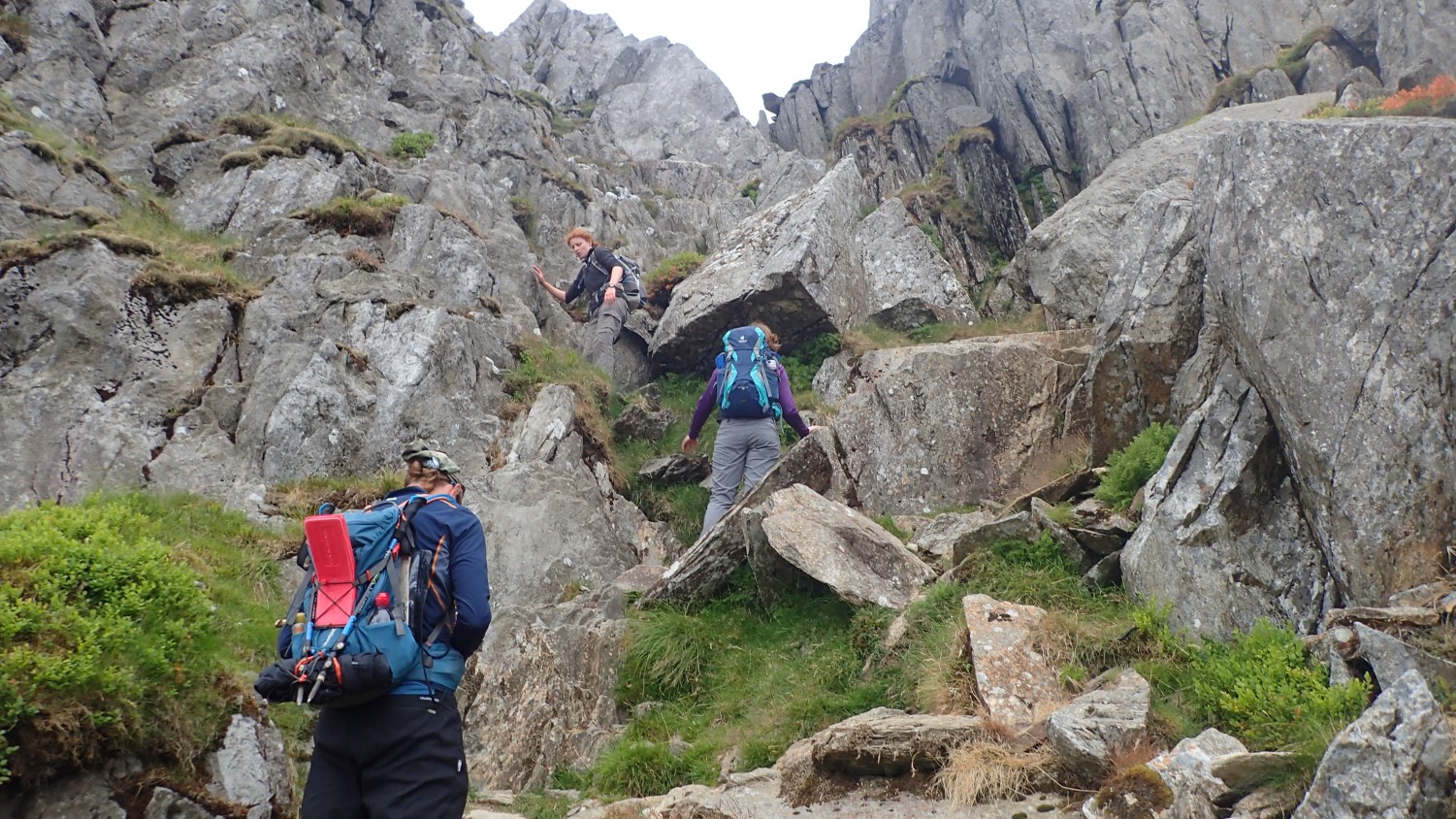
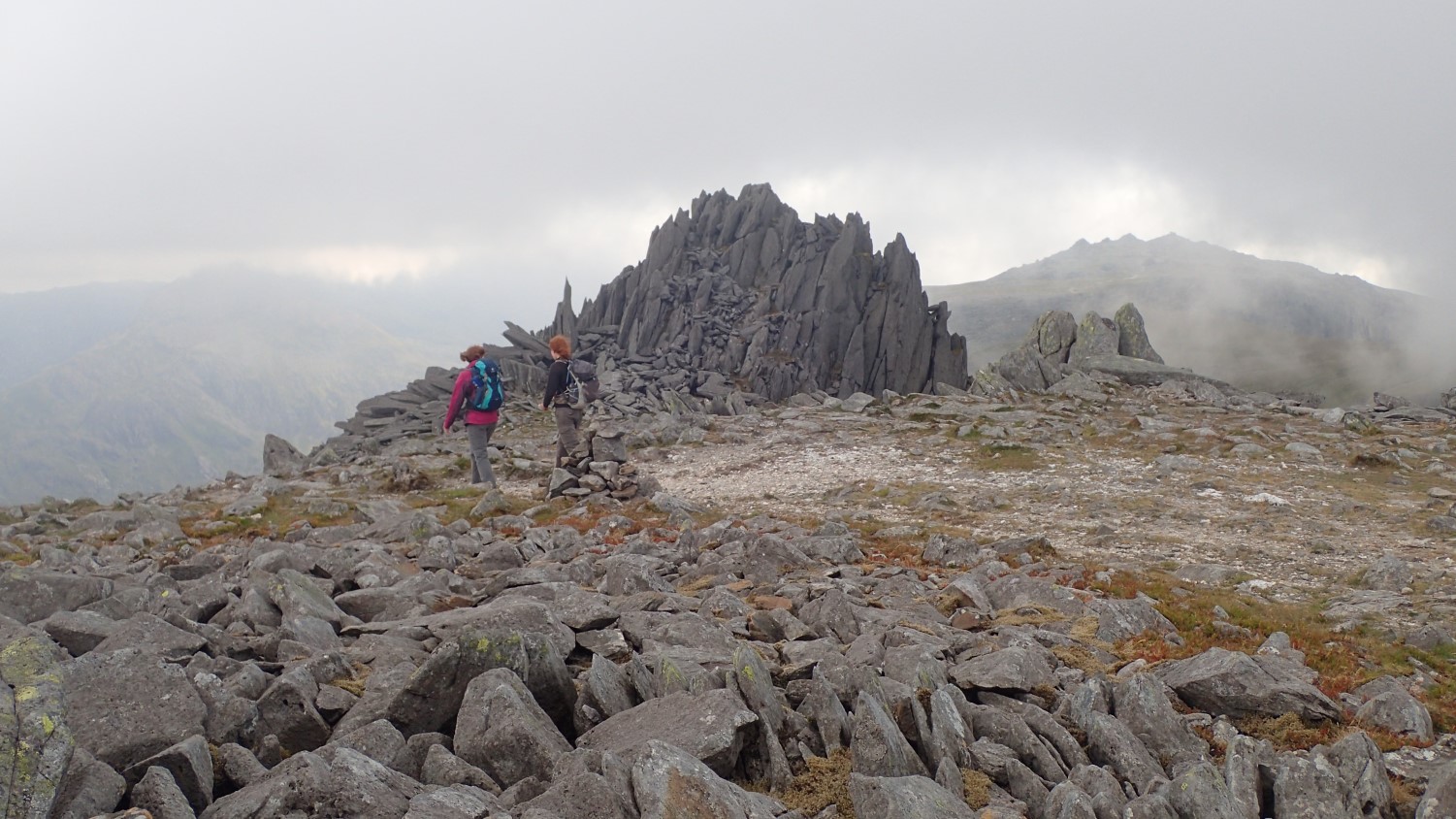
As if we hadn’t done enough scrambling for one day, we were next making our way up on to the plateau of the Glyders, via a route known as Sinister Gully.
There’s an alternative, scree-laden footpath that avoids all of this. Looking back now, it was quite scary… I don’t remember looking down until I was up! But it was enjoyable.
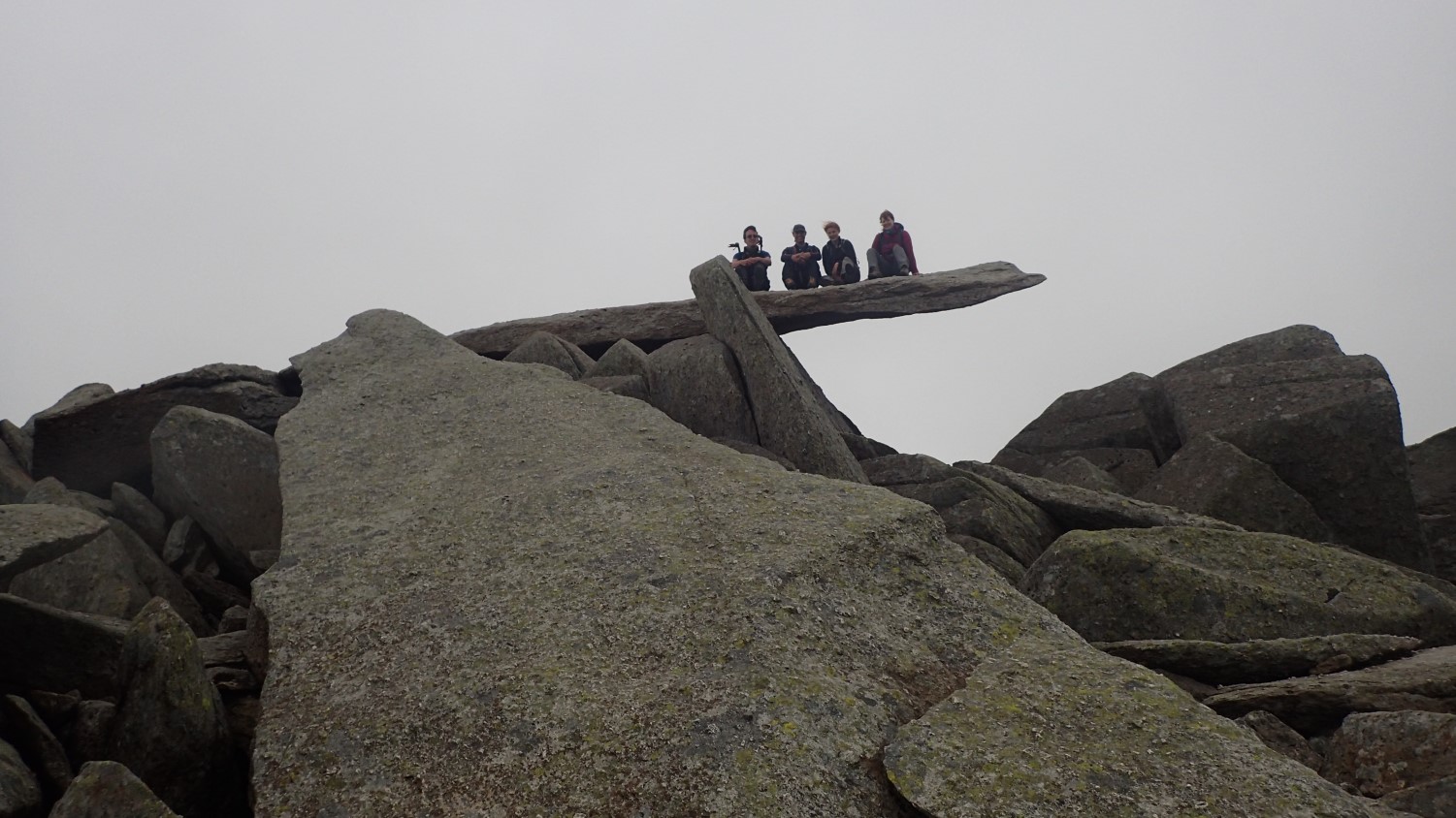
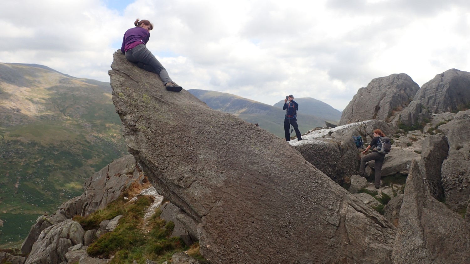
From the wind-beaten top of Glyder Fach, we aligned ourselves along the Cantilever Stone, just in time for my camera to capture the shot. Everybody does this. But it was far too windy to stand up.
We found the real Castle of the Wind before marching on across the mountain pass to Glyder Fawr.
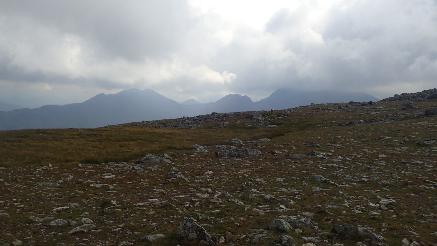
I wasn’t one-hundred per cent certain at the time but we could see Snowdon from here, even thought its summit was hidden beyond the cloud. Two days from here, we’d be following much of that ridge and the peaks beyond.
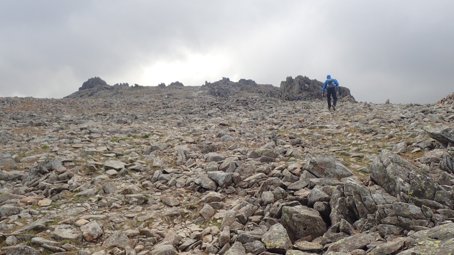
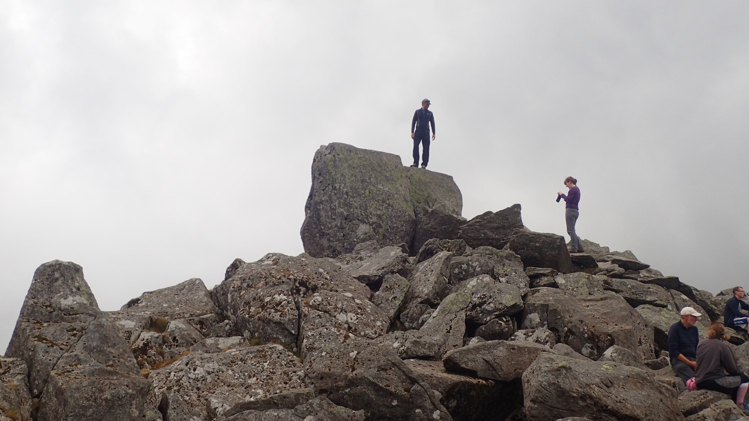
Glyder Fawr has an otherworldly-feel to its rock-laden landscape. I wish I knew more about geology, so that I could imagine what had caused these rock formations. No-one else had ventured as far as this summit, at 1,001m. Perhaps due to a lack of photo opportunities…
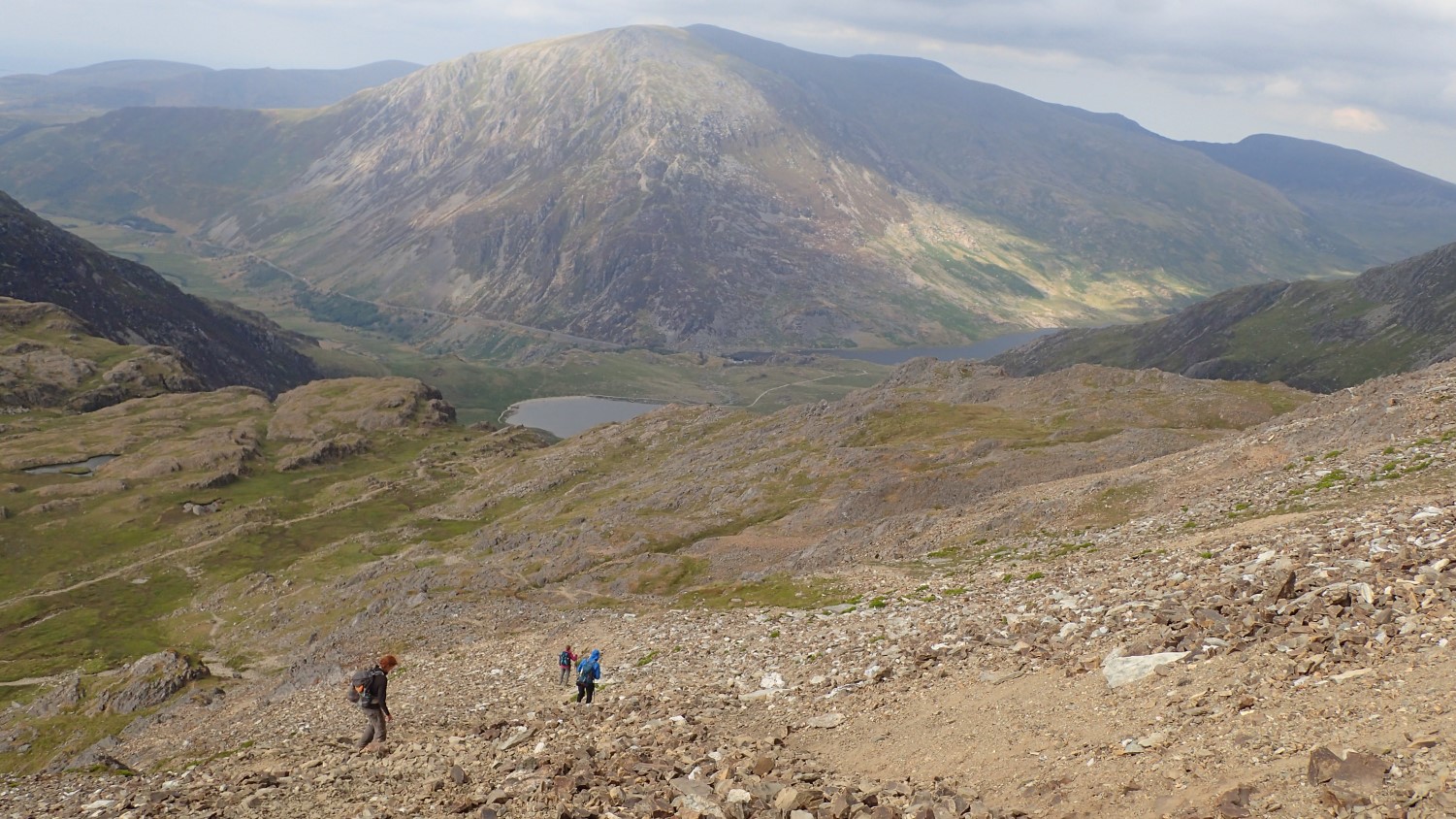
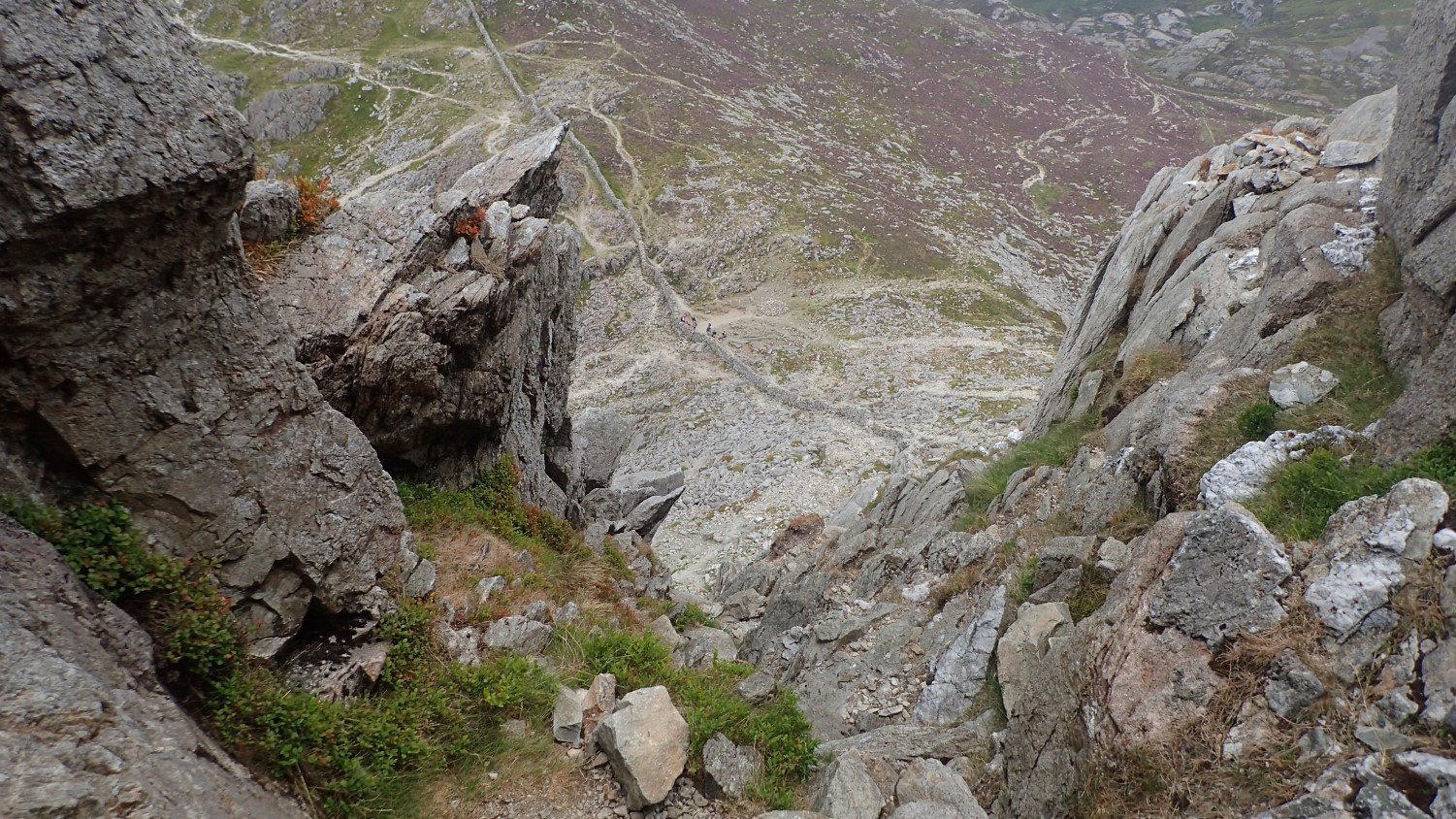
Perhaps our biggest challenge of the day was in the never-ending descent. We were parked at around 300m above sea level and would have to lose 700m to get there. It wasn’t quick or painless. From the scree-laden track that felt as though it had been set by a young Kevin McAllister, to a long series of stone steps from which our knees received a constant pounding.
I’ll have to look at investing in a paramotor glider…..
Pontcysyllte Aqueduct

Monday was forecast to be a wet one and, after many hours of scrambling up and down the day before, we decided to make this our ‘rest day’.
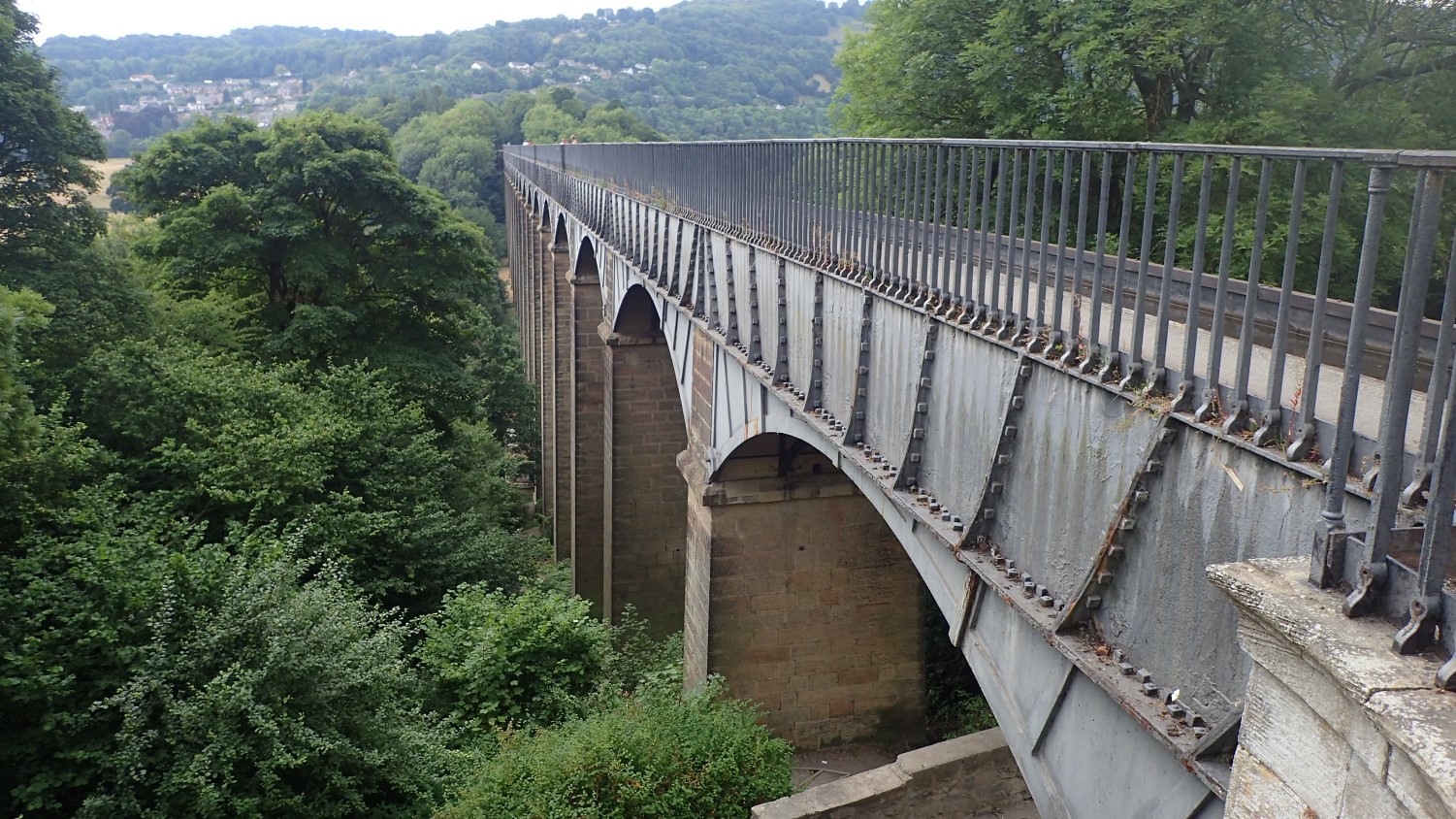
Instead of staying indoors, we drove east past the centre of Llangollen to explore the aforementioned aqueduct (I didn’t even know how to correctly spell “aquaduct” so, please don’t expect me to be able to pronounce the Welsh name before it).
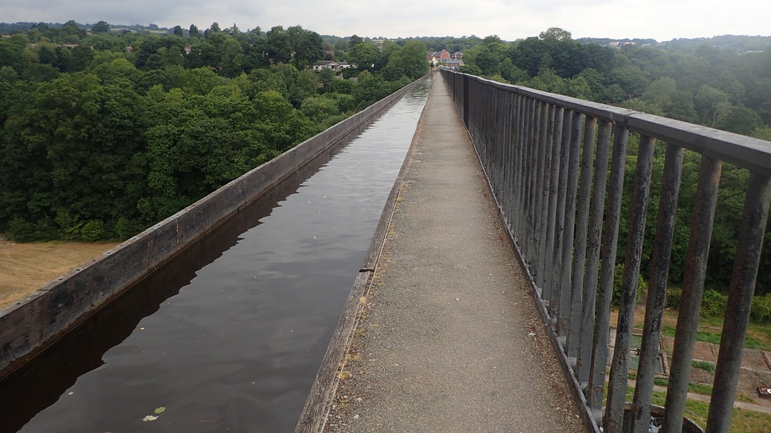
At just over 300m long, this structure carries the Llangollen Canal (and narrowboats) across the River Dee.
We went back to Llangollen and found a café for our late lunch, ahead of the drive home and more ‘preparation’ ahead of what would be another challenging day for the next one.
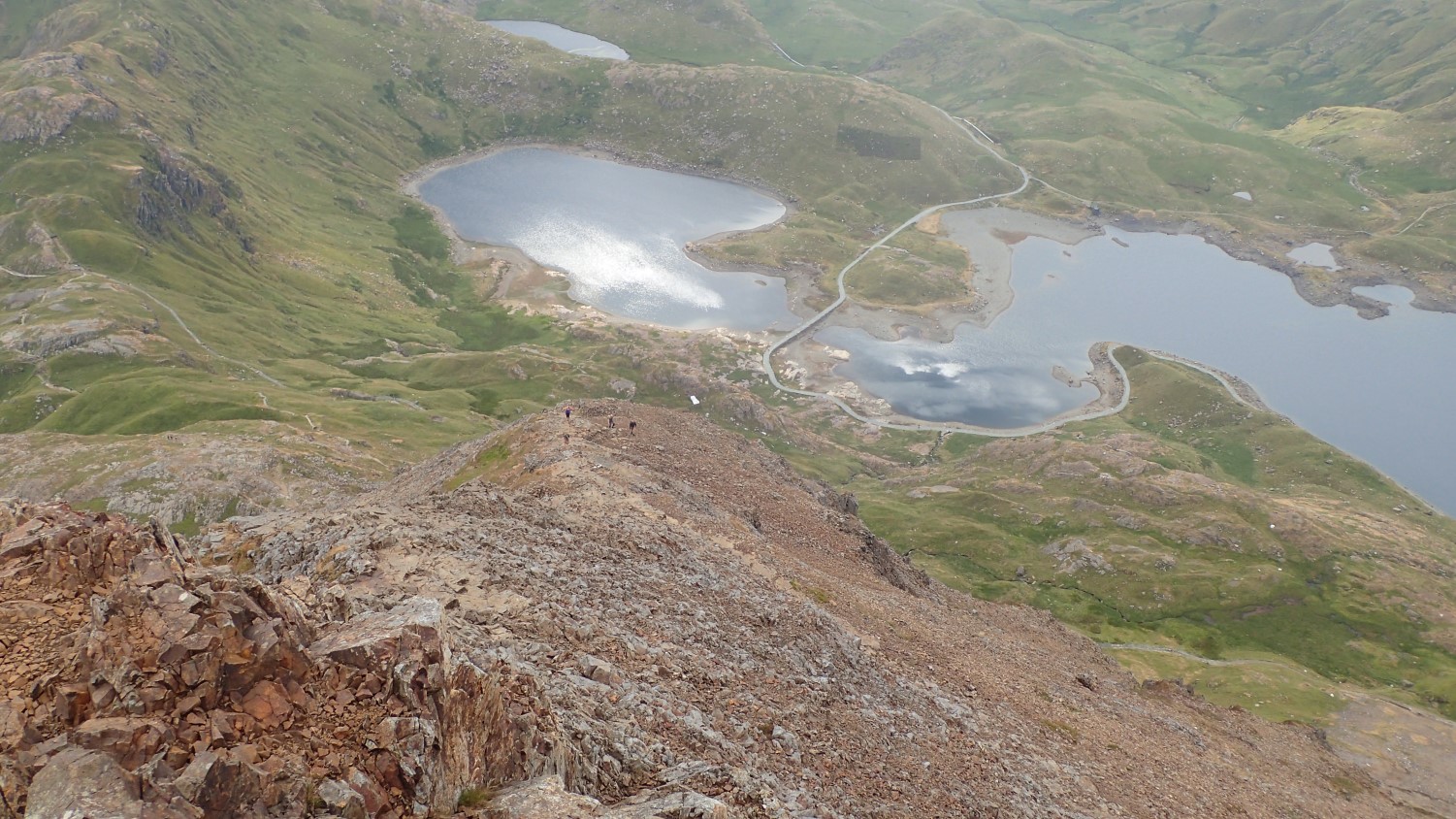
Snowdon via. Crib Goch
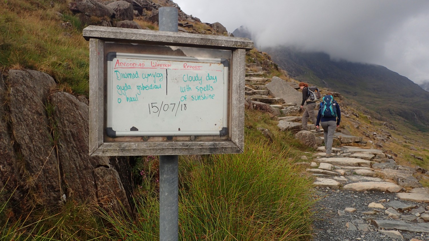
This is the one we were most looking forward to and we’d reserved it until the day before we would be leaving Wales. It also happened to be a weekday (Tuesday) and, with an early start and 8am arrival, we were able to obtain one of the remaining parking spaces at Pen-Y-Pass, at a cost of £10 for the day.
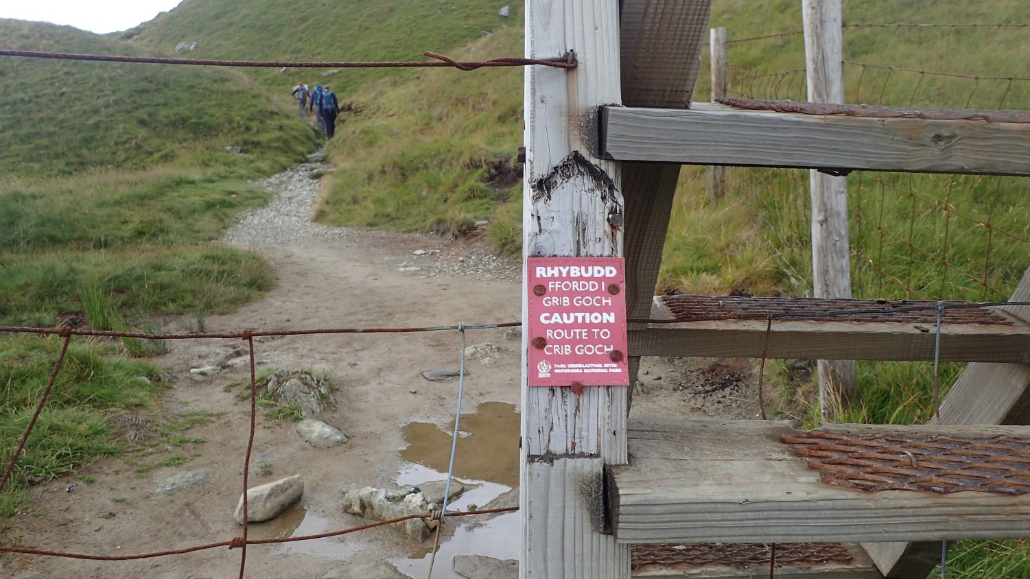
We weren’t just heading for the summit of Snowdon; we were going to climb and conquer the knife-edge ridge that is Crib Goch. To put that in to perspective; someone tragically died from falling off this ridge on Saturday. This is why the warning notices are quite frequent. I cannot speak of this particular situation but walkers are occasionally known to approach Crib Goch over-confident and un-prepared.
From other people’s photographs, I had an idea that we’d be climbing up from the Pyg Track (an easier route to the summit) to reach the actual ridge. I just hadn’t imagined it being so vertical. One lone-hiker ahead of us had already turned back. How could Crib Goch be any more dangerous than this?!
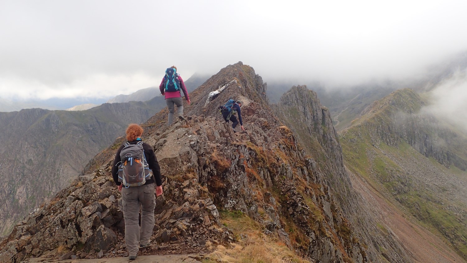
We were fortunate with the views – which is a good thing, unless you’re afraid of heights of have a compulsion to look down. There were sections where you could ‘hand rail’ alongside the ridge on an actual footpath. But it was the truly exposed sections where you could only scramble along the top, that we found to be the most terrifying.
This knife-like features is only 1km long but it’s a time-consuming journey that is not meant to be rushed. We were occasionally overtaken by sprightly youngsters casually walking along the top in climbing shoes…
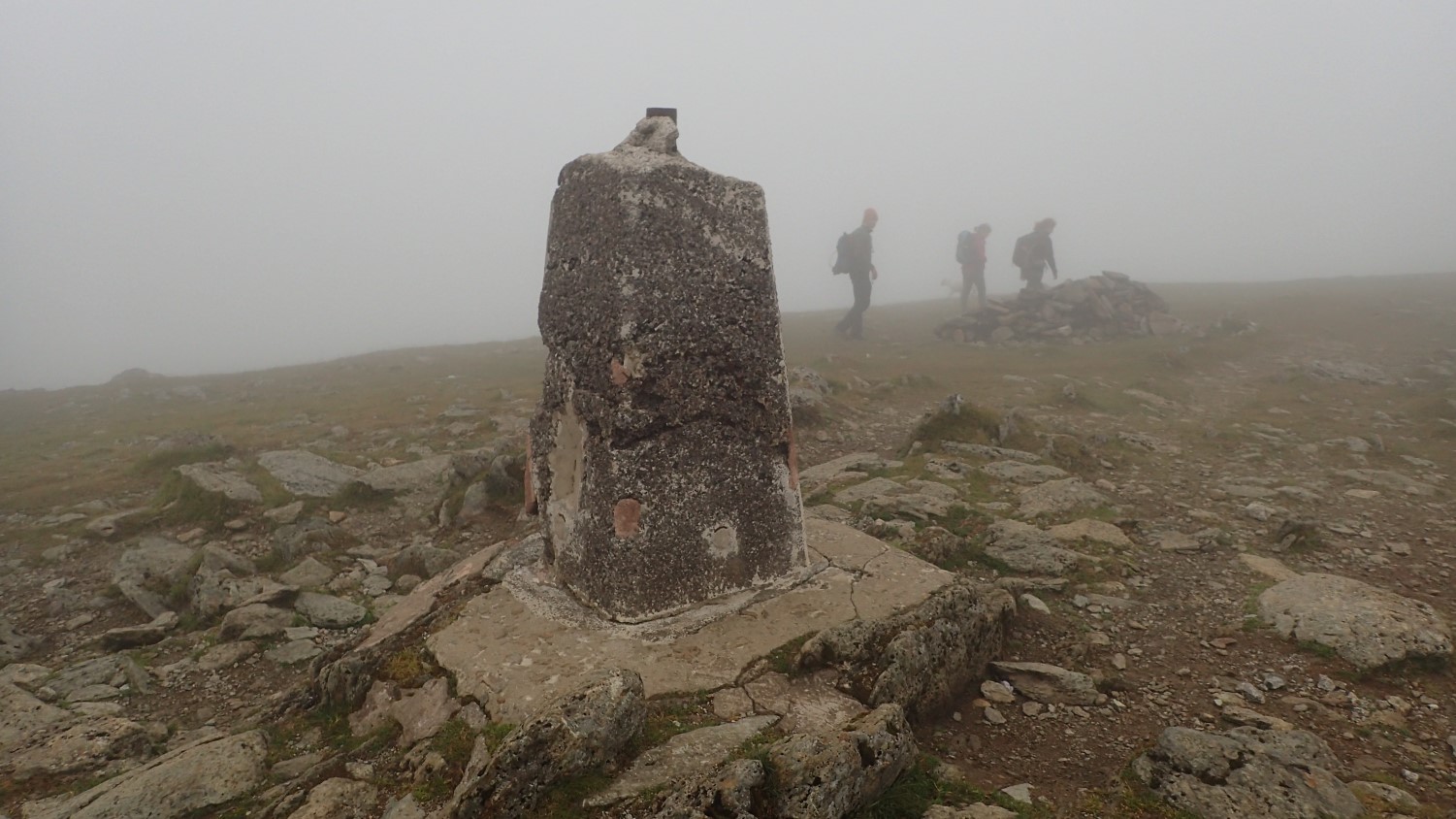
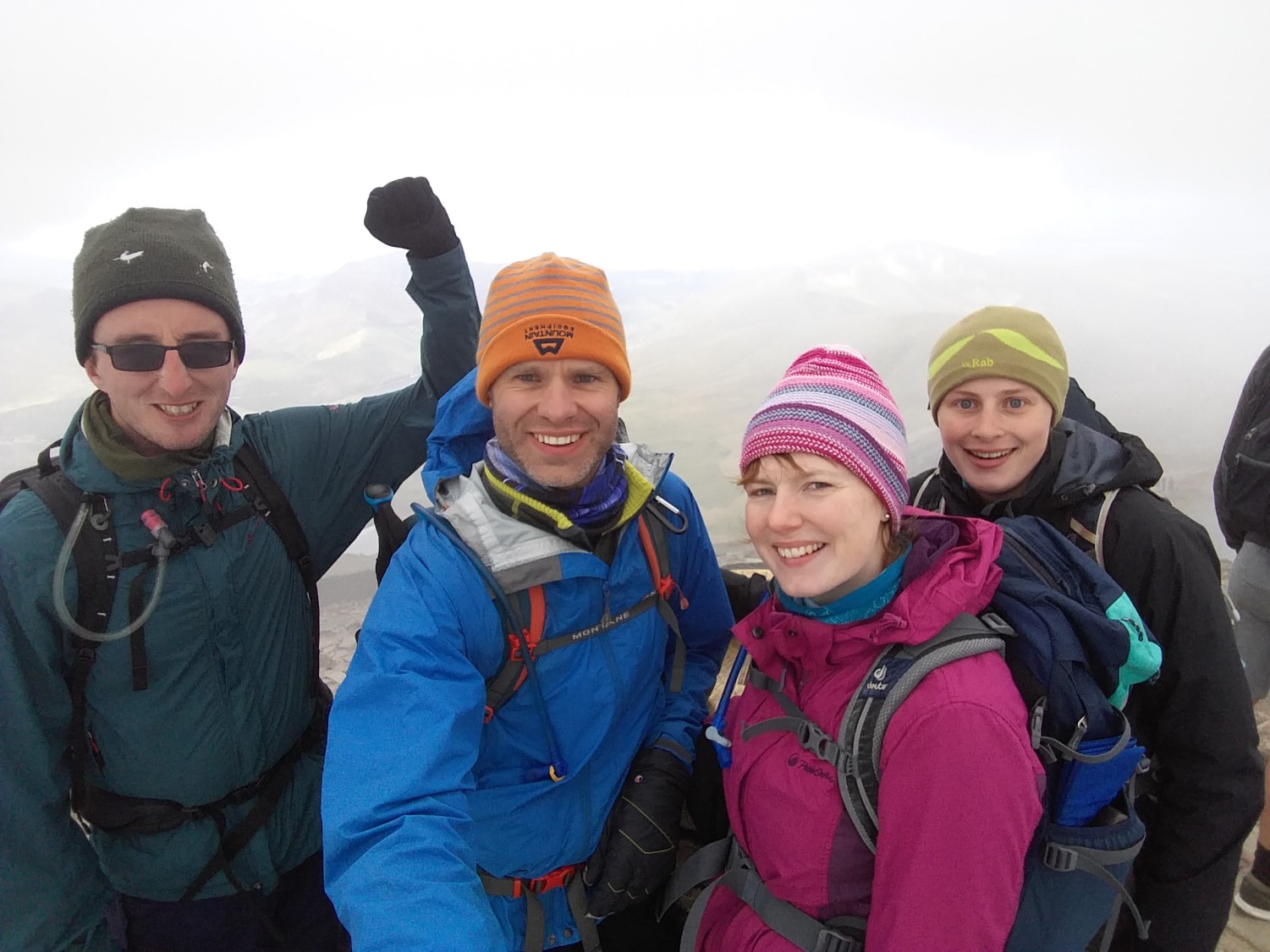
We overcame the Goch and continued up to the battered trig point of Garnedd Ugain, sitting twenty-metres beneath the cloud-covered summit of Snowdon. We had lunch here, wrapped up warm within the cloud.
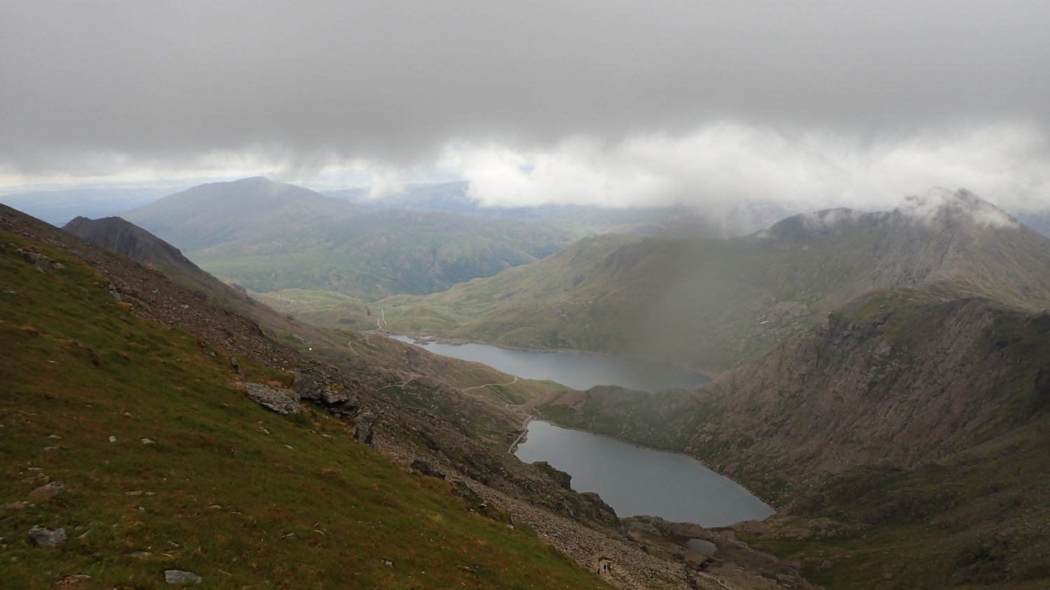
While Snowdon itself had remained hidden for most of the day, we had been fortunate to be able to experience the stunning views elsewhere and all around us.
Pressing on, we arrived at what Jenny refers to as ‘Clapham Junction’; the point at which several popular routes to Snowdon all converge in to one over-crowded mass ascent towards the top.
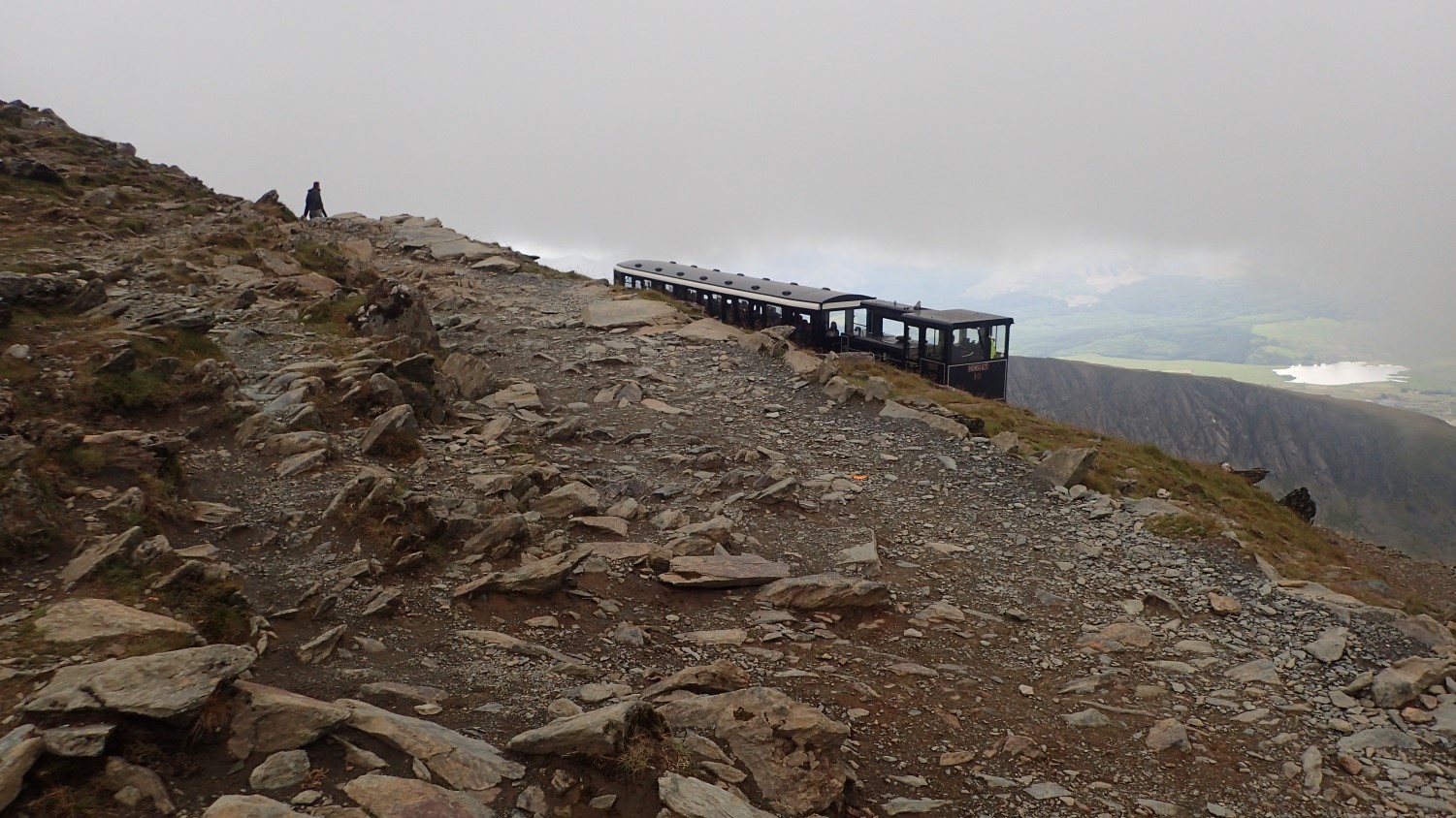
We even saw the train puff along ahead of us. If not for the sight of passengers waving, I found the smell to be unnatural – and, quite frankly, unwelcome – for a mountain summit.
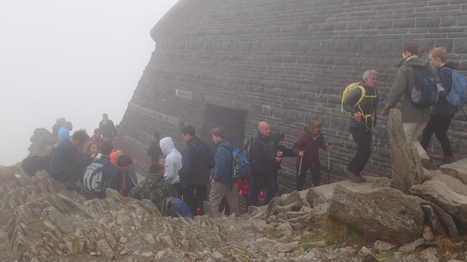
Speaking of smells, the could ‘sense’ the visitor centre’s toilets from many metres away. Apparently, the taps weren’t working well either. I briefly entered the café area, only to do an about-turn at the sight of two-hundred people!

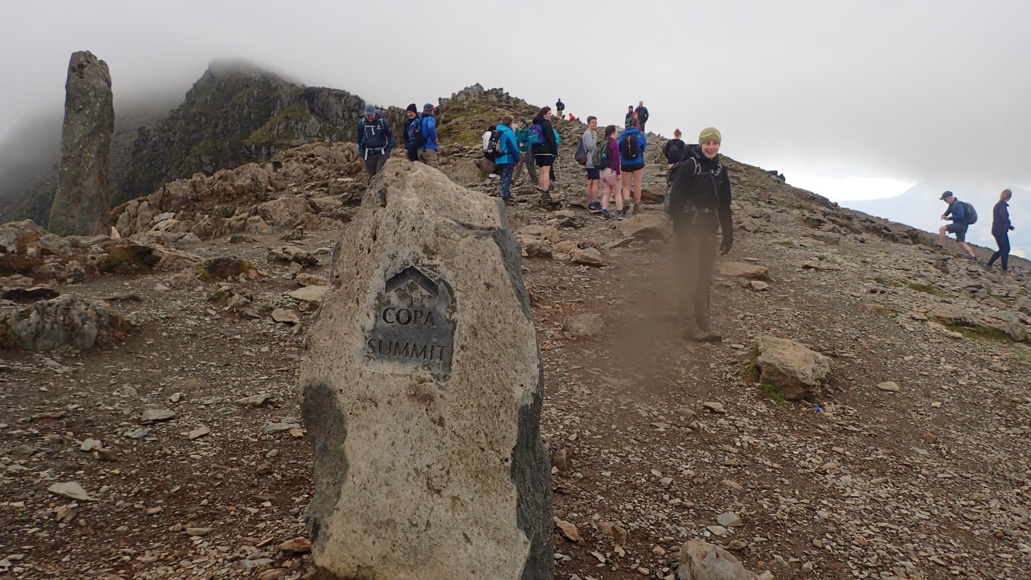
Naturally, we had to join the queue in heading up to the trig point. This was on a Tuesday afternoon, remember… Thank goodness we hadn’t arrived seventy-two hours earlier!!

There was no time to read or appreciate the markings on this toposcope. So many people; everyone waiting to stand on the highest point in Wales.

I’ve already said that I won’t bother with the summit of Snowdon again unless it’s for a very good reason. However, Both Scafell Pike and Ben Nevis are now greater priorities and to be followed by other less-touristy mountains around Wales.
I’m very pleased with all that we managed to achieve within those five days. I enjoyed and appreciated the company. Personally, I’m pleased to have ticked off Snowdon, to have overcome the challenge of Crib Goch and to have experience Tryfan – probably by most satisfying mountain experience to date. Tryfan is one I would definitely do again. Perhaps without the Glyderau!

Glad you finally made it to the top of Snowdon, I know you’ve wanted to get there for some time. The other walks look excellent too. Whilst I’ve been to Llangollen, I’ve now been over that aqueduct, and I hope to get there sometimes!
LikeLiked by 1 person
Thanks, Jon. I’m certainly pleased to have ticked it off and hope to visit Scafell Pike and Ben Nevis at some point.
As far as Llangollen and the aqueduct goes, you could probably work it in to a longer walk or day if you wanted. We were a bit pushed for time with the weather set to change.
LikeLike
One of my favorite walks has been Snowdon at sunset. Honestly it was beautiful and no crowds! Going down the Llanberis path is probably the safest in the dark and I know for some it’s their least favorite path but I thought the views where just as good as the Pyg and Miners track.
Thanks for sharing with us- Tryfan and the Glyders look amazing
LikeLiked by 1 person
I can imagine that. I had an idea to do the Llamberis path at sunset with a friend in 2015 but it never happened. I hope you get to explore Tryfan and the Glyders at some point. 🙂
LikeLiked by 1 person