Sunday 22nd July 2018
Waking up in the youth hostel of Streatley-on-Thames, I was downstairs in the restaurant at 8am (a time arranged the evening before) and ready for the full-English breakfast that would fuel me on for another fifteen miles of following The Ridgeway National Trail.

I didn’t need to carry any porridge with me or bother with making myself a drink. My breakfast was cooked for me and served around five-minutes after I’d sat down. While waiting, there was the option of helping myself to a selection of fruit, croissants and tea, coffee or juice from the side table.
It was a very well organised setup with only three other diners for company. I was quite happy to have paid an extra £5 for this service. But when my “full” breakfast arrived with only one sausage, a single rasher of bacon, one hash brown and a spoonful of beans, I felt as though it was “half empty” at best. Still, I didn’t complain. Partly because I’m British but also because it was well cooked.
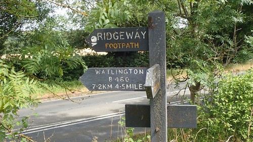
Leaving the hostel at 9:00, I would have to reach my end-point in Watlington at 16:00; the pre-arranged pick-up point and meeting time with my generous friends, Matt and Jo.
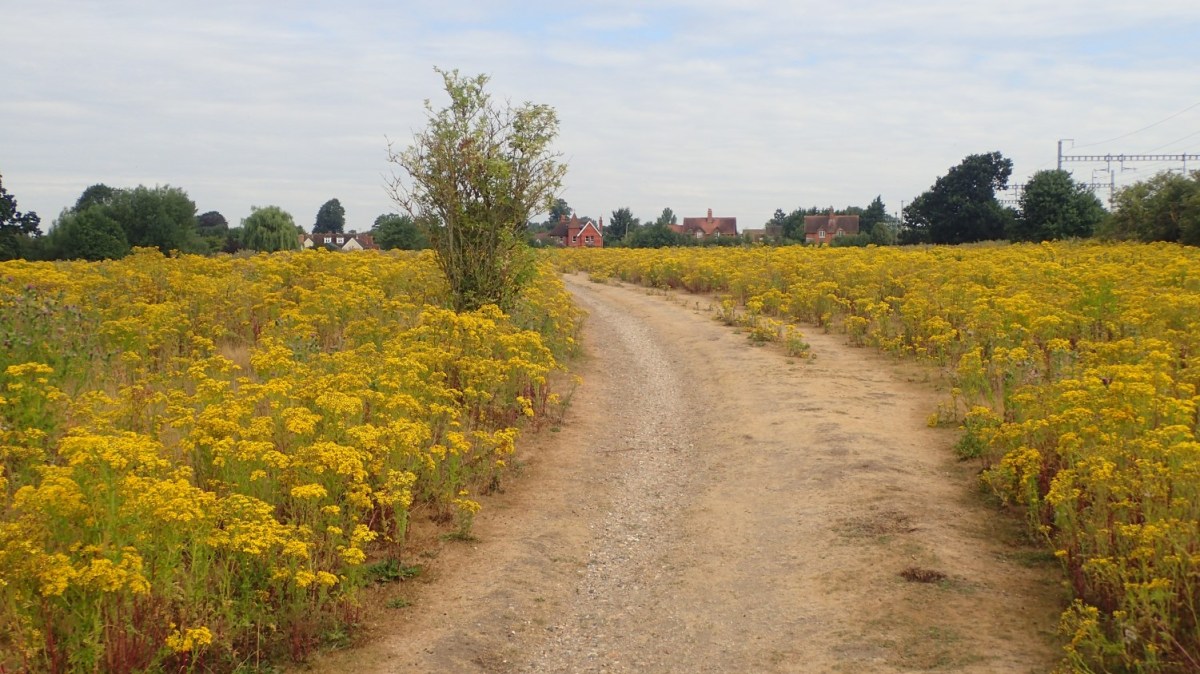
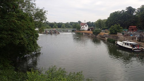
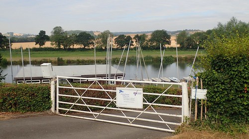
I picked up the trail heading east along the B4526 and almost immediately crossing the River Thames, while simultaneously walking the Thames Path for a couple of hundred metres at best.
I’ve had thoughts about one day walking the Thames Path but, at the best part of two-hundred miles long, it would require a good fortnight of walking and, right now, I’ve yet to properly complete five consecutive days.
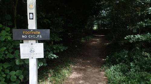
I knew there would be a left-turn coming up to continue north alongside the Thames. But, where the Thames Path was clearly signed, I saw nothing for The Ridgeway.
My suspicion was that this was because the next section of the trail is strictly a footpath for walkers only, where as much of the way up until this point had also allowed for cyclists and horse riders to follow… (I may be wrong).

Regardless; I turned left along Thames Road. Looking on Google StreetView now, I can see a sign for The Ridgeway on the lamp post at the road junction. It’s entirely possible I didn’t see this on the day.
Twelve-hours earlier, I’d read a preview of this day’s walk in my Cicerone guidebook and had imagined walking along the bank of the River Thames for these first two hours…
But, the reality was quite different. I could barely even see the river and I could only maintain a distance.

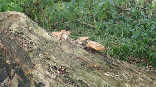
Withymead Nature Reserve was a brief but welcome distraction from this disappointment.

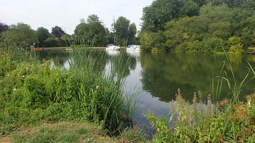
Heading in to South Stoke, I could see (and hear) the railway line that Matt and Jo had been using in their own strides along the Thames Path on this same weekend.

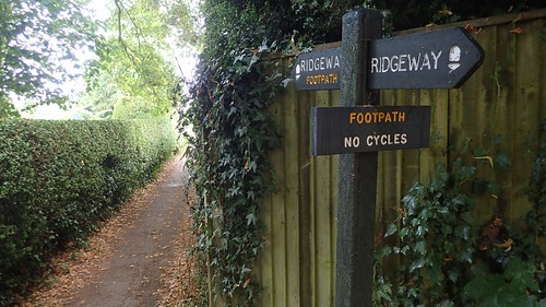
Generally speaking, The Ridgeway is as clearly and frequently waymarked and sign-posted as the next National Trail. But this sign upon entering the village offered great reassurance. I’d love to see this adopted by the rest of the UK.
Walking through sleepy South Stoke, I talked briefly with a trio of adults. I couldn’t work out which of the two ladies might’ve been the mother of the child the assumed father was pushing in its buggy. One of them, however, was very supportive of my efforts to walk The Ridgeway and commented on how many other people have and do stay at the same YHA where I’d just spent the night.
Just like the others who I would meet on this day; they were staggered to learn that I was walking fifteen miles all the way to Watlington. This was without mentioning my previous day’s hike of over twenty-miles from the west! I find it funny how I think little of these distances.
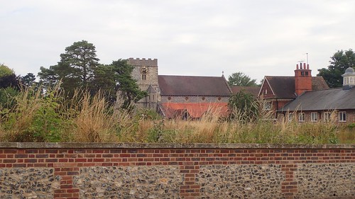
Already, this was the third church that I had seen on my day.

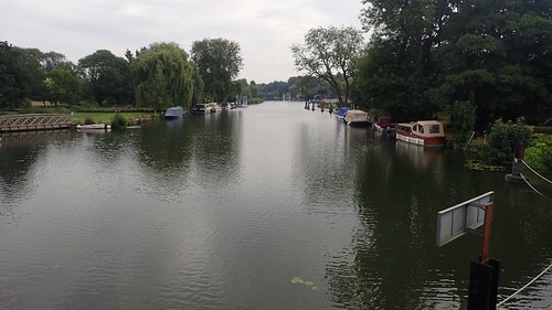
Shortly after passing, the trail heads west on a direct route to the eastern bank of the River Thames. At last!
There it was; the longest running river in England, I believe.
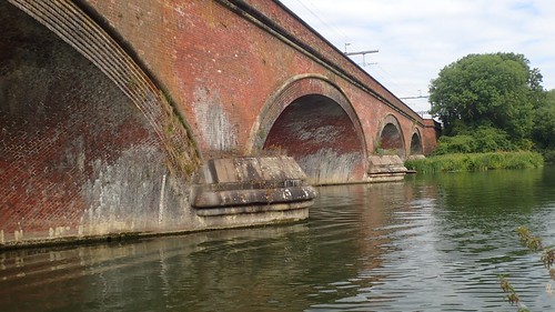
I passed beneath this mighty viaduct that carries the railway line across the water. If cyclists were permitted along this section, I could imagine it being as busy as the towpath between Bath and Bradford-on-Avon.
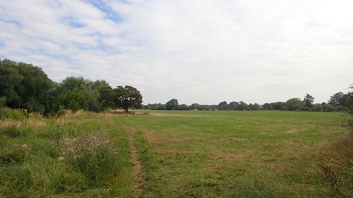
Almost losing sight of the Thames, the trail continues alongside open countryside. It was so green and unlike the previous forty-odd miles that I had covered across two days of hard, dry chalk.
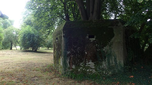
I spotted this pillbox just south of North Stoke. Taller than any that I had previously encountered. For such a wide and long-running river, I was a little surprised to have not seen any more thus far. A shame that it sits on the private side of a kissing gate.
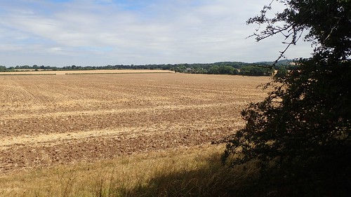
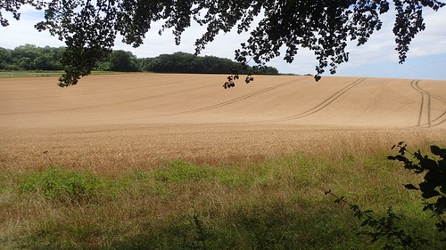
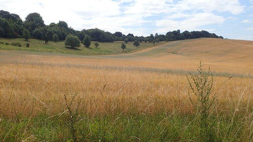
One of the next fields was as brown, barren and liable to burn as much of the British (and European) countryside has been during this ongoing heatwave.
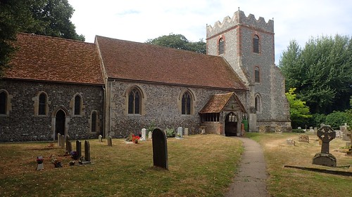
A sign at this next church informs that they doors were open and welcoming to visitors. But, running close to 11:00 now, I knew that a service would be due to start soon. Instead, I sat on a bench, admiring the western elevation and tucking in to my flapjack.
Before I could finish, I was joined by a well-spoken lady (perhaps in her sixties) who was curious to learn about my mutli-day walk as others have been. She spoke highly of the Chillterns and all I would have to look forward too; how one should explore the beech woodland in the spring for the reward of bright bluebells. She also told me I could expect to meet lots of people walking The Ridgeway… So far, I’d seen no-one!
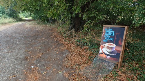
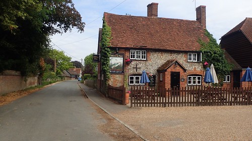
My route continued north towards Mongewell and I knew that I’d be following the A-road from there. By the way, Costa Coffee really do get in everywhere…!
Having said goodbye to the River Thames and with the sound of rushing traffic in my ears, I took a short detour out to the ruined church of St. John the Baptist.
Whoever owns the surrounding land, they don’t appear to be very welcoming to visitors near their home. One sign even suggests that you may be asked to produce ID! But the waymarking is adequate. I wonder, do they experience regular trouble, here?
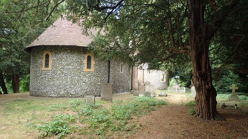
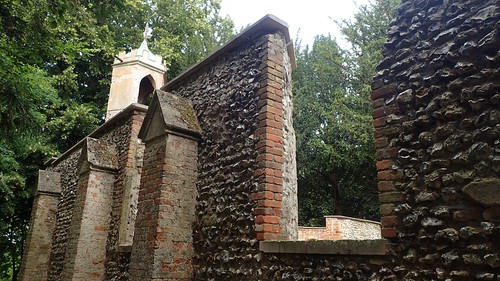

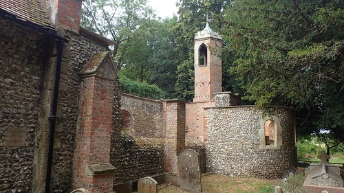
I felt a sense of unease from lingering within this space and soon returned to the trail.

In the bright light of the image above, a car races past along the A4130. Trees and a woodland walkway offered visual shelter for much of this section, even if my ears could not forget.
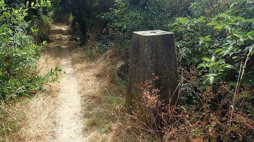
Continuing east, I followed The Ridgeway across the A4070. Ahead of the minor road junction at Cart Gap, I couldn’t help but stumble upon this trig point part-buried within the hedge and standing a mere ninety-eight metres above sea level.
As on the previous day, temperatures here were expected to reach in to the mid-twenties, if not higher. I was grateful for the wooded shade that I had received so far, along with the suggestion of an occasional light breeze.

I soon crossed my halfway point before marching on past Morrell’s Bottom. Deep in these woods, I met a group of four teenage girls, sat helplessly on the floor and who told me they were lost, didn’t have a clue as to their whereabouts and asked for my assistance.
I was quite surprised that they hadn’t realised they were following a National Trail, on what was a very brood and obvious path running beside Grim’s Ditch. They did have an OS map with them and offered the reassurance that would guide them on their way.
Thinking back, I wonder if I could’ve done a bit more to try and help them see and understand where they were and how they had arrived at said point.
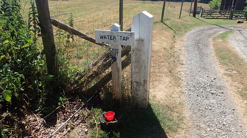
Emerging from the other end of the woods, I almost missed this water tap (meaning: I walked past before realising and making an about-turn). It was at this point that a man asked me if I had seen a group of girls with rucksacks… He was clearly responsible for them and I reassured him that they were not far behind me and were on the right track. I also overheard him on the phone to someone at the church I knew the girls were heading for.

Grim’s Ditch is a form of prehistoric earthworks that closely follows The Ridgeway trail for five-miles, heading across Oxfordshire as far east as the Chilterns. It’s original purpose is apparently unknown.
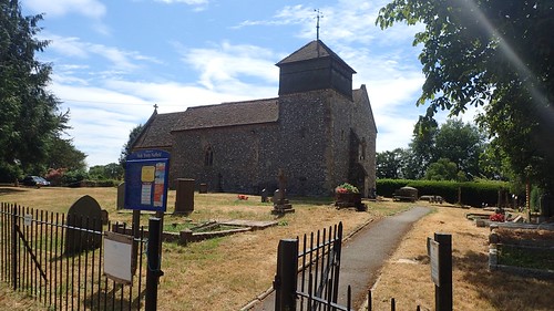
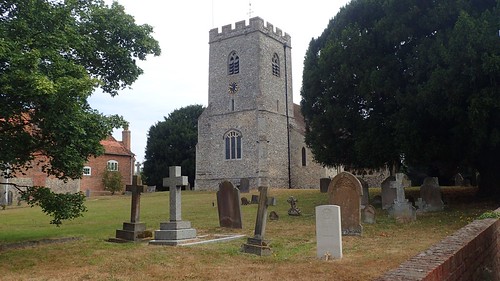
This was the Holy Trinity at church at Nuffield. My guide book talks about the short deviations to holy and historic points along The Ridgeway that can be made. But, when you’re trying to cover fifteen-to-twenty miles each day, these little breaks away from the trail are less appealing, in my opinion and perhaps best suited to those completing the trek in smaller chunks.
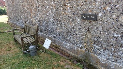
Nuffield’s church not only boasts a water tap that’s available to use all year round but another sign indicates that TEA is available inside! All they require in exchange is a donation. If it wasn’t so hot outside, I would’ve invited myself in. I only hope I didn’t pass on the possibility of finding cake served alongside…
I’ve mentioned previously on this blog that I don’t like walking across golf course. In the majority of my own experiences; they put up signs advising you to ‘stick to the footpath’ but don’t offer any form of waymarking beyond that to guide you on your way. Satellite-navigation and GPS tracking are almost compulsory, while keeping an eye open for airborne golf balls.
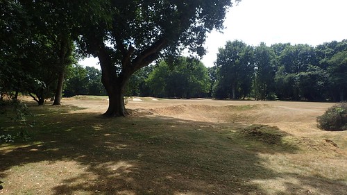
Fortunately, I didn’t encounter any difficulties across Huntercombe Golf Club, moving from one white-topped post and on to the next. I only had to pause and allow for one golfer to take a swing (I don’t think they were willing to give way to me, even if they were alert to my presence).
Interestingly, Nuffield Common (on which the golf course resides) is open access land. But, if I tried to traipse around the perimeter, I can imagine someone waving their nine-iron at me in anger.
Skirting around a housing development, I would meet this road crossing of the A4130, with a sign suggesting I was less than two-hours from finishing and looking likely to arrive ahead of time.
A quintet of teenage backpackers approached from the east. I assumed they were also walking The Ridgeway (I could see they were carrying sleeping kit and all) but, had they taken a wrong turn? Or were they also as wary of golf courses as I can be?
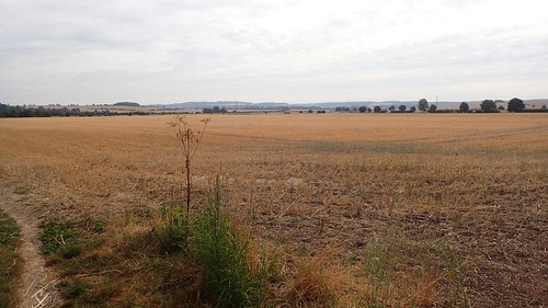
Walking north now, I’d cross one cropped field (with a distinctly clear path), followed by a brief sense of respite in the woods. Then, it would repeat; hot, open field, followed by shading trees.
I continue around and past Ewelme Park before setting myself down on to a fungus-feeding log in Jacob’s Tent [woodland, not an actual tent!], at the head of a downward slope. Allowing the other backpackers to carry on, I rested for a good half-hour here while enjoying my lunch. Other day-walkers would huff and puff their way up the hill as I rested.

After lunch, I passed another church, crossed a road and continued to follow the trail downhill. Having now descended for the second time and without regained that lost height, I knew that a climb was on the cards – almost immediately after and it was the toughest ascent of my day, without barely a couple of miles of walking to go.
I followed the byway from North Farm, past Icknield House and on to the road junction beside White Mark Farm – this was originally going to be my camp site for night three and it seems to be a popular choice for Ridgeway walkers.
I’d only have to walk another kilometre north-west up the road to arrive at the Watlington car park where I’d arranged to be collected.

With time to spare, I decided to head up Watlington Hill. Suddenly, I’d caught up with this four teenage boys who should’ve been thirty-minutes ahead of me… Pausing with uncertainty, they asked if I knew where the camp site was (basically, the leader had made the easy mistake of recognising the ‘camp site’ icon but not spotting the blue line pointing to its precise location across the track.
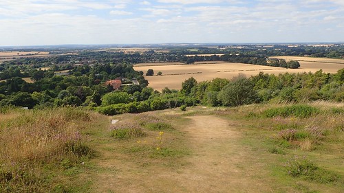
Back down they went, as I climbed up looking for the White Mark…
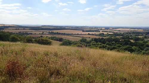
Looking for a tall obelisk, painted white, I found nothing like it, close to two-hundred metres above sea level. Even with the assistance of GPS on my phone, I was unable to locate it and retreated down to the road.

Since returning home, I’ve read that it is, quite literally, a White Mark – closely resembling an exclamation mark in its appearance – that can be seen from a distance to the north. I didn’t capture that in any of my photos but will look to do so at the beginning of day four.
I didn’t have to walk far up the road before Matt and Jo arrived, kindly saving me the bother of having to trek along the hot, dry pavement. A plan that ran smoothly and, once again, I’m extremely grateful for their time and assistance.

I really like the Thames path. I first walked it about 15 years ago. The trail is, as you might expect, almost entirely flat. Just a few bridges to cross and one hill on the edge of the Chilterns. It has been such a lovely summer this year I’ve been re-walking sections of it after work of an evening sometimes (from the flood barrier to Staines, so far). I do recommended it. Although there is a lot in a large city (London) most of the path west of the centre is really rather green and lovely, and you pass lots of attractions (Hampton Court, Kew Gardens, Parliament, Tower of London, Tower Bridge, London Eye, Greenwich (World Heritage site) etc, there is a lot to see).
Once out of London you contihue through interesting places like Windsor and Oxford and some very pretty ones too (like Marlow and Henley). You could do a lot of it in winter too, since much of the path is surfaced (tarmac or gravel). Though some sections need to be as they are subject to tidal flooding. It’s a very easy to plan as day walks too since there are stations at regular intervals as far as Oxford.
LikeLiked by 1 person
Hi Jon,
I’m glad to hear you liked the Thames Path and that you’ve been re-walking sections of it. Who could’ve predicted this summer!
I did have a thought about doing it last Christmas, during a week off work… But then I realised it was nearly 200 miles long! I’m pleased to hear that, compared to The Ridgeway, it is well-served for transport links. But I guess that’s not hard to believe, as the river would’ve been used as a trading route some time ago. I hadn’t thought about the risk of tidal flooding. I saw a video of someone walking the Peddars Way or Norfolk Coast Path in the spring and one of the nature reserves was completely underwater. Even on the boardwalks, he it was almost up to his knees. But then, we did have an extreme winter.
LikeLike