
Saturday 25th August 2018
This was a 13 mile route that I had devised and plotted myself, to lead Brunel Walking Group on what was our second day of a long-weekend camping in Cornwall. As far as the weather was concerned, it would also happen to be the stand-out most beautiful of them all.
I’d decided that we would start the walk from the National Trust car park at Godrevy. National Trust members (like myself) can park here for free by scanning their membership cards at the machine to receive a ticket. While non-members have to pay £6 to park all day… Which may sound like a lot but, we typically arrange for car-sharing and pack people in to vehicles who can equally contribute to such costs (and it’s still cheaper than parking in St. Ives).
I’d given clear directions to the other drivers (head north up the A30 past Hayle, then come in and join the B3301 running parallel to the coast) but, for some reason, refused to follow them myself. In fact, I did the opposite; following the B3301 through Hayle and then joining the A30 heading north…
Several miles later, we left the A30 at Camborne (I realised before this that I’d made a mistake) and it was with great thanks to my two passengers that we were able to forge our way to the car park, much later than expected. But, at least the walk couldn’t begin without me and I’d provided an extended tour of Cornwall!
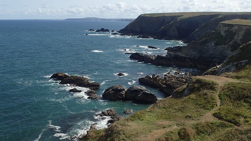
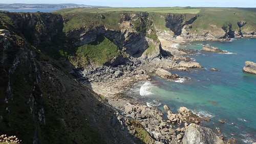
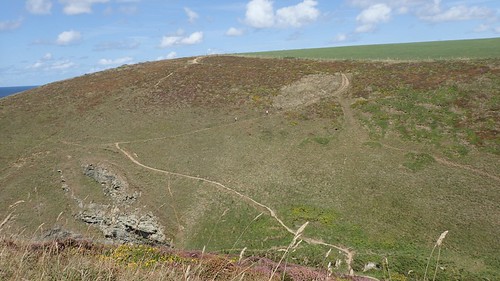
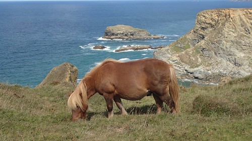
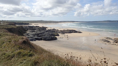
At Godrevy (at last), we found the main car park was full but we were directed to the overflow field, where they must’ve had room for another hundred or so cars (you can just see it in the photo above). A day later, the whole car park would be closed due to the impending wet and windy weather. I imagine the mass of four-wheeled monsters would destroy the land.
I felt quite a relief to be able to begin the walk with everyone present, cars parked up, ticketed and people within the group were in good spirits. We began by following the South West Coast Path clockwise, in the direction of Portreath.
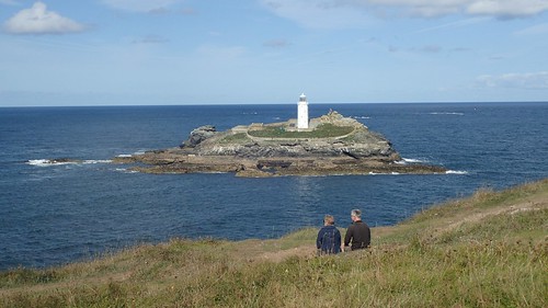
From Godrevy Point, we could look out to the iconic lighthouse on Godrevy Island.
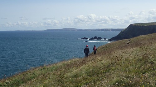
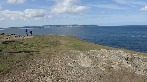
Further north-east and at the end of our view, I believe that’s St. Agnes’ Head pointing out to sea. Having recently completed my first National Trail and long-distance footpath [more on that, soon], I’ve been wondering about how feasible it would be to one day walk a good stretch of the SWCP. Southern Cornwall, for me, is a good three-hour drive from home, which puts it almost in line with Snowdonia and the Peak District.
While this coast path is a National Trail in itself, I can see myself tackling another hundred-mile route in the more immediate future.

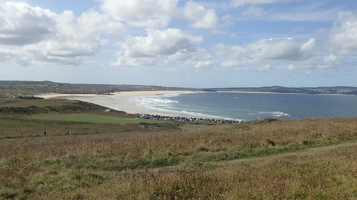
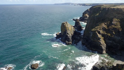
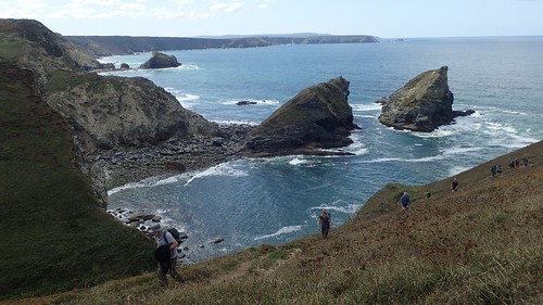
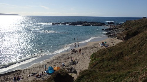
There were many points along this stretch of coast, heading east now, where we could pause and become amateur or enthusiast photographers.
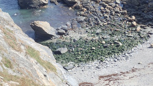
I wasn’t the first to spot this but seals could be seen basking along the bay far beneath us.
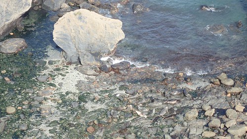
Perhaps this shot will display them more clearly. I’d never noticed seals on a walk before but they are known to be common in this part of Cornwall. We weren’t the only admirers on this day.

A brief climb soon followed, as we reached what would be our only trig point of the day at The Knavocks [it does sound like slang for male testicles, doesn’t it?!]; a mere 76m above sea level. I was impressed by the structure of the trig itself, which was more befitting what I might expect to (one day) see up in the Lake District.
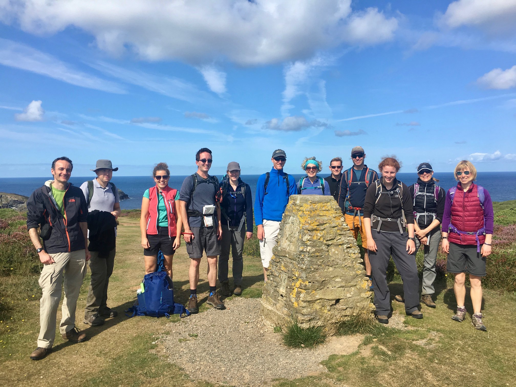
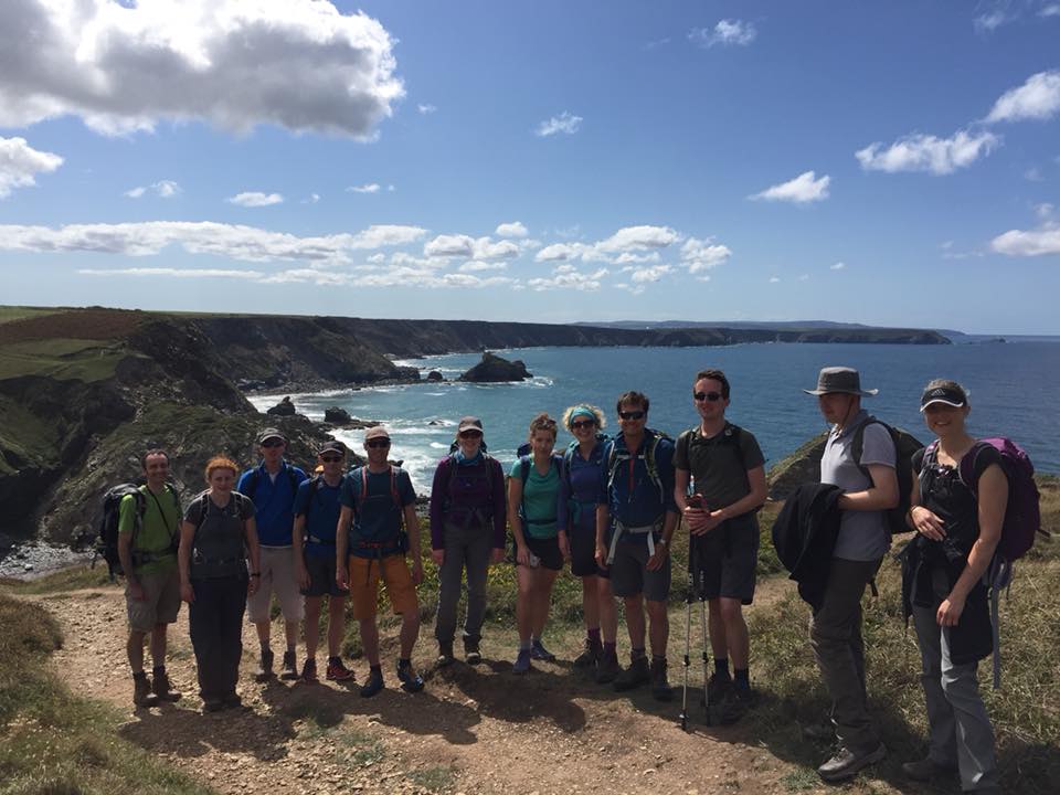
My thanks go to Nick for this first group photo, which I’ve acquired via Facebook.
After pausing for a snack break, we continued on. I felt a temptation to pause frequently and take more photos… But I also realised that, each time I did so, the others would follow and, consequently, we were reducing the overall pace of the walk and potentially extending the finish time.
I don’t like to shy away from the opportunity of taking a photo (unless I’m set to appear in it) so, it’s really about striking that balance, in my opinion.
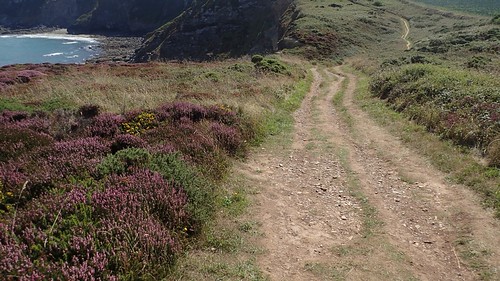
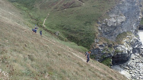
I find it can be tricky to accurately read and understand the contour lines when studying a route that follows a coastal path. There were a few undulations along the way. But, nothing (yet) quite as significant as I might have feared.
We followed the weaving coast path; in towards the road, then back out to the cliff edges. In again, then out once more.

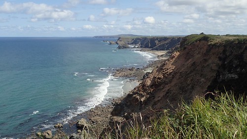
It was beyond Reskajeage Downs that we would encounter our first valley crossing, with the option to cut a dramatic chunk off the walk by heading inland along a byway at this point. I almost made this mistake, as I was mostly following the route from memory and my lack of mobile data signal was preventing me from loading the saved route in OS maps.
In fact, I’d made a school boy error in preparing for this walk… Everything had been plotted online and I was confident that I didn’t need to buy another paper map or print one off as I purchased a map that included St. Ives back in 2016…
But, we were several miles north-east of St. Ives, now and, as I’d realised the previous evening; only one-third of the entire route (the western half) was visible on my paper map! I managed to scrape by though, by loading up a few extra squares on my phone.
Not long after that first valley crossing, we arrived at the breach of Carvannel Downs. My aim here was to leave the coast path and follow a public right of way, heading south-east and without losing height, to the head of the valley before us…

According to my map and the three of our GPS readings, it would pass directly through the barbed wire fence you can see to the right of the photo above. I felt I was passive in allowing two other group members to climb over and soldier on, while I held back with the rest of us.
No waymarking and no suggestion of a stile, gate or route of passage. But it was as clear as day on the map. Realising we could bypass the curious cattle without incident, I encouraged us all to scale the fence in some belief that we’d be able to pick up the path and continued on (‘sticking to the plan’, you might say)… But, we couldn’t. I didn’t spot it straight away but, according to our GPS units, the right of way was next terminated by a stone wall. One that looked as though it had been present for a number of years.
I found an ounce of assertiveness and lead everyone back to the coast path, where we’d stop for lunch overlooking the valley, before I’d decide upon our next move.
We would end up crossing this valley after lunch. I don’t like to turn back on my walks, although the option of that aforementioned shortcut was tempting.
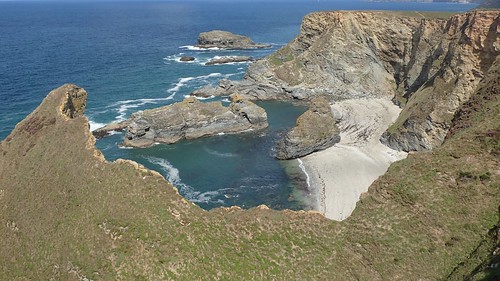
It was all good and well. We were extending our walk along the coast and, had we not done this, we’d have missed out on the spectacle of Porth-cadjack Cove.

Look closely and you can see shallow caves undercut in to the cliffs. My memory suggests people were on the beach. We’d spotted a number of surfers along much of this coastline.
According to the map on my phone, we’d be able to follow another right of way, running parallel to the obstructed one and towards the same desired point at the head of the valley…

While this second option would apparently run down the outside of the fence you see above, I couldn’t see any appeal in following it. If, even, it did exist!
As was pointed out to me at the time: in the photo above, you can see where barbed wire had previously been cut to allow access for some reason… It may’ve been for land management and not a self-righteous ramblers. But something was very amiss with the right of way network in this immediate area.
I’ve reported both of these incidents directly to Cornwall County Council. Sadly – and, unlike many councils around the country – they’re lacking the resources to investigate every single issue. Apparently they’re receiving a high number of reports this year. As these instances were deemed to be ‘non-threatening’ to public safety, they cannot be issued with the priority required for immediate investigation.
I may hear more on this in the future but, I’m not holding my breath.
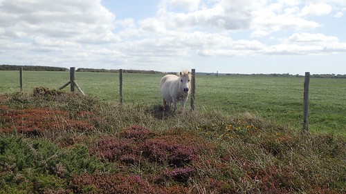
Continuing clockwise for another few hundred metres, there’s a point on the coast path labelled as ‘The Horse’.
Both of these specimens are genuine horses. HOW they knew to just stand there though… I’ll never understand!

Here’s another photo from Nick, where I can be seen leading the herd over a chained and padlocked gate. According to the latets OS mapping, a permissive footpath (orange dashed line) runs through here… But, upon reporting the presence of a chain, I’ve been told by the council that it is not a designated right of way and that they will not investigate any further.
Well, legally or otherwise, I led the group along here, passing the buildings of Carvannel Farm and to a road crossing that would see us back on track.
From here on, I didn’t really take any photos. I was conscious of the time we’d lost due to path obstructions, my own moments of hesitation, the numerous photo opportunities we’d taken and my great mis-direction in driving to the car park. I wanted to press on and keep the pace going. At the same time, my need for navigation was going to increase as we’d left the easy-to-follow coastal route and would now be crossing farmland, joining woodland tracks and the occasional quiet road.
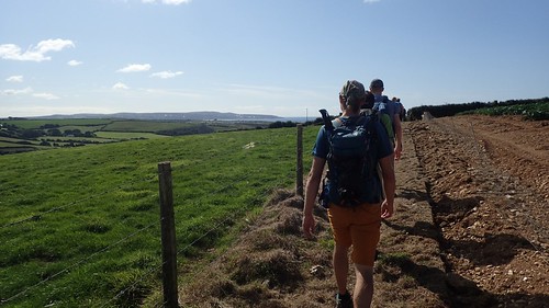
Basically, we joined a bridleway at Eastern Lodge, headed west through the woods of Tehidy Country Park to Coombe, then following the Red River in the same direction, to follow a field path from Menardava to the quiet road, ahead of a precarious walk along the busy B-road and returning to the cars. I recall issues with unlocking and securing a couple of field gates.

We did make an impromptu ice cream and cold drink stop at Poldcrowjy Tea Room (post code: TR14 0JG) before entering the Red River Valley. I’m grateful to the few who asked if we could stop there as it had barely crossed my mind, in a determined effort to finish the walk in time.
I like to think that my walk was one of the highlights of the weekend and largely due to the weather.
We didn’t have time to head down to the beach, while the other half of our group had decided upon a much shorter walk that required a certain amount of time to be spent in the (apparently cold) water.
Godrevy was clearly a very popular place to be and for so many reasons. I’m pleased they were able to accommodate so many cars and tourists. I had a back up plan in place, to use one of the ‘free’ parks along the north coast, had there not been enough room.
It was a good walk all round and there was not a single complaint – which is just the way I like it! We would arrive back at the camp site in good time before the barbecue had even started. I’d enjoyed the experience of walk leading, even with the few minor altercations before and after lunch. With the exception of my most recent walk prior to this, I’d been experiencing a ‘lull’ in which I was happy to lead walks but, ultimately, I wasn’t enjoying the experience.
Our necessary diversions to complete my route only cost us an extra half-a-mile of walking.
Distance of this walk: 13.5 miles
Sadly, this would be my last ‘action’ in Cornwall that weekend. I had a solo walk in mind for the following day (the Sunday) but, if you remember the August Bank Holiday weekend well, it started raining heavily at 4am, the wind had changed direction and it was farm from the best of days to be following a coast path… Plus, I would still have to make the three-to-four hour drive home, which was completed in time for the early afternoon.

I’m glad you enjoyed this route despite the problems with footpaths. I always rate the very western part of Cornwall as my favourite stretch of the coast path in Cornwall. Basically the area that I refer to as Penwith (roughly Hayle in the north to Penzance in the south), though the Council of the same name (Penwith) was abolished about 10 years ago I think.
I have heard Cornwall Council is very good about maintaining the coast path but that the inland footpath network was poorly maintained, which seems to match your experience. Probably not worth it if you are not going there regularly, but there is a legal process you can follow to force the Council to remove obstructions (Highways Act Section 130). I did have some success with this with Dorset County Council who had failed to removed obstructions from a path for many years, though I did not have to go as far as actually taking them to court. I do find Councils always claim lack of resources with footpaths (which they legally are required to maintain) but somehow always have the money to spend on lots of projects they don’t need to do and aren’t legally required to do, so I always take claims of lack of funding with a pinch of salt. I think it’s usually down to having their priorities wrong.
I highly recommend all the South West Coast Path if you want to walk another National Trail. You don’t have to backpack all the way (I know you struggled with that on the Ridgeway). I did it all as a series of day walks, using buses to get between places along the coast. So then you only need to carry with you what you need for the day. I only did one walk where I had to walk “up and back” and that was in South Devon, rather than Cornwall. I did post details of the bus services I used on all the walks I did in Cornwall on my blog (see https://britishcoast.wordpress.com/category/cornwall) though the bus company that ran most of the buses (Western Greyhound) has since gone bust and I haven’t gone back to updat the links (bus routes change so often, it is hard to keep it all up to date), but I think most of the places where I used the bus still have a service even if a different route number and/or operator.
LikeLiked by 1 person
Sorry no ability to edit comments … but I meant Penwith is the area roughly west of a line drawn from Hayle to Penzance.
LikeLike
Hi Jon,
Thanks for reading and for your comment.
I found that some councils are certainly more pro-active in responding to reports than others. But they’re certainly in the minority! With a National Trail, I believe it’s easier as another team (sometimes volunteers) can be commissioned to carry out the work (I used to know someone who was a project co-ordintor for much of the western half of The Ridgeway, a decade ago. The volunteers under his management were reformed individuals (homeless, released from prison) looking to find their way back in to society.
Locally, I find that both North Somerset and Bath & North East Somerset are generally very good at responding to anything I report. I’ve seen improvements made within a matter of weeks, if not days. Whereas, Somerset and Gloucestershire are more like Cornwall, sadly. I’ve heard that Powys is quite bad, despite its size… Apparently they won’t even acknowledge the existence of one long-distance path (it might be the Cambrian Way). I know that path maintenance can be an expensive business. I was asked to look in to organising a weekend of it for our walking group but would told it would costs thousands of pounds for the training to use a few simple power and hand tools! I think Councils are happy to be seen to be spending money in areas that the media will take notice of.
A friend of mine has recently finished walking the SWCP. She started 6 years ago, taking one or two weeks each year to progress a bit further and, finally, the 630 mile long trail is complete. I’ve made some improvements to my backpacking arrangement and was able to complete The Ridgeway last week (more on that, soon). I will take a look at your post. I sometimes find public transport can appear complicated and not always as convenient as hoped.
LikeLike