Wednesday 5th September 2018
An entire month had passed since my previous outing (Days 2 and 3) along this National Trail. August had been a fairly busy month and for a number of reasons (mostly, walking-related). I was also fearful of heading out at a time when the majority of school kids and working parents were likely to be outside… Overpopulating spaces, crying and congesting public transport systems.
In the first week of September, I decided that the time was right for my return to complete my final two days of walking The Ridgeway. Everything had been planned out in advance and it began with a drive to Watlington.
My destination was Watlington Hill and the free-to-use National Trust car park to the east of it. My SatNav said this journey would only two two-hours but I lost an extra half-hour due to the city centre traffic of Bristol at 7:30. With the benefit of hindsight, I now think I’d have been better off leaving home the previous evening and camping at White Mark Farm; ready for an early start to Day 4.
With regards to the car park, I’d read one negative review relating to the high risk of crime in the area. Upon my arrival, I found Police notices adhered to many trees and examples of broken glass spread all around the parking area. With some concern and reluctance, I left my car and began the day’s walk. My had was locked and with nothing valuable left in sight.
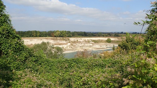
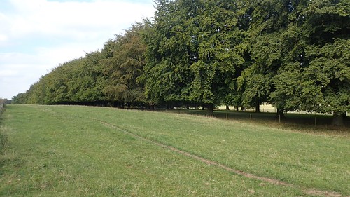
Through the woods, heading west and I would climb to the top of the hill and where I reached at the end of Day 3’s walk, with a view of Watlington down beneath me. There is only one car park in the town and its hours of use are restricted during the day.
I continued my decent alongside the White Mark. Back in July, I hadn’t appreciated this man-made form in the chalk.
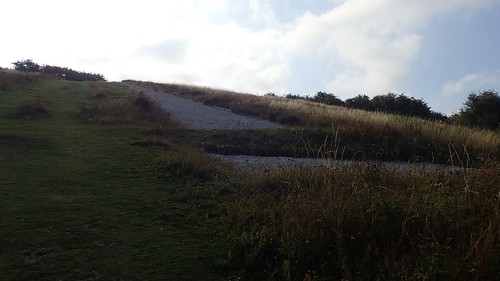
From lower down, you can see it almost resembled an inverted exclamation point or an inverted ‘i’.

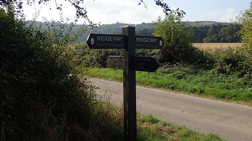
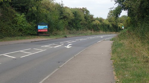
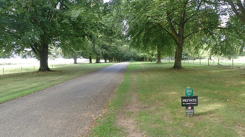
Across Hill Road and I was back on The Ridgeway!

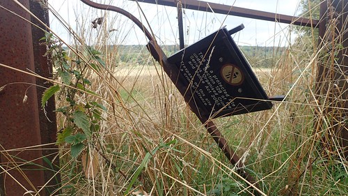
From reading the Cicerone guide book the night before, I was ware that I could’ve potentially left my car at this point on the trail. But, as you can see, there is further evidence of broken glass! Such a shame. It’s not always fair to blame the car owners. No-one deserves to have their rear windscreen broken.
A few hundred metres on and I would cross the Oxfordshire Way; earmarking this way as a more direct return route to my car, depending on my travel plans for the Thursday evening.
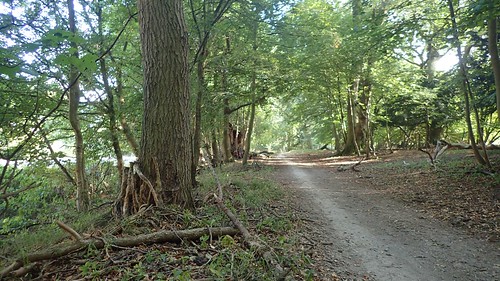
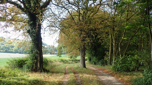
I found myself walking beneath trees, as The Ridgeway is joined by the Swan’s Way. Reminiscent of the trail I covered on Day 3.
But I was also treading on that hard and familiar chalk that characterises so much of this National Trail. With views of the occasional hill and nature reserve ahead. At least wasn’t even nearly as deeply rutted as the early sections heading east from Wiltshire.
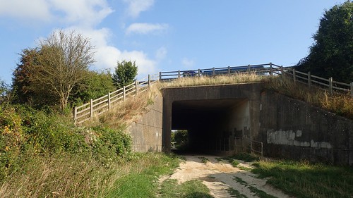
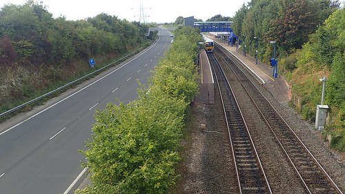
I would pass beneath the busy M40 motorway, whose traffic could be heard from some distance away, both before and after this point. No artwork on the walls of the underpass, this time.
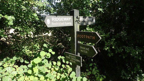
Shortly after the M40, I passed a sign for the next water tap along this trail and my first of the day. This is just before the crossing of the A40 and, although I didn’t visit it, with 2 litres of water in my rucksack, it’s said to be outside one of the barns at the farm. But the signage is good.
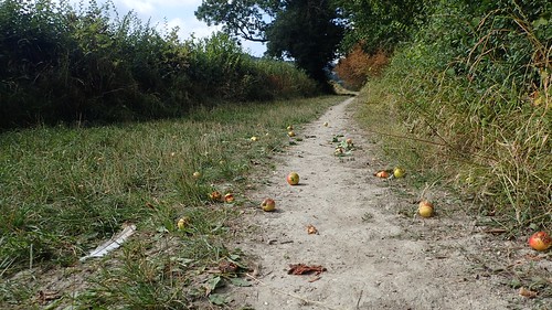
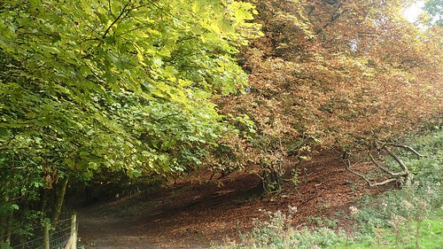
Heading onwards, I noticed the early signs of autumn creeping in.
This was a warm day. T-shirt weather, with temperatures up in the high teens. I thought about how less comfortable the situation could’ve been, walking along here a month or two ago, during the peak of that long-running heatwave we experienced.
I looked forward to walking on cooler days and with a good excuse to wear long sleeves and gloves.
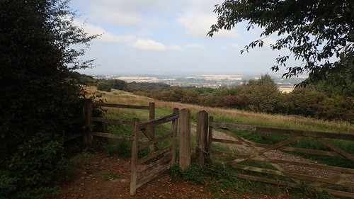
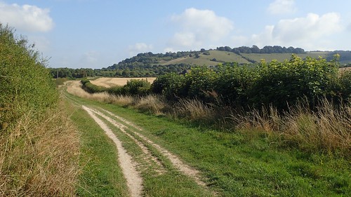
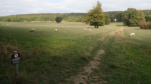
There was what looked like a former quarry and chalk pit away to my left, as I continued past the village of Chinnor – a potential return point upon completion of the trail.
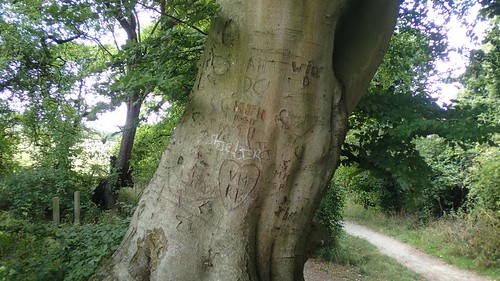
I passed another nature reserve ahead of Bledlow, where several previous visitors had carved their names in to a tree.

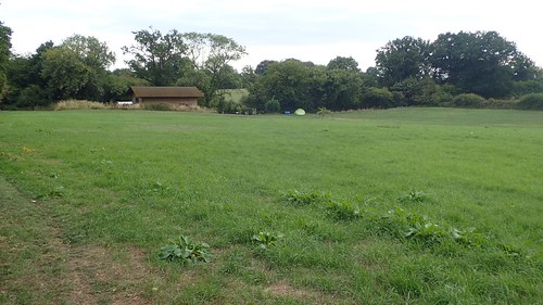
It was somewhere around here that I spotted a picnic bench to my left, in what looked to be a vacant playing field, free of dog walkers and kids. Seating has been very uncommon along The Ridgeway, in my experience. So, I decided to take the opportunity to sit quite comfortably eating a couple of my snacks; namely a home-made flapjack and breakfast bar.
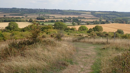
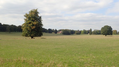
A theme of sheltered, woodland walking continued as the way soon turned east. Leaving the trees, I could see shallow hills in the greater distance… Was one of those Ivinghoe Beacon? The end-point to my long-distance walk that I would reach in a little more than twenty-four hours?
I was both pleased and surprised to find that The Ridgeway leaves the dry, chalk byway in favour of a walk across fields. While I paused to savour this, a friendly runner overtook me from behind. She was not the first runner I had seen on this morning and they’d all said hello.
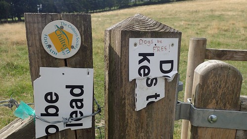
At the far end, I found that someone Chiltern dog walkers would prefer their pets to be able to roam free… This is not something I agree with and particularly when livestock are present. This is why extendable leads were invented. There is always a right time and a right place to allow a dog to run free.

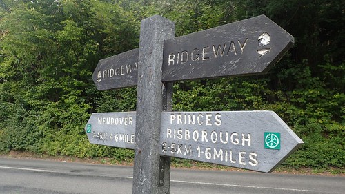
I was soon heading towards Pricnes Risborough and only ninety-minutes away, as I took the photo of this sign. If you’re walking the trail yourself and find yourself in need of refreshment or food supplies, this may provide a worthy diversion and the trail passes close by the edge of the town.

But, of course, I’d packed and was carrying everything I was going to need for these two days, including my full camping kit. All of which adds to the strain of climbing up Lodge Hill.

This was my first sighting of natural poppies since I began walking The Ridgeway back in June; on that agonising day where I walked with twenty-five miles with an uncomfortable and unbalanced rucksack, with the consequences felt down the outside of my left leg.
So far and, several hours in to Day 4, I’d not felt any such discomfort, even though I felt consciously aware that ‘might’ kick in at any given moment… I’d managed to carry a good 2kg less [I’d like to reduce this further still] than when I started this walk and my rucksack generally felt more comfortable.
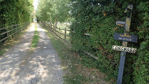
I was pleased to encounter another section of the trail where cyclists were prohibited from following. Up until I started this walk, I’d only believed that it was possible to cycle The Ridgeway in its entirety… But, no. I’ve realised along the way that only the western half (Overton Hill to Goring) is fully accessible by bike and on horse.

Following a border of trees on either side, I realised I was on the local golf course. As I’ve mentioned before; I detest walking across these spaces as, even where the right of way network exists, the signage is often non-existent and the average golfer is unwelcoming to a walker looking to cross ‘their’ path.

Fortunately, I found nothing to worry about, here. I saw the occasional sign, warning of ‘flying golf balls’ but The Ridgeway doesn’t cross any of the greens and, just like on the Cotswold Way near Lansdown (and on my previous walk), the warmarking is excellent.

South of here, this line runs down to High Wycombe. Going north, it passes through Bicester in Oxfordshire.
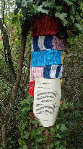
I found my first of several ‘Rhymes of The Ridgeway’ installations wrapped around this tree. I’m not sure of the intention but, with the photos I have, I may dedicate them to their own post.
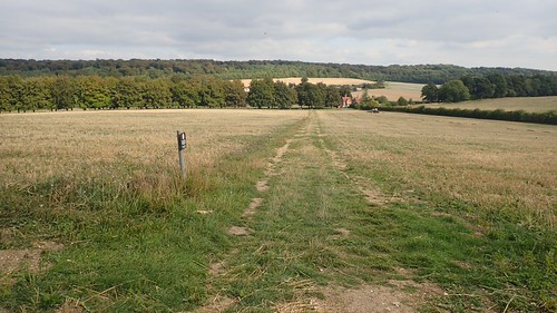
Crossing a couple of fields, I would then follow the A4010 north towards Princes Risborough, where I noticed this sign for the Kop Hill Climb.

It’s potentially viable to take a diagonal shortcut across this field and skip a short section of this roadside walk. I decided not to, as I was trying to follow the trail as complete as possible.
Passing a school, I would slowly begin my next climb with a very chalk-like field to my left.

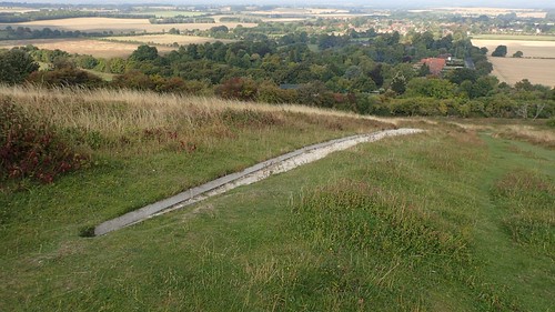
Look closely and you can see what I believe to be the chalk carving of Whiteleaf Cross, just east of Monks Risborough.
There was a steep, stepped climb up Brush Hill.

Close to the top, I could admire the views, the toposcope and I would soon be caught by a pair of day walkers who I’d overtaken earlier.
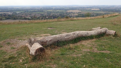
…Not being local to this area, I wasn’t familiar with any of the highlighted features. I’d wanted to photograph myself up here but, with people coming and going, up and down the hill, I felt too self-conscious. Instead, I acquired the bench (my second of the day) and stopped for lunch.
Crossing the next hill, I continued up to Whiteleaf Hill, having forgotten all about any possibility of looking down over the edge to try and spot the chalk cross.
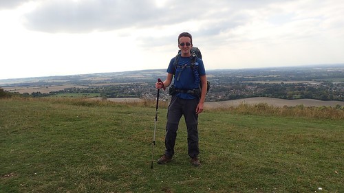
I was more concerned with getting a photograph of myself, using my walking pole as a monopod (but balanced against the log-seat you see above).
Now, I was just ninety-minutes away from Wendover; shortly beyond which, I would find my camp site for the evening. The Ridgeway passes through this town and, again, if you’re looking for a refuelling point along the trail for yourself, it seems like a great option.

I passed a pub called The Plough on my walk – beside which, there is supposed to be a water tap that you can use. I was disappointed not to find any of the familiar ‘water tap’ signs from earlier in the trail. Perhaps the owners fear it would discourage visitors from buying drinks? I trust it’s otherwise there and accessible.
It’s also the last available water tap, heading east along The Ridgeway.
I would climb again, up on to The Grangelands and Pulpit Hill.
Autumn was bringing this landscape to life, in the inevitable passing of the many leaves.
Following the Cradle Footpath around the Chequers Estate, I knew what would come next…
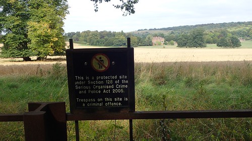
A great point from which to fire a rocket launcher or sniper rifle, as you’re legally prohibited from leaving the public right of way… As on any public land, really! I think the mention of ‘serious crime’ is only in place because this is the Prime Minister’s residence.
Heading east towards the gatehouse, these warning signs remain constant. I found it interesting that there was no National Trails acorn emblem on either of the gates I walked through.
These tree-lines bordering the driveway to the house were apparently planted by Winston Churchill. Undoubtedly, one of the most-respected leaders we’ve had in this country’s history.
With CCTV cameras burning the back of my skull, I took this shot looking down the driveway. I felt a temptation to walk down the middle of it and count how long it would take before response vehicles would interrupt me…
Across the driveway and those warning signs remain. For all but the exception of sheep, who can apparently wander wherever they like.
One last look.
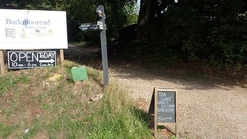
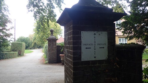
I crossed the next road, having left the estate and paused at this sign for Buckmoorend Farm. I felt a great temptation to stop here for a proper cup of tea and cake was always an option…
I had the time to spare but, I could also see the hill and climb ahead. Had I just come down in the opposite direction, it would’ve been ideal. I’m bookmarking this place for the next time I happen to pass through.

Not for the first time in my walk of The Ridgeway, I found that the white acorn and yellow footpath arrows had been painted on to trees.
Another road crossing and I was on to Coombe Hill, which is owned by the National Trust.
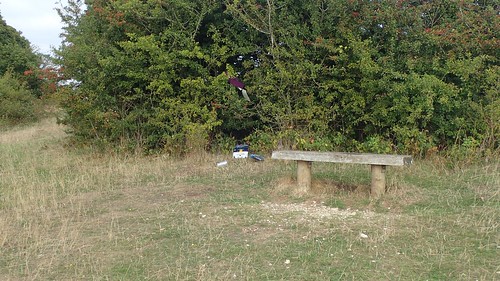
I contemplated stopping at the first bench I encountered by I wasn’t comfortable sitting in front of other peoples’ recklessly discarded waste. By contrast, the next bench was more inviting.
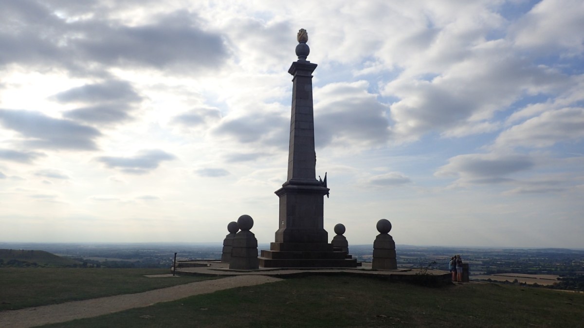
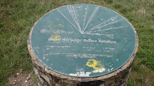
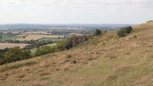
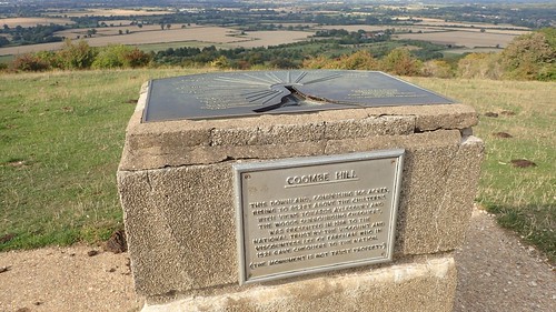
At 260m above sea level, Coombe Hill is one of the highest points in the local area and along The Ridgeway National Trail itself. West of here is Beacon Hill, as shown above.
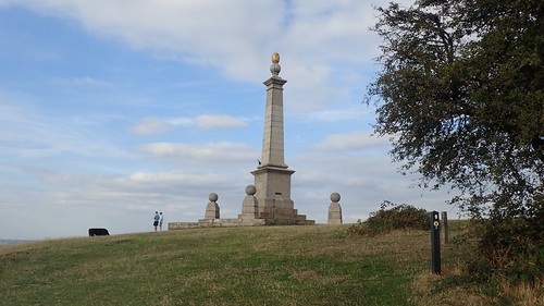
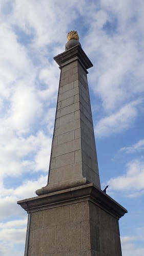
I’d forgotten about the monument here, that sits 3m beneath the highest point. Despite having read about it in the previous evening.
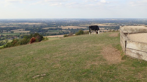
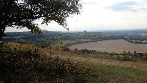
Cattle graze the surrounding slopes.
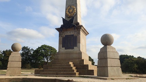
This monument – not owned by the National Trust – was erected in 1904, to commemorate the 148 men of Buckinghamshire who lost their lives during the Second Boer War. I’ve read that this monument can be seen from the Cotswolds… I’ll try to keep my eyes open, the next time I’m there.
Ahead of this lies a toposcope…
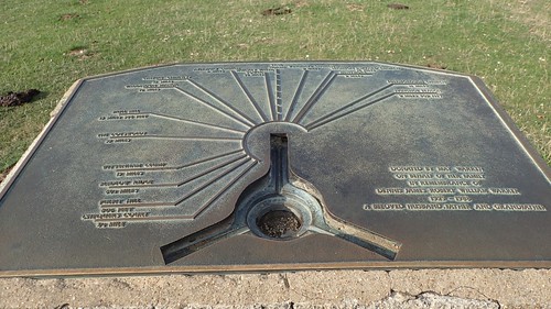
Which would’ve been used for triangulation around eighty-years ago; making it my first and only trig point of the day.
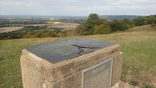
According to the information provided, Ivinghoe Beacon is just nine-miles away, as the crow flies.
This was another opportunity where I’d wanted to set myself up for a photo. But, I felt there were too many people around.
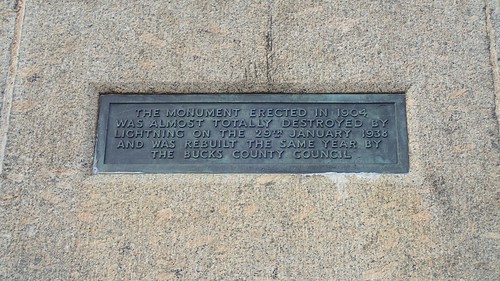
Lightning can strike at around 257m above sea level!
Continuing on with my walk, I descended Bacombe Hill to cross the main road and railway line in to Wendover.

I didn’t actually take any photos in the town. It was quiet a built-up area, with frequent passing traffic and people all over the place. Most of all, I was struggling to find my way to continue with The Ridgeway… This was where I felt a lack of detail in the Harvey’s mapping was a hindrance.
I would end up resorting to OS Maps and the GPS function on my phone. With which, I was able to find the National Trail sign – it had been visible from across the road but was merely bare wood, where every other fingerpost I’d seen for the past 70+ miles had been painted black.
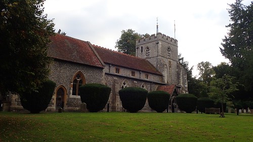
I briefly explored the local churchyard, in my escape from the town centre.
Beyond which, I had no difficulties in following the trail.
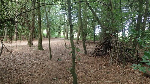
This led me in to Concord Wood, from which I would leave the trail and take a one-mile detour towards my intended camp site. I’d hoped to be able to bag my second trig point of the day but, the path I’d intended to follow didn’t exist on the ground. As it was already past 18:00 and I knew I had barely two hours of daylight left, I decided to head on to my home for the evening.

Finding my way down to Kingsash was easy enough and I didn’t need to activate the GPS or data on my phone.
A public right of way follows the edge of Corner Farm, where I would be staying. I was surprised to find the entrance gates were chained shut and so, I had to phone the owner. I thought it was strange as I could see one tent already in the field. As it turns out, he only locked the gate because no-one else was around.
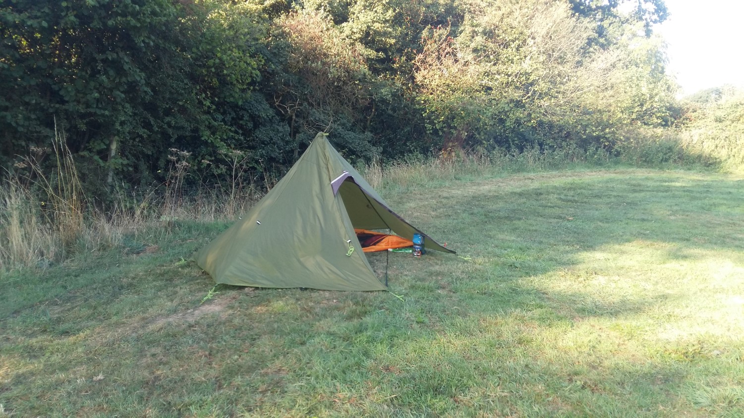
At a cost of only £5 for the night, I was soon pitched up and ready to relax, at around 18:30, having begun my walk at 9:30. I’ll write a separate, brief post about the campsite itself. This wasn’t my first time pitching the Hex Peak V4A shelter but it was possibly my worst attempt, with the inner and outer terribly misaligned!
Distance of this walk: 20.5 miles
(including 19 miles of The Ridgeway)
I’ve been reading and researching since and now feel more confident in being able to set it up properly, next time.

I happened to do a circular walk a couple of weekends ago that took in a short stretch of the Ridgeway (https://www.walkingclub.org.uk/walk/saunderton-via-bledlow-circular/) (I hadn’t realised it would do so until I set off), so I passed the part of the Ridgeway around Chinnor and saw that vandalised “Dogs to be kept on lead” sign you photographed and another on a footpath to the side where “dogs” had been crossed out and changed to farmers.
It is a beautiful area, but increasing signs of Autumn. I’m glad you managed to complete the Ridgeway in the end.
LikeLiked by 1 person
I hope the weather was good for your walk, Jon. Interesting to know that you also spotted the broken dogs sign and I wish I’d spotted the farmers alteration – very interesting! I wonder what provoked this?
I’m also pleased to have finished The Ridgeway. Thank you, Jon. I’m eyeing up the South Downs Way for 2019.
LikeLike
I made a start on the Oxfordshire Way last Saturday (despite the terrible weather forecast it wasn’t actually too bad), walking from Henley-on-Thames to Watlington and I used the brief section of the Ridgeway to enter Watlington. Anyway here are a few photos if you are interested in seeing a few of the places you passed through again, and at a different time of year : https://www.flickr.com/photos/joncombe/sets/72157711674444103
LikeLiked by 1 person
Thanks very much for sharing these images, Jon. I don’t know too much of the Oxfordshire Way so it is appreciated. I’m sorry for the delaying in responding.
My walking group are off to Streatley-on-Thames this month for an annual “Christmas” weekend away… Sadly, I won’t be joining (I’m not a big fan of hostels – especially small ones – with lots of people for multiple days…). It would’ve been nice to revisit certain stretches of The Ridgeway in person.
LikeLike