Saturday 24th November 2018
Three weeks after leaving the trail near Elmore, I returned to my journey along the Severn Way, having started the day in Gloucester and followed the canal towpath to the point at which I previously left off.
I rejoined the Severn Way at the roadside near Stonebench (SO 795 148) and would follow the uninspired tarmac walkway up to Lower Rea.

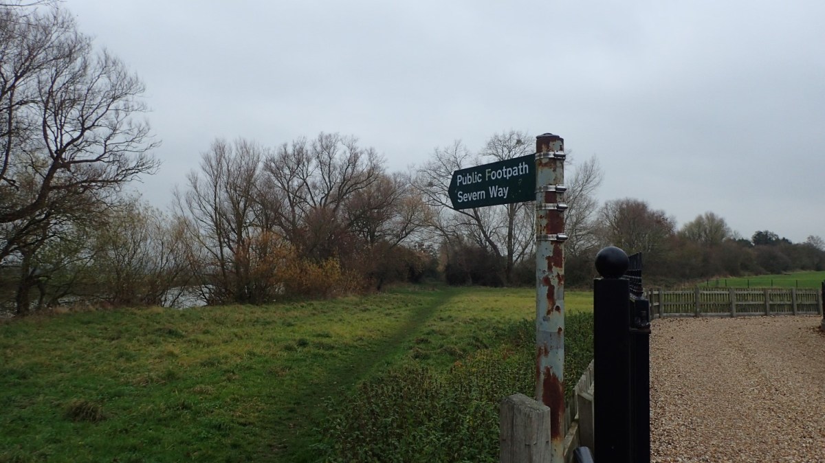
Dodging the occasional car, I was relieved to find this clear fingerpost for the trail.

As I came to the first in a series of fields, with a clear view of the River Severn, I decided to stop on the edge of the river for my first break of the day (bearing in mind that I’d already walked a good hour to arrive here from the city centre).
Waymarking on this section seemed good and reliable. Unlike certain situations I experienced following the route through Elmore.
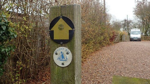
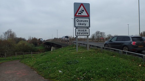
There was a dedicated marker for the Severn Way, would you believe! A few hundred metres ahead of another road walk at Middle Rea.
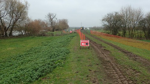

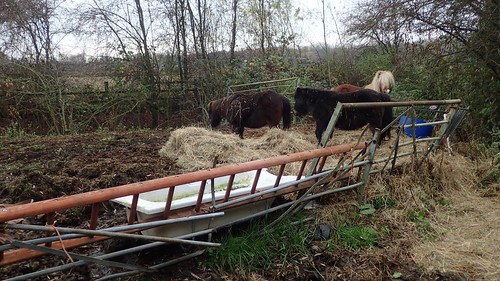
Leaving the road at a right-hand bend, I’d have to negotiate the ongoing efforts of the Environment Agency to improve the local flood defences.
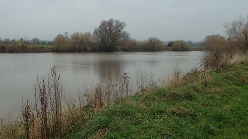
My view of the Severn itself was intermittent. Frequently interrupted by a hedge. I imagine this route will one day be officially designated as part of the England Coast Path (provided the current government haven’t ballsed that up and stolen the funding for the project, which is due to be completed within a couple of years…).
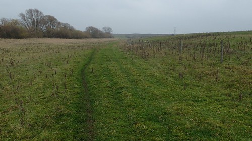
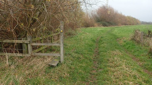
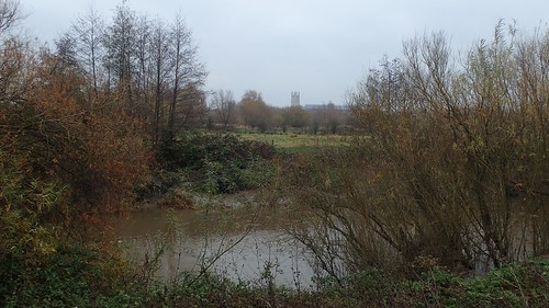
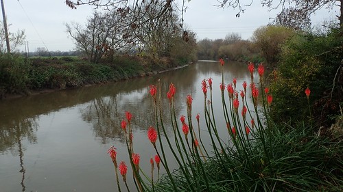
An uninterrupted stretch of walking the Way followed. Sticking to the obvious path on the ground, I would find myself wandering away from the water’s edge, which is where the Ordnance Survey maps imply that the route should follow.
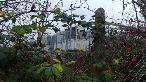
I followed the course around Sud Meadow, which looked like a form of secluded, shallow quarry. Beyond that, I was returning to the industrial land, with tall wire fencing on my right-hand side.

I’ve heard that the eastern end of the Hadrian’s Wall path is as unappealing as this.
A distant view of Gloucester Cathedral (well worth exploring), as I followed the East Channel from where the River Severn bifurcates.
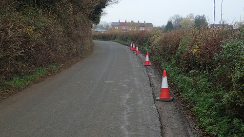
Heading for the noisy A-roads now, following the Severn Way precisely can be a challenge, as at least one other long-distance footpath cuts through this area and, without surveying the LDWA’s website, I’ve found it’s hard to determine the correct route.

I was pleased and impressed to find these pointers for the Severn Way, close to the traffic lights. Just think… I’d walked for many miles across farmland and countryside with much less of a direction to follow!
Crossing one busy road, I got a bit carried away taking photos of the gloomy river, that I made the mistake of following the road north and away from the intended route… To the point where I actually walked through the car park from where my day began!
With the aid of GPS on my phone (I struggle to navigate efficiently in urban areas), I almost ended up following my return route in reverse… Before I found the Severn Way running beneath this underpass.
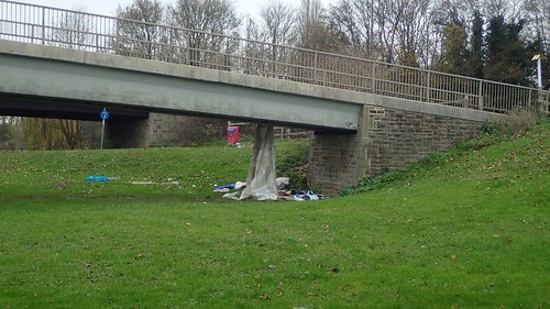
I felt quite uneasy walking through the park and along the water’s edge. While I’d feel sorry for anyone sleeping rough in such a situation, my thoughts returned to all of the many ‘bad things’ I’ve heard about Gloucester over the years.

At one point, I almost convinced myself that I was being followed and decided to increase my pace. There weren’t many other people around and I was keen to return to the countryside, from which I could hopefully release my mind.

Negotiating the occasional fallen tree, I found myself also following the Glevum Way towards Walham in the Vale of Gloucester. The Glevum Way is a twenty-four mile long circular route around Gloucester… A full day’s walk for some. I may even attempt it myself, one day.
Reaching the road at Walham and close to a local pub and restaurant, I would leave the Severn Way. To be resumed on a future date and, quite possibly, some time in 2019.

Now, I needed to return to Gloucester.
Lunch had been on my mind for some time. By now, it was probably close to 13:30 and I’d not yet come across a resting space which I had determined to be suitable.
Heading south-eastwards, I’d follow the country road beneath the A40 and would take an immediate right turn ahead of Frogcastle Farm.
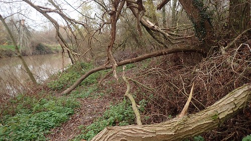
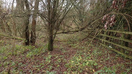
I followed this right of way in to a woodland area plagued with undergrowth, while the A40 roared up away to my right.
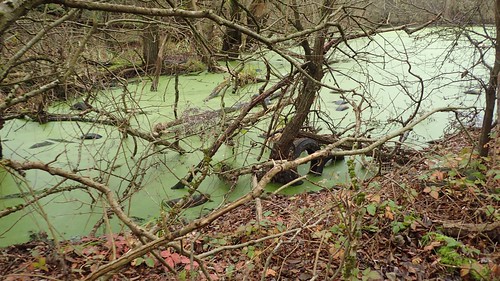
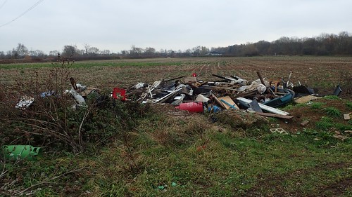
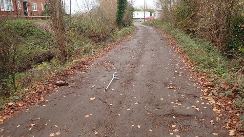
Not only was there litter everywhere (presumably from feckless drivers) but someone had, somehow, dumped dozens of car tyres in to this “pond”.

Somehow, I would have to cross this… It looked straightforward on the map but fallen trees had destroyed portions of the fence, there was no waymark or fingerpost to find and I feared the only available ground would be soft and marshy…
Paying homage to the GPS on my phone, I found my way across, safely and was soon passing between a housing estate (St. Oswald’s Park) and a large static caravan park.
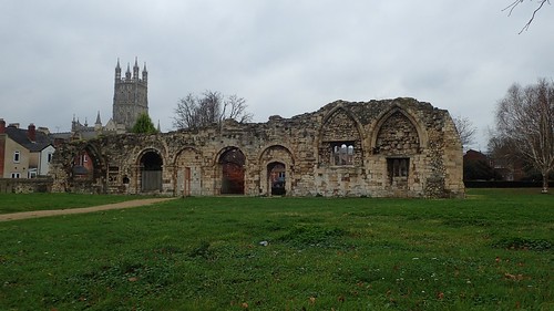
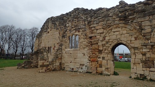
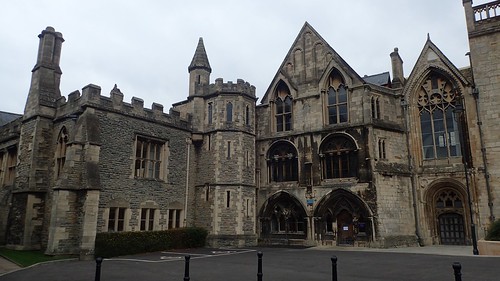
I followed the A417 briefly, before diverting in towards the city to pass the ruin of St. Oswald’s Priory. It was here that I would find vacant benches and decided to rest for lunch.
This was also a feature and highlight of a day-trip to Gloucester with two friends early last year.

From here, it’s only a short walk in towards the centre and you don’t need a map to spot to cathedral from a distance.
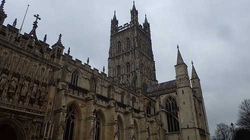
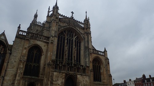
I didn’t visit Gloucester Cathedral on this occasion; feeling a bit pressed for time and stressed, after all the urban walking. But if you ever get the chance, I would STRONGLY recommend it to you and definitely purchase a ticket for a tour of the crypt below.
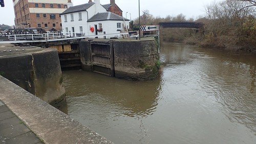
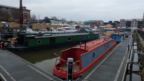
Back at the docks (another short walk from the cathedral), it was easy for me to retrace my steps to the car park. Sometimes. I think of this city as a second home. There was a time when I would contemplate having to move, one day.
I was born in Bristol. I’ve grown up and have lived in North Somerset but, while I do appreciate Bristol, I don’t think I would ever consider living there. While it’s not the biggest city in the UK, it seems to be growing and I get the impression it could soon become ‘Another London’ (not that I’ve visited London any time in the past fifteen years…).
Before changing my boots and heading home, I decided to explore the Victorian Christmas Market and the many hundreds and thousands of people who’d resigned themselves to spending an afternoon, here… IN NOVEMBER!!
Needless to say, I didn’t buy anything… Or see much else other than cider and chocolate available to buy from every other stall!
So, I must now be a good fifty-miles or so along with my walk of the Severn Way from Bristol. At the very least, I’m in to the forties and edging closer to Tewkesbury; my end-point in a journey that, for others, would continue all the way up and in to the Cambrian Mountains.

An interesting walk. I’ve thought about doing the Severn Way at some point, as an extension of my coastal walk. I would be interested to see if any of it does become part of the England coast path. It is possible the England Coast Path will stop at the Severn Crossing (the original one), which you can walk across. But I don’t know for sure. Hopefully time will tell (one day).
LikeLike
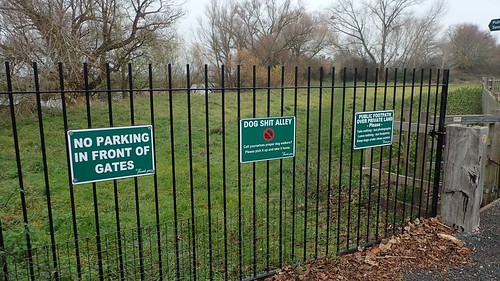
Sud Meadow is where the tip is. You may have spotted about a million seagulls there…
I reckon once you get past Upper Parting you should be fairly free of fly tipping and general skankyness. When we walked the Glevum Way it was the Walham/Alney island bit that was very definitely the worst for it
Red Lion at Wainlode would be a good lunch stop for your next leg!
LikeLiked by 1 person
Thanks, Katy. I reckon the wind had blown the seagulls away… Not surprised to learn it’s where the tip is! People used to tell me Matson is an avoidable area but not one I need to worry about on this trail.
Ah, I knew the Glevum Way was familiar for a reason. I must’ve read your blog post at the time. 😉
My next walk may be a big loop around Sandhurst, bagging a trig a long the way. There’s a camp site near the pub – I was thinking about walking to Tewkesbury and back and camping in between. But I’d still need to ditch the car safely.
I’ve walked through Deerhurst before and recall seeing another idyllic pub beside the Severn there.
LikeLike