
Wednesday 29th May 2019
I woke up early at my chosen campsite in Westmeston. In fact, I was probably awake before this… Following a peaceful night’s sleep, undisturbed by the neighbouring horse and, thankfully, no midnight dash to the toilet and its bucket!
This would be my final full day along the South Downs Way, leading to my final and fifth consecutive night of camping.

I was up a bit earlier than I had been on previous days. Keen to get on with my final big walk; eager to escape the need to fill that bucket one final time! My pack was soon… Packed. Before I was able to finish my breakfast and move on, one of the lady’s dogs was occasionally barking and then jumping at my tent. It neither fell down or blew away, while the other dog was elsewhere in this field, probably going about or doing its business!
Although I’d pitched after the previous evening’s rain shower, the ground was still wet and this would encourage condensation to rise and form on the inside of my outer-fly, overnight. Therefore, the outer tent was attached to the outsider of my rucksack once more. To stop if flapping and slapping this time, I used a longer third strap to lash it securely.

Although there was no running (mains) water on this site, this was the only occasion on which I cleaned out the plastic bowl of my Jetboil MiniMo, which I’d been using to serve my porridge, once cooked. I bought this compact pot scraper in Taunton Leisure last year. It was only £5. I’d never seen anything like it before but it seemed like a good purchase for removing stubborn oats.

Sometime before 9am, I was able to escape without making any form of contact with the lady who owns the place. Freeing myself from the main door was the only obstacle in my way… I felt as if I was in the Crystal Maze, with time running out. At the same time, it looked as though it could’ve been built by Shredder and his Foot clan to withhold Tokka and Rahzar until they had matured…
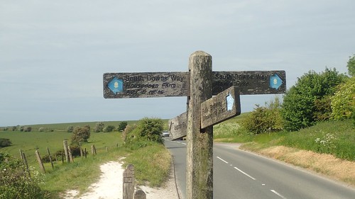
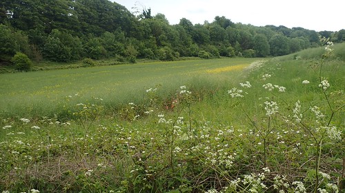
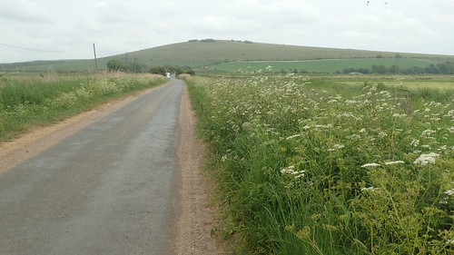
Taking a different route to the way I’m come down, I made my way up to Ditchling Beacon, following a bridleway up to a car park. A road crosses the downs here, much like something I’d expect to find on Exmoor. By not retracing my exact route from the previous evening, I have officially skipped around four-hundred metres of the South Downs Way… I’m trusting you to keep that bit quiet!
Housedean Farm and its water tap was only five miles further on. Had I felt like it, I possibly could’ve walked that extra distance the night before and enjoyed a more-acceptable camping experience.

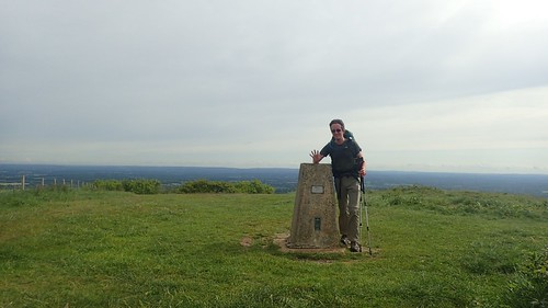
Standing at 248m above sea level, this is the trig point I’d been unable to visit during the hail and rain, sixteen-hours earlier. It’s also the third-highest point on the South Downs.

Crossing the car park, I passed another man walking alone and with a well-sized rucksack behind him… I’d guesstimate it was 60-70 litres in capacity. You can just see him crossing the horizon in the photo above. I sized him up as another SDW backpacker, although he didn’t seem to be in a chatty mood (and he definitely hadn’t shared my same campsite).

Before him, a pair who appeared to be out walking for the day, although reasonably well equipped for it.

Away to the south, I could see what looked very much like a football stadium. I knew that Brighton was probably not far away but I couldn’t for the life of me think of its name… Later in the day, I’d overhear someone else mention ‘AmEx’ and it was in this moment that I was able to remember it is indeed, where Brighton and Hove Albion play their home games. I would potentially be sharing this trail with Premier League millionaires…


Where the Way turns south and away from Plumpton, I took a detour to the east to bag the next trig point at Black Cap.

These trees on top of the hill were planted back in 1955, to commemorate the Queen’s Coronation.
For all of my deviating in this few minutes, I’d allowed this two walkers to move on ahead, after I’d skipped on past them. Only a lone cyclist seemed to be as keen as I was to bag that trig, while I met a couple of others at the path junction who weren’t as certain of the clearly-signed way forward (again, I was asked and did help).

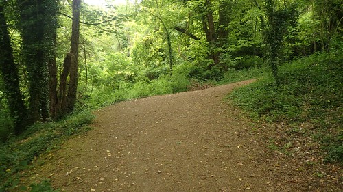
After a long and casual descent, the path takes a hard turn uphill through the woods, before descending towards the farm and the every-busy A27.

You can just see part of the camping field of Housedean Farm in this photo. On my final day, I’d catch up with two walkers I met back in Cocking (at the end of Day Two) who had spent their fourth night here, after what must’ve been a very long walk from their Washington B&B and in excess of twenty miles… It seems to be accepted that most backpackers will experience ‘one long day’ on any given trail.

Another couple of hours of walking from here and I’d be looking for a place to stop for lunch.

There is a working water tap outside of Housedean Farm and right along the trail. Very easy to find. No need to go knocking on doors or searching between walls.

I took this opportunity to stop for ten-minutes and energise myself with one of these electrolyte tablets dissolved in my 600ml bottle of water. I don’t usually buy this brand but I was happy with the truly citrus flavour. I always carry these on long day hikes. They’re good for replenishment and, to be honest, they taste nicer than plain water!

I also spent some time rearranging the outside of my rucksack; moving the outer tent from the bottom to the top, using the same method of strapping. I would find these to be even more comfortable than before.
Crossing the A27 via a road bridge, I soon found myself back in the green of the countryside, even though I could still hear the traffic roar past.

From this lowpoint, I would have to begin climbing to regain my vantage from the top of the South Downs.


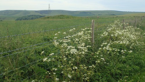
There was much to admire about by immediate surroundings, as I made my way up to a track known as Jugg’s Road (an ancient ridgeway). A somewhat familiar transition of the South Downs Way.

This elevated section of walking seemed to continue on.

Beyond the windmill lies the town of Lewes.

I passed very few others while up on this section of the downs. There was a suggestion that the dry weather could turn at any moment. It did whip out my waterproof jacket and raincover for my rucksack. A strong breeze was blowing across this exposed land and my layers would help to break the chill.

There were sections up here where I chose to walk along the ‘grass alternative’ route to the main tracks. All in the name of my screaming heels.

A dead-straight and almost never-ending concrete path would lead me most of the way to Southease, down from Iford Hill.

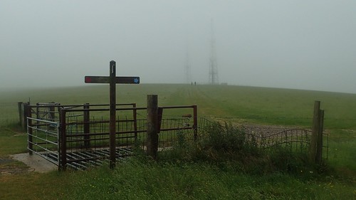
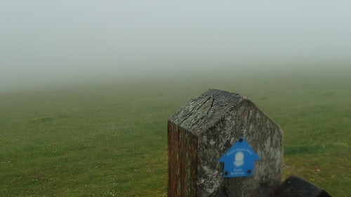
It was coming down from Mill Hill, after crossing a quiet road, that I encountered this fingerpost with a heaped stack of stones beneath (at first glance, I thought they were skulls).

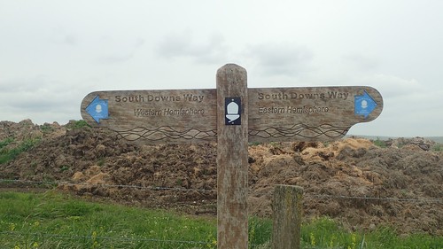
This is the Greenwich Meridian marker, where the eastern and western hemispheres meet. I hadn’t expected to find this on any part of the trail. It isn’t marked on either of my maps. I had a very faint recollection of having read about this on someone else’s blog some months ago.
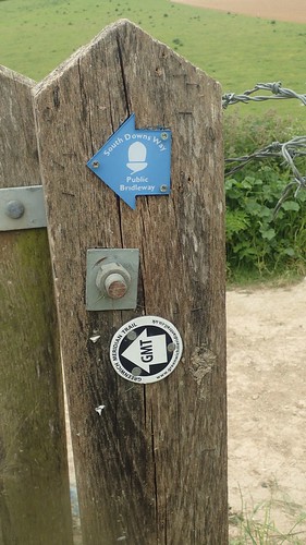
Then there’s the Greenwich Meridian Trail… A 273-mile north-south crossing of England, between Brighton an Kingston-upon-Hull! I wonder whether similar hemisphere markers exist along that trail? More importantly, how many people have actually walked the full distance in one hit?

…For those not interested in walking further! This fingerpost is also quite familiar across social media.
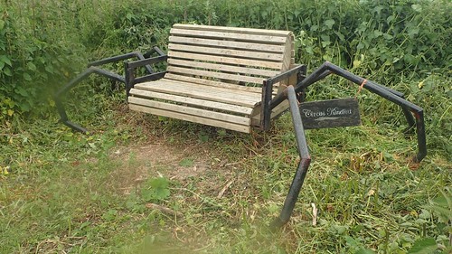
Near the farm beneath this hill, I spotted a rather unique bench from Circus Kinetica. I couldn’t think, at the time, of where I’d heard this name before. But I believe now, thanks to Google, that they built an art-structure for the Green Man Festival (South Wales) in 2014, which I attended.

I felt drawn to these benches in front of the church in Southease, just in time for lunch and with a water tap very close by. Again, none of the other walkers or cyclists I saw would make to minor detour to re-hydrate.
Raindrops began to fall gently while I sat on that bench.

In the event of more severe weather, the Courtyard Cafe lies beyond the River Ouse. One could even stay in the hostel accommodation.


Even the bridge that crosses the river here has been decorated in a typical ‘YHA’ colour.


Crossing the railway line at Southease. Not being very experienced in the world of catching trains, I wonder how you would purchase a ticket from a station like this and whether that tiny blue box accepts card payments. Or, whether it’s cash only.

I didn’t head off to find the Courtyard Café but did follow the hostel-coloured Itford Bridge over the A26.
By now, it was raining. Not heavily but constant. I was metres ahead of a fully-waterproofed man who’d just left the café with a miserable looking face. Judging from the size of his rucksack, I recognised him as someone I’d crossed up on Ditchling Beacon that morning.

I had a good two hours of walking to follow, before I would arrive in Alfriston and find my campsite. It seemed perfectly manageable.

From the farm, I began the next meandering ascent of Itford Hill. Climbing higher with each step, the rain became more persistent. Wind speed increasing by the moment.

More people were present now. Walking east along the trail but bearing small daypacks at best. Had they just awoken from their half-day slumber at the hostel? Maybe they were leaving post-lunch, in the hope of getting home before the weather settles in?

In hindsight, I should’ve pulled on my waterproof overtrousers by this point. While my Craghoppers Kiwi Pro zip-offs are more water-repellent than most, I would soon discover that they have a breaking point.

My first trig point, beside Red Lion Pond and at 164m above sea level (not that I could see the sea, with the mist and cloud having over-run the landscape). A measure of progress on my journey to Alfriston.

I wasn’t enjoying this section of the walk. Persistent, almost-horizontal rain with wind howling in off the south coast. My Vaude waterproof jacket was… Not. It would’ve been a mistake to have worn long sleeves underneath the jacket as they’d only get wet, leaving me to feel the cold. As I said, I should’ve put my overtrousers on already. Walking with wet socks and underwear is not nice when you’re due to spend the night camping.
I would normally take photos but there was nothing much to see beyond this weather. I would pass the radio station ahead and perhaps another couple of walkers before surrendering to a bench beside the next car park and zipping up those waterproof trousers.
There was no way to escape this weather, up on the South Downs. I’d know that this Wednesday might’ve been the one rainy day. I felt like I’d made a mistake in not packing my Mountain Equipment jacket. It is heavier and has a larger pack size but ultimately keeps me dry inside.
Head down, swearing to myself, I pushed on. Speeding past a couple of waterproof-less day walkers. Back at the car park, I wondered whether someone might’ve been kind enough to drive me to Alfriston. I was already wet, likely to feel the cold in time. At risk of hypothermia?!
I had to keep moving. To keep the blood flowing and my body as warm as could be. I wasn’t carrying the full survival kit I’d usually take on a day walk in the Welsh mountains. There was no escaping this weather. This high-level route was the most direct link to my end point.

Firle Beacon – although you may have to take my word for it! 217m above sea level and what had felt like a VERY long walk to this trig point from the last. Alfriston was still so far ahead.

By the time I reached the village, my shoes and socks were soaked through (sorry, Columbia, I don’t hold much faith in the ‘OutDry’ technology of your footwear). Quite the painful descent on already beaten feet.

It was still raining as I walked the roads towards the campsite. Navigation was straightforward. Was I really going to pitch in this?!
Descending the hill, I had thoughts about finding a warm café for a cup of tea and plotting the local bus routes to the nearest train station. Closer to Alfriston, I began to think about expensive B&B accommodation… I’d written off the idea of camping in this. Yet, when I found minimal shelter under a tree, I found that using my phone was a challenge, even while protected in its waterproof housing.
I’m not the most confident of people. I don’t like drawing attention to myself or braving situations that I’m less familiar or comfortable with. I didn’t knock on any doors or enter a single pub, of which there were several. Plodding on in pain, I made it to Alfrston Camping, where I had already booked my pitch online (but not paid).
They have toilets and free hot showers. Signs inform you to ‘pitch up and we’ll come to you’, which I welcomed… With a brief gap in the clouds, I was able to whip up the outer shell of my tent and climb inside. When the staff member did trek over on his quadbike, we talked about the weather (as British people do), my intentions to finish the walk tomorrow and I paid only £9.
I was wet, at risk of feeling very cold and uncomfortable. But I felt an improvement in my spirits.

I managed to gather the last of my clean belongings in to a dry bag and, as the next shower eased, I took a chance and fled for the showers. I was in there for ages… Warm water felt amazing. I wanted to stand there until the wet weather would pass.
Retreating to my tent, I managed to pitch the inner without getting wet and ate nothing more than a single flapjack all evening. I wasn’t in the spirit of fetching water and rehydrating a meal. iPod in my ears, I was in bed before 20:00. If I could just survive this evening, night and make it to the morning… I’d have only ten miles left. A day of coastal walking and the completion of the South Downs Way!
