Friday 10th April 2020
We were barely one week in to what has become known as Lockdown in the UK and I feel bad that it’s taken me this long to write about it. This was my first ‘proper’ walk during the Covid-19/Coronavirus pandemic, where I would otherwise spend my evenings walking short circuits around my very local area.
At the time, there was no specified limit on how far one could travel during exercise or how long we could exercise for. Social distancing rules applied but we were not allowed to travel for the purpose of walking, running or cycling, as three examples.
On foot, I packed my bag and set off from my front door. Leaving the car alone to follow overly-familiar paths and with every hope of avoiding many other people.
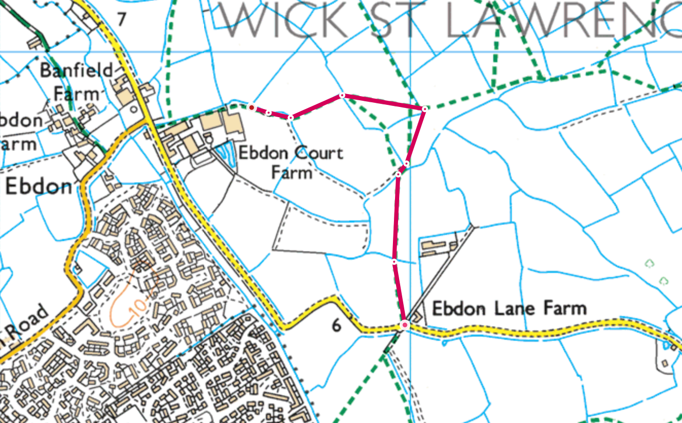

For whatever reason, the farmer had decided to close this section of the footpath. In all of my evening walks along here, I’ve never encountered this problem. This “gate” was too much to be climbed without bars and I didn’t feel this ‘battle’ was going to be worth the effort.
It’s worth knowing that throughout the pandemic, no landowner has a right to obstruct or close a public right of way. Only the local council can do this. They are allowed to put it permissive diversions but our right to roam remains.
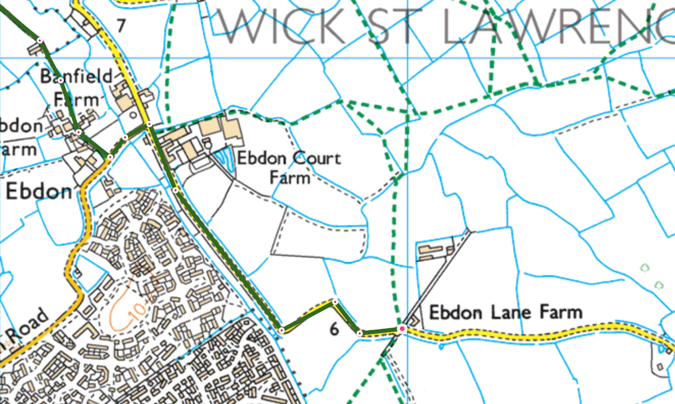

I spotted this at the road junction before braving another farm… Fortunately, there were no such obstructions through Ebdon and Banfield Farm. Their bridleway remained open for all.

Rising gently in the distance was Worlebury Hill with Weston Woods. It’s only an hour’s walk, although it may look far. I’d said to myself that I would go there on another Lockdown walk but… Now I’m back in work full-time and I never made it!

Clear and easy walking.


In the final field before reaching the road of Collum Lane, you can often meet a herd of cattle. I’ve never had a problem with them but a ‘Bull In Field’ sign can often be find at the far end. I was pleased to see nothing else on my walk.

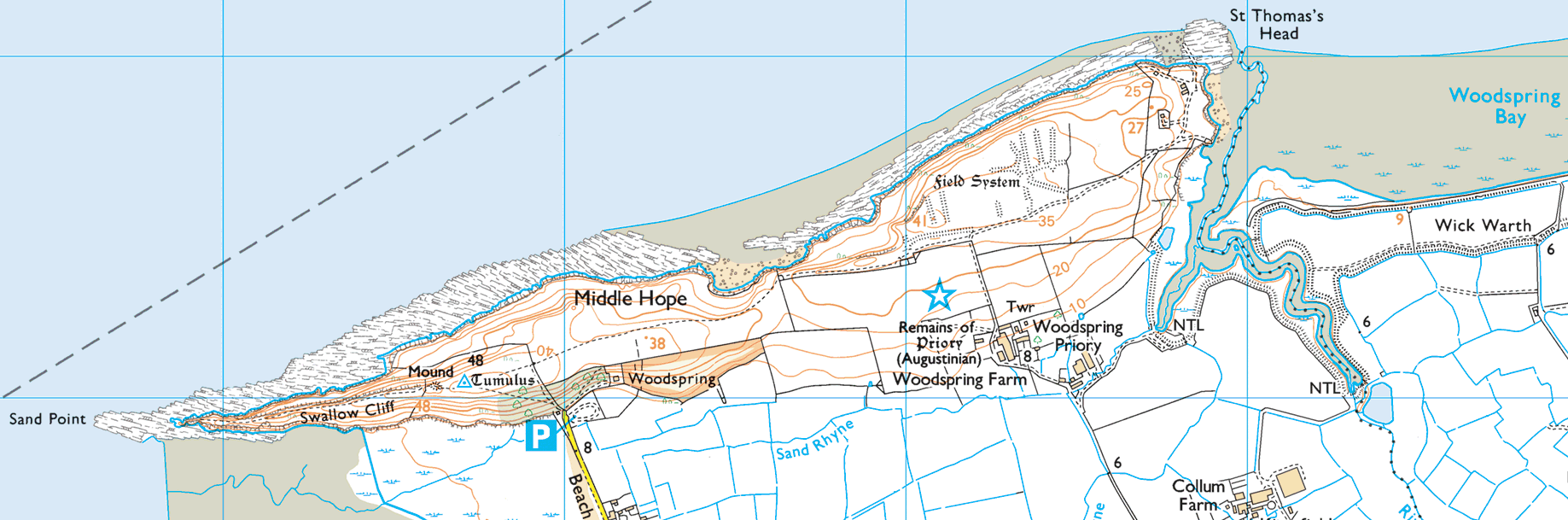
I followed the road north to the junction with Culm Farm, where I would turn left and follow a bridleway in the direction of Sand Bay. Looking north, I could see Sand Point and Middle Hope beyond Woodspring Priory.
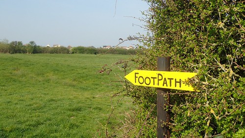
Footpath signs were frequent as I edged closer to Sand Farm and made it through without obstruction or incident.

Crossing the road and stepping out towards the sea, I could not believe how quiet and people-free the scene was ahead of me. In another year, these benches would’ve been occupied; dog walkers treading up and down.

Down to the beach and I did see two dog walkers walking south towards the woods; many metres apart. How far had they come, I wondered? Did they live locally?


…Did it matter?!

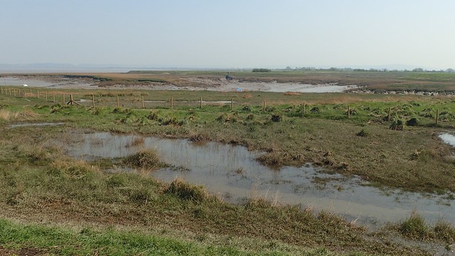
My walk continued north towards Sand Point. As the beach came to an end, I found myself walking on wet and very marsh-like land. I hadn’t seen it like this for quite a long time.

It didn’t get any better as I plodded on – possibly wearing walking shoes that I had only just purchased. I found a way up to and over the bank, down to the road and I follow this to the steps that would lead me up on to Sand Point.

Police Tape across the (National Trust-owned) car park; a sure sign of Lockdown in action. My chances of finding solitude on the higher ground remained high.

Looking back down along Sand Bay.

I can remember driving to and walking her on New Year’s Day, at a time when I wasn’t feeling at my best and people seemed to be walking at every turn. This was my first trip here since and there was no-one else in sight!

I made my way down towards the peninsular but not as far as its end. I’m used to seeing others sitting and lurking around here.

Perching myself on the concrete slab that many people use as a sat, I dipped in to my flask of tea (peppermint, in case you’re interested). I wasn’t sure of how long I was ‘legally’ allowed to sit at this time and so I didn’t linger long enough for anyone else to show up.

After my tea I would turn east away from the end of Sand Point and towards Middle Hope, with only a couple of others ahead of me.

I always favour the lower route alone here, staying close to the sea. I’ve even thought about wild camping along here… Not that it’s ever normally allowed and certainly not now!


It was a good time to be out. Almost uncomfortably warm at times but with the gorse flowering beautifully.
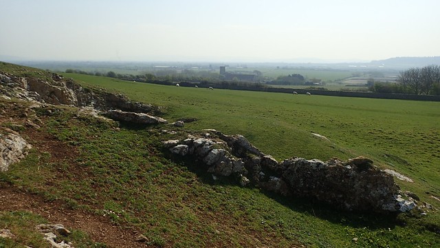
I continued walking east, spotting a small number of others on mountain bikes (presumably, they had ridden here) and with Woodspring Priory down to my right.

I’ve walked along this way a good number of times over the years. But not once before, had I noticed one of these warning signs of explosive ordnance on the land below. Those red flags are long gone as the MOD no longer occupies even a square metre of St. Thomas’ Head.

Beyond all of this, I could see Clevedon. Barely a month had passed since I did a brief coastal walk along there and another walk nearby with my Meetup walking group.

Although the fencing remains, there is no ongoing ‘activity’ at St. Thomas’ Head – which was once used as a site to test the Bouncing Bomb among other things.
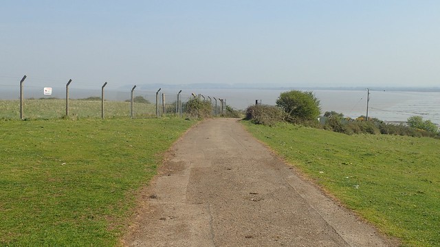
People have often speculated that an underground bunker was once in existence. All buildings above ground have been removed in recent years. Even the CCTV cameras are now gone and, with the gates taken away, there’s nothing to stop a curious mind from extending their walk (perhaps the next time I’m there – fishermen go much further down towards the water’s edge).

Orbiting around the Priory still, I was nearing the straight that would lead me home – and hopefully, back in time for lunch; before any of the hordes may have awoken to relish in their new-found passion for spending time outdoors.

One day, we’ll be able to walk a near-complete coastline heading up to Clevedon. It won’t reach quite as far as Sand Point and the work was due to start in July of this year… I’ve not seen any recent official word but I imagine the effects of Lockdown and the pandemic will mean it’s postponed until 2021.
Yet you may not know this from looking at a map. There isn’t even a public right of way and the online true Access Land is the small space labelled as ‘Woodspring’. With all the talk and action towards rediscovering ‘lost’ paths and saving them for future generations; are we at risk of losing our right to roam these spaces?
Probably not, as much of it is owned by the National Trust and their own properties are rarely designated as open for access by a cartographer.

I followed the lesser-known path around Hucker’s Bow and on to a car park that’s normally free-to-use and I assumed would remain open.
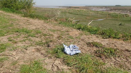
A discarded handkerchief is one item you surely MUST NOT touch in the wake of a pandemic!

Just as I’d suspected, the Woodspring Priory car park was ‘open’. I was quite disappointed to see more than a single car here and then to realise that some had driven here WITH their bikes for the purpose of exercising! But I fell short of taking names, number plates and pledging my allegiance to the society of Facbook Police who have surely not impressed many people over the past eight weeks.
It’s been suggested that the horsebox is either a frequent visitor or long-term resident of this locality…

Shortly after this, I was back on the long road that would lead me home… Or to the bridleway I followed earlier, on to another road around Ebdon and then home across some fields that once housed a light railway that would reach out to Clevedon and Portishead.

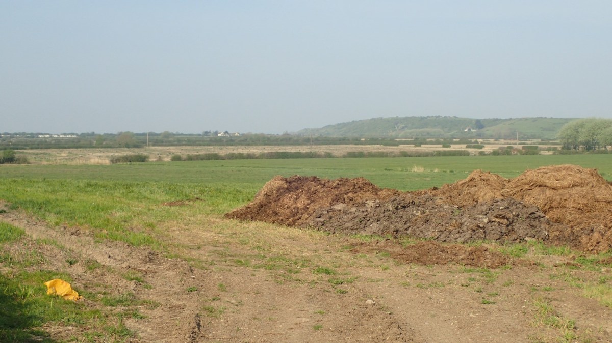
Living on the edge of a town, it was no surprise to find flytipping on the border with countryside. I reported this to the council through their website and the bag beside the gate, at least, was collected the next day.
On another walk nearby, I find a discarded sofa at the roadside and, to their credit, North Somerset Council cleared someone else’s mess within twenty-four hours.
But anyway, it had been a good day out and I’d done well to get it all in and done before lunch.

An interesting read as I walked some of this area on my coast walk albeit it was 8 years ago now so my memory is little hazy but I do remember going up Middle Hope quite well. I recall the military base there and remember photographing some of the buildings – green Nissen huts (see https://www.flickr.com/photos/joncombe/11074964033/in/album-72157638095171843/) So these buildings have gone now?
Middle Hope was a nice bit of coast but I do remember Sand Bay was more mud than sand! Perhaps it varies I don’t know. I do remember however access along the coast around there was very tricky. I do hope the England Coast Path improves things and if it does perhaps I’ll come back and walk it again.
LikeLiked by 2 people
Hi Jon,
Indeed, all of the huts have been removed – it was possibly four years ago when the last were dismantled. It doesn’t quite look the same without them so I’m grateful to see your photos. Less of a hazy day than my own, by the looks of it; clear views across the estuary in both directions.
Sand Bay can be quite muddy, as can Weston’s beach! Neither really compare to the south coast… But that doesn’t seem to stop visitors from the West Midlands!
From what I’ve seen, the proposed walking and cycle path will probably miss Sand Point and possibly latch on to Sand Bay before heading up through the woods. But to be able to walk most of that stretch to Clevedon and back… That’s what I’m waiting for. 🙂
LikeLiked by 1 person