
Sunday 23rd August 2020
For the first time since lockdown had been thrust upon us, I made the ninety-minute drive down to Exmoor. A National Park I’d have spent more time exploring this year; but for the intervention of the pandemic.

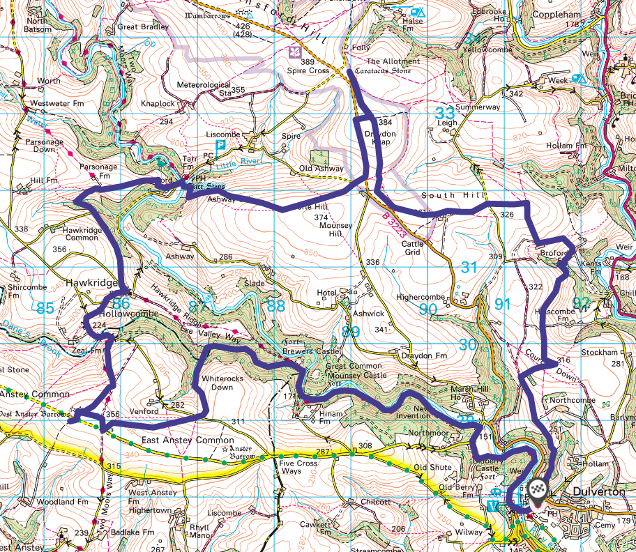
I’d plotted a route that would begin and end at Dulverton, which lies close to the southern boundary of Exmoor National Park. As I arrived, I was pleased to find that all of the pay-and-display car parks were free to use (it’s part of an effort to encourage more visitor to this and other areas around Somerset.

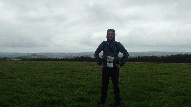
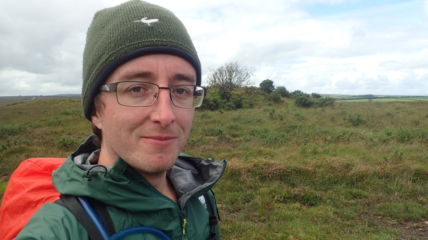
In a typically August way (which many people seem to forget about this month), it was raining and the shower was likely to remain throughout the morning. Of course, I’d come prepared and donned my waterproofs before setting off from the boot of my car.

Following a byway running north from behind the church, I made my way on towards Court Down.

This rain wasn’t heavy or torrential. A rather ‘welcome’ form of rainfall, if there is even such a thing! I strode out towards the trig point in relative comfort.
From Court Down, I had several options but continued north toward Broford Farm.
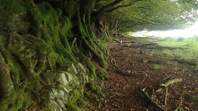
I was interested in the stones enveloped by the roots of these trees. Several hours later, I realised that the wall was probably built before or quite soon after the trees were planted and, as they’ve grown over time, they’ve formed the more natural and unquestioned boundary line.

At the other end of this field, young pheasants ran all over the place, like the proverbial headless chicken. Most were probably running from me! But this was not the first time I’d encountered this. Only a week or two earlier, I met a similar gathering just south of Crook Peak. A local resident told me they had successfully fled from a local shoot in the woodland. Hopefully these guys were also successful in evading a questionable sport!

I don’t like walking through farm yards at the best of times and, until the final approach towards Broford Farm, the waymarking had been as excellent and consistent as it is known on Exmoor. But then, through those final gates… Nothing. I could see on my map that I was on the right track and I believe each of the gates were unlocked… But still, I walk with that feeling of unease, fear and doubt.

By no means, was it a great distance to walk before I’d join the road above the Exe Valley. A short walk uphill, bypassing the next farm and along the next track, I’d find the safeguarding of Exmoor’s blue arrows.

Now walking west toward South Hill, I could see Dunkery Beacon – the highest point in all of Somerset – away to my right.

At the end of this field, I met a road and also discovered that the gate to be closed… No longer functions. There’s a risk that the cattle could squeeze through and escape but, with a cattle grid nearby, it’s unlikely they’d travel too far.

Next, I was on to the Open Access Land of Mounsey Hill Gate. There are many ‘gates’ across Exmoor. I believe they were historic points of access – possibly dating back to the original forest boundary, some seven-hundred years ago.

While one horse was happy to graze, the rest of the ponies sought whatever shelter they could find. By now, the rain had eased a little. But it still wasn’t perfect weather for flying a kite.

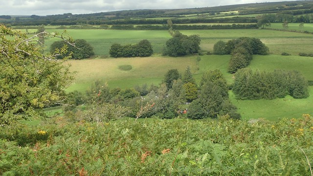
I walked north toward Draydon Knap; parallel to the road and not quite as true to the line of the bridleway as I’d hoped. In the photo above, I picked out the only landscape feature I could find that even remotely resembled the disused quarry markings on the OS map.

By now, I was overdue a rest stop and Draydon Knap had been far more gorse-lined than I’d hoped for, meaning it was harder to find a comfortable spot to sit but away from the bridleway. Also, I would then have to re-trace my steps down towards the road junction you can see above…

Still walking northwards (after my cup of tea), I was on a mission to discover the existence of the Caratacus Stone. I knew nothing of it; other than it for-some-reason deserved italic print on my map. I did spot the name in early 2019, on a walk near Winsford with two friends… But didn’t want to drag them too far off-route for my own endeavours.

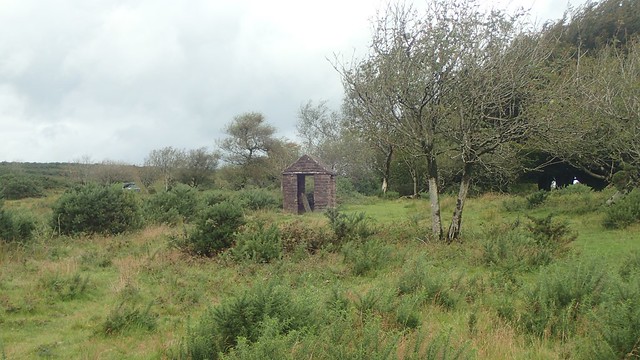
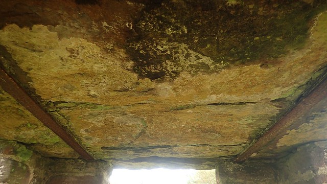
Surrounded by a stone structure – perhaps more enticing than the token token – I knew that this was where I’d find the Caratacus Stone; apparently a memorial for a descendant of King Caratacus (or Caractacus) and… About a Century ago, someone decided it was worth preserving.


Even the roof appears to be made from stone. Not something we ever seen in modern times.

I wasn’t at all surprised to find that there was no queue leading up to this attraction. With my viewing appeased and having read the laminated information board inside, I began my return journey back toward that road crossing.
In fact, I would leave the moor to continue on tarmac. Partly for efficiency but also because I could feel the pain of new boots striking in to my left ankle again.

From the B3223, I continued across Varle Hill, knowing that I would soon be descending towards the tourist trap of Tarr Steps from Ashway Side.
Sun was almost breaking through the cloud and, with this being a Sunday in August, I could see that the main car park for Tarr Steps was pretty busy. No chances then, of peace and solitude beside the River Barle!

I did struggle to find the current footpath down toward Tarr Steps. In the photo above, you can clearly see the path that leads fair-weather “tourists” between the car park and the clapper bridge.

After a few Exmoor ponies made noises to herd me away from the wrong path, I found my way on to the woodland descent. But then, the aforementioned discomfort in my ankle intensified. How could the cuff of a mid-height boot could so much pain?! I was almost in tears.
I threw my pack on the ground. Boot off. Dug in to my first aid kit for painkillers. Re-laced and boot back on…

I was resigned to the idea of hobbling across the clapper bridge. In no way, was I about to phone Search and Rescue for a five-mile evacuation back to my car… I was determined to make it over the water without causing a scene.

As expected, it was very busy down there. Stepping on to the clapper bridge and for just a moment, I had a clear run to the other side. Then, a family jumps on from the other end… Does social distancing not apply in the National Parks?! Thoughts of catching a virus or infecting others were a long way from my own mind.

From that other walk early last year (which started at Tarr Steps), I was at least familiar with the next stretch; following the Exe Valley Way and Two Moors Way up to Parsonage Farm. I knew it would be people-free. I could swear, curse and grumble to my heart’s content.


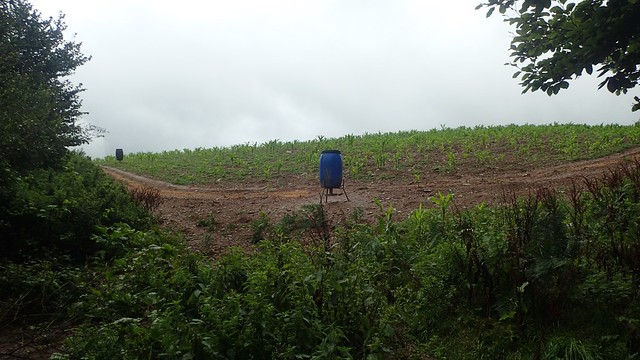
I was perplexed to find a set of solar panels, a small wind turbine and speakers or receivers, in a field still some distance from the nearest building. If they were powering something, what could it be?

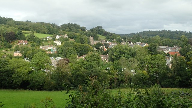
From escaping the valley, I felt a sense of endurance kick in. Maybe it was the Ibuprofen! But with the walk levelling out for a moment, I was determined to walk on the Hawkridge; apparently one of the most remote villages in the area.

Still following the Two Moors Way, I could see the next challenge ahead… Doubt kicked in. Could I do it, with this ankle? …I had to. It would be my final hill of the day. I’d come this far and didn’t want to risk cutting it short just yet.

I paused for a few minutes beside Dane’s Brook, taking in the sounds, the sights and sensation. Had I packed my water filter bottle, I could’ve had a cool and refreshing drink.

I was on the way up to the common and, to be honest, the hill wasn’t quite as bad as it had looked. My pre-lockdown hill fitness was returning, with or without a ganglion forming on the outside of my left ankle.

This stone was inscribed with ‘VENFORD’ and I assume it’s an old boundary stone.
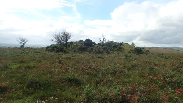
Anstey Money Common or West Anstey Common. Two barrows, one trig point and I’d soon be heading downhill on an easier route to the finish.

Using basic navigation skills, I was able to quite easily locate both of the West Anstey Barrows, having left the bridleway to head off-piste.

I didn’t care about the wind or the chill brought with it; I was enjoying the walk again. Even though there was another road within earshot.

Then, I wandered over to the trig point and there was no-one else about. But a good number of cars in the nearby parking area… Where did these other walkers go?

Crossing Ridge Road south on to Woodland Common, I could just make out Dartmoor on the faint horizon. A good place to stop for an overdue lunch – I remember it being about 15:00 by this point!

From here, the Two Moors Way continues south across Devon and on to Dartmoor. Meanwhile, I was to head west across Venford Moor.

A bridleway would guide me down on a descent before Whiterocks Down and towards the course of Dane’s Brook. A chirpy runner overtook me on the way down. I tend to think of running downhill as being easier than any other kind and yet, as a walker, those are the situations I find most challenging.

Several other walkers and their dogs were pondering about the ford and footbridge. My walk would follow the water’s edge running east and on to Dulverton.
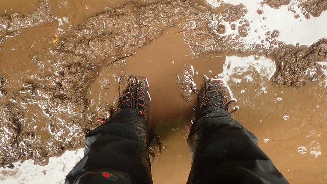
This was the first proper waterproofing test for my La Sportiva boots. By now, I think the ankle pain had mostly subsided but I’m not going to lie; my toes were quite damp after a very little exposure to the puddles or this well-walked route.

Some time further on, I would cross the brook via a footbridge and rejoin the Exe Valley Way – a fifty-two mile trail that runs between Tiverton and Exford.

From the crossing of that footbridge, I had also met with the River Barle – the same water course I had crossed back at Tarr Steps. This final leg of my day’s walking did undulate; occasionally losing sight of the river.

I passed on the potential opportunity for ice cream as I left Syd Wood toward the next road. I wonder how much trade they had seen after what was quite a miserable start to the day?

One final loop around Burridge Woods and I’d almost be back at my car. I passed a few casual walkers around here – a clear sign that civilisation wasn’t far away! It was quite a long walk here, following the natural bow in the river. Waymarked posts suggest that I could’ve taken a short (but also steep) diversion over the top.
With a good eighteen-miles under my belt – my longest walk of 2020, at the time – I was more than ready to sit down, get the boots off, exchange my damp socks and peel off the waterproof layers that had kept me clean for so long. Another satisfying day spent on Exmoor and it wouldn’t be long before I would return again!
Distance of this walk = 18 miles

It’s a nice walk this. I did a very similar route, also starting from Dulverton myself earlier this year following the Exe Valley Way from Dulverton to Tarr Steps then up to Winsford Hill and back, it looks quite similar to your route but in reverse. Very beautiful though I was lucky with the weather (it looks like you were not so lucky).
LikeLike
Hi Jon,
Great minds think alike then! I chose to walk anti-clockwise so that I could get most of the hills done sooner… Or so I thought. In spite of the weather (and ankle pain), I really did enjoy this walk. It was wet in the morning but never cold. I’d like to walk more of the Exe Valley Way and I also hope to return to Exmoor before Christmas(!) and include Winsford Hill as a repeat of a different walk from last year.
LikeLike