Friday 18th September 2020
After four memorable days in the Yorkshire Dales, it was almost time to head home to North Somerset. I’d packed away my damp tent and all associated gear from inside. With my car boot fully loaded, I still had one more stop on my mind.
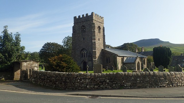
I drove twenty-minutes or so to arrive at Horton-in-Ribblesdale. Pen y Ghent was in my sights – the last of Yorkshire’s Three Peaks, having conquered Whermside and Ingleborough in the previous days.

My plan was to tick off this final hill or mountain in a circular walk of no more than ten miles. That should still leave me with plenty of time and energy for the four hour journey that awaited me.
I parked at what appeared to be the main pay-and-display car park with toilets, at a cost of £4.80 for the day. Having contributed little to the local economy so far, I was quite happy to pay this. From memory, I think you can pay £2.70 to park for three hours and other options are available at nearby pubs.

It is also possible to buy an annual car parking pass for the Yorkshire Dales, as I presume some locals do. This is a great idea, although not one I’d encountered before.

I was mostly surprised by how busy Horton was on this fine Friday morning. Cars parking for free at every opportunity along and off from the B-road. If I lived locally, I might not come here on a weekend and especially, during a pandemic.

I followed the road south for about half a mile (maybe less), before crossing to climb up past Dub Cote and now following… A Pennine Journey; one of Alfred Wainwright’s lesser celebrated walks behind the Coast to Coast.

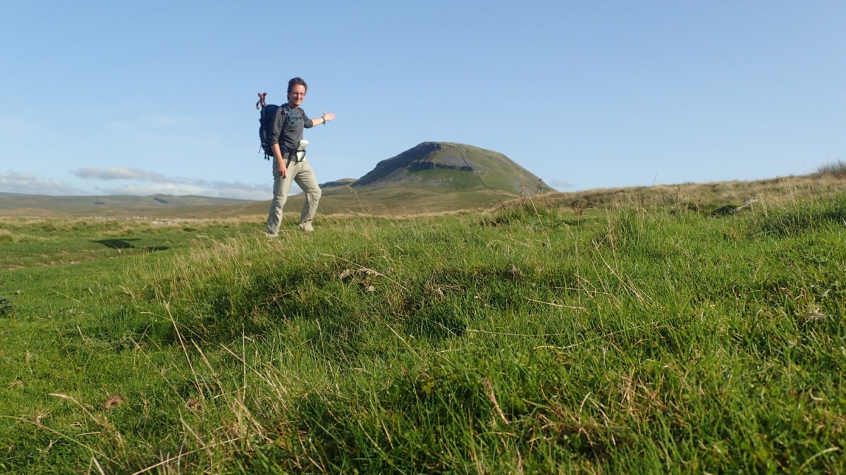
It was quite steep heading up towards a byway, crossing fields of sheep. Behind me, Ingleborough looked less distinguished against the horizon.

I left Wainwright’s Journey and would follow the byway north, heading straight for Pen y Ghent. Being the most eastward of the Three Peaks, it was fully exposed to the day’s weather.

You’re probably thinking of ‘how lovely and sunny this looks’… But I can promise you, the air was bitterly cold with that breeze. Slowly gaining height, I only felt that wind speed begin to increase.

Soon enough, I joined the Pennine Way for the penultimate time of my week in Yorkshire. Pen y Ghent stood to the north. But over to the east, the Way leads you up to Fountains Fell, which I had visited on the previous day.

By the moment of my final approach, I had a warm hat on, thin fingerless gloves and a jacket to keep the wind out. Nothing about this ascent was going to be easy!

For the most part, the path was visually easy to follow with only a few brief moments of low-grade scrambling towards the top. From 30mph, I felt the gusts creep up towards 40mph as I gained in elevation.

Another limestone walkway paved the way to the summit. A man wearing shorts and a minimalist backpack was clearly on the mission, having started his climb somewhere behind me and then overtaken as the reach for the summit levelled out.

My photos don’t show you how windy it was – my YouTube video may give a better idea. I estimate that the gusts were now between 40-50mph, with a general wind speed of at least 30mph. This morning’s Met Office mountain forecast had not predicted this… But I was very close to being blown off my feet!

Pen y Ghent‘s wind shelter was occupied by people seated on the other side, as I queued for my chance to touch the trig point.

Few would linger on this exposed high point for more than a minute. But for all of its easterly chill, this wind kept all and any clouds very far away.


Most would appeared to following the Pennine Way/Three Peaks Walk down to Horton-in-Ribblesdale; possibly even concluding their day out. Others would not budge from that stone seat – and understandably so! I crossed the dry-stone wall and followed it north towards Plover Hill.

I only walked for a couple of hundred metres before tucking in beneath the shelter of the wall and digging in to rations and flask of day. The biggest challenge was done but I was in no rush to get back to my car and concede in the idea of heading home.
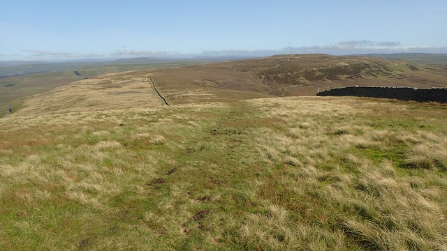
A friendly group of walkers soon overtook me, after having hesitated over where to go from the trig point. But I was following a marked right of way on towards Plover Hill, where my walk from Ingleborough to Park Fell was mostly followed an uncharted path.

Like so many of the Yorkshire hills and fells, there was peat underfoot.

Away to the west, I think I could just make out some fells of the Lake District – one to keep in mind for 2021.

To the north, there were… Hills. Open land. No signs of civilisation. Somewhere beyond that, you’d meet the Hardian’s Wall Path, Northumberland and the Cheviot Hills, before reaching Scotland!
Plover Hill‘s summit is almost marked by a T-junction of dry-stone walls, with a short flight of steps to help you over. If you to wander a bit further away, you might find some small cairns and a pile of stones – at least, according to the OS Map.

My walk continued down towards Foxup Moor. I briefly caught up with the guy ahead of me (blue backpack) but struggled to understand his dialect with the prevailing wind.

If you analyse the map at this point, you’ll see the contours are stacked quite closely together and I’ll admit, that this was quite a challenging descent, even with the many rocks under foot.

I passed another man who was heading up in the opposite direction. Head down and panting, he barely even noticed me before he passed me, having stood to one side! He did comment on how it must be easier to climb this section than to descend it… Even with a pole in each hand, I could only agree with that!

I would soon rejoin A Pennine Journey and follow that south-west towards Horton.

I might pass a small handful of others on this walk to cross Horton Moor. Each one as friendly as the last.

I stopped for lunch on a small mound, somewhere between High Hull Cave and Marble Quarry Hill. That man with the blue backpack again overtook me – I had spotted him tucked in to a shake hole for his own lunch break. Looking around at the landscape and the map, I know there’s a great wealth of history to this area.


From here on, I’ll only presume that people wearing shorts in the Yorkshire Dales are only following the Three Peaks Walk… Because many of the other walkers who I met (in September) wore gaiters – and with very good reason.

After lunch, I would rejoin the Pennine Way for the final time this year(!), at a point where others might’ve descend from Pen y Ghent on this day.

Now, the Pennine Way does something a bit cruel here, in heading all the way down to the village… Before winding all the way back up in a parallel direction as you return to a northbound journey!

But I suppose that passing through Horton-in-Ribblesdale is good for both tourism and a backpacker’s wellbeing. A chance to restock on food, take a break or even stop for the night. Alternatively, it looks as though one may be able to cut out Horton with a direct walk across Whitber Hill.

But I followed the “boring” gravel track down towards Horton, fenced in on either side by drystone walls. It was a bit of a slog but probably welcome to anyone intending to camp overnight in Horton.
I mostly remember passing two Scottish guys, “Alright, Pal!”, in a testament to how far north I felt I was! I don’t know how far they were walking but they weren’t packed as if to suggest that they were walking all the way home to Kirk Yetholm!

Advertising came as quite a surprised to me, on the very fringe of the village. But I guess many, many people do tackle the Pennine Way and Three Peaks Walk every year.
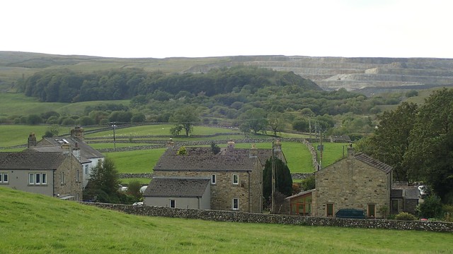
Horton Quarry stands tall behind the village and I felt as though some of these houses almost had the feel of a Welsh mining village.

Another useful map outside the visitor centre and close to the Pen y Ghent Cafe – both of which were closed at the time, due to Coronavirus restrictions and risk.
This trip has been the absolute highlight of what has been a challenging and very different year. I could’ve gone off to walk the Cleveland Way… But have absolutely no regrets over choosing this option. I look forward to discovering more of Yorkshire in another year.
Length of this walk = 9.25 miles
(If I had more time, I might’ve attempted this longer route from the Walking Englishman.)
Thanks for reading.
