Monday 10th May 2021
This would be my third walk in following and documenting the West Mendip Way, with one more journey to follow. Another circular loop in the region of fifteen miles, so that I could get back to my car.

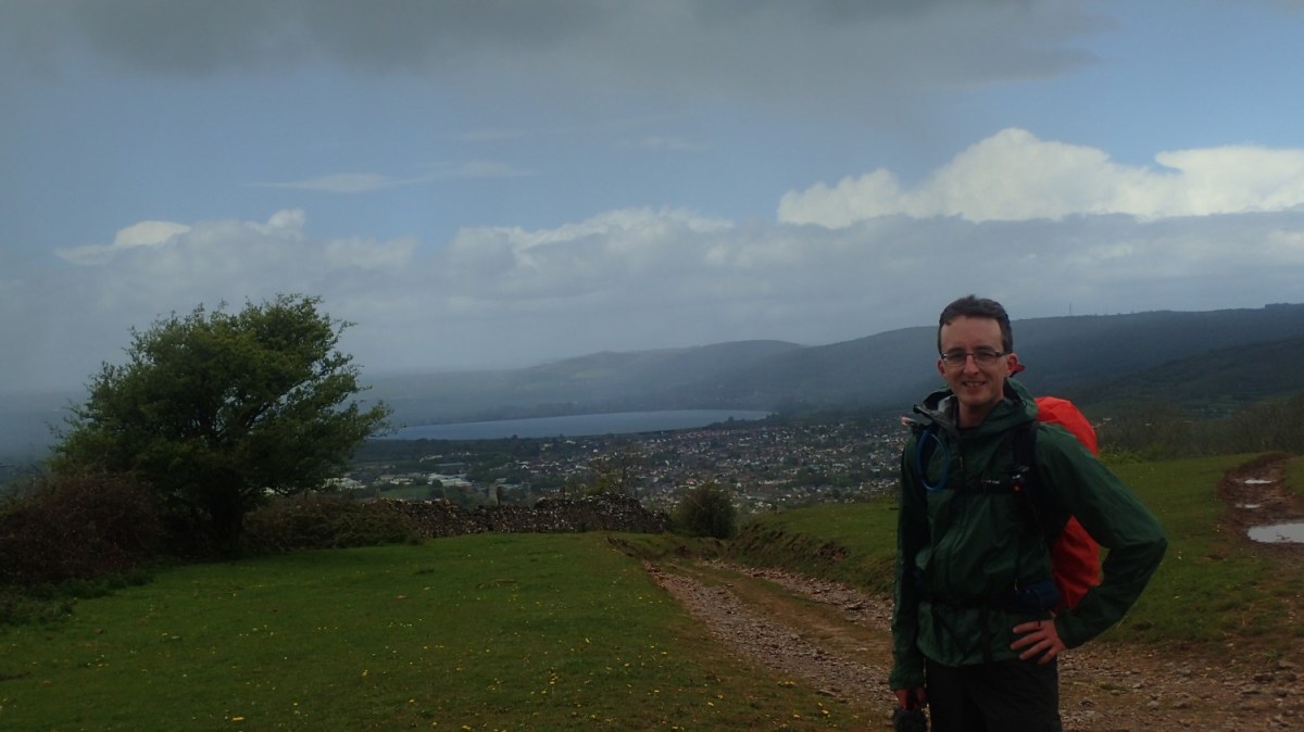
Picking up from the end of my previous walk in this series; I parked my car along one of the roads in the centre of Shipham. Parking isn’t always ‘easy’ here. I’d usually aim for the primary school or church – both of which were already surrounded by cars on this day. Another option might be to use the village hall car park – although, I’ve not checked whether that’s allowed.

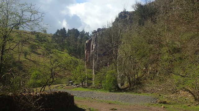
I followed the road uphill to soon join Lippiatt Lane. From the green sign, I began my steady descent in to Rowberrow Warren.

From the bottom of the valley, I crossed the stream to be climbing up, out and on towards Tyning’s Farm. Wateproofs were equipped along the way – it was one of those days where rain often seemed imminent, in accordance with the forecast.

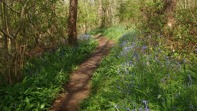
Leaving the woods, I spotted a collection of bluebells away to the south.
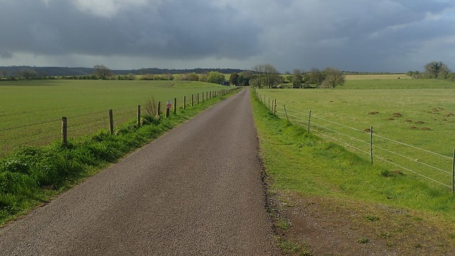
My walk now continues along the road, from Tyning’s Farm to Charterhouse Farm. It’s about ten minutes’ walking for me and I still find it quite sad how the Mendip Way skips Black Down and the AONB’s highest point (Beacon Batch). It would add to the challenge but then I’m not the biggest fan of road walking.
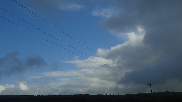
I marched on, destined to reach Cheddar Gorge before long. Ever-aware of the impending dark clouds.

After the next descent, I took a detour from the Way, following paths up and around Long Wood, which is an excellent local hive for bluebells at this time of year.

Back to the Way and my walk continues, passing Velvet Bottom and on along another valley known as Black Rock.
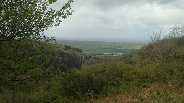
But before reaching the gorge road, I turned right and sharply uphill, following newer fingerposts for the redirected Mendip Way (the West Mendip Way previously continued to cross the road and up the other side of the gorge).
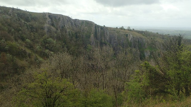
I paused for a while at the top; cup of tea in one hand. I could feel the pressure dropping but this rain had yet to arrive.

On the way down from these northern cliffs, I would follow the beginning of the National Trust’s own Gorge Walk. As I said in my YouTube video; I regard this as being one of the four toughest ascents/descents in the Mendip Hills.

Not only for the gradient but for what you find underfoot. Steps for a brief portion near the top. Wild tree rocks and slippery-when-wet rocks for the rest of the way.

I’d wanted to believe that I was also following the Mendip Way… But this is not the case. I would later discover that the West Mendip Way takes a far ‘safer’ route to or from the top, for as steep as it may remain.

By now, it was raining. Not too heavily but enough for me to warrant pulling my hood up. I chose I quieter path away from the B-road, on my way down through the touristy-portion of Cheddar Gorge.

A left turn up the hill and I was on my way towards Bradley Cross. Good views back towards Crook Peak, Wavering Down and the previous instalment along this Way.

Passing Mascall’s Wood and on towards Draycott. I was making good progress, which the rain had departed indefinitely.

I reached the junction with Middle Down Drove – which I’d soon be following on as part of my return route towards Shipham.

But my first thought was for lunch. To find somewhere ideally tucked away and out of the wind.

I crossed the valley towards Draycott Sleights… Where the Mendip Way would previously drop down (or climb up from) Batcombe Hollow – another one of my four toughest ascents/descents across the area. Today, the Way takes a welcome bypass through the nature reserve – which probably didn’t have public access decades ago.

While the rain held off, the wind was relentless. I had no chance of finding any form of shelter on the Sleights… It was time to turn back and follow that aforementioned track. Perhaps, over the otherside of these hills, I might find a break from the weather.

I didn’t expect much of all to come from this walk along Middle Down Drove. I had only walked along here just once before. It was on the way uphill from the top end of the gorge road, after two friends had misled us off course. I could see Rowberrow Warren, from the start of the walk and knowing that Shipham would be just beyond. It still seemed at least three miles away.
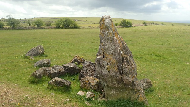
Then I stumbled upon a gated access point on to Middledown Nature Reserve. There’s no public right of way here but you are allowed to walk along this bordered track from ST 487 527, soon passing this peculiar stone within the row.

I decided to stop at a stone with a flatter top. Away from the others, almost a perfect seating height. It was time for lunch. No-one else around and, hopefully, the rain would continue to hold off.

…Well, some of my hopes went unfulfilled. As I was packing up, I was almost pelted with hailstones in the same moment. Trying to pack everything away; snap-to- and detach bits of my camera to make it waterproof; zipping up the waterproof layers I had already donned… I got a bit wet in this chaotic process. As I motioned to walk on, of course, those dark and heavy clouds dispersed!

I found my way on to a public right of way (footpath) that I was going to follow on around Bubwith Acres Nature Reserve… I would’ve met with the old West Mendip Way but, having studied the contour lines, I realised it would’ve meant an extra ascent.
Instead, I crossed the Open Access Land to follow a marked track that would lead me past the Totty Pot, which you can just see above; cover in place.

Meeting this high fences was an indication that I was about to step on to land that is part of Cheddar Gorge. I think the idea is that these keep the deer away from the goats and gorge.

I’d not walked the next particular path at all but I soon recognised at where it would emerge.

I know these southern cliffs of Cheddar Gorge quite well, along with the enormous views. It wasn’t long before I was descending the concrete steps of a very quiet Jacob’s Ladder.

On the way down, I noticed further evidence of a clearance due to Ash Dieback Disease.

Back over the gorge road from the National Trust shop. I passed my way down from the top of the gorge in the morning and then the official West Mendip Way route… For a challenging walk up Tuttors Hill.

A stone’s throw from the quarry here, I found a large collection of litter and industrial waste items, recklessly dumped within this woodland.

My next set of footpaths – and one I know from previous walks – would lead me on to Ashridge Farm. Cattle spread all over the first field; cows with calves… I gave them all as wide a berth as was practical, before realising that my path carried on through the corner of the field and I had to backtrack a bit.

At Milkway Farm near Tyning’s Gate, there’s what appears to have once been a shelter – it looks not unlike two other air-raid bunkers found up on nearby Black Down. This was all to do with Operation Starfish back in the Second World War. I’ve been told that this third iteration beside the farm both looks and smells terrible inside! But you can clearly see the blast wall standing opposite the door.

From Tyning’s Gate, as I continued my walk along roads; I could just make out the eyesore that had recently made the local news. It’s not a white chalk horse but a piece of ‘art’ to celebrate the latest Resident Evil computer game.

I’m really hoping this doesn’t catch on and inspire others to start a trend. On the side of a wall in the centre of a town or city, this would make more sense.
I followed the bridleway up from Longbottom Farm (home to Mendip Camp) and passing beside Cuck Hill, above. Then it was downhill back to my car in Shipham.

Nice one Olly!
LikeLiked by 1 person