
Thursday 24th June 2021
I was on the road and heading up to Shropshire for a long weekend away – my first “holiday” (I refuse to use that term) since September, when I went all the way to Yorkshire for a week. I’d decided to stop off close to the Forest of Dean… To be honest, I wasn’t quite sure whether I was in Herefordshire, Gloucestershire or Monmouthshire at any particular point… But my goal was to head for May Hill.

It’s a hill that I have often admired from a distance. In my walks around the Cotswold Hills and also from following the Severn Way north to Tewkesbury. This was a route that I drew up sometime in 2019. It’s barely an hour’s drive from home and yet, I’d not previously made the journey. My walk begins from the free car park on Plump Hill (SO 658 170).

From here I would pick up the Gloucestershire Way almost immediately; crossing the A4136 and continuing in an eastward direction (…After I had accidentally spent a few minutes following the Way west, through the woods and in the wrong direction). There are no apparent parking restrictions here and no gates to keep the riff-raff away at night… I managed to parked infront of a stash of those silver gas canisters that Yoofs seem to enjoy these days.

It wasn’t long at all before I came unstuck in my attempts to follow the intended route. From following a private driveway and not the road I had intended; to be unable to find footpaths and waymarks that I’d felt would’ve been apparent, given that that the Gloucestershire Way is some 100 miles long.

With a moment of additional zig-zagging from my intended route, I eventually found a way down towards Green Farm.

I missed the intended left-turn here and continued south to the next right of way near the school, where I found the kissing gate had been chained shut. Of course, I scrambled over, while workers were installing wire fencing at the far side of this next field.

Soon, I joined a bridleway (having walked right past those workers) and hoped my way towards Abenhall would remain undisturbed.

Cattle were present in the fields to my left. All over them! For the most part, I was safe. Except for those few areas higher up, where they could sneak through a large gap in the hedge… Fortunately, they were more scared of me and fled the bridleway to return to their herd.


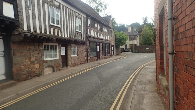
There were no issues in navigating these quiet roads. I did feel as though the layout of the text on the church sign was quite unfortunate.

My walk continues to the north of Hope Wood. Some of the fields through here were quite overgrown and, as it had rained recently, my lower trousers, socks and boots were getting soaked. I’d deliberately left my gaiters in the car because… It’s JUNE! And I wasn’t up north.

This was my clearest sighting of May Hill so far. Yet I still felt as though I was walking away from it… And only because I was keen to tick off a few miles of the largely-unexplored Gloucestershire Way.

A series of steps with wooden reinforcement led me down towards Whitmore Farm. I can distinctly recall struggling with this. I had been looking forward to this time away from life and work… But to be honest, I’d not been feeling “up for it” in the days before. Along with the stress of pre-trip packing and final preparations. I was knackered. Mentally. Physically. Navigational issues and the threat of long grass added to this.

At least I wasn’t the only person to feel this way! While it’s not a well-preserved National Trail, I felt that if more local people walked these ways then, the right of way would become more clearly defined with that.

Another bout of doubt struck as I marched on towards Brook Farm, where I’d momentarily rejoin the A4136. Metal fencing had been installed to keep people out of the (presumably dangerous and unstable) buildings. It looked as if the right of way had also been disguised.

I looked around. Hesitated. In my exhausted stated, I thought I could see the path continuing around these buildings on the map… I now see that was not correct. There was no-one about to ask and, as I realised this, I felt a rush of urgency, saw the main track leading to the main road and took it (which of course, turned out to be the right way after all).

I left the Gloucestershire Way at the roadside and would continued following paths heading east; yet remaining south of the A-road and Longhope. I climbed the gate above as I couldn’t be bothered with the carabineer holding the chain.

Waymarking was absent again, as I crossed a private garden and arrived at a point where, on the map, one right of way appears to cross through (or over) a large building… I decided to steer clear of that, wandered south and found a clear path junction (above) in the next field.

A short section of stone wall borders a footpath west of a footbridge (FB) and close to a pond on the map. I’ve no idea what or why.

I crossed a stream, someone’s driveway and marched across another grassy field towards the sewage works, where I turned in to meet a minor road. I wasn’t thinking clearly, even as I continued south along this road, when I should’ve gone north and then east, much earlier… But I did pass a house called The Map Barn! Curious to have known what might’ve been beyond those gates.

I wandered down this road for far too long and it wasn’t until I got to a road junction near Woodgreen Cottage that I realised this. I’d vaguely kept my eyes peeled to the left for a footpath opening – there should’ve been two to choose from…
SO 692 177 and SO 692 174
But even with GPS switched on and tracking my movements, I could not find any way through this everlasting hedge. No waymarking, stiles, overgrown gates or broken posts. A complete and utter mystery!
I trekked back up the road and towards the A-road once more. To a point (SO 692 184) where I should’ve come out on to this quieter road sooner.

A steep climb up this brief hill and I made my way on to the A4136 once more. For the third or fourth time now?! I then left the busier road again, as soon as I had rediscovered it. Now following a byway/quiet road down and around to join a path towards the woods.

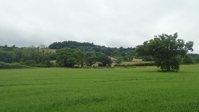
From one field, I could clearly see the high ground of the Cotswold Hills on the horizon. I’ve been up there a number of times and was confident I was looking at the area surrounding Cleeve Hill and Cleeve Common.

Blaisdon Wood was a welcoming space with clear and easy to follow paths. I’d hope to find somewhere in here to stop for lunch, as time was pressing on. But there were no benches as such and I didn’t want to sit amongst the green stuff and potential creepy crawlies.

Still heading east, I would make my way through Little London, while relying heavily upon the GPS on my phone, as my feelings of tiredness increased. I wasn’t particularly enjoying this walk and, over the past year, I’ve had struggles with the GPS function of OS Maps on my phone. It used to be fine… But an update somewhere, somehow has meant it no longer works ‘offline’ and I have to switch on mobile data to get it going again.

I would soon rejoin the Gloucestershire Way and meet with the Geopark Way for the first time. My hopes of a lunch stop dissolved as flies dominated any field with grass that was below knee-height.
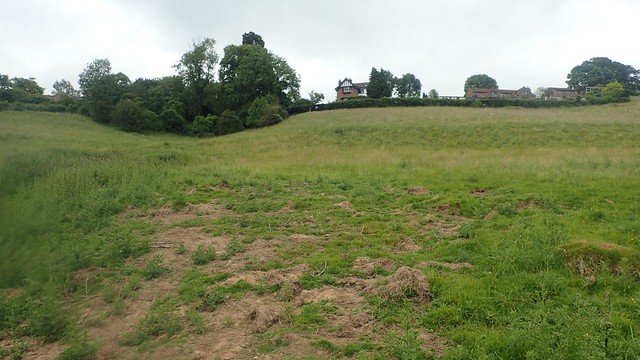
In the photo above, I had to follow vehicle tracks that appeared to deviate from the public right of way. But this worked in my favour as a shortcut, where the way zigs diagonally across one field and then zags left along the top edge.
I crossed another stream in to yet another field of long grass. From here, I would soon cross that A-road. Beyond which, I could at least see the woods that were now concealing May Hill beyond. It was around 14:00 by this point and I still hadn’t eaten. But I felt as though I was finally making progress.

I then crossed the A40 and followed both Ways past the school and up in to the woods of Brights Hill.

It was quiet enough that I’d feel comfortable stopping here. May Hill wasn’t too much further on… But I could imagine it being busy, even on a Thursday afternoon. I found a space a short distance from the path and gave my legs and mind an overdue rest. With all the shade, even on an overcast day, I found this space to be cool and refreshing.

I’d seen a couple of people pass by during my break – one of whom was doing a reccy for her own group walk and wanted to assess how muddy the paths were further ahead. I’d come out to do this walk with the added intention of pre-walking it for a future walking group event… But, after this experience, I can only say that my route needs to be rewritten and followed up with a second attempt.

Continuing on and feeling somewhat refreshed, I briefly met a man (probably in his 70s) who’d told me that on his previous visit here, he’d suffered a heart attack going up this very hill and had received further operations since! It was good to see him keeping active and taking things at a very steady pace. But I had to press on. Hills to do, paths to find and a tent to unpack and pitch before the end of the day.

From a higher point free of the trees, I could see Bredon Hill near Evesham. I’ve not been up there for a few years now but it’s one of the northernmost points of the Cotswold Hills – which will probably surprise some people, giving its proximity from Cleeve Hill, Winchcombe and the rest.

Following signed paths through and from the village of May Hill, I finally made it up on to the open access land of May Hill.

That cluster of trees, a signature of this hill from miles away, now stood before me. I had finally made it!

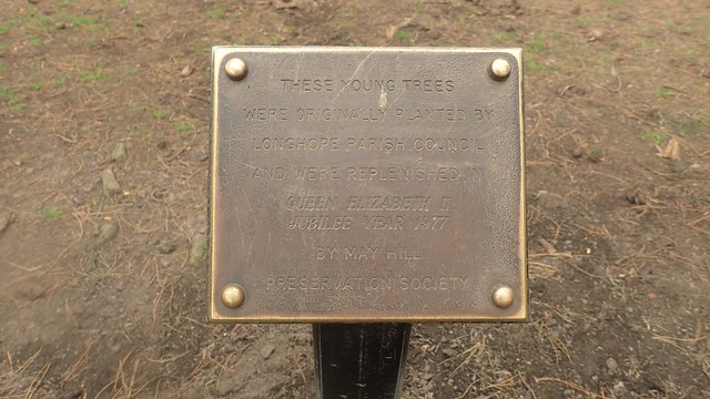

I read that these trees were originally planted in the late 19th Century and then replenished in the 1970s.


I found it interesting how this toposcope only refers to the Brecon Beacons and co. as being “Welsh Mountains”. Only today, while reviewing these photos, did I discover the Marcle Ridge in Herefordshire – one to consider for a future visit or passing through this part of the UK.


But the views from up here were quite spectacular, as I had always hoped they would be. From the River Severn to the Malvern Hills (barely visible through trees) and, on the otherside, the Brecon Beacons, Black Mountains and much of what South Wales has to offer. I could even pick out Sugar Loaf, as faint as it may have been.
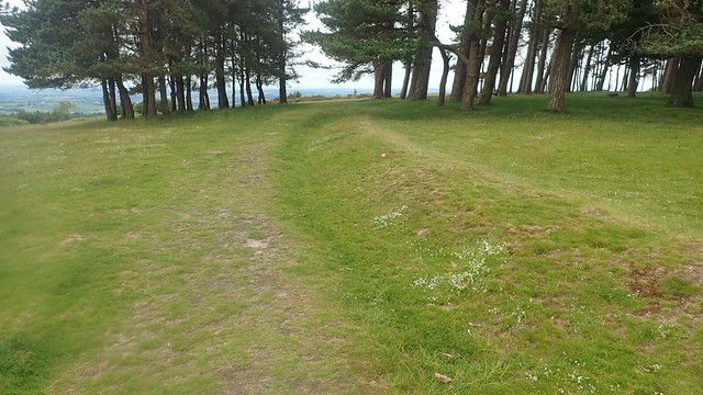

There’s more of a history to May Hill, with the shallow ditch that now surrounds these trees. But this was also the first place in the UK where I’ve seen (and heard) cows wearing bells. It was (not) like being in the Alps!

This would’ve been a great place on which to stop for lunch, had I not encountered so many issues earlier in the day. I continued walking north from the summit… Then corrected myself by retreating and heading west!


I’d left the Gloucestershire Way and would now follow the Wysis Way. A real mixture of fields and quiet roads.

But it wasn’t without its undulations – as if I hadn’t endured enough of them already! Crossing back over the A40, another hill awaited. Near the top of this, I could look back at May Hill.

I then found my legs ploughing through the longest, thickest and wettest grass I had yet seen on this walk. A vague path ran ahead of me but it didn’t make the going easy. I was quite concerned by ticks at this point and had spent most of the day with my trousers tucked in to my socks (which I don’t usually do).

I overcame this latest challenge, as May Hill began to shrink behind me.

Now, my walk would head downhill from Bilbut Farm, on a clear path towards Mitcheldean. Beyond that were the woods concealing my car. I’d soon have to walk alongside a busy B-road but that seem to preferable to some of this day’s experiences.


I passed by the church and through the town. Soon heading uphill one final time and in towards the woods. More overgrown paths awaited but they were unlike those I’d already conquered.

I followed the Wysis Way past an area known as The Wilderness – it appears to be an activity centre. Although the Easter Island Head, among other large stones, remains a bit of a mystery!


If I had more time, I’d have passed through that small gate and explored things up close. But I would have another ninety-minutes of driving ahead of me, followed by pitching my tent, cooking dinner… And it was already around 18:00 by now.

I passed a friendly dog walker in these woods, who was impressed to hear that I’d walked all the way out to May Hill and back around. He was keen to know how long it had taken me and I believe it was between 7.5 and 8 hours… Much longer than the six hours I’d accounted for!
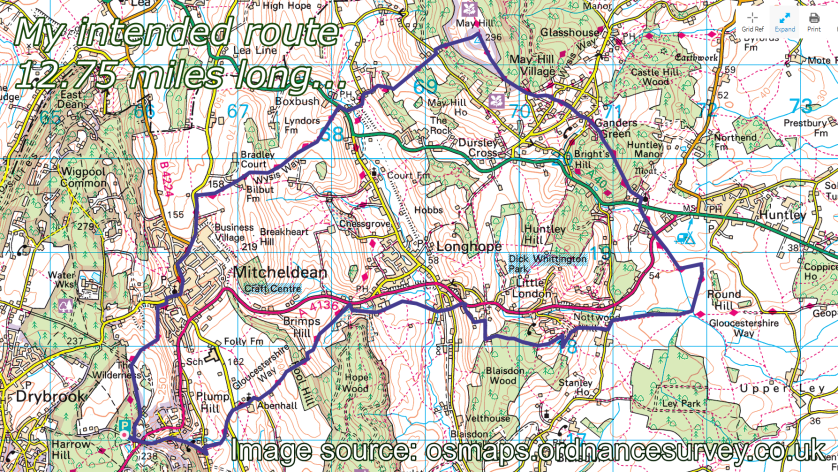
This was the route I plotted in 2019 and had intended to follow:
Here’s what I actually did:
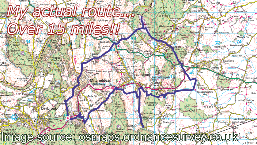
May Hill is well worth visiting but better – and even shorter – routes must be available. I was entertaining thoughts of driving home and abandoning the camping trip… I was that tired and fed up. But I persevered, pitched up and was looking forward to my next day’s walking, which you’ll be able to read about soon.
Thanks for reading.

Another great read Olly, worthy of more praise, but I am in hospital lying down trying to text. Good luck on your travels.
LikeLike