
Monday 14th June 2021
It’s probably been a year since we first talked about walking the Coleridge Way. My friend Anna has been keen on completing this fifty-one mile route across West Somerset. Together, we’d previously completed the entire Somerset Coast Path and this was going to be our next adventure.

As before, we made our separate ways down in to Somerset, with the intention of leaving one car at either end of the walk and then sharing a lift back to the start. I’d identified a layby off the A358 that we could use as the end point for our first ten-mile walk. We left one car beside the trees – on a day where shade would be sought – and drove on to Nether Stowey.

Things were a bit chaotic in this adored Somerset village, with one road leading in to it closed not far from the A39. We found our way in to the village but, expectedly, there were cars parked up and down both sides and oncoming vehicles all trying to squeeze past…

Instead of parking behind The Ancient Mariner pub (we’ve both completed the Castles and Coast Way, separately, from here), we drove partially uphill to nab one of the two available spaces outside of the library.

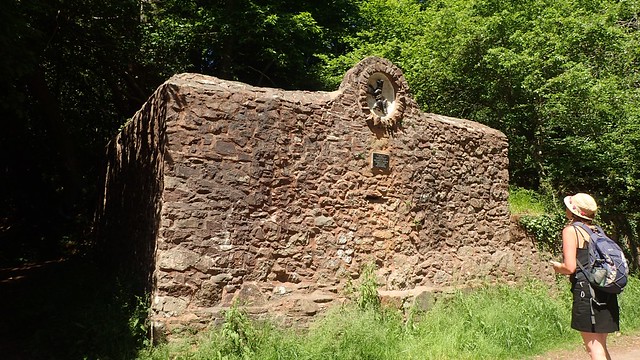
Our walk began with a tarmac ascent. Soon passing the entrance to Stowey Castle – the shapely remains of an old motte and bailey hillfort, which also features in the Castles and Coast Way walk.

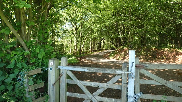
As the road began to level at near the brow of this hill, we had to contend with this steel ‘guardian’ before we could carry on down the other side of the hill…


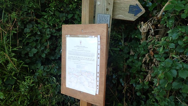
We were then looking to turn right, leaving the road for a bridleway. But miss it the first time, with the signature ‘quill’ of this trail having been hidden behind a footpath closure sign, installed by Somerset County Council…

We could’ve walked a bit further south and follow a path beyond Bincombe Farm…

Instead, we walked north, then turning west along Hack Lane, before climbing up and unsigned track to rejoin the Coleridge Way. In hindsight, the farm-route would’ve involved slightly less elevation.

Another climb was waiting in the next field, with evidence of disused quarries toward the higher ground.

Great views looking back. Across Somerset and on to the Bristol Channel.
Another road to follow from the top. Just outside of Bin Combe and close to the site of Walford’s Gibbet; where John Walford was once left to die in a cage suspended from one of the trees, here.

Our walk through the woods was clearly signed and much sought after, with the temperature only set to rise on this day. I was concerned we might run in to the Quantock Stag Hunt – I’ve only “met” them once but have been informed they’re out here most Mondays and Thursdays… But the only human evidence we saw was this forgotten hat.
Back in to the open (after a toilet break), as we passed beneath Dowsborough (or Danesborough). This track would lead us over Woodlands Hill – a point I would usually cross early in to my solo walks of this land, from Holford.
Looking back towards Dowsborough – possibly the only former hillfort in the Quantock Hills AONB.

We overtook two pairs of other walkers, on our descent towards Holford. Our walk continued down past the bowling green and the car park I would otherwise use for a long walk from here.
Anna spotted the dog pound at a junction of path and road. This was given to the village of Holford back in 1892. The previous owners had also owned Alfoxton House – which you’ll be able to see, shortly.


Along this northern edge of Alfoxton Wood, there are several benches where one can pause and taken in the north-facing view. Having started this walk late in the morning, we did arrive here in time for lunch, despite the fact that we were less than halfway in to our day.

Alfoxton House is where William Wordworth once stayed. In more recent times, it has been neglected. Vandalised. Explored. There have even been squatters…
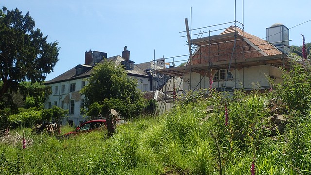
Until last year, when the site was purchased by a Buddhist charity. I believe it’s from the Triratna foundation – teachings of which I am somewhat personally familiar. Their long-term goal is to create a retreat here. In such a beautiful setting, one could imagine all sorts of travellers and visitors wanting to stop here as they would do a youth hostel – and there aren’t many low-cost accommodation options between Bridgwater and Minehead.


Up another hill and we then found ourselves descending towards the first of several combes we’d soon cross. At this one (Dens Combe?), someone had discarded their towel on a tree branch…

Not that there was much water in which to bathe!

I’ve often wondered why the Coleridge Way skirts around the northern edge of the Quantock Hills, instead of climbing up over and even following a level walk over the hilltops… It’s possible there were access restrictions back in Samuel-Taylor’s day… But I tend to think that he was an “unfit” man, perhaps not best equipped for lots of up and down in one day!

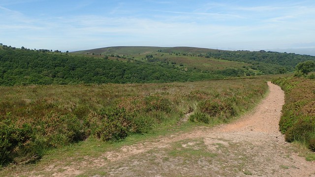
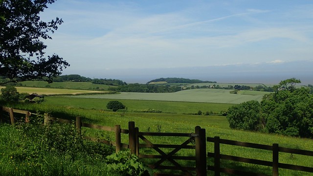
There are still decent views looking north towards the channel and you can often just see the coast of South Wales. But, having been on the top, this doesn’t compare to the panorama.

I do forget just how challening this section can be, despite the fact that it goes ‘around’ the hills and not up them. Signs kept pointing us towards “Perry Combe”. We’d cross one combe, then another valley and one more… But those same signs would continue. I do feel as though an elevated walk could be less monotonous.

Within these exposed tree roots, we could see evidence of old dry-stone walls. Boundaries that have existed for… A long time!

Further along the path and the tentacle-like roots of another specimen ran parallel to the path and not across it. I could not understand why. It must be reaching for the nearest combe?

I’d walked along this route several times before but had never paid attention to the markings on this gate…
I’ll never support such a bloodsport and my understanding is that the Quantock Stag Hounds (QSH) can only hunt on land where the landowner has given permission… I don’t know of the specific where and where-nots but I’m certainly there are areas of these hills that are off-limits.


Following the path now above the A39 but close to it, we met waymark posts engraved with ammonites – signifying the former route of the West Somerset Coast path.

In more recent years – and with the creation of the England Coast Path between Brean Down and Minehead – that route is now more true-to-the-coast, following along St. Audries Bay, just visible in the photo above.

Turning south towards West Quantoxhead, we could now see all the way across the vale to Exmoor. Butlins in Minehead was as visible as ever.

Another bench, another viewpoint. Looking west over the Brendon Hills and on to Exmoor.

Down beneath us in St. Audrie’s Park, deer ran happily around their enclosure. Closely following the groundskeeper for food or attention; in a scene not unlike that of Father Christmas and those who would drive his sleigh.

Our walk along the Coleridge Way was nearing its end for this day. Through West Quantoxhead, we’d only have to pass through the village of Bicknoller to return to Anna’s car.

Dropping down to follow the A39, we walked past The Windmill Inn, on what appeared to be a good day for them. How pubs and hospitality businesses must have suffered through this past year. I know we’re not ‘out of the woods’ with this pandemic but, speaking personally, I’m happy to see the current restrictions remain. We’re far better off than we were in March and, if it only means that we can’t go to night clubs or travel abroad just yet then… I think that’s another acceptable sacrifice.


Heading back in to the woods of Staple Plantation from West Quantoxhead, we passed the tiny doorway to a well that has probably been here for many years. I’ve yet to find any further information online. Neither was I prepared to test its watery depths! It is quite clearly marked on the map with a blue ‘W’.

Tall and mighty trees lined the paths through Weacombe.

Across the stream of our final combe, I spied this old enclosure.


This was possibly related to another disused quarry but I cannot be certain. As for the tree stump in the centre… It was only a log that someone had positioned as a seat – which I discovered as I went to test it with my foot!

My first ever walk on these hills – back in April 2014 – followed the northern loop of the Quantock Greenway. I could remember reading about the fingerposts around Bicknoller. How the one above was almost lost to the undergrowth, while another, elsewhere, lay broken in two.

We left the woods and combes to take the quiet roads through Bicknoller. Passing another pair of bimbling walkers, we crossed the A358 to return to the car at Quantockside. That morning, Anna had tucked her car neatly in to the shade… By now, the sun had shifted so that there was no hiding. A warm and humid day but a good walk and we had made a positive start to our newest shared adventure.
Our next walk along the Coleridge Way will continue from here and for another ten or twelve miles. We’re not sure when or how soon that may happen, as we each have our own commitments.
Length of this walk = 10 miles
Thanks for reading.
