Friday 25th June 2021
This would be my first walk in the Elan Valley. A place I’d been wanting to visit for a couple of years and one of the main reasons I’d decided to pitch my tent in this part of the UK. Before I booked the campsite in Knighton, I had been looking at sites around Llandridnod Wells and Rhayader… But they were either too expensive for my liking or required you to bring your own toilet!

I woke up in a better mood on this day. Somewhat lethargic, following a typical poor night’s sleep in a tent. Yet I was optimistic and looking forward to meeting the Cambrian Mountains for the first time.

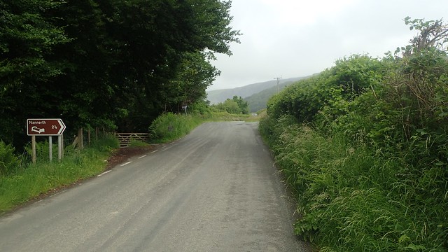
It was about a forty-minute drive out to Rhayader from Knighton and I stopped in a signed car park across the road from the end of the cycle-friendly Elan Valley Trail.
I was loosely following a route that I’d found on OS Maps – and one very similar to a route that I penned with the input of a friend. You can find the link to it, above.

Off I went, following a quiet road over the Dderw Bridge and along part of the National Cycle Network. There’s no off-road alternative to the beginning of this route.
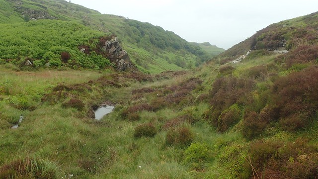
Turning right off this road, I could see big hills – if not small mountains – in the mist beyond. A day in which it had threatened to rain, while the scene remained overcast.
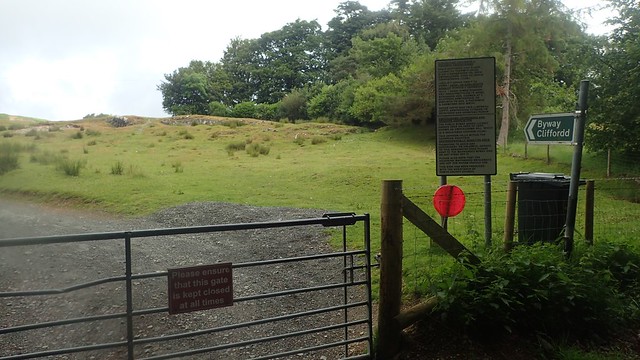
Then I left the roads for a signed byway, opposite Gwardolau Farm.

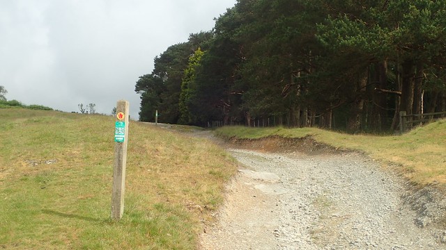
There’s no uncertainty about the way forward from here, as the byway is clearly signed and with frequency. I presume this is to keep motor vehicles on the track, while walkers would be free to roam all over the open access land, here.


…As I did, on my push to the summit of Esgair Dderw.

I followed a narrow path – probably a sheep track – where practical. I don’t like to do any more damage to these landscapes than is necessary.

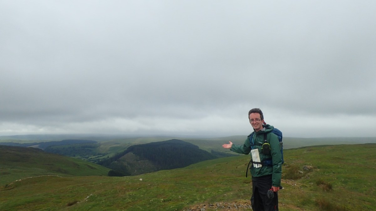
I made it to what and where I felt was the highest point here, at around 463m above sea level. No trig point but a good vantage over the valley to the west.
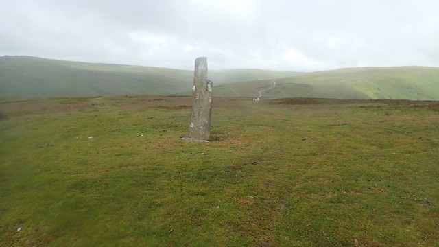
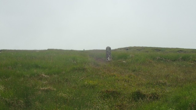
Returning to the byway, I met this standing stone and I’ve only just realised, looking again at the map, that it is named as Maen-serth. “Big stone of the obscene religion” is one potential translation. Or the Prince’s Stone!

There was a symbol inscribed on the north face. A ‘T’ or possibly an ‘I’. It may also date back to the Bronze Age and could’ve been carved in to around 1,200 years ago.


Then I would leave the byway, heading west downhill along a bridleway and towards the next road.

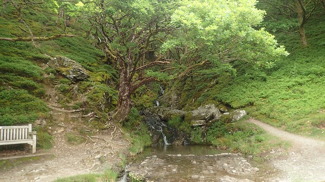
I crossed over close to a small waterfall, where the water of this stream runs down the valley and in to the River Wye. Speaking of the Wye, I was only a few miles or so away from the source of that river and also the River Severn.
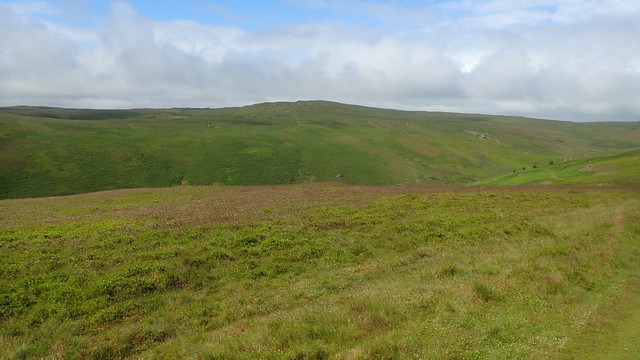
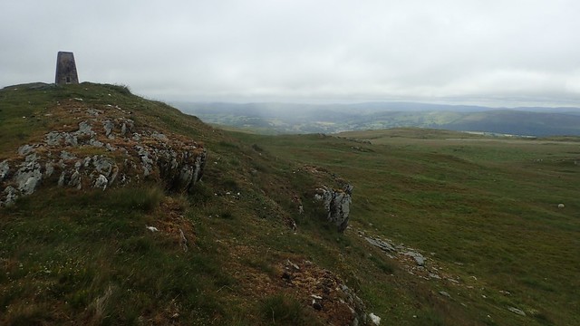
I marched up and on towards Crugyn Ci. There would be a trig point, somewhere, up amongst the rocks. Also, the wind was much stronger up here. But again, no issues of following the way.
I tried to search for the off-piste trig point using only a map and compass but turned up towards them far too soon. GPS on my phoned confirmed this, while I did pass a series of marker or boundary posts – possibly running north-west to south-east but I’m currently unaware of their purpose.


Then it was there, stood on top of a rocky mound. At 533m above sea level, this would be the highest point of my walk. Of course, much of this concrete pillar exists underground. Those Ordnance Survey workers must’ve had a torrid time installing them all, back in the day.

I sought wind shelter beneath the mound. Everything was covered in sheep poo but I managed to find a space to sit. So far, I’d seen just one mountain biker up on the byway. A car without a driver near the waterfalls. This was unlike walking in the Brecon Beacons!
There was a campaign that ended back in the 1970s to try and grant National Park status to the Cambrian Mountains. Thankfully, this didn’t come to fruition and these many acres and miles between Snowdonia and the Beacons remains very wild and without all of the manicured and maintained footpaths.

With my cup of tea, I tucked in to a bara brith bar that I’d recently purchased as part of a larger order from The Fell Store. It was delicious! I taste of orange and tea and less likely to rot your teeth than Kendal mint cake!

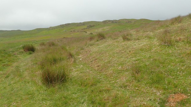
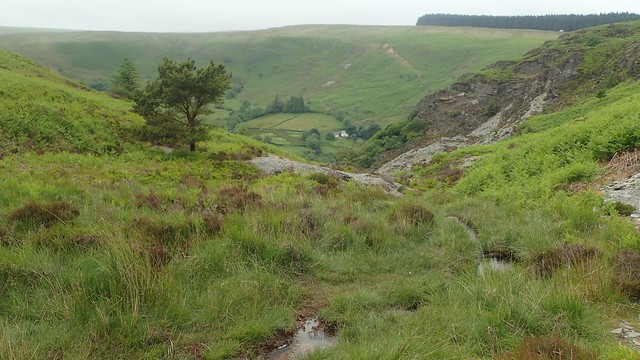
Heading down towards the next valley, there was no wrong path to choose, really. But I wanted to keep to the north side of Nant y Blymbren, down towards Penygarreg farm.


I could see the dam of Penygarreg Reservoir and the bridleway before me was clear on the ground… But with a lack of waymarking, finger posts and a farm below, I became doubtful. My GPS wouldn’t work; I started to panic. I’m always apprehensive about passing through farms.

So, I turned back. Hesitated for a moment and then decided to follow the boundary line to see if I could evade the farm buildings. Still on open access land, this was technically legal. I just meant contending with bracken that was almost up to my shoulders.
There was a minute where I heard a quad bike rev up from the farm and ascend the bridleway I had just escaped from. Had the farmer seen me looking lost and raced up to help me on my way? Probably not. But I felt the urge to duck beneath the bracken – probably covered in millions of ticks by now – until the noise passed.
I followed the fenceline downhill, through the ferns and at pace, to reach another well defined bridleway. This ‘absence of waymarking’ is a theme I would soon have to get used to over the coming days.

I didn’t make it down to the dam of Penygarreg Reservoir – it looked like a sizeable diversion at the time. Perhaps I’ll get there on my future walk in this area. Or, do the drive by tour of all of them, as many seem to do.
I was now walking south along a higher road above Garreg-Ddu Reservoir, with the Elan Valley Trail beneath me.

A few years ago, I went to the Port Eliot Festival in Cornwall and listened to a talk by Dr. Matthew Green, about Britain’s lost cities and civilisations (as featured in a book that is sadly no longer available). He talked about the Elan Valley and how these reservoirs were created to serve the suffering people of Birmingham. Many villages were lost in the rise of all these many tonnes of water. In one village (I forget which and forget which dam), the last people to be evacuated from their homes had the surname… Parry-Jones!
I don’t believe I’m related at all but it was interesting to hear.

My walk would continue along the Elan Valley Trail. I believe it’s about 8 miles in length and linear. There was a lady ahead of me, running with her dog. Two bikepacking women cycled past me. Were they on some Land’s End to John O’Groats journey? I’ve met a few people doing that recently. I didn’t get to ask.

This original route now follows the easy trail in its entirety, all the way back to the car… It’s probably good as a cycle run or running route but, to me, continuing aaaallll the way along past Caban-Coch Reservoir… Just looked boring. I was also wearing heavy leather boots – overkill for a flat gravel track.
I had other ideas and turned left, climbing up towards the road at the first opportunity. Then walking right (it’s not a busy road), I arrived at the bottom of this combe – a very clear indication of where I was on the map.

A bit further along the road and I met a bridleway that I could follow steeply – VERY steeply – up towards the source of the water.

There aren’t enough expletives to describe how tough that ascent was and, after a day of frustration previously, it took a lot out of me. I was also pushing for a lunch break and decided to stock up on water from the fast-flowing stream, using my Aquapure Traveller bottle from Pure Hydration:


I was looking for a cairn from then on and possible found it at this… Gathering of stones that’s otherwise unexplored. I also walked past the first two other walkers I’d seen up on the higher ground. But I can’t imagine it ever getting too busy up here.

A bit further on and ahead of my next path junction, I found this broad opening, mostly sheltered from the wind. It was still littered with sheep poo but I found a space to sit down in good time for lunch. I was feeling a lot better within myself than how I was twenty-four hours earlier.

After lunch, it was back to the map and compass work. Initially, I was confident in following the bridleway beneath my feet… Then it seemed to disappear. I put my faith in my ability to read the landscape and could see that I’d have to follow it down the valley and close to Nant Madog.

Where had that bridleway gone?!?
Cotton grass is a warning sign of boggy conditions under foot and there was much marsh from here on, as I sploshed and splashed my way along this descent. Yet never sinking any deeper than the depth of my own ankles.


This was why I had worn leather boots over fabric! My socks were bone dry, although I perhaps should’ve also worn gaiters to keep my trousers clean. I did find a resemblance of solid but narrow path further down. I wonder how many – if any – horse riders venture this way?
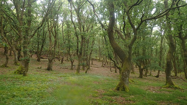

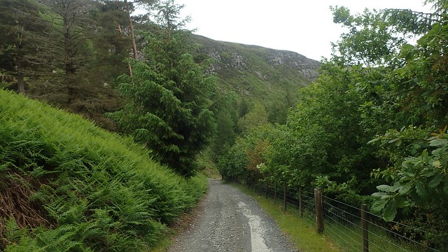
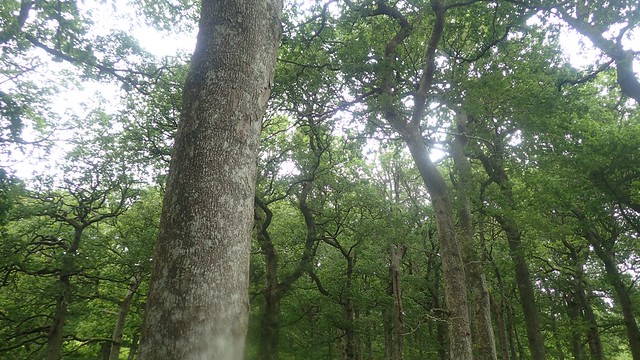
I soon joined a quiet, elevated road, as the rain began to fall a bit heavier. Trees overheard help to keep my dry. I didn’t need to keep my hood up. On paper, this section looks a bit ‘dull’ and featureless. But it was direct, for all two-miles of duration and, in wet weather, it was quite convenient.
Eventually, I would cross the B-road close to Dol-afallen Bridge. I could’ve walked further south-east to a confluence of the River Wye and River Elan… But I felt it would’ve taken me quite far off course, while I turned left through a gate back on to the Elan Valley Trail.

With about one mile left to walk, this was very do-able, even in heavy and sturdy footwear.


There was once a railway running through this area – another of the UK’s many lost lines. Beneath the path at one point, you can see the entrance to the old tunnel – which has of course, been bricked up.

I think I passed a couple of other walkers on my way back towards Rhayader. I like the idea of returning here one day with my bike to cycle the full trail, there and back again.

I could then stop at and admire the dam. Perhaps also seeing the Elan Valley Visitor Centre. I’d made the assumption that it would be close, thanks to the pandemic… But Google Maps suggests it’s probably still open.

That was it! My introduction to the Elan Valley, the Cambrian Mountains and I am keen to revisit this area and explore much further!
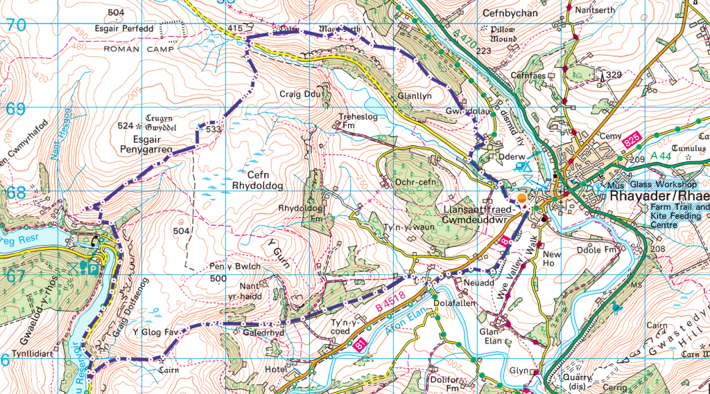
Length of this walk = 10.75 miles
For another route that touches on some of these features, please see the Elan Valley website:
Thanks for reading.

Hi Olly.
Nice story and a lot of pictures of beautifull landscapes too.
Have more great adventures! 👍
LikeLike