Saturday 26th June 2021
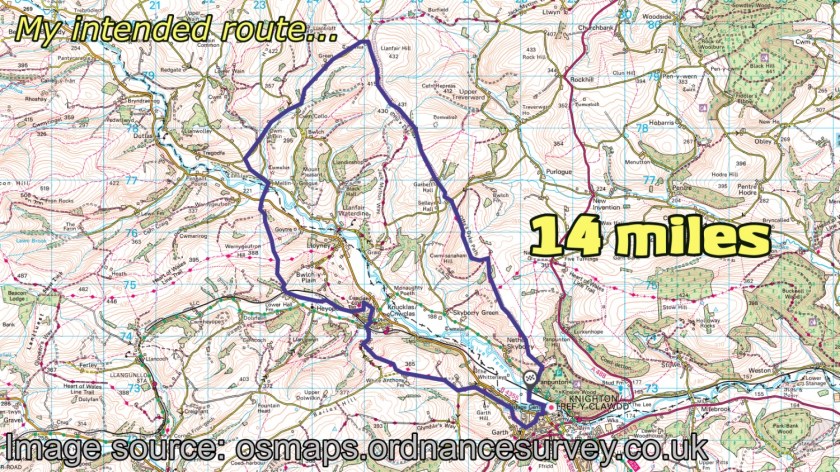
It was time to leave the car alone for a couple of days. I quite enjoy being able to do this; setting off from the campsite and returning on foot, later that day. In this walk, I’d begin by following Offa‘s Dyke Path several miles to the north, before leaving that National Trail and looping back along a variety of footpaths and bridleways.

From the gates of the campsite at Panpwnton Farm, I swiftly joined the National Trail before 9am. Crossing the quiet road, I began the steep climb up Panpwnton Hill.

It was looking like quite a “Welsh weather” day, in spite of the fact that I was currently north of the River Teme and probably walking within the Shropshire Hills AONB.
Being a UK National Trail, the waymarking along here should be close to excellent and there should (should) rarely be any struggles when attempting to follow the way.

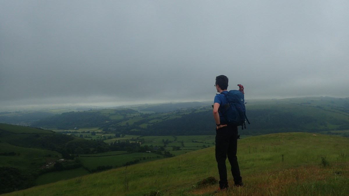
Was it going to rain? Would it remain dry? I can’t recall the forecast of the day now but I don’t remember it being forecast to rain heavily. Neither was it likely to be hot and sunny. But I quite like the conditions, looking back down towards the town of Knighton.

A bench awaits at the top of Panpunton Hill.
“Tref-y-Clwdd” – Knighton is known as the ‘Town of the Dyke’. You can even find the Offa’s Dyke Centre, across the river from my campsite. Sadly, it was closed during my time here.

Far beneath me was the River Teme, which spends most of its life running through the hills and towns of Shropshire. I’d be crossing over later on this morning.


As expected, there was no issues over following the way thus far.

Beyond the next combe, another hill awaits and with the reward of a trig point standing on its summit.


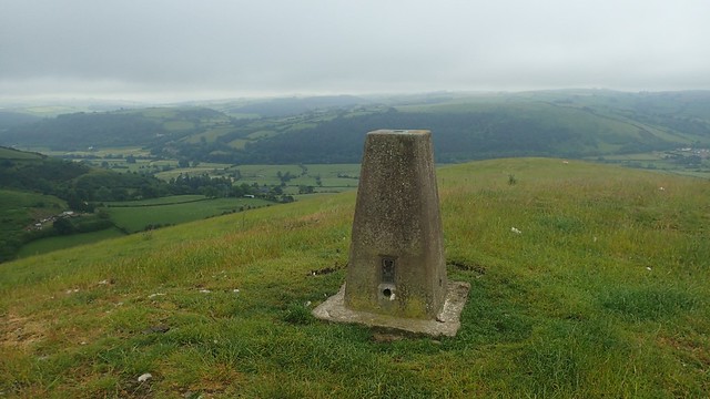
This was Cwm-sanaham Hill and at 406m above sea level, it would be the highest point of my day out. Had it not been so wild and windy up here, I’d have stopped for a cup on tea. Yet on what I considered to be a decent Saturday morning for a walk… There was no-one else about.

Some of the grass so far had been long – although nothing compared to what I’d seen in Gloucestershire, two days earlier. With the rain having fallen overnight, it was also wet and this quickly transferred on to my lower trousers, my socks and down in to my “waterproof” boots…
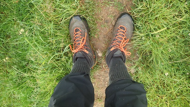
I’d made a potential error in not wearing leather boots for this one – but with the mileage on the increase, I was also wanting the comfort of my La Sportiva TX4 boots. But despite what they claim and, even after washing and reproofing, these boots do NOT keep your feet dry.
I also adopted the Stereotypical Ramblers’ approach of tucking my trousers in to my socks, in order to help keep my trousers dry and clean.

Heading steeply downhill towards Selley Hall, I did momentarily lose the way (in spite of the yellow arrows) but didn’t wander far from the right path.

I passed another walker before Garbett Hill – the first other human being I’d seen since leaving the campsite. Part of the route had been officially redirected here but it still matches up with the current OS maps.

I did slip and fall backwards, descending a set of wooden steps too confidently, after the night’s rainfall. Neither of my cameras had been able to capture this!


From Garbett Villa, the Path begins to climb once again, following a stone-laden byway. Soon to meet with Offa’s Dyke itself.

I went a bit wrong from the fingerpost above. I followed the red arrow (byway) too far on and to the field corner opposite… From the map, I could see that I should’ve turned left immediately after the earthworks and waymarking. Although it’s not entirely clear without following a map.


Following the track and with portions of Offa’s Dyke away to my left, I marched on to the point where I’d be leaving the trail for this day. There was also the question of bagging a nearby trig point…

This one stands on private land, at 430m above sea level. I won’t condone trespassing but it was easy enough to hop over the five-bar gate. Just be aware of the long grass. This pillar was only two metres beneath the true summit of Llanfair Hill.

Only a red dragon across the track would know of my mini trespass (before writing this).


My original plan from here was to continue north to the next road and then follow that all the way down to the river; potentially incorporating bridleways and footpaths on the way. But I turned south, leaving the Dyke Path and following the earthworks.

I was now intending to follow the Jack Mytton Way downhill but I turned off too soon and now following a permissive footpath towards a farm, marked only as a black dashed line on the OS Map. Someone passed me on his quad bike and was friendly. There was no ‘get off my land’ or questioning of my presence.

I followed this down towards the farm buildings and bridleways of Llandinshop, where I would rejoin the Jack Mytton Way – in itself, this is a 93 mile trail around Shropshire that appears to follow many bridleway-like paths.

I followed this Way down the road and past Llanfair Court. I would then continue west along this minor road, to a footpath across from Llanfair Hall.


This led me on to a footbridge, where I could cross the River Teme for the first time today. I’m not sure what might’ve happened to the kissing gate on the other side!

Then there was grass. Long grass! Up the my waist and with no clear footpath worn through. It was a tussle and the population of thistles and sharp things increased in the second field. I took the first available opportunity to climb a gate, escape and step on to the B4355 road.
My plan now was to follow a public right of way (a footpath) up through Lower Goytre Farm. I found the farm gates instantly… But there was no waymarking whatsoever and no signs of anything former. This track runs right beside the buildings. I felt uneasy about treading this way, even though it looked right on the map. Through experience, I’ve learnt that a lack of invitation upon entry can lead to further obstruction ahead.
My next plan was to walk further west along the B-road to Brynedin… Where the mapped public footpath from the road does not exist! I felt more confident in following the bridleway along the driveway.
No signs but horse riders must use this, right?!
I found my way. But again, there was no waymarking. Every gate beyond the first had to be climbed or untied, until I got to the Open Access Land. Horse riders and mountain bikers could not enjoy this route!

What is going on in Powys?!
I’ve noticed this in other parts of the county and even in the Brecon Beacons. Are landowners getting away with it? Or are these paths only available to “those who know”. I’ve previously read of the council’s reluctance to put new waymarkers along the Cambrian Way.

There was no turning back from Wernygeufrom Hill, as I followed the broad bridleway up beside a heather-clad valley. I’d been apprehensive all the way up to this point; listening for the shout of a lurking landowner.

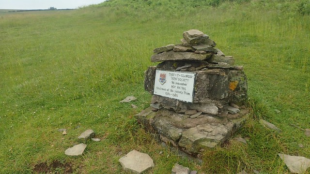
There’s nothing overly rewarding about the top of this long hill. No trig point on any one of its high points. But the bridleways ran wide and I could stop here for lunch, having walked all morning thus far without a break.

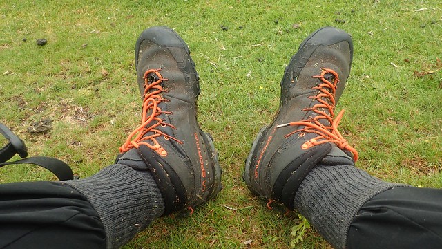
My boots and socks were soaked from all the long grass. I’m sure that La Sportiva market them as being waterproof. Even my Salomon fabric boots were better than this. But apart from that, they were comfortable, after two days of sweaty feet encased in leather.

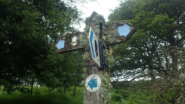
After lunch, I’d be walking east along the southern edge of the Open Access Land. At a gate, I noticed this waymarker – I didn’t realise at the time but it’s for the Heart of Wales Line Trail. A fairly recently-developed walk that can be completed in combination with the railway line. As for the viaduct, that’s probably the one in Knucklas.

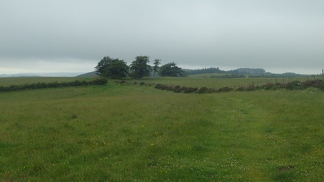
Crossing Goytre Hill towards Lloyney, I passed this private fenced off area, where walkers were kindly invited to explore.

I’d follow the bridleway down to a road near Lloyney, having been unable to spot the footpath veering off down to the right. I followed this road south-west past Hobby Farm, looking for a road to pass Upper Forest Farm… Beyond that, I could see farm buildings and felt uneasy. No waymarking for any of the other options.

After much hesitation, I returned to the B-road. One mile later, I was looking for a right-turn of a footpath, heading up Castle Hill… I stopped at the top of this one, where CCTV cameras and warnings towards ‘trespassers’ were present. Again, not a single waymark anywhere. I probably could’ve found the way through but my confidence was sinking.
Back to the road…

In the end, I’d followed the B4355 all the way to Knucklas. I don’t imagine the Heart of Wales Line Trail does this!

I did see the iconic railway viaduct on my way through the village. Apparently Knucklas was formerly part of Radnorshire and not Powys.

My final approach to Knucklas Castle would begin from the west. And it was waymarked! I’d also passed a friendly local in the village.


There would’ve been a castle here in the 13th Century, while the hill itself has a history dating back to the Bronze Age.


I took the time up here to air my boots and socks for a few minutes, while contemplating my return to the campsite. I’d planned to do more road walking and to then follow Glyndwr’s Way back – which would’ve spoilt the start of my next day’s walking. I could get a train from Knucklas, which would pass right beside my campsite. But it was less than an hour’s walk to get back from here…
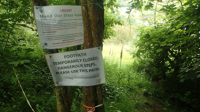
On the way down from the castle, I found these notices to state that a set of steps leading up the hill were in need of repair.

I hadn’t spotted them on the way through the village. Looking at the photo above… I’m not sure how!

I returned to the B-road, crossed over and then followed the minor road on a direct return to Panpwnton Farm. Passing Skyborry Green and Nether Skyborry. I used to hate road walking but, on this weekend, it was becoming preferable to the supposedly public paths!
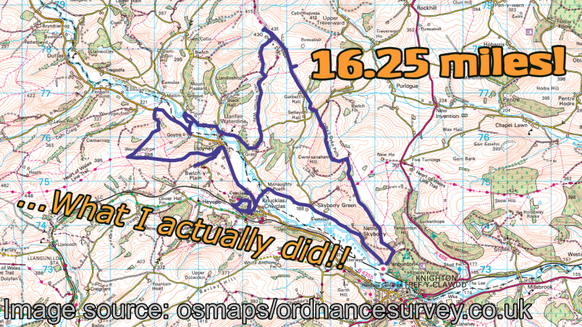
Aside from the challenges of finding my way through the second half, this had been a good day out. I hadn’t expect much at all from either of these weekend walks but there’s something about following Offa’s Dyke and I hope I get to walk more of that Path in the future.
Thanks for reading.

Well done Olly another great read!
LikeLike