
Sunday 1st August 2021
For only the second time in 2021, I had made the journey across the border and on to Wales for a walk in the Brecon Beacons. This walk would be almost-completed new to me; a twelve-mile circuit following a route commonly known as Bwlch With Altitude… Then, adding an extra hill an ascent before the end.

It took me almost an hour-and-a-half to get to Llangorse Lake from Weston-super-Mare. Forecasts suggested it would inevitably rain through the morning. But I’d set this date aside and was determined to see it through. Waterproofs packed along with leather boots.

I was pleased to find that it is free to park at Llangors Lake – and quite surprised, to be honest. Traditionally, this walk should begin in the village of Bwlch, where there are incredibly few parking options. Bwlch is a Welsh word for ‘pass’. A pass between the hills and mountains. I wasn’t sure which of the three parking areas was the ‘P’ I’d spotted on the OS Map.

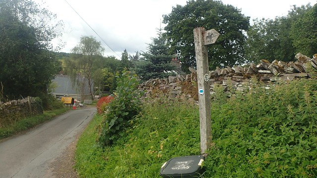
I’d parked on the left, shortly after the café and toilets. Walking back up the track once I was ready, I did find this blatant footpath fingerpost, adorned with yellow paint. My anti-clockwise circuit could begin!


In the fields beyond, the going was clear and obvious. I would soon find myself passing other walkers – mostly dog walkers – and the occasional runner. It was quite busy, for a 9:30 start on a murky Sunday morning.

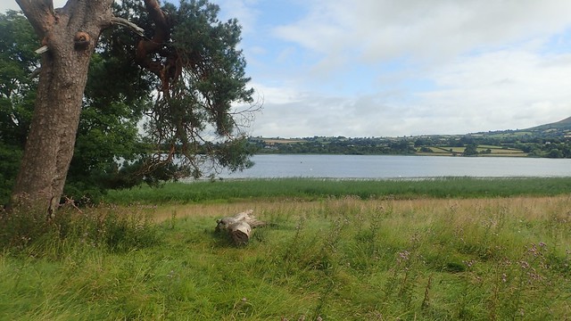
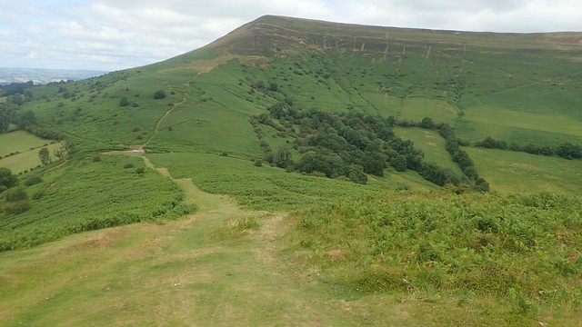
There’s no legal right of way that closely follows the edge of the lake. So, I followed a series of footpaths that circumnavigated the water as close as was practical. To the south, was a sizeable hill that I was sure I wouldn’t be climbing…
How wrong I was. This was the ridge of Allt yr Esgair, which I would meet in another hour or so.
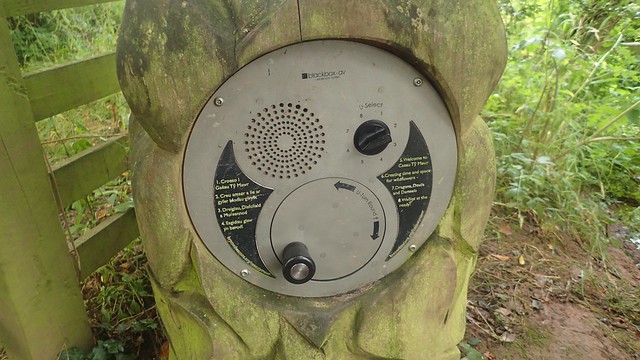
If you wind the handle of this “black box”, a recorded voice begins to play from beyond and encourages you to keep turning to hear more.

Later on this afternoon, I’d be walking along the top of Mynydd Llangorse. In this moment, it was partially within the cloud. How long would I need to wait before those clouds would dump their contents on me?

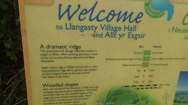
I walked on as far as the church of Llangasty-Talyllyn, where an information board would tell me a bit more about the local area, its history and this walk.

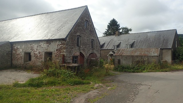

I then followed the road heading south-west from the church to a T-junction. I could’ve turned off sooner and followed paths through Tymawr Farm.
There’s an opportunity to park beside Llangasty Hall when the hall is not in used. Donations would be appreciated and there’s information available on how to pay via text on your phone.
From beside the hall, I followed this bracken-clad bridleway heading uphill and to the south.

This led me to a junction with another bridleway where I’d meet the Three Rivers Ride path. Turning left, I would continue on my way towards Allt yr Esgair.

There’s a lot of history to this site, some dating back to the Bronze Age. Despite standing at less than 400m high, the surrounding views are spectacular and one of the reasons why this walk should be high on the to-do list for many of us.


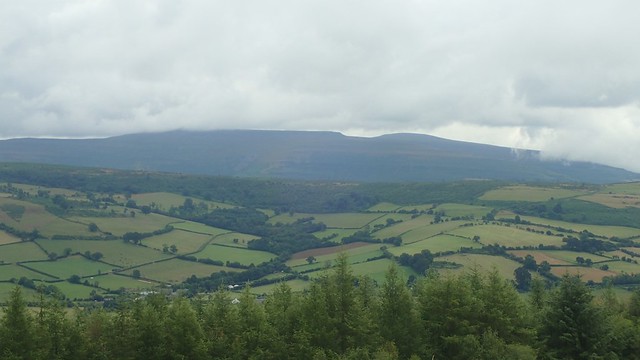
Away to the west were the central Brecon Beacons. Pen y Fan, Corn Du, Cribyn… They were somewhere within the cloud.


Still to come on this day, I’d be climbing up towards Mynydd Llangorse and, if I was feeling up to it, then continuing north towards the corner of Mynydd Troed.

No breeze and no other person about. I took this large rock as my seat and stopped for awhile.

As I packed up to move on, two other walkers arrived in my own footsteps. They were probably following the same route, as I plodded on downhill, following the bridleway.
I passed the friendly farmer on the way down; heading uphill on his quad bike. Cattle ahead of me began to rise and stir. Rain was no longer forecast! They were alive to the sounds of the engine and, as they caught sight of me, assumed that I’d arrived in time for feeding, or something…

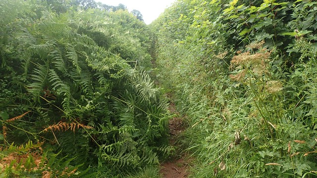
I’m less afraid of cattle than many people and a line of trees on either side helped to create a partial-boundary as they ran up and down. But as I left this field, I would continue on down a path that narrows and scratches before reaching the next road… A family and their dog were heading in the opposite direction. I probably should’ve warned them!

I’d made it on to the A40, just west of Bwlch. There’s no right of way to otherwise avoid this short section. But a wide run of grass exists on one side of the road at a time. With care and caution, it is possible to reach the village and its paved sides.

I stayed at the bunkhouse in the New Inn on a weekend back in November 2017. This was while a small group of us were partaking on a mountain skills and navigation course at the Llangorse Activity Centre, not far from the lake. We even had a good meal there – on a night were Wales were playing in the rugby…
Leaving the A40 and I would join the Beacons Way long-distance path, now heading north-north-east towards Cefn Moel.

It was a tough old climb up from here. Over to the west, the cloud had lifted and Pen y Fan (if that is what I’ve photographed) could be seen with clarity.

But south-east of here and Sugar Loaf’s summit was now in the cloud. Not a drop of rain had fallen in this part of Wales and yet, back home in North Somerset, it would have been torrential in places.
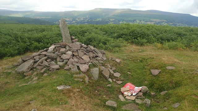
I walked on as far as this cairn – possibly the one about 360m above sea level – where I couldn’t help but spot the abandoned box of Budweiser beside it. Inside were just two empty cans of the drink. I packed it all up and decided I would carry it off the landscape with me. I can only hope that the drinker(s) at least took the other cans back with them. Otherwise, I’d fear they’re somewhere amongst the bracken!

I was feeling ready for lunch. But there was still some way to go before I’d reach the highest point and that was always going to feel like the better location, to me.

When I did that navigation course in 2017, we clambered up this way in the winter’s afternoon. Not quite to the trig point, at 506m above sea level. But somewhere beneath; moving point-to-point between pools of water. Practising our pacing and compass bearing work, as we’d learnt in the classroom that morning.


This trig point sits a few metres beneath the true highest point of Mynydd Llangorse. I would’ve stopped here for lunch but the place was swarming with flies and wasps… Whatever they were, they wouldn’t leave me alone. Perhaps they were drawn to the empty beer cans? A bit further on and I swatted them away with my map.

Mynydd Troed was looking almighty. Was I really going to embark on such a near-vertical detour?! I could save myself some serious exertion and take a direct route back down to the lake.

I decided to have lunch, sat in a cleft of land behind this large rock, which was partially obscuring my view of Llangors Lake, which seems so very far away.

Disaster struck towards the end of my lunch break when a gust upended what would’ve been the last cup of tea from my flask. I didn’t even notice until I reached for it. I had been very much looking forward to it, ahead of the final challenge.

After lunch, I pressed on towards the pass where I’d begin the final ascent of Mynydd Troed. It wasn’t going to be easy! I followed a perilous footpath beside the escarpment, before plunging down to the road. A few cars had parked here, while the official Bwlch With Altitude route follows this road down towards the lake.

No-one else was walking this way and in either direction. Beyond what you see above would follow at least one false summit. It really was hard going, while the path was quite easy to follow, visually.


That false summit was unwelcome! A bit further on and I could see the trig point beginning to rise.

At 609m above sea level, this was now the highest point of my day’s walking. No-one else to be seen or heard. Mynydd Troed itself continues to the south-east in a ridge-like formation.


North-east of here you have the Black Mountains… Y Grib, Rhos Dirion, Twmpa… I might also have been looking at Hay Bluff but I’m not sure.

I didn’t linger up here for long, even with all of these views and the solace. Another descent was inevitable. I had to return to that distant lake.

There was no right of way leading up to the summit and I’d follow a “path” on my way back down. First, walking the ‘spine’ of the hill, heading in a northward direction. Then turning west-south-west on more of a gradual descent.


Around the foothills, I would soon find myself brushing my way through the bracken. I felt some hesitation in choosing which “path” to take next and whether or not I was on track. But I did soon find a way out to the next road and even, passed a group of horse riders heading the other way.

I made it out and on to the road near to Pentwyn and was looking immediately for a footpath heading to the west (SO 157 293)… But beyond the long grass, the grass grew even longer as the path narrowed! I decided to avoid it would stick to the roads.

These roads weren’t busy or frequent with vehicles or people. I passed a number of farms with signed footpaths heading in all directions. It was probably a good two-miles of walking to get down to Llangors.

I was soon crossing fields on my way back to the car park of Llangorse Lake. A very good day’s walking was coming to an end. I would still have the long drive home but I was pleased with what I had achieved. I’m not sure I recommended adding Mynydd Troed on to a 12 mile walk but I’m pleased to have ticked it off and bagged the trig point.


It may be worth mentioning that piles of horse poo can be found around the edge of the car park. I’m not sure whether this is from horses left to graze or those when taken out from the riding centre. But along with the views… There are also the poos to contend with!
Length of this walk = 14.5 miles
Thanks for reading.
