Sunday 23rd January 2022
A few years ago, I challenged myself with the quiet intention of completing more of the walks available in the Walk West series of eBooks (all of which are free to download from this website). I couldn’t recall the last time I had embarked on one of Geoff Mullet’s walks and I wasn’t feeling too enthusiastic about another local walk on the Mendip Hills.
I dove in to Walk West Again (the second title in this trilogy) and printed out instructions and a basic map for the final route on the contents page.

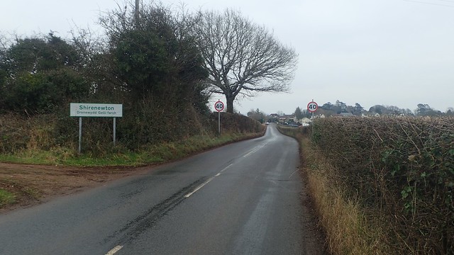
In less than an hour, I had crossed the River Severn and made my way in to Monmouthshire from Weston-super-Mare.

It was after arriving at the Foresters Oak car park and picnic site that I realised I had indeed been here once before. Someone else had driven (I’d have struggled to find it without GPS) and I was following in the lead of others, on what was a very wet day, perhaps five years ago.

Two other cars had already arrived before, even though I’d done very well to get there before 9am myself. But the air was still and motionless. A cold winter’s day. Akin to working in a chilled warehouse (and I do speak from experience).

Normally, the wind would blow cold and cut right through you. But in these conditions, the chill consumes from all over and without permitting an escape.

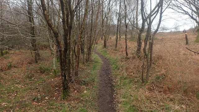
I passed a bridged walkway leading from the woods towards a cafe, which might also be the ‘sawmills’ that Geoff refers to in his original text (last updated in 2013, I’d like to point out).

I find it hard to trust the words of a written guide fully, when I’m aware that the text has not been updated for at least nine-years. Yet many of the features mentioned thus far (from fingerposts to streams) were as present on this day. I did face a few moments of confusing when I met the sign above…
Was it telling me to not following the bridleway ahead? Or was it to deter people from following the non-public right of way to the right and behind the sign?

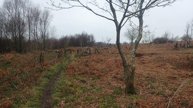
Well, I decided to turn right and step away from the bridleway; now following a path that isn’t an official PROW. But I was still within the boundaries of Open Access Land. A lot of tree felling had already taken place.

At the end of this detour path, I met a track that follows the forest boundary and also, a sign confirming that I had just walked the way of ‘No Admittance’… But this was a Sunday and no men could be seen or heard at work!

This led me back on track and swiftly to a junction known as The Five Paths, where I could rediscover my point within the text (I was also carrying an Ordnance Survey map, just incase).


A trio of friendly runners soon overtook me, as the route began to descend in to a valley. These were the only people I’d seen so far.
Beyond the small pond, I took a path to the right and it was one that would’ve been hard to miss. I quite often find myself feeling disoriented within woodland and sometimes struggle to follow another person’s guidance. But this experience was going very well.
Another turning and I was soon heading down to a T-junction, where the path to the right apparently soon comes to an abrupt end, where the landowners have illegally decided to revoke access to the public footpath crossing their land.
Not wanting it investigate or face a potential confrontation, I turned left (as instructed) and retreated to the road.
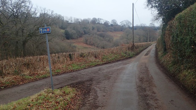
I briefly met a portion of the National Cycle Network before I would next cross and leave the road. I don’t recall any cars passing at this point.

Here’s the next stile, somewhat less consumed by the undergrowth than in Geoff’s past experiences. This next path (although less distinct on the ground) would lead me down to a stream crossing.

There is a footbridge to the left of this footpath and in the next field. It looks to be next to a small pumping station of sorts… But it is away from the right of way.

I followed Geoff’s words over this stream and without needing to build a bridge. Here, the water level was barely any greater than some of the small stones within.

Then, came the challenging part. Hiking up the hillside and following the field boundary, as I bashed my way through this bracken along a narrow and meandering path towards the top corner; in full view of a house to the right.
I felt a little bit like I was taking on my own straight line mission across England and Wales.


Some of the fields along this walk were a joy to cross.

But this stile was less convenient. Concealed between one wall of fencing and a gate on the other side. Alpaca-proofing, perhaps. But not entirely welcoming towards able-bodied walkers.
Then, I would cross the boundary to the right and encounter this…

An intense nest of bracken, brambles and worse!

I tried to kick and wade my way through for as far as a could. Perhaps less than twenty metres, before the depth of the brambles increased and it just wasn’t funny any more!
This wasn’t a straight-line mission attempt. I could cross back over the stile and sneak up along the other side of the boundary. Then being able to find another way back over and on to the public right of way… I then crossed the fence ahead (with care) and made it to the unobstructed road.

If not for this hellish field just east of Springfield, I’d be looking to repeat this walk another time. A diversion would have to be sought before I’d consider an entourage of others.

I crossed further fields to a quieter road beside Mynydd-Bach. Geoff talks of further access issues in his text from this point and again, without any further investigation, I followed in his advice.
In this photo above, there’s supposed to be a footpath pass right through the hedge. As according to the OS map.

I was soon on my way towards Bullyhole Bottom – what a great name! Waymarking from the road were absent around the large field gate. But neither was there any padlock and I could see plenty of footprints in the mud, leading to and from this way.

A short but steep climb up the road then followed, before I met a padlock gate (and lack of waymarking) at the top. Carefully, I climbed over (at the hinge-end and noticing the muddy marks left by others before me).
This path would lead me towards the farm at Pant-y-Cosyn. I noticed discrpencies between Geoff’s instructed line and the right of way (green dashed line) on the current Ordnance Survey map…

In short, I didn’t follow this walk exactly. A yellow waymark arrow directed me to turn left before the farmhouse. I found a boggy crossing over the steam. But from there, I was left to my own devices. No welcoming kissing gates or stiles. Young ponies scattering about this small field in a panic.
I began to panic myself. What if someone from the house to my right was to challenge my presence and try to tell me there was no footpath…
I soon retreated to the farm drive, unchallenged and without question, to follow it steeply up to the road and passing Little Pant-y-Cosyn.
I walked carefully along the B-road too rejoin my intended route. Not an act I’d recommend, as cars can pass frequently. I’d missed out on a mile of woodland walking and a few further fields. But I was now on my way up to Batwell.

Waymarks came and went. A recurring theme! There was a suggestion in the text that this final field before the next road might provide a challenge. But the small gate to the right was available. I don’t usually fear cattle but my senses felt lively on the approach, here.


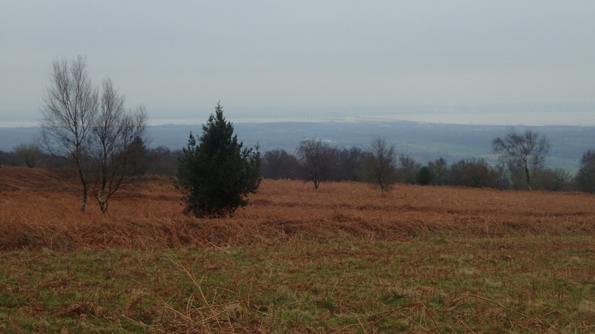
A few more fields and I was on my way towards the village of Shirenewton, with a greater view of the Severn Estuary and Prince of Wales Bridge beyond.
By now, my feelings of hunger were growing. It was near enough to lunchtime and I’d not stopped once all morning. Yet as much as I was enjoying the walk, I wasn’t finding anywhere suitable to sit and stop for half an hour.

From The Oaks, I climbed an unmarked stile before Stoneycroft Wood and precoded to cross the next field to the north of a wind turbine. I can imagine the terrain here being a challenge in the summer months.

One alternative option might be to follow the track around the woods for a bit further before crossing on to the field paths. Coombe Farm itself is quite a large place. Out of shot, a woman was walking her dog from from any public paths.

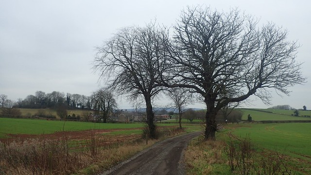
I found my way to the gate in the field corner with relative ease and then continued to descend through this woodland.

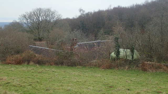
I followed this road through the combe to the south and soon passing an old mill up away to the left. Either a private residence or place of events today.

I’d been walking downhill. It was inevitable that I’d now have to head up across the eastern corner of Cuhere Wood! Forever hungry for lunch.
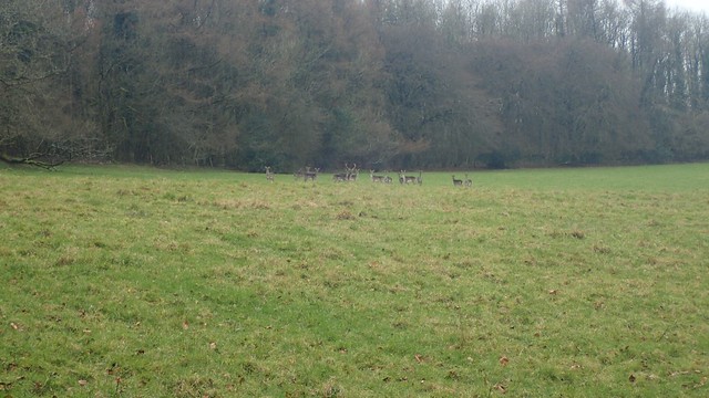
As my walked plateaued out at this field near Penhein, this herd of deer had already spotted me before our eyes met. They would linger for long. But I was able to take a photo that I was pleased with, before they began to cross the field in a frenzy, to the right and then left; soon leaping over a jump in order to escape.

In the next field, I spotted this weathered rock. In view of the house and just off the right of way. But it was near-perfect seat-height and, with a foam mat on top, my body was insulated from its shivers. Flask out, mouth open. It was time for lunch.

Within the hour, I would be on Gray Hill – the official title of the walk I was following. Penhein itself has much history to it, including the limekilns that still stand across the main driveway. I believe it was once a hunting lodge – hence the grand deer park stature.


My final hill climb of the day was about to begin. A clear track on the ground led the way, even though it didn’t accurately follow the footpath. Cows gave me no trouble.
I was looking to the left for a thatched cottage (as mentioned in the description) but didn’t spot it. Not too sure what happened there.


Crossing the stone and I turned left alongside the woodland’s edge. This path was well defined and soon led me to a more open hillside.
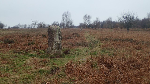
One of two standing stones on Gray Hill and right beside a stone circle, which is said to date back some four-thousand years!


When I was ready, I followed a faint path heading north-west and passing a second standing stone.


I found it was suddenly busier than I’d anticipated it would’ve been on Gray Hill. For the majority, walk up to here from the car park and then back down again, maybe be enough for a Sunday afternoon. With views like this all around, who could blame them?!

Wentwood was in sight and I knew that my car was near. Down the hill and along bridleways passing more friendly walkers; I was coming to the end of my walk and in good time.
I’d set myself the challenge of leaving home early in the morning. I’d pressured myself with ideas of other plans for the afternoon and evening. It was all falling neatly in to place and I’d enjoyed walking in an area that was less familiar to me. I was looking forward to future walks from this Walk West series.
Length of this walk = 11.25 miles
Thanks for reading.
