Saturday 12th February 2022
On a rare Saturday off work, I drove across to South Wales. But not towards the Brecon Beacons for any forest I might’ve explored before. I was heading out for another route from the Walk West series. To the west of Newport and just outside of Caerphilly, I parked up in the village of Machen.

I made my way down to the spacious and free-to-use car park of the village hall, where a man in a hi-vis jacket was directing cars in to spaces. This seemed a bit too ‘official’ for my liking and I soon spotted small groups of runners making their way out from the cars. So, I parked on the road just outside of the car park, so as to leave space for any future participants to arrive.

It started with a long and steep slog up a road across the A468. At times, this felt never-ending. Cruel for the start of any walk.

I crossed a bridge over a former railway line. Today, you’d barely know of its past existence, if not for markings on a map and the bridge itself.

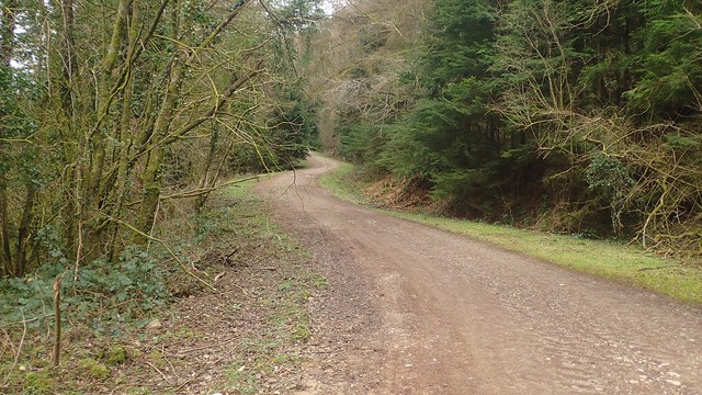
I was relieved to meet this byway at the bend in the road and leave it to follow a leaf-lined byway further up the hill.


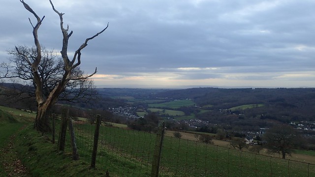
I followed the way with dramatic views down to the south.


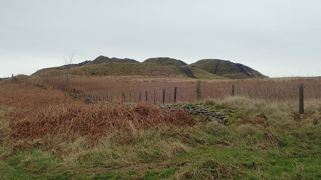
Back over my right shoulder, I could see a formation of land that I’d deemed to be Mynydd Machen itself. It seemed very likely I’d be visiting it before the end.

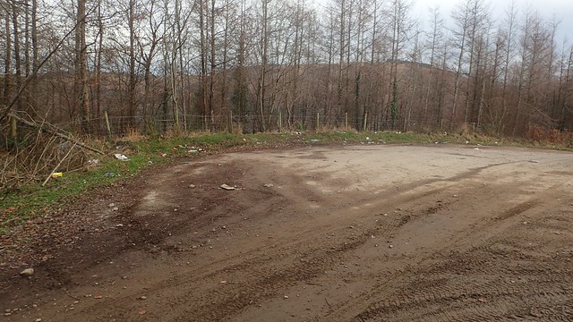
Pressing on to the west, I passed an area that could be use for car parking and also, for the dumping and tipping of rubbish.


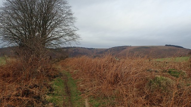
A stunning view down beyond the Sirhowy Valley. Otherwise blighted by flytipping upon this higher ground, or so I’d read.


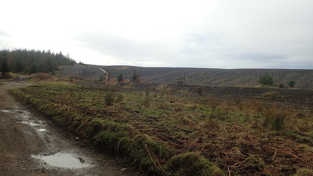
I passed a large spoil tip on my left, harking back to the area’s mining history.

My walk continued across Mynydd y Grug common. Great views remained beyond.

I was also following a short section of the Rhymney Valley Ridgeway Walk.

Walking towards the north now, my walk continued by descending this hillside, following a track beside a parking area and down on to a road.


I passed the site of an old quarry on my left, with forgotten buildings visible from the edge of the road.
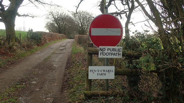
My intention now was to turn right on to the driveway of Pen-y-Chwarel Farm. This driveway is clearly marked on the OS map as a public byway. But the signs above were of concern and I’d read about footpath issues and aggressive dogs with the rights of way beyond.
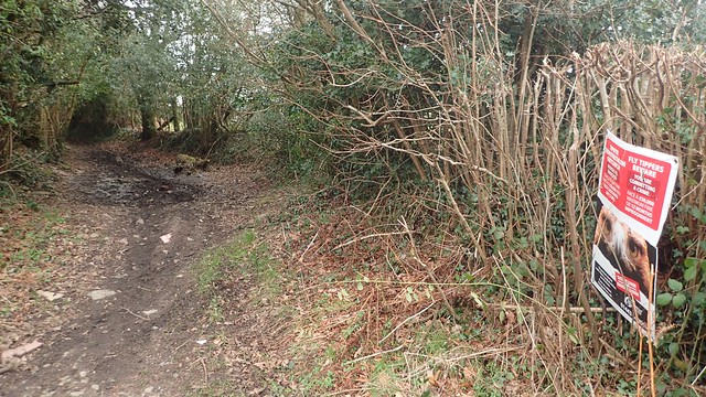
I kept my distance and walked on to the next unmarked lane, which I’d earmarked as a possible route anyway.

There was a footpath fingerpost and metal kissing gate at the other end. Although it’s not marked as a public right of way. There were no obstructions.

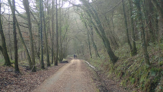
Shortly before this route joined a road, I turned right (before the kissing gate, above) and followed this path through the woodland. Also following the Sirhowy Valley Walk.


I soon dropped down to join a path along the National Cycle Network, which was also once the trackbed for a tramway.


It was far along this path before I turned right, climbing steps up a path marked as The Raven Walk; a twelve-mile circular walk about the Sirhowy and Ebbw valleys.


This walk was easy enough to follow. A more ‘exciting’ woodland path. Not too well worn. Elevated. Many firs under foot.

From the next road, I turned right and entered land owned by the Ynys Hywel Activity Centre. Waymarking is very clear and no to be disputed.

In the written instructions, Geoff talks about turning left and passing before the bunkhouse. But from these steps, the only signs point to the right or guide the back down. Even the steps leading further up the hill are probably private.
So, I took the signed path to the right, heading back in to the forest. Then having to zag, after a long zig, to get back on to the intended path.

Ahead of me now, the peak of what was probably Mynydd Machen was beginning to rise between the tree tops.


Up the next road – another steep one – and, crossing back over a cattle grid I’d passed earlier on, I was about to begin my final journey to the top of Mynydd Machen.

It soon became clear to me (and with thanks to the text) that the mass I’d spotted in the morning was actually another spoil tip. Down to my left was an area known as The Black Vein, where several methane explosions caused many deaths around the mines here.


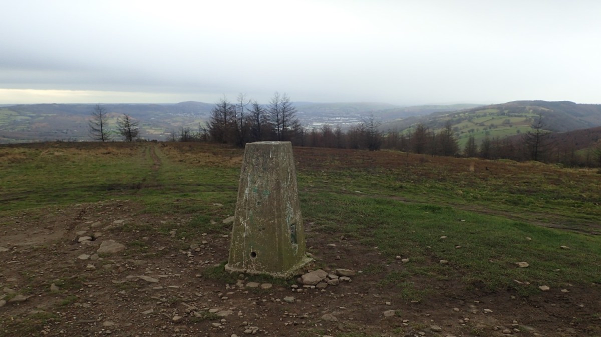
Shortly before reaching the trig point, I learned that I was also on the Cambrian Way path. One of the longest routes across Wales – excluding the coastal path. Waymarking for this trail has been improved over the last few years.

As I made that final push for the top, another unseen man emerged from the other side of the mound. We both reached the top in a shared moment, before continuing on our ways as the wind continued to blow strong, the air pressure dropped and I felt as though heavy rain was imminent.

My descent – a harsh one, very hard on the knees – began to the south-east, before turning west.


On the way down, I made use of a stone seat to have my lunch before the end. A decent over the Rhymney Valley and not much further to walk. That rain was threatening and had been forecast. But still, it didn’t quite fall.


A decent view looking back towards the Mendip Hills, North Somerset and Weston-super-Mare. Places that I know as home.

There were a number of charred and burnt tree stumps along this final field path. Were they deliberate? I could see no evidence of burning on the ground nearby. Wild fires seemed unlikely, given the time of year and how wet it has been. Was it to kill off disease? I do not know.


I crossed another section of that disused railway line that I’d passed in the morning, before descending steps in to the village.

I continued by turning left on to the main road, where I should’ve gone right. Not wanting to turn around and admit to my mistake, I marched on, in the hope of following the next road turn over the Rhymney River. This was quite pleasant, gentle and I was soon back at my car.
It then only began to rain once I’d started my drive back to the M4 motorway.
Length of this walk = 12.5 miles
Thanks for reading.
