
Tuesday 29th March 2022
My inspiration for this walk came from a trip to Snowdonia in May 2019. A group of us were camping at Bwch yn Ychaf in Llanuwchllyn and very close to the Bala Lake Railway. We spent much of the weekend looking up at the ridge but, with other plans on the table, not one of us quite decided to venture up and explore it (even fewer of us could pronounce its summits).
It’s been on my mind ever since. I had to wait almost three years but I’m pleased to say that I have tackled and conquered the Aran Ridge. My walk starts in the small car park at Llanuwchllyn, after a forty-minute drive from Ffestiniog.
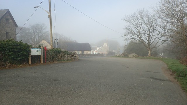
On the drive over, passing through Bala and then alongside the lake (Llyn Tegid), I found myself in a world of fog and poor visibility. Back over in Ffestiniog to the west, this had started as another fine spring day.
I’d found a route on OS Maps that I would use as inspiration for my own walk. It followed a track that appeared to be private on the map (and I’ve since learned that it is the official start/end of the waymarked Aran Ridge Path). Instead, I chose to follow the closest footpaths and rights of way before a bridleway that would lead me higher.


My only issues, following these paths very close to a farm, was a single kissing gate. As I went to open it, it jammed against a loose rock underneath. I could neither open it sufficiently or close it again. I had to climb over. I can’t suggest that it was put there deliberately. Who knows!


Waymarking from the farm onwards was very decent and much more than I’d expected. This route’s popularity must have grown in recent years. But I find it hard to imagine people getting lost on a day of good visibility.

I passed a permissive footpath (not recorded on the maps) that leads up to Garth Bach (labelled as Garth Fach on the OS maps). I didn’t take the detour but this landowner is clearly quite happy with walkers rightfully crossing their land.
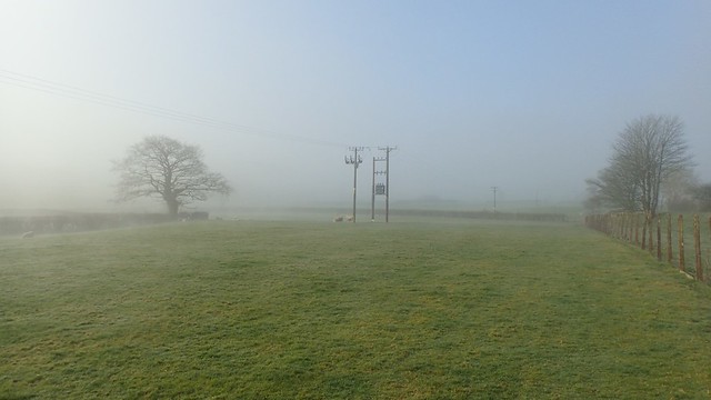
Bala Lake sat somewhere deep beneath that cloud.
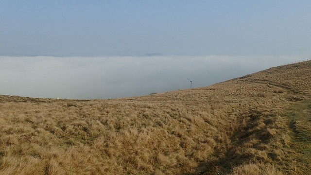
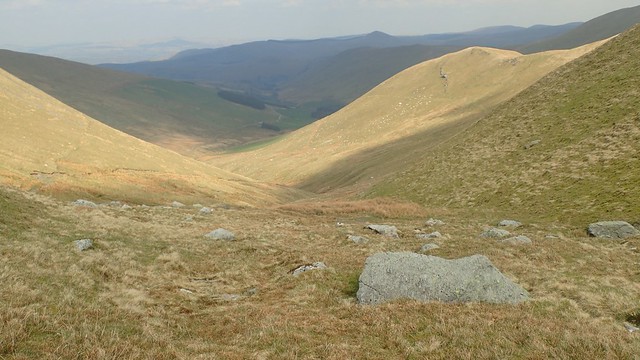
From here on, I didn’t need to study my map. With the sun beginning to burn through the thin cloud above me, I could see the line ahead and its many undulations.

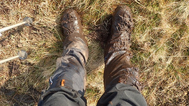
It wasn’t long after this that I lost half of my right leg to a bog! I hadn’t learnt much from my walk around Moel Siabod… But at least now, the score was even. I’d already dunked my left leg twice in North Wales and now, this was the equaliser for my right side.


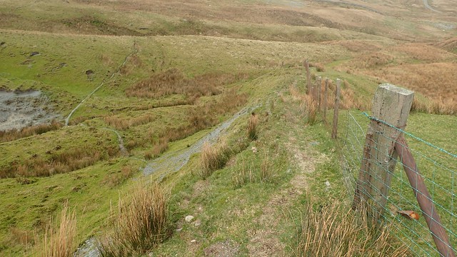
Ladder stiles like this became a regular occurrence, presenting the option to walk along either side of the boundary. I generally tried to abide by the black dashed line on the map when making these decisions. Most stiles were also labelled with a handy six-figure grid reference, in case anyone needs reassurance of their bearings.

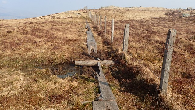
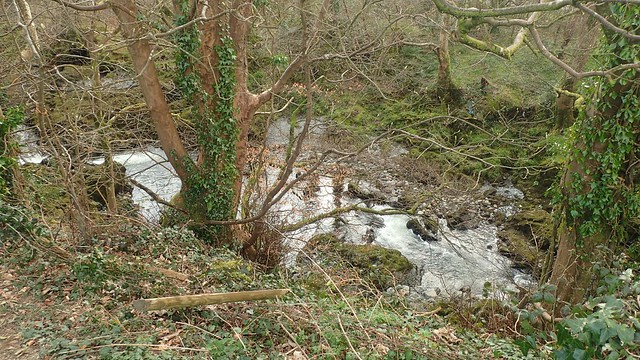
A broken boardwalk helped to keep my legs dry for the remainder of this walk.
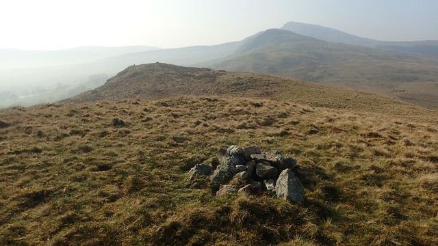
I stopped for a bite to eat beside this cairn and ahead of what looked to be a punishing climb up to Craig y Llyn and then along Aran Benllyn. Climbing higher, I was beginning to feel more of chill and force of a wind that I’d evaded thus far.


I don’t wish to condone or encourage wild camping where it isn’t allowed. But water sources could be found and, to add to this, I would go the entire day without passing a single person! Weekday or not, this was a very unique experience for a walk in Snowdonia.

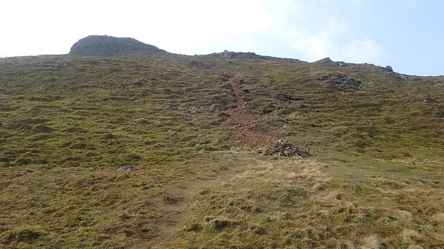
Beneath me, the terrain had changed from field paths to moorland and finally, I was crossing a partial boulderfield ahead of the final climb to the summit of Aran Fawddwy, the highest point of the walk.

Behind me, a tall cairn stood on the hillside, overlooking the valley below. My return route was unclear at this point but it seemed likely I would meet it after arriving at and then descending from the summit.

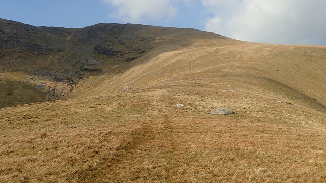
From the base of this final ascent, a clear path begins to zig-zag its way up. Small, loose rocks provide a minor hazard. Further up and the way forward becomes less clear. Although, you’re inevitably looking to gain height. I would soon find that the greater challenge comes in finding your way back down this way.

As I arrived close to the summit of Aran Fawddwy, I could soon see the trig point on top of the pile of stones. It had taken me almost three hours to walk this far, having waited the best part of three years to return here. Yet here I was. I had done it! I was doing it.


I once met a guy outside the pub in Llanuwchllyn, who told me of another route heading up here from Glasgwm. Perhaps I’ll get to explore it in the future. Depending on public transport links (which I’d not looked in to), one could potentially make a linear walk of it, between Glasgwm and Llanuwchllyn. Or if not Glasgwm itself, perhaps a bit further on to Dolgellau.


I made my way back down to the base of Aran Fawddwy before stopping for lunch. I could’ve sat at the top and found shelter from the wind. But I really wanted to complete the treacherous descent and minimise the risk of slipping in a state of post-rest relaxation.

Far beneath me was the lake of Creiglyn Dyfi. There was no footpath to follow from here. I knew that I’d want to keep to the north of this lake and then head down in to the valley.

I met with the aforementioned cairn but the going here was too steep and rocky to consider a descent.

Neither of these cairns are recorded on the OS Map. But it was from this broad and short pile that I would begin to make my way down in to the valley.
I was able to follow vehicle tracks (probably from a quad bike) down and along the “spine” of this hill (Erw y Ddafad-Ddu). It was murder upon my left knee, which was in to its third day of pain. I’d hoped to meet said quad bike-owner and beg for a lift. Very slow and perhaps less steady, taking regular breaks, I made it safely down and to the head of the valley.


From here, I could join a track down along Cwm Llwyd. It wasn’t marked as a public right of way but I was still on Open Access Land. Although I knew that, further ahead, my right to roam would end as this track would continue across private land with no right of way.
I snaked my way around the edge of one enclosure, following a path that others had worn before me. I’d thought about crossing the field itself but many sheep were present and they were already alarmed to have seen me.
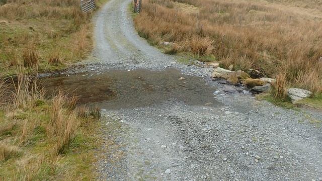
There’s a warning within the route description (on OS Maps) of a “deep ford”… But this puddle barely got my boots wet! Perhaps it is worse in the winter.
As soon as I left the access land through one unlocked gate, a quad bike passed in the field above and to my left. I was afraid to look in its direction and risk confrontation. But even if they did see me… I was neither questioned or challenged. Perhaps walkers are permitted to walk along here? There’s no way that I’d have been the first. Each of the gates beyond here was also unlocked.

This track soon converges with a public right of way, before the farm of Nant-y-Barcut. This would lead me on to the series of quiet roads that I’d walked for the final few miles back to Llanuwchllyn.
A bit further back, I’d thought about trying to cross the valley and its streams to join the footpath before I’d have left the access land. But with a track before me, I felt it was at least worth trying and I could otherwise have further aggravated my knee.

I don’t remember now how long it took for me to walk these roads back to my car. But I was grateful for the flat beneath my feet and the certain way forward. It was over an hour. Perhaps this is why some have rated this walk at only four out of five stars.
One may wish to attempt an alternative route back to Llanuwchllyn; following a footpath up to Tyn-y-Cae, ahead of the first road junction. Then on to Plas-Morgan and rejoining the ridge path near Garth Fawr. But it would be steep in places.

I noticed several jets (heard before they were seen) flying about the airspace that surrounds this valley. In each of my previous visits to Snowdonia, I’d not witnessed as many fly-bys as I had within this week.

My favourite aspect of this return along the roads was in being able to look back along the ridge that I had conquered. What a sight!


It wouldn’t take me three hours to return to my car and soon crossing the Afon Twrch.

This would be my final walk in this trip to Snowdonia. I’d planned to explore Arenig Fawr on the following day. But the weather looked set to turn wintry, my left knee was quite sore and I eventually decided that a rest day might be good, ahead of a long drive home the next morning.
Length of this walk = 12 miles
Thanks for reading.

Hi Olly.
Another great read with pics from you. It’s taken me ages to read it all on my phone, because every 5 mins, someone decides to ring me.
Anyway I got there in the end, so thank you very much. 👍
LikeLiked by 1 person