Saturday 12th August 2017
After almost two-years, I was finally making my return to the Peak District. I’d even be staying at the same camp site and so, I knew much of what to expect.

On this Saturday morning, I’d decided to get a walk in first before continuing on to pitch my tent. I was destined for Gradbach in Staffordshire and confident I could complete the journey without using my SatNav…
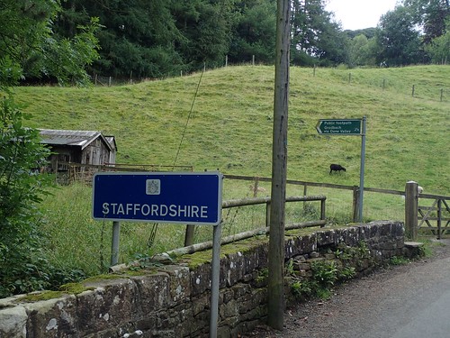
Had a portion of the M6 not been closed near Birmingham and sent me on an M1 diversion that I misunderstood, I might have been fine. But I soon found myself driving on the wrong side of Stoke-on-Trent. Ashby-de-la-Zouch was still an hour away from where I’d intended to be!

Quite literally – and, with the inevitable aid of satellite navigation – I bagged the last available parking space in the free to use car park for The Roaches, Lud’s Church and everything in between. As I stepped out and got my boots on, the heavens opened… Lunchtime, first, then.
This is yet another route taken from The Walking Englishman. One I’d kept in mind for September 2015 but, the weather had been inconvenient.
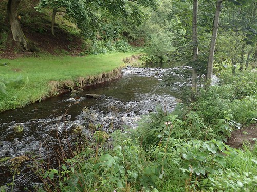
So, this walk begins by following the driveway of Gradbach Mill down to walk alongside the River Dane. There was a lot going on at the mill on this day and I remember signs offering ice cream… But, it was far too early to stop!
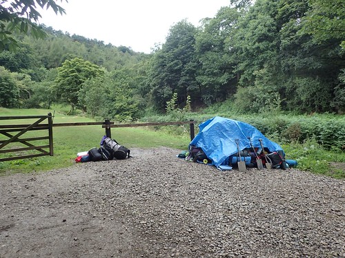
Back on the road, I’d found a stack of abandoned backpacks that must’ve been unloaded from a truck and trailer that had passed during the previous rain shower. It must’ve been a Duke of Edinburgh event. Still, a few look as though they’d tried to escape.
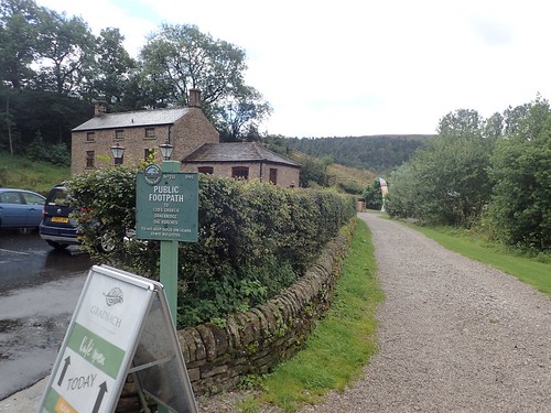
I was quite apprehensive about walking on – as I often find myself with an unexpected ‘audience’, at times where I’m uncertain of my own whereabouts or the legal way ahead. Gratefully, I found that signposting in this part of Staffordshire was as informative as what I’d seen in the Peak District two years ago.
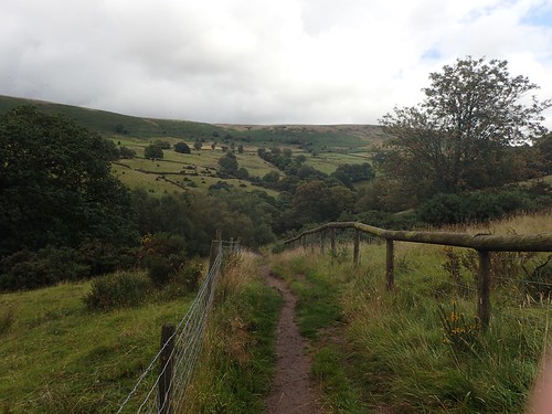
From the river, the path climbed up from the bank to continue through Forest Wood, which maintaining the same course. I passed a few people along here – most probably coming towards the end of their day’s walking and likely to curse the inconvenient manner in which I’d left my car.
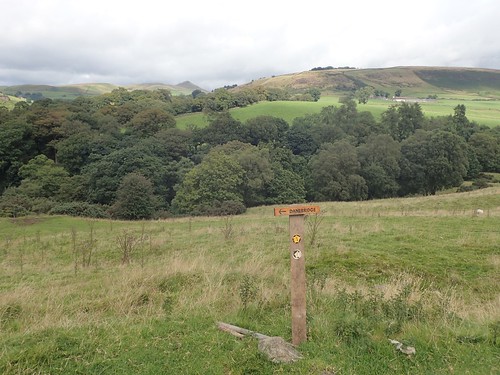
Out of the woods and there were two farms to cross ahead (I’ve had some bad experiences in and around farms). First, it was Back Forest Farm and soon to be followed by Back Dane… With clear signs pointing towards Danebridge, I could not go wrong!
I continued to follow the Dane Valley Way through a brief stint of woodland, before climbing to a point at which a road crosses the river.
Minutes earlier, I’d almost continued up a set of steps to my left…
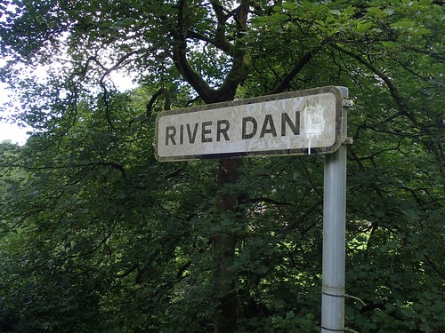
They probably would’ve led me to the same path but I would’ve missed out on an opportunity to look over the River Dane, one last time.

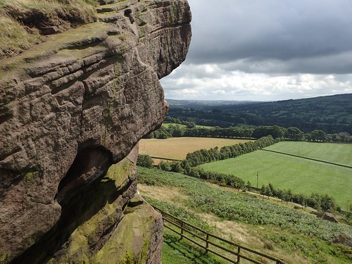
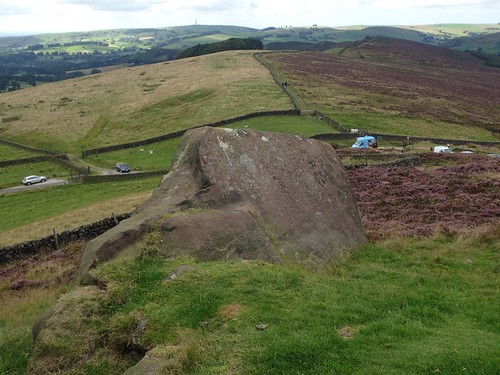
Soon, I was heading towards Hangingstone Farm, with the Hanging Stone lurking over it.
Initially, I kept with the clear footpath following the contour of the hill. As I got nearer to the point at which I imagined I would climb higher, I met warning signs, asking people to ‘keep out’ and that the official bridleway to the stone was still further ahead.
I soon took a left turn but, as I reached the top, I realised it probably wasn’t the official right of way, as another route appeared to be sign posted (clearly) heading down beneath the rock. I’m grateful to the unknowing lady for being a feature of the scale of this shot.
It’s suggested online that no actual hangings took place here and that the name may simply derive from the stone’s appearance.
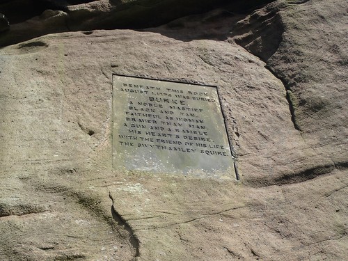
Although, Burke was laid to rest here. He was probably a member of the family who once owned the estate.

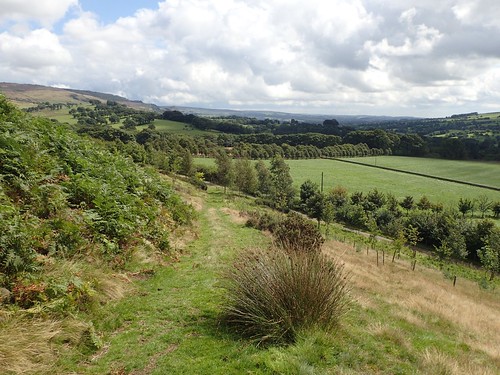
You can also just see the northern end of The Roaches from here.

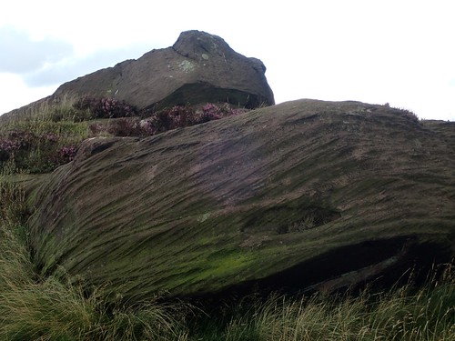
As soon as the two other visitors had moved on, I made my way on to the windswept plateau of the stone, where a number of people had previously carved their names in to the surface.

I was barely 300m above sea level and the wind was blowing hard. Not the kind of conditions in which one would care to linger but, the views in all directions were fantastic.
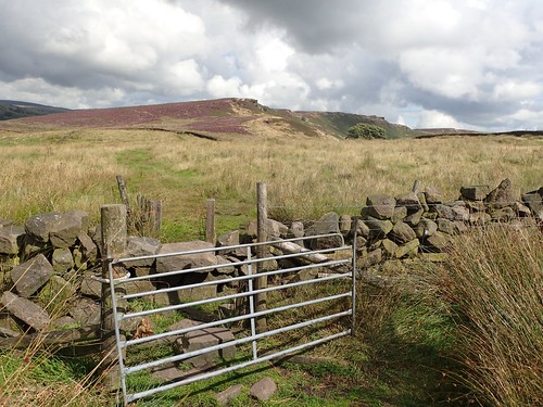
Maintaining height, I walked on towards Back Forest, only one kilometre from the car park but with many miles still to cover.
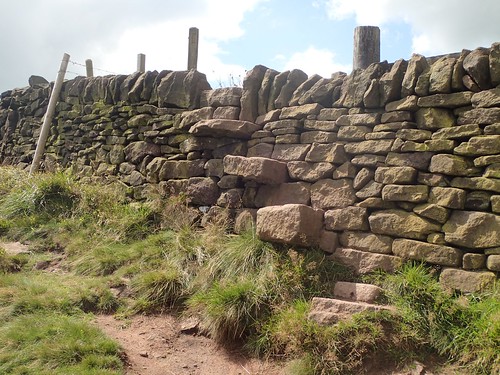
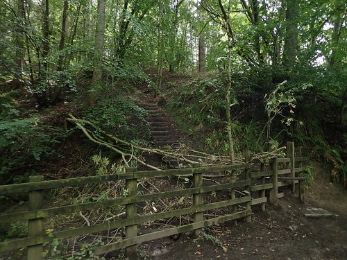
Little did I know but stone steps, just like this, were to be a recurring discovery throughout my weekend in Derbyshire.
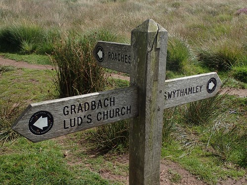
I was searching for Lud’s Church (a deep chasm) at this point and almost expecting to see a plaque upon my arrival… But the signposting intermediately was excellent, once again.
I wonder…
Is this signage in place because it’s a popular place to walk?
Or, is it a popular place to walk because of the signage in place?!
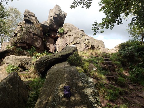
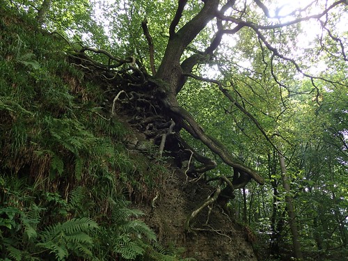
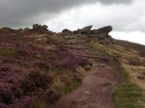
I found an impressive stack and formation of rock among the higher regions of Forest Wood. This warranted a brief exploration before continuing to the “church”.
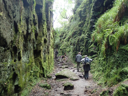
I saw a group of people heading ‘out’ and guessed upon the right direction on which to find Lud’s Church, with its steep sides and narrow, wet and muddy valley bottom.
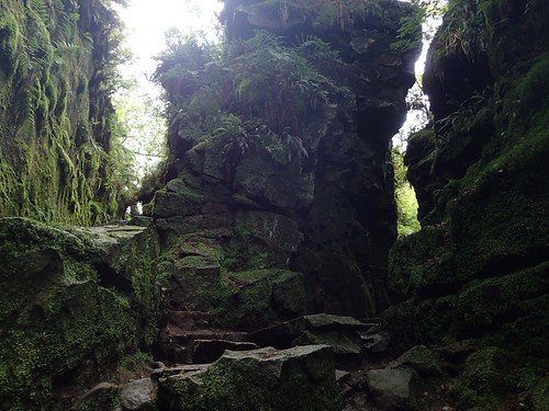
An impressive example of something nature has so far left behind. But equally, I found it to be quite busy, here and there wasn’t an awful lot of room in which to give way to everyone.
Climbing up from the chasm, I marched through an increasingly muddy stretch of woodland to then reach a road bend near to Bearstone Rock.
It was here that I did take advantage of the conveniently-placed ice cream van, while cars otherwise use the road sides to unofficially park their cars and climb up to The Roaches with a 400m head start!

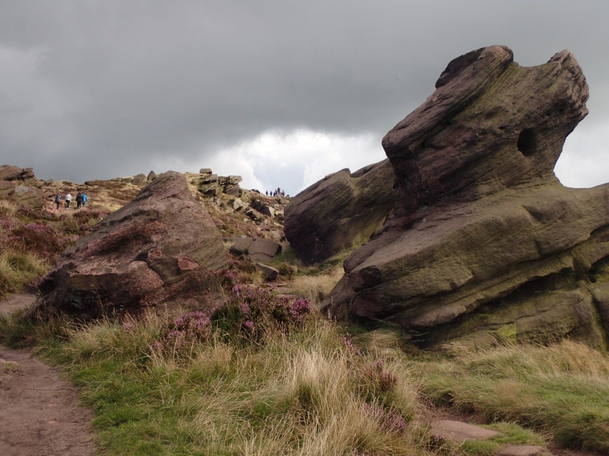
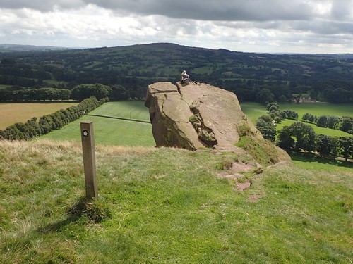
I couldn’t tell you which rock was Bearstone Rock but, it looked as though this impressive landscape was going to be as popular as Lud’s Church.

These rocks are huge! From a roadside far below, they must look like ‘roaches’ – and, I guess, the name hold more of a stature than ‘The Ants’. But, how did they get here?
Climbing higher, the wind speed continued to increase.
Just over the brow, I would find a trig point.
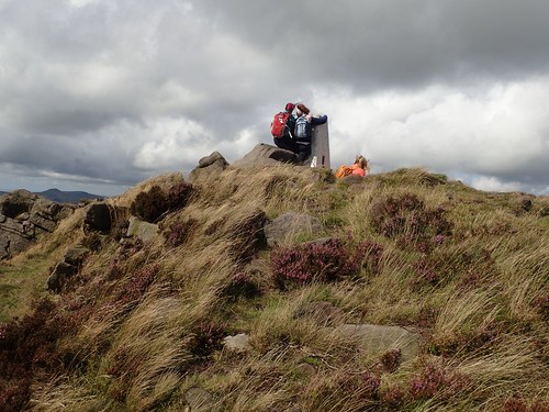
There was indeed a trig pillar. But two girls were also holding on for dear life… At 505m above sea level, the wind was quite relentless. But, at least, it wasn’t raining again. This also means I’ll have to revisit the area in order to adequately “bag” this point.
From here on, I walked across The Roaches; between towering rocks, seemingly scattered along the ridge line.

Looks like a nice hike. I can see that we have the same references hi hi I also use a lot the walking englishman website to find where to hike.
LikeLiked by 1 person
Glad to hear you’re also using his website. It is indeed an excellent resource. 🙂
LikeLiked by 1 person
Some great photos there! This isn’t far from where I live. Great to see you got all the way down to Lud’s Church – I think it’s really magical there 🙂
LikeLiked by 1 person
Thanks, Shell. It’s certainly a special place. 🙂
LikeLike