
Sunday 1st October 2017
My first walk of the month that was October would see me return to Lansdown, an area that lies to the north-west of Bath. It was probably more than three-years since I last did this exact walk and, back then, I was leading a group of more than a dozen people.
This is probably one of the first routes I followed from the Walk West series of eBooks and it’s a walk that I’d been meaning to return to for some time. A vision of road walking had stuck in my mind, along with ambition, I guess, to walk in a wide variety of places; near and far from home.
I began my walk from the same lay-by as mentioned in the description; where the Cotswold Way crosses the road that links the A420 with the north of Bath. There was one other car that I could remember… Last time, here with the group, we were only just able to squeeze everyone in.
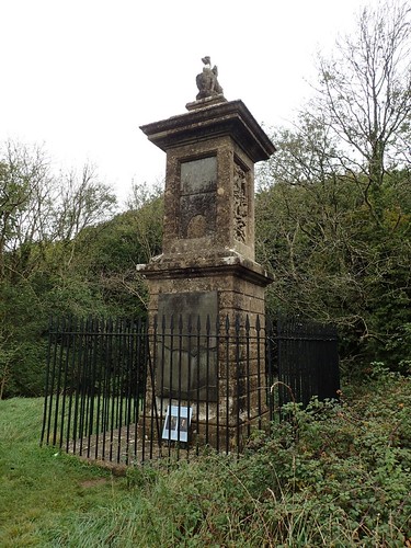
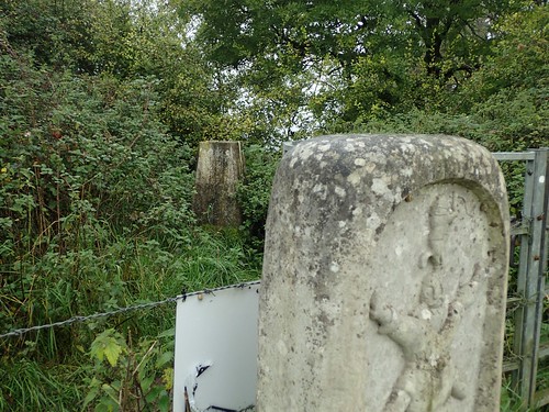
Following the Cotswold Way in the direction of Cold Ashton, I soon arrived at the Bevil Grenville Monument. This area is marked as the historic site of the Battle of Lansdown and there are several information points and flags to be found.
As I reached the monument, I caught up with the an older couple who’d arrived in the car behind me. They looked like runners and told me they were walking their final miles of the Cotswold Way on this day, having started their own challenge a year ago. They also asked me to take a photo of them.
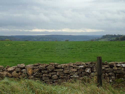
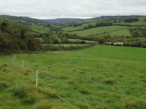
Turning further away from the busy road and negotiating a stile within a stone wall, I began heading downhill with an uninterrupted landscape of green, beneath me.
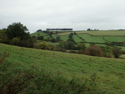
Following the Way in a north-eastern direction, I could see the infamous treeline of Freezing Hill, away to the north. I look forward to walking beneath it once more. Iconic and instantly recognisable from miles away.
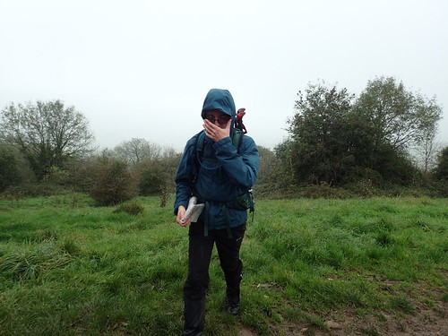
This wasn’t the brightest of days in which to do a walk but I’d left my car with a pair of gaiters already equipped.

Plodding to the bottom of this valley and I would leave the Cotswold Way beside the ford at Hall Lane.
I’ve never measured how much of the Cotswold Way I’ve actually walked… I’d be surprised if I’ve covered much less than half of the 101-mile distance, through circular walks of my own… An aim of mine is to try and complete it throughout 2018 (I haven’t seriously thought about backpacking, as it’s quite close to home and I’m already familiar with much of the Cotswolds). We shall see. I could certainly looking at doing a different circular walk through Lansdown.
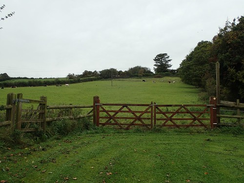
Crunching along the stones of the driveway at Vine Cottage, I passed through a pair of wooden gates to begin climbing steeply.
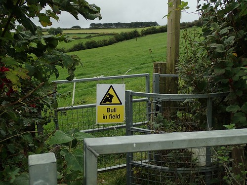
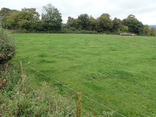
None of the cows paid me any attention and, in spite of the ‘bull in field’ warnings, I didn’t see even one within reach of the public right of way.
I also passed a farmer who was on his way downhill. He was friendly enough. I’m very wary of meeting potential landowners; holding on to a fear of being questioned or challenged. That rarely happens, though.

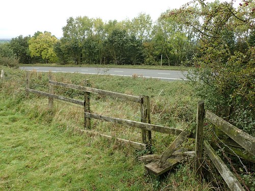
From the top of this hill, I would join Freezing Hill Lane, with almost half-a-mile of busy road to cover before I would reach the desired public right of way… Not an inch of pavement or grass verge to stand on.
In the text of the written guide for this walk, Geoff writes of ‘a gap’ in the hedge to your right and, although there is no right of way here, I have previously walked along the safe side of the hedge, in to a second field and then, on to the actual right of way…
Unfortunately, all of the gaps have now been fenced off (as they should be, I suppose) and anyone attempting this walk is forced to stay on the busy road.

Even the gates to Tracy Cottage Farm had been chained shut, even though my map implies that a right of way follows the driveway down and in to the nearby golf course. I was merely hoping to hope through the gates and follow the other side of the hedge but a tractor’s engine could be heard nearby and I feared getting caught.
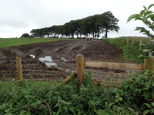
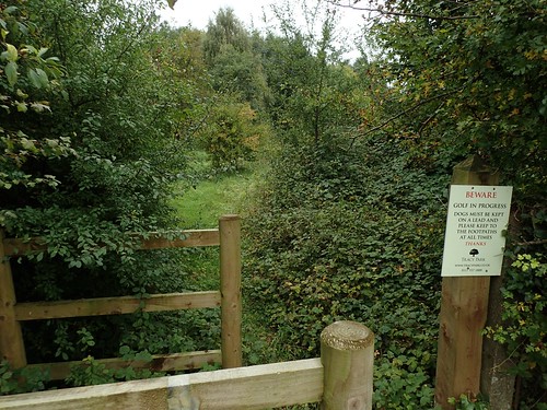
There used to be a damage gate at the access point for the footpath from the road. More recently, it’s been replaced with a wooden fence… Not a stile. A great frustration, as if I was to negotiate the cattle successfully, the walk continues beside ancient earthworks from the far end of the treeline.
I’ve reported this to Bath and North East Somerset Council as it prohibits the ease of public access. There’s also a distinct lack of signpost and/or waymarking. They logged my report days after doing this walk and I’ve yet to hear anything back.
From here, I had two choices…
I could continue for another half-a-mile down this road and end up a few hundred metres from my car; or, I could head back to where I joined the road and try to follow an alternative, if elongated, route.
I couldn’t see any suggestion of the right of way opposite (ST 727 720), which appears to pass through someone’s house! There wasn’t even a driveway to follow. But, a bit further on, I found a clear path leading on to a junction of tracks, somewhere between Toghill Farm and Toghill House Farm.
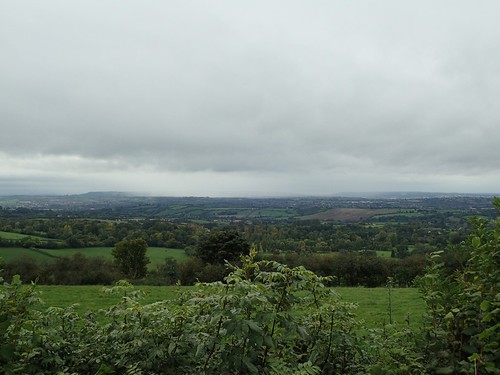
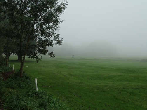
Across South Gloucestershire, to the north; I could see the likely forecast for my afternoon.
I soon found my way down to the A420, close to a telephone exchange. There was a broken stile, which I was able to cross and I’ve also reported that to the council.
From here, it looked as though I could follow the busy road west for a bit (treading on a broad grass verge) to cut through the golf course and re-join my intended walk, along a series of previously unwalked paths. Meanwhile, Freezing Hill seemed so far away.
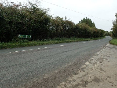
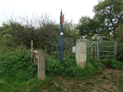
According to my map, there should be a pair of footpaths opposite the junction for Culleysgate Lane; somewhere behind the sign in the image above.
I walked up and down, in view of numerous passing cars but, there was no hint or suggestion of a footpath, past or present… Bizarre!
Forced to continue further west along London Road, I was soon able to enter Tracy Park (sadly, it’s not even remotely related to Thunderbirds).
I hate walking through golf courses.
They always say the same thing: ‘please keep to the footpaths’. But, as soon as you step out on to the green, the waymarking is gone and there are many more details and features on the ground that what you’ll find in an Ordnance Survey map.
If the owners don’t want ramblers walking aimlessly over their land, why not keep the waymarking in place?!
Laughing nervously at my compass, I walked followed a “path” cutting through the trees, past a group of golfers at the next hole and, from there, decided to follow their “track” between holes until I set off (unchallenged, I might add) for a gate in the next visible boundary…
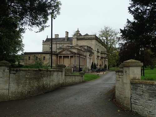
From the far side, I could read that I was not welcome to pass through this gate but, I’d found my way to the main driveway in to the park and, from there, I could walk up past the hotel and head on to Bath Road.

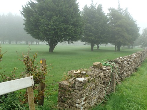
From here, I climbed up the road very briefly before crossing a series of fields in a south-western direction, then to arrive at another road near Hanging Hill Cottages.

This is where I found The Retreat; a small and partially wooden area of Open Access Land that probably makes for a good picnic spot on a dry day.

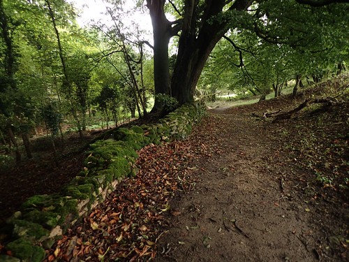
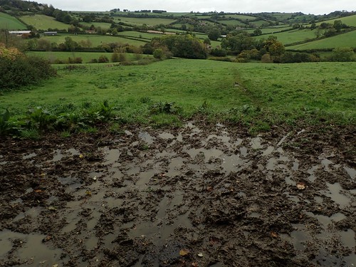
Back on track; my walk continued up from Beach Farm – this was a path I could remember walking earlier this year as part of a group walk. At the time, we were able to walk along the French Drain and avoid the mud… Since then, as you can see; wooden fencing has been installed (to protect the wall?).
At the top of this hill, I rejoin the Cotswold Way and also the site of the Battle of Lansdowne.
There’s a trig point hidden in the bush, 235m above sea level on Hanging Hill.
I perched my camera on top of the stone and set the timer… Forgetting that it lasts for twelve seconds on this camera and not for ten, as on each of my previous models.

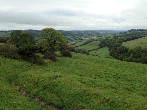
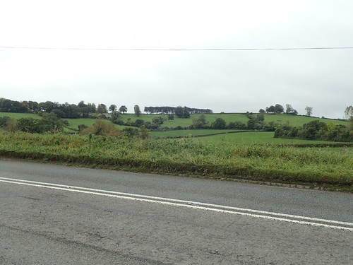
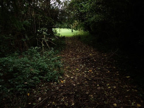
Following the Cotswold Way from here, you can barely go wrong and, even on a grey, wet day, the views soon return.
Lansdown Golf Course is a place that welcomes walkers. Although, I suppose, they can’t really complain when a National Trail like the Cotswold Way runs through it! But alternative footpaths are equally well singposted (take note, Tracy Park!).

I was pleased to find this art installation remains, on my way out of the golf course. Immy, on Instagram, told me that these sculptures are the work of a group of artists from the barn next door. I still don’t know whether there’s any further significance to their form.
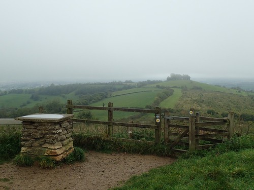
I marched further along the Cotswold Way until Prospect Stile; looking on to Kelston Round Hill. At which point, I would leave the trail for a final time, as it descends towards its southern end point in Bath. I actually stopped for lunch on a bench beneath the fencing in this shot.
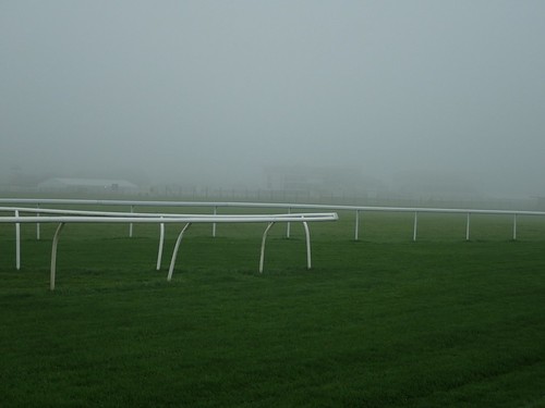
Next, I had to negotiate the racecourse, where two rights of way cross the racecourse itself… Ducking under each fence, I would go. On a day like this, I was confident I was unlikely to be whipped by jockeys.
But the waymarking is a bit scarce. I was quite confident in my walk, as I’ve passed through here a couple of times before and knew of the gap at the end of a wall that I would look for.
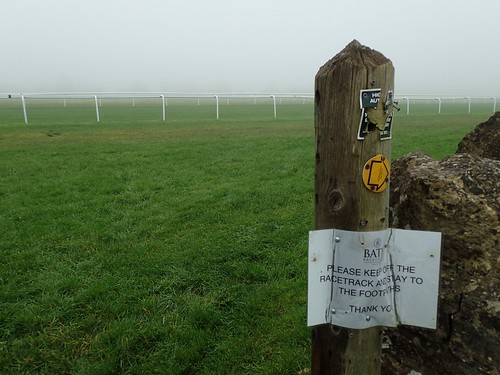
Ironically, the waymark heading back wants to direct you around the racecourse… It would make sense on a race day, I suppose. But the ‘STAY TO THE FOOTPATHS’ sign is again laughable, with a lack of direction given beyond this point.
Why can’t then illuminate the right of way accurately but with a notice along the lines of:
‘During a race, please walk around and DO NOT CROSS the racetrack’

I passed through a final golf course at Lansdown Hill, crossed the busy road and then walked beyond Upper Langridge, with a trio of other walkers ahead of me.
Again, I was both confident in and familiar with this final furlong to the car.
I feel it’s worth mentioning again that I would currently consider the Walk West route to be impractical, due to the existing obstruction at Freezing Hill. I’ve made a note of this on the relevant page and beneath the download links for all three eBooks. When I come to hear from the council or, I noticed a change myself, I’ll let you know.

Oh dear. A frustrating day with blocked rights of way. Glad you took the time to report them.
LikeLike
Hi Ruth,
I’ve always felt it’s important to report such issues. The next person may not and there’s a chance to improve access for others. Some councils though, are more responsive than others, in my experience.
Do you often report issues encountered along your coastal walks?
I’ve also taken on the role of ‘Footpaths Secretary’ with our walking group for the next year. So, it’s part of my job. 😉
LikeLike
Yes, I try to report major problems. (Recently I’ve been walking in Scotland, where there is a ‘right to roam’ but few ‘rights of way’, and that’s a whole different problem.) I’ve also use the Ramblers PathWatch app, which makes reporting much easier, but it only works if you have a phone signal of course. Good luck with your Footpaths Secretary role. It’s important.
LikeLiked by 1 person
Thanks, Ruth. You can also use the Pathwatch App from a computer (and still upload a photo) but then, you need to be able to trace and remember the location. I sometimes download squares to my phone in advance of a walk (to save the signal issue) but often forget beforehand.
LikeLike