Saturday 14th October 2017
I’ve walked the full-distance of the West Mendip Way several times now. But I never venture in the other direction to follow the East Mendip Way.

This is the first of two walks where I attempt to complete the nineteen-mile trail, which crosses Somerset from Wells to Frome.
This challenge was always going to be a circular walk. I could see an easy way to make public transport work efficiently over a ten-mile distance and, at the time, I felt as though twenty-miles would be too much for me to walk in one day.
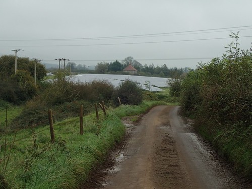
Following the A371 across Google Maps, I settled upon parking near the village hall in Croscombe; a few miles south-east of Wells. There is a village hall car park but the signs state it’s for patrons only. Plenty of space at the quiet roadside was available.

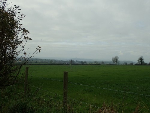
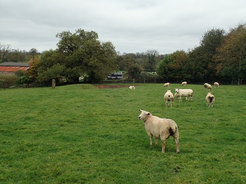
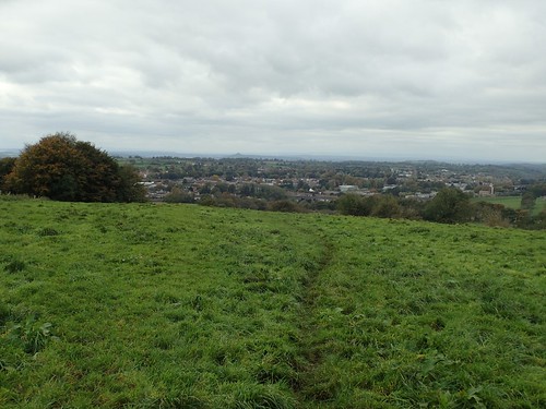
From Croscombe, I began by walking west and on to the next village, Dinder. At this time, the East Mendip Way could be found just over a kilometre north of my location, running parallel to my route.

I have previously walked the initial miles of this Way, heading east from Wells. On a day that was likely to be busy with tourists and slow-moving people, I decided not to venture that far out and instead, heading north, I would join the East Mendip Way from Sharcombe Park, above Dinder Wood.
Away to the north and west a bit, I could just see the transmitter mast on Penn Hill, poking out through the low cloud.

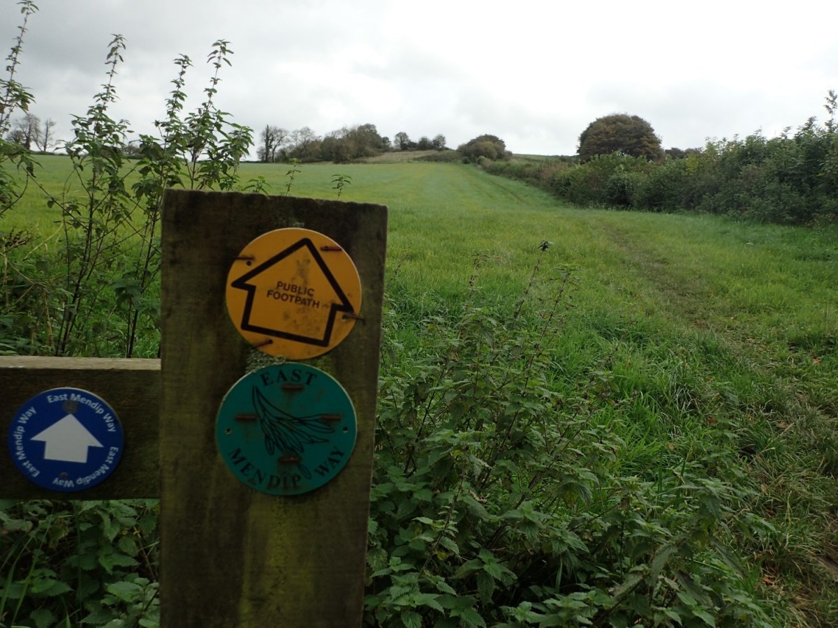
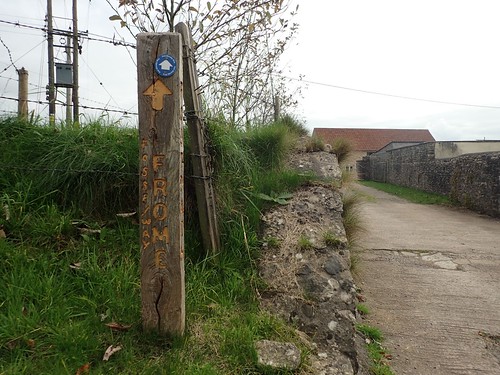
Last time I set foot on any point of the East Mendip Way, I found the waymarking to be insufficient and, any waymarks I did encounter looked tired and outdated.
In 2016, a team of volunteers installed brand-new spanking blue waymarks all along the entire Mendip Way path (East and West). I feel sad that there’s no logo or emblem to accompany the white-on-blue arrow but it’s definitely a good thing.
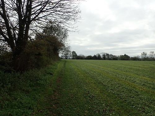
My other memories of the East Mendip Way involve overgrown paths. So, as I joined the trail and set off along Furzy Slate, I was relieved to find such a wide open field and the shadow of a footpath worn in to the grass.
Now walking to the north of Croscombe village, I passed a reasonably-sized solar farm opposite Crapnell Farm. I thought it was a strange and very rural area to find something like this. At the same time and, in my opinion, it didn’t disturb the countryside image.
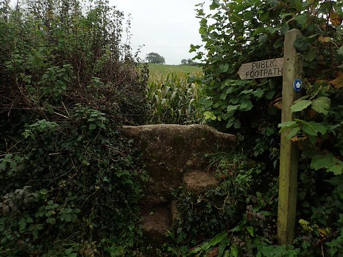
Over a stone stile (a prominent feature of the Mendip Hills’ rural corners) and I followed a cleared path through the head-height crops, giving way to a runner at one point.
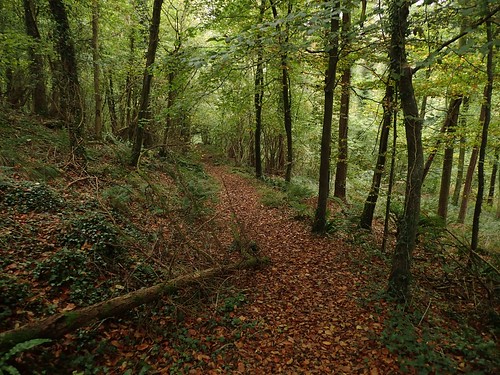
Along another road, just south of Thrupe and I would enter Ham Woods.
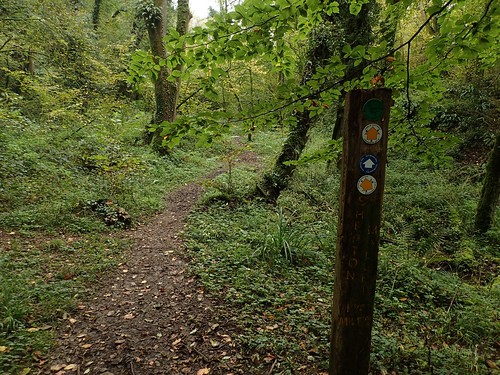
If I am ever to find myself lost, it is certainly going to be under the cover of trees. However, I found the waymarking in these woods to be brilliant, with directions offered for the Way I was following and alternative footpaths.
I would also return to this point before ending my walk.
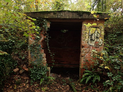
I passed a pair of brick-built buildings that had been tagged with graffiti. I’ve noticed, on the OS map, that a railway line once ran through these woods, from Shepton Mallet up towards Binegar. I wonder if these buildings were part of a small station? Maybe even the toilets?!
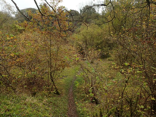
I don’t think I’d even heard of Ham Woods before this walk but, it was very beautiful place to be in October.
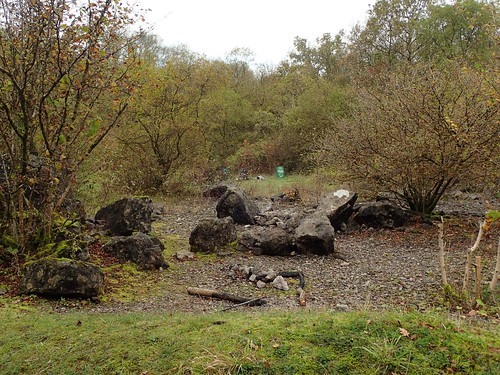
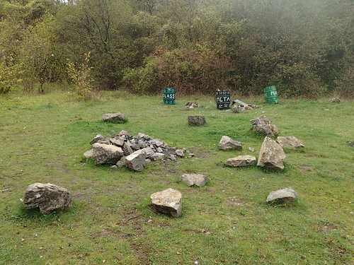
An almost-circle of rocks define one open space what looks to have been a disused quarry. One man sat alone on a rock. Although, he was also friendly enough to say hello. He didn’t look like a hiker. Perhaps he just wanted to escape Shepton Mallet for awhile.

Up from the steep stone steps, I escape the woods to follow the boundary around Windsor Hill. This also involved fighting beside and through crops that were higher than my head.
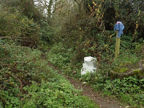
At the next country road, I crossed to continue along a path beside Rosamond Green Farm. At the entrance, someone had failed to hide their unwanted toilet in the bushes, while a denim jacket obscured all visibility of the sign highlighting this as a public right of way.
I could see Glastonbury Tor on the faint horizon, as I looked in a south-westward direction.
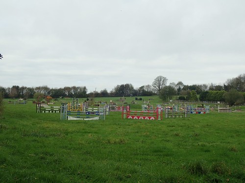
This farm is home to what looks like the equine version of the Krypton Factor…
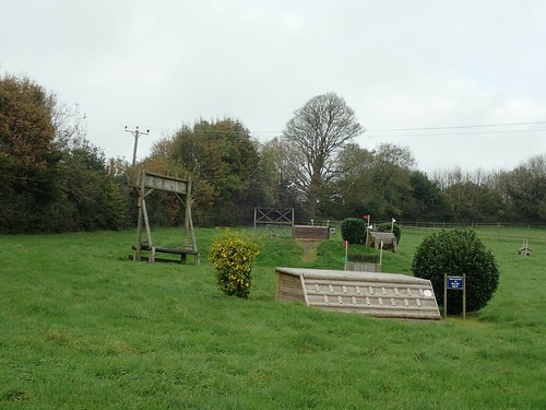
Even if that’s not true, I wonder whether the tall apparatus on the left was designed to train horse jockeys on the importance of keeping their heads down.
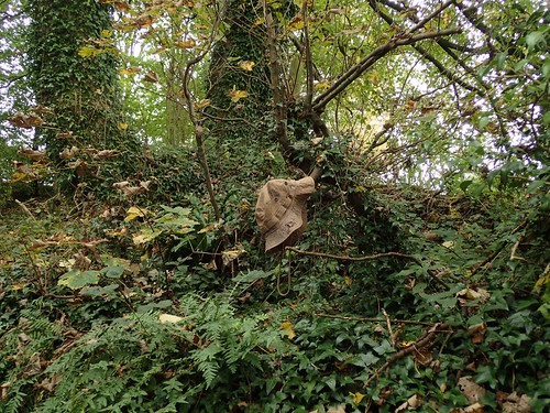
On to the next road, where I found a discarded hat, held aloft by the branch of a hedge. Perhaps someone else was as un-hat-friendly as I can be.
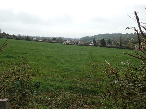
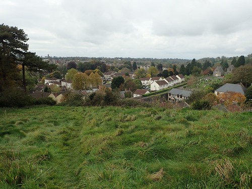
I stopped for a cup of tea and short snack break along the edge of one field; knowing too well that I was about to descend in to Shepton Mallet.

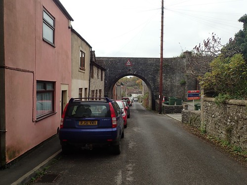
From side streets initially, I passed the northern edge of the town.
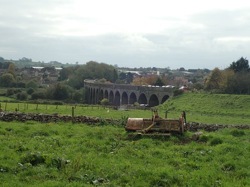
Part of Shepton Mallet is also dominated by the viaduct of a former railway. An impressive structure but still, a waste to see it unused, just like the one further north in Pensford. Even if the train line is not, one day, reopened, it would make for an excellent cycle path, I’m sure.
Crossing over the B3136, I immediately climbed a steep series of stone stairs. After which, I was able to enjoy his view, near Barren Down.

There were a few toadstools up on his hill. I’m aware that Shepton Mallet, today, bears a bit of a ‘drugs’ reputation but I’ve no idea how relevant this field may be!

Further on and the right of way skirts around the northern edge of Cornhill Prison. No longer in use, it remains open for exploration and guided tours, if you like that kind of thing.
Over the A37 and the East Mendip Way joins what is signposted as the Fosse Way; once a road stretching from Exeter to Lincoln.
I soon began to descend towards Charlton Viaduct – yet another disused railway line in Somerset. This was part of the same line I made reference to earlier.
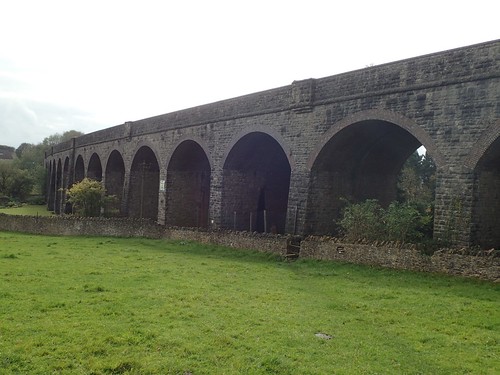
There’s a single right of way that passes through one of the arches (I think I walked through there in November 2015), while the rest of the structure bears a number of ‘PRIVATE’ and ‘KEEP OUT’ signs, with further warning of guard dogs.
But the East Mendip Way turns up and away from the viaduct, gradually reaching for the summit of Ingsdons Hill.

Some of these fields are surely home to ravenous cattle through the summer months. I was relieved to find no more than a few care-free beasts and this stone squeezer stile, before reaching a road near Chelynch.

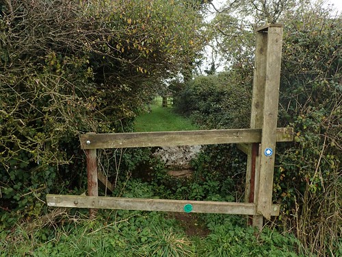
From leaving King’s Road, I began to encounter a series of minor issues in my attempts the follow the public right of way… At the corner of this first field, the wooden stile was quite well hidden within a hedge. It wasn’t completely obscured but it was very hard to spot from a distance and the approaching angle.
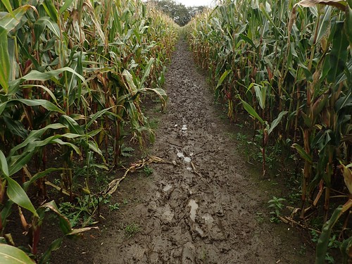
Walking towards Newman Street Farm, I came up against a field of crops. This time, the accurate right of way path had not been cleared.
I attempted to walk on, keeping to the left (west) side of the crops, only to encounter a barbed wire fence at the field boundary, with no way to walk around. Awkwardly, I scrambled over the fence to reach a narrow road that would leave me past the farm and back on to the Way…
I took the photo above, from the other end of the footpath. It’s possibly I might’ve been able to walk around the eastern edge of the crops but I had no way of knowing this at the time.
I noticed what I thought was a standing stone near Temple House Farm but the sheep wasn’t telling me anything.
If I could remember exactly where this stile was, I’d report it, as it was a challenge to climb over.
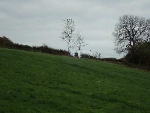
This was past lunchtime by now, I was growing ever-hungry but knew that the tower (and my intended resting point) wouldn’t be much further ahead.
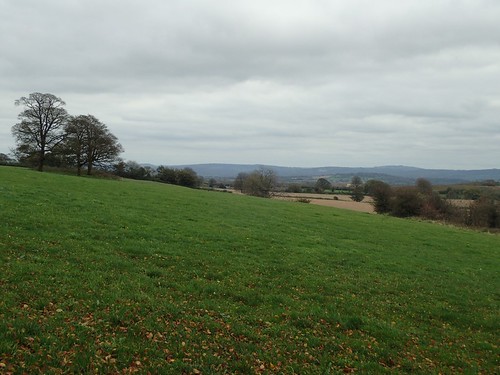
As I turned a corner, there were good views ahead; looking roughly south-eastward towards the Wiltshire and Dorset border… Stourhead may not be far beyond the trees.
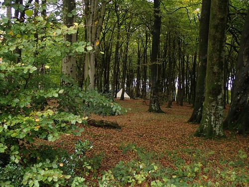
I turned north towards Great Gains Wood. knowing the tower was only metres away. Off to my right, a tipi-style tent caught my eye. I don’t think it was a wild camper as such.
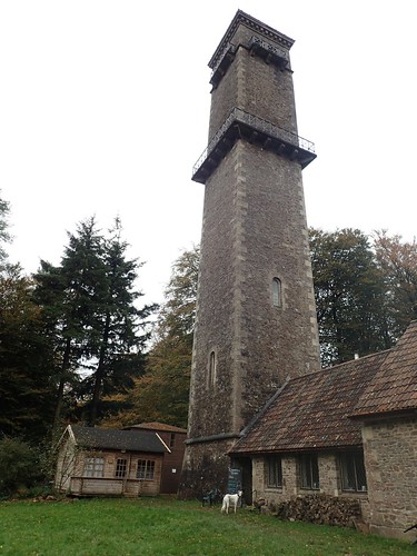
Cranmore Tower marks the halfway point between Shepton Mallet and Frome. There’s every chance I’ll return here when I complete the second half of the East Mendip Way.
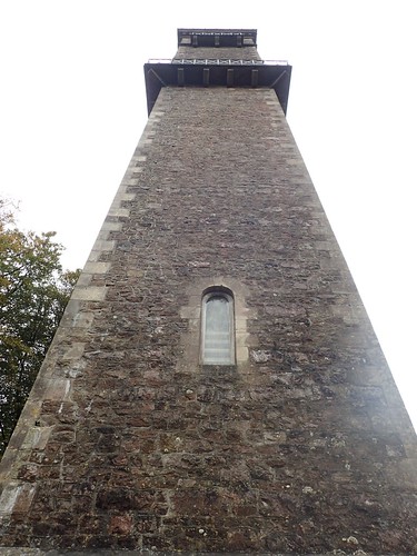
You can climb an interior staircase towards the top, with a small charge for entry (£2 per adult). There’s even a café beside the foot of the tower and a small space for car parking nearby.
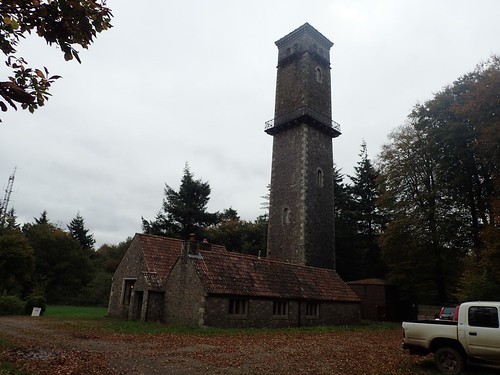
I still had a long way to walk back to my car in Croscombe and didn’t think the steps would help. Also, I could hear kids heading up or down and I wasn’t in the mood to be sticking fingers in my ears.
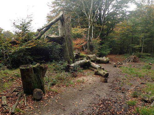
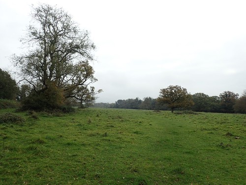
I found my seat on one of these fallen logs and enjoyed a reasonable lunch break, well deserved after a good ten-miles of walking.
When it was time to begin my return route, I left the Mendip Way to walk north along Dallimore Lane, stepping over an awkward pair of metal gates to cross Old Wells Road.
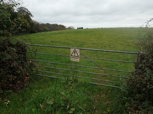
My map indicates a definite right of way beyond this gate but, there was no fingerpost or waymark arrow to be found. It’s almost as if someone thinks the ‘DANGER’ sign is enough to keep people off their land.
This path does skirt beside Moons Hill Quarry, the only basalt quarry within the Mendip region of Somerset. I lost the right of way in the final field (where I should’ve cut through a hedge opening) and climbed a larger barbed wire fence to return to the road.
I followed this to the junction with Old Frome Road. I had a return route plotted, to follow a right of way north of Newman Street Farm… Only to encounter locked gates and lack of waymarking issues early on. Not wanting to get involved with something that may present a challenge, I returned to the tarmac; following Boulter’s Lane in to Downside; crossing the A37 north of Shepton Mallet; then crossing the former railway line along a series of paths that would see me follow the East Mendip Way back in to Ham Woods.
But, I would leave the Way one last time and instead follow a path along the valley floor.

From a navigational point of view, it seemed straight forward – once I had clambered over the fallen trees.

Waymarking beyond this point was poor, at very best. I should’ve turn right and climbed up and out of the valley at some point. Instead, I continued in to a field that warned of horses… Horses I would see, but who would not bother me for even a moment.
This led me down to the A371, from which I could follow a series of narrow roads (after “eliminating” a couple of increasingly steep options) back to my car.
I’m pleased that I can now say I’ve completed the first ten-miles of the East Mendip Way. I look forward to tackling the final half soon, once I’ve plotted it and arranged car parking, of course.

An interesting read. I walked the West Mendip Way a couple of years ago and have the East Mendip Way pencilled in as a possibility for 2018 (probably all in one day). Though like you I’ve found transport links are a bit tricky, from Frome to Shepton Mellot the suggested route is to travel into Bath and back! It’s a shame that railway line is not still in use, though at least as you have shown me the viaducts and structures seem to still exist.
LikeLiked by 1 person
Hi Jon, thanks for reading.
It’s certainly a route that’s doable in a day (when we have more daylight hours). I can only think of Bath as being the most convenient train option. Yep, the viaduct still stands. There’s also a short steam train line, south and away from the trail, known as the East Somerset Railway.
LikeLike